Ventura River Trail

VenturaRiverTrail.jpg

The Ventura River Trail is a 6.3 mile asphalt pedestrian and bike path that follows the old Southern Pacific Railroad right-of-way from Main Street in Ventura to Foster Park inland towards Ojai. The path, originally opened in 1999, connects the Ojai Valley Trail to the Omer Rains Trail along the beachfront for 17 miles of great bicycling. The trail is open dawn to dusk.

Much of the Ventura River Trail parallels Ojai Freeway 33 and as such is also referred to as the Ojai Valley Trail Extension. Here are the various access points from south to north:

OK, so now for some commentary. This is not exactly the most exciting bike path in the world. You are paralleling Highway 33 and are kind of off the beaten path in an industrial area, but it is a peaceful path. Also, there are several stops you need to make as you cross streets, so your kids (and you) do need to be aware of that. You won't find an ocean view on this path.  But...it is never crowded, quite flat and a great way to get out on the bikes away, for the most part, from automobiles.

One of the more interesting, albeit somewhat creepy scenes along the path is this dormant USA Petroleum Refinery that was closed in 1984 after operating less than 10 years.  A bit of an eyesore this 96 acre, barbed wire fence enclosed section on the north end of the trail is. In the past there have been homeless encampments in the vicinity, but I've never seen them.

USAPetrol_view1.JPG
USAPetrol2.JPG
USAPetrol4.JPG

What I like to do is park in the free city parking lot near the Omer Rains Trail at the corner of W. Main St and Peking St, then take Main St a block east to N. Olive St, turn left (north) to Rex St. Take a left on Rex to the bike path entrance.

VenturaTrailEntry.JPG
VenturaTrailHwy33.JPG

Oakbrook Neighborhood Park in Thousand Oaks

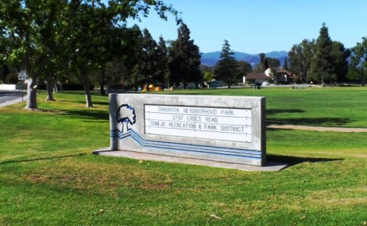
Located at the corner of Erbes Road and Pederson Road in Thousand Oaks, the 14 acre Oakbrook Neighborhood Park was expanded dramatically in 2012. The original park included a play area, sand volleyball court and large grassy area. The expansion includes a decent-sized parking area, small restroom, basketball and netball* courts, a jogging/walking/bike path and a nice horseshoe pit area. Visit the Conejo Recreation and Park District website at www.crpd.org for more information.

OakbrookParkTOsign.JPG
OakbrookParkGrassPlayArea.JPG
OakbrookParkPath.JPG
OakbrookParkHorseshoes.JPG

This is the original section of the park; primarily expansive grassy area with play area in background.Paved path area in the expanded section of the park.Something you don't see too often these days...new horseshoe pit area .

Yes, this is a netball court, not to be confused with a basketball court!

Yes, this is a netball court, not to be confused with a basketball court!

To learn more about the game of netball, click this link. This is the first, and, as of May 2013, only netball court in Thousand Oaks. And yes, I was confused when I saw it too.

Wheeler Gorge Visitor Center and Campground in Ojai

WheelerGorge.jpg

The Wheeler Gorge Visitor Center is located at 17017 Maricopa Highway, Ojai. To reach the Center from Ventura take Highway 33 towards Ojai at the “Y” intersection (by the Vons shopping center) turn left on Hwy 33 for about eight miles.

The Center provides information about the Los Padres National Forest and also sells maps, trail guides, forest-related books, Adventure Passes and other items. It opened in June 2001. Staff are on hand to help you plan your backcountry trip planning in the area.

The Center also serves as a hub for interpretive and educational activities and programs. These include membership functions and presentations about the resources and issues of Los Padres National Forest. One of the more popular programs is the Introduction to Backpacking course.

The Visitor Center has a kitchen, classroom, library, audiovisual equipment, large parking area, outside picnic areas, and tools/equipment storage and serves as a staging area for forest projects in the southern section of the Los Padres National Forest.

The Center is open on weekends from 9am to 3pm, except Thanksgiving and Christmas. More information at lpforest.org/wheeler or call 805.640.9060.

Across the street is the Wheeler Gorge Campground, which is open year-round and offers over 60 single-family sites for tent or RV camping. Some sites are available on a first-come, first-served basis. Visit www.recreation.gov/camping/Wheeler_Gorge/r/campgroundDetails.do?contractCode=NRSO&parkId=70392 to learn more about the Wheeler Gorge Campground.

Alumni Park at Pepperdine University

Situated in front of Pepperdine's Malibu campus at 24255 Pacific Coast Highway, Malibu, Alumni Park is a beautiful 30 acre expanse of lawn, rolling hills, ponds and coral trees. The two ponds are actually open reservoirs (about 40,000 square feet each) of reclaimed water, but add beauty and serenity to the park. Intramural games are played in the flat field area, and picnics can be held under the scenic coral trees lining the crest of the park.

You cannot ask for a more serene setting overlooking the Pacific Ocean on a Sunday afternoon...unless of course I'm there with my kids.  This park is not geared towards children in that there is no playground facility, etc.  But...if you're looking for a very inexpensive, yet wonderful, peaceful and romantic date, bring a picnic basket and blanket to this park with your significant other and take in the unbelievable views.

If you are looking for peace, quiet and the most amazing views of the Pacific Ocean, stop by Alumni Park in front of Pepperdine University in Malibu. Pepperdine students are blessed to have such an incredible location.

Park View Trail in Dos Vientos Section of Newbury Park

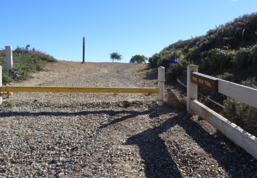
ParkViewTrail_sign1.JPG

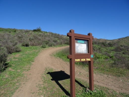
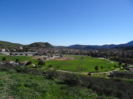
The Park View Trail is a short little 1/2 mile trail adjacent to Dos Vientos Community Park in Newbury Park. There are two main access points. There is a trailhead near the corner of Rancho Dos Vientos and Via Rincon at the southwest corner of the park, and there is another trailhead on Via Ricardo, one block east of Via Pisa.

Views of Dos Vientos Community Park from the Park View Trail.

Views of Dos Vientos Community Park from the Park View Trail.

This short hike is perfect with the kids as it is not too strenuous and is adjacent to the park. Good for a quick getaway. There's also at least one geocache on this trail that's pretty cool.

Moderate trail it is. Not too steep, yet not completely flat.

Moderate trail it is. Not too steep, yet not completely flat.

View of the Edison power lines going up Conejo Mountain from Park View Trail.

View of the Edison power lines going up Conejo Mountain from Park View Trail.

Nice quick access to views of the park, Dos Vientos, the Powerline Trail and beyond. And speaking of the Powerline trail, the trailhead is directly across the street from the west end of the trail.

Trailhead on west side of Park View Trail off of Via Ricardo

Trailhead on west side of Park View Trail off of Via Ricardo

Interested in other Dos Vientos trails? Learn about the El Rincon, El Cerro and Las Brisas trails and the nearby (access point just south on Via Ricardo) Vista Del Mar Trail.

Chumash Trail in Simi Valley

The Chumash Trail in Simi Valley is a roughly 2.7 mile trail that takes you from near Chumash Park to the trailhead at the north end of Flanagan Drive to the Rocky Peak Trail. It is a moderate, uphill trail with plenty of views of Simi Valley. No trees and thus no shade. Dogs allowed on leash.

To get to the Chumash Trail trailhead, take the 118 to Yosemite, go north, turn right on Flanagan to the end. Park on the street. More information at www.rsrpd.org/simi_valley/trails/chumash_park_and_trail.php.

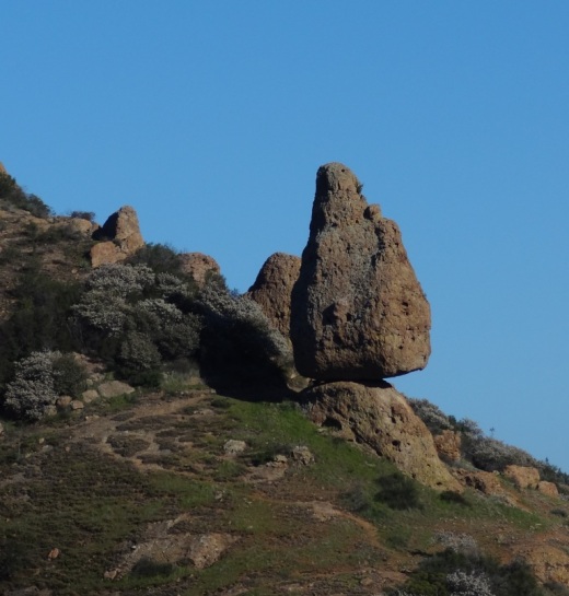
Sandstone formations appear on the upper portion of the trail.

Sandstone formations appear on the upper portion of the trail.

Red Tile Walking Tour in Santa Barbara

The Red Tile Walking Tour in Santa Barbara is an informal, 12 block walk in the downtown area that will take you past a variety of Santa Barbara historical landmarks. It was originally developed by the Santa Barbara Chamber of Commerce. The walk is summarized below but visit Santa Barbara Car Free website at www.santabarbaracarfree.org for additional details and a printable map.

  1. Santa Barbara County Courthouse (Built in 1929)
  2. Public Library
  3. Santa Barbara Museum of Art
  4. Hill-Carrillo Adobe
  5. El Paseo
  6. Casa De La Guerra
  7. Plaza De La Guerra
  8. Orena Adobes
  9. Presidio Avenue (the oldest street in Santa Barbara)
  10. Lugo Adobe
  11. Santa Barbara Historical Museum
  12. Casa Covarrubias
  13. Rochin Adobe
  14. El Presidio de Santa Barbara State Historic Park
  15. El Cuartel (second oldest surviving building in California)
  16. Main Post Office
  17. Lobero Theatre

Santa Barbara Audubon Aviary

EyesInTheSky.png

Eyes in the Sky (EITS) is an education program with the Santa Barbara Audubon Society (SBAS) that brings a variety of programs to children and adults in the Santa Barbara area. EITS features wildlife messengers - birds of prey native to the area that are no longer capable of surviving in the wild. 

The SBAS has teamed with the Santa Barbara Museum of Natural History (2559 Puesta del Sol, Santa Barbara) to build the Santa Barbara Audubon Aviary, a physical structure located in the "backyard" area of the Museum. The Aviary is open every afternoon between 2 and 4PM. During this time, volunteers bring the birds out for exercise, sunshine, misting/baths and close up encounters with visitors.  We have seen these animals up close and they are quite impressive!

For more information, visit www.eyesinthesky.org.

AudubonAviary_building.JPG
AudubonAviary.JPG
AudubonOwl.JPG
Kisa the Peregrine Falcon

Kisa the Peregrine Falcon

Palo Comado Canyon to Simi Peak Hike in Oak Park

If you're looking for a challenge, consider hiking from the Palo Comado Canyon Doubletree Road Trailhead to the 2,405 foot elevation Simi Peak in Oak Park. This is about a 4 to 4 1/2 mile trek each way with a 1,200 foot elevation gain to the top that is well worth it if you have the time and the energy.

Mind you, this particular stretch of trail, the Palo Comado Fire Road, I've rarely seen more than a handful of hikers and runners on over the years. I usually see more cyclists up here than anything. Part of the challenge is that it can get pretty hot up here on these trails as most of them get full exposure to the sun. So do bring plenty of water and wear sunscreen unless it happens to be a rare, overcast day. No restrooms either.

A quicker, easier path to the panoramic Simi Peak, the highest point in the Simi Hills, is via the China Flat Trailhead.

So if you're up to the challenge, park your car near the trailhead on Doubletree Road , just east of Clear Haven Drive, in Oak Park. From the 101, take Kanan to Sunnycrest Drive, and make a right. Sunnycrest becomes Doubletree after it veers left. The trailhead is on the right.

About a half mile from the trailhead gets you to the Palo Comado Canyon Trail, where you'll head north (left).

About a half mile from the trailhead gets you to the Palo Comado Canyon Trail, where you'll head north (left).

The Palo Comado Canyon Trail is fire road, so it is nice and wide.

The Palo Comado Canyon Trail is fire road, so it is nice and wide.

Eventually, after a bit of a grueling climb (this hike is not kid friendly if you ask me), you'll reach this corral area. Continue west (left).

Eventually, after a bit of a grueling climb (this hike is not kid friendly if you ask me), you'll reach this corral area. Continue west (left).

Follow the direction of the signs toward the Simi Peak Trail and you're on your way.

Follow the direction of the signs toward the Simi Peak Trail and you're on your way.

Follow the direction of the sign towards Simi Peak. The only challenge is that you have to go with your gut at some point as the signs stop.

Follow the direction of the sign towards Simi Peak. The only challenge is that you have to go with your gut at some point as the signs stop.

The trails get narrower and a bit more technical as you head your way to the peak. Wear good shoes.

The trails get narrower and a bit more technical as you head your way to the peak. Wear good shoes.

You've reached your destination when you see this.

You've reached your destination when you see this.

You are now at Simi Peak, the highest point of the Simi Hills. The round marker on the right is from the Ventura County Surveyor. In background is Lindero Canyon Road headed south.

You are now at Simi Peak, the highest point of the Simi Hills. The round marker on the right is from the Ventura County Surveyor. In background is Lindero Canyon Road headed south.

Fancy, green highlighted map (courtesy National Park Service).