Potrero Ridge Trail in Newbury Park

The Potrero Ridge Trail in Newbury Park is an interesting ridgeline trail that runs west/east in three sections over approximately 2 1/2 miles one way. You can access the trail from a number of locations and neighborhood feeder trails, but the main sections are as follows (west to east):

Via Las Brisas in the Dos Vientos tract, just north of Paseo Santa Rosa to Reino Road, just north of Paseo de Leon and Lynn Road, is a little over a mile. This is one of my favorite trails in the area, providing panoramic views of the southern portion of Newbury Park, Boney Mountain and Dos Vientos. There are some switchbacks on the west end near Reino Road but they are not overly strenuous.

Potrero Ridge Trailhead on Via Las Brisas, just north of Paseo Santa Rosa.

Potrero Ridge Trailhead on Via Las Brisas, just north of Paseo Santa Rosa.

potreroridgeview.JPG
Potrero Ridge Trail trailhead (and parking area) off of Reino Road

Potrero Ridge Trail trailhead (and parking area) off of Reino Road

The middle section of the Potrero Ridge Trail runs from Woodland Oak Place off of Reino Road to Wendy Drive between Felton and Peppermint, where there's a convenient dirt parking lot.  Only about a half mile to the top of the trail, where you'll see a water tank. The primary trail is a wide fire road to the water tank from Wendy Drive. There's a secondary single track trail that mostly runs parallel (south) to the main fire road that is accessible from several points. This trail treats you to wonderful, panoramic views of the area.

Potrero Ridge Trail trailhead off of Wendy Drive.

Potrero Ridge Trail trailhead off of Wendy Drive.

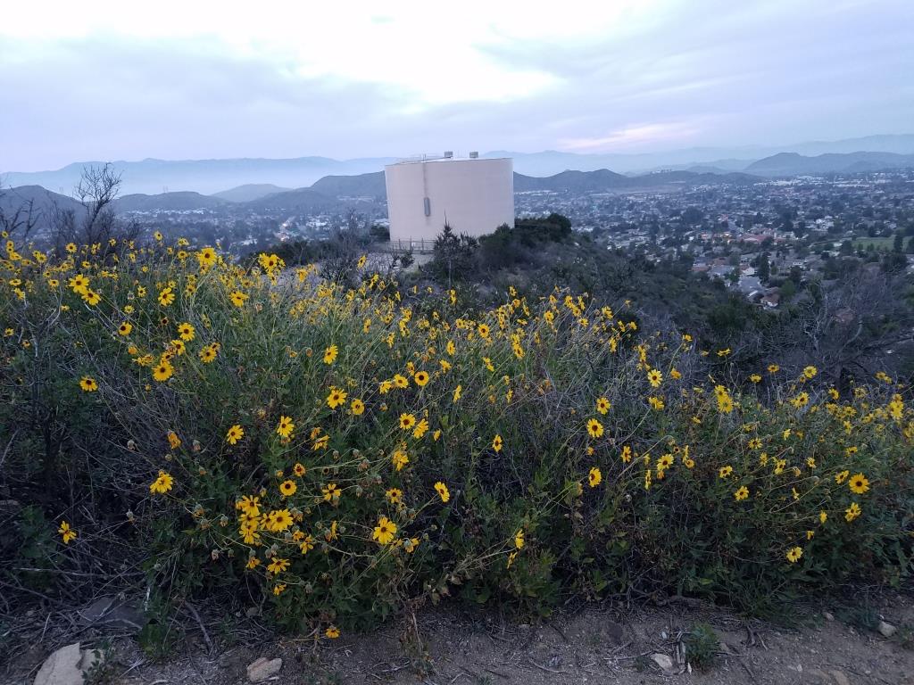
Views towards the water tank at top of Potrero Ridge Trail (middle section)

Views towards the water tank at top of Potrero Ridge Trail (middle section)

The east section of the trail runs from across the parking lot on Wendy Drive to another peak, then down towards Silas Lane near Grace Bible Church, about half a mile in total. There is no parking available for this section of trail, though you can park in the Wendy lot and find a crosswalk to cross over to the trailhead.

View from east section of Potrero Ridge Trail.

View from east section of Potrero Ridge Trail.

So basically these 3 segments are split between Via las Brisas and Reino Road, Reino Road and Wendy Drive and Wendy Drive and Silas Lane.

If you'e like to extend your trail trekking on the west side, cross over Via las Brisas and take the Sierra Vista Trail west another mile to Rancho Dos Vientos.

This trail is maintained by the Conejo Open Space Foundation.

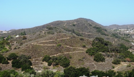
Here's a view of the initial section of the western section of the Potrero Ridge Trail from the Wendy Water Tank section of the trail across Reino Road.

Here's a view of the initial section of the western section of the Potrero Ridge Trail from the Wendy Water Tank section of the trail across Reino Road.

Views into the Dos Vientos section of Newbury Park

Views into the Dos Vientos section of Newbury Park

Potrero Ridge Trail bench provide extensive views

Potrero Ridge Trail bench provide extensive views

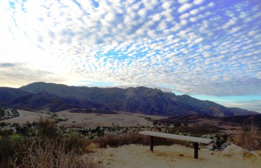
Views from the same bench on a cloudy late October day in 2013

Views from the same bench on a cloudy late October day in 2013

El Encanto Trail in Dos Vientos Section of Newbury Park

ElEncanto_sign.JPG

If you're looking for quick access to gorgeous views in the Dos Vientos section of Newbury Park, from Thousand Oaks to Camarillo to the Santa Monica Mountains, stop by the roughly 1.2 mile El Encanto Trail. Access the trail either at the western endpoint of Kimber Drive, just past Greenway Avenue, or inside Dos Vientos at the eastern endpoint of Via Laguna, near the Calle Del Prado intersection.

After a fairly flat start off of Kimber, the trail gets a bit steep and narrow. My young kids were fine on it but it take a decent effort, with an elevation climb of about 300 feet.

And towards Thousand Oaks on the east

This little trail seems quite popular with mountain cyclists as well as hikers. Here's an inviting bench that awaits you near the top of the trail, about halfway between the Kimber and Via Laguna trailheads.

ElEncanto_Bench.JPG

The area was ravaged by the Springs Fire of 2013. The bench has an inscription dedicated to the efforts of the Ventura County Fire Department that did such a fantastic job protecting local neighborhoods.

ElEncanto_benchsign.JPG

If you start on the Kimber side all the way to the Via Laguna side, you can either retrace your steps back or take Calle Del Prado down to Via Rio, turning left (east) for a about a quarter mile walk back to the Kimber side.

For a detailed trail map of Dos Vientos area trails on the Conejo Open Space Foundation website, visit https://cosf.org/files/maps/dos_vientos_trail_map.pdf.

Upper Sycamore Canyon Trail in Point Mugu State Park

The Upper Sycamore Canyon Trail is a 1.3 mile trail connects to the bottom of steep Sycamore Canyon Fire Road on the west to the Danielson Road trail on the east.

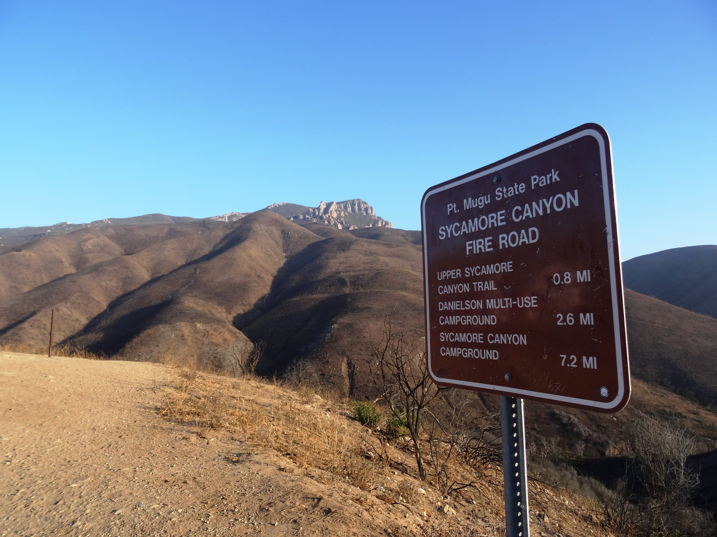
Sign at top of Sycamore Canyon Road before the descent into the canyon.

Sign at top of Sycamore Canyon Road before the descent into the canyon.

The trail goes deep into the canyon and can get quite overgrown, especially after solid winter rains. But it is an interesting hike and alternative to other trails that take you to "The Waterfall" in the Boney Mountain Wilderness. Bike and dogs are not allowed on these back country trails. Watch out of course for poison oak and snakes.

The "Narrow Bridge" sign marks the bottom of the steep initial grade down Sycamore Canyon Fire Road. You'll cross the bridge, then see the Upper Sycamore Canyon Trail entry to the left.

The "Narrow Bridge" sign marks the bottom of the steep initial grade down Sycamore Canyon Fire Road. You'll cross the bridge, then see the Upper Sycamore Canyon Trail entry to the left.

After you enter the west end of the Upper Sycamore Canyon Trail, within about a 1/10th of a mile is the entry point to the Fossil Trail, a very steep trail that leads up to the Old Boney Trail. 

Inside the canyon, looking west, towards the Sycamore Canyon Fire Road.

Inside the canyon, looking west, towards the Sycamore Canyon Fire Road.

After the substantial rains of Winter 2017, a creek has been flowing through this canyon and has caused some obstacles and overgrown sections of the trail. Do wear good hiking shoes.

Upper Sycamore Canyon Trail (Map excerpt courtesy of National Park Service)

Upper Sycamore Canyon Trail (Map excerpt courtesy of National Park Service)

Danielson Road sign you will see at the east end of Upper Sycamore Canyon Trail, Now you can head back up towards Rancho Sierra Vista/Satwiwa to the left or go the The Waterfall and/or Danielson Monument.

Danielson Road sign you will see at the east end of Upper Sycamore Canyon Trail, Now you can head back up towards Rancho Sierra Vista/Satwiwa to the left or go the The Waterfall and/or Danielson Monument.

The Village at Dos Vientos Ranch

The Village at Dos Vientos Ranch (originally known as Paraiso at Dos Vientos Ranch), located at 350 Via Las Brisas, Thousand Oaks ("Dos Vientos" community of Newbury Park) is a 50,000 square foot community retail shopping center.

Tenants currently include The Local Table, Sushi2 Vientos, Honeycup Coffeehouse and Creamery, Fitness Together, Bubbles Dry Cleaners, Paraiso Family Dental, ETF Portfolio Management, Nati Boutique, Calvary Church and Village Trader Market and Deli.

No functional website as of December 2021.

www.facebook.com/thevillagedosvientos

Sycamore to the Sea Hike, Run or Bike From Newbury Park to Sycamore Cove

Did you know that you can walk, hike, run or bike from Newbury Park to the ocean over 8 1/4 miles pretty easily, without dealing with automobiles? Park your car at the Wendy and Potrero trailhead or at the Rancho Sierra Vista/Satwiwa parking lot in Newbury Park and experience it yourself.

The entry to the Rancho Sierra Vista/Satwiwa area.

The entry to the Rancho Sierra Vista/Satwiwa area.

The Satwiwa Native American Indian Culture Center is a short walk from the parking lot.

The Satwiwa Native American Indian Culture Center is a short walk from the parking lot.

From there, take the paved road, called the Sycamore Canyon Fire Road, towards the ocean.

From there, take the paved road, called the Sycamore Canyon Fire Road, towards the ocean.

PtMuguNewburyPark.JPG

This is a nice, wide paved road with trails along the side much of the way. Generally cool in the early morning year-round as you head towards the ocean, plenty of rest/pit stop areas on the way down and nice and peaceful and beautiful, full of canyons, trees and wildlife.

Sycamore Canyon Top.JPG

The steepest descent on this course is a roughly 800 foot drop over a 3/4 of a mile into the canyon on the paved road after you see this sign. Coming back up if you do the full round-trip circuit is a bit of a challenge.

SycamoreCanyonRoad.JPG

After you drop into the canyon, it is pretty much smooth sailing. The paved road stops right around the Danielson Multi-Use area (see image below for that juncture). After that, follow the wide, dirt fire road towards the beach.

Sycamore_RangerHouse.JPG

There are numerous water spigots on the side of the road going down, which comes in quite handy on warmer days. If you use them, just make sure to turn them off.

About 3/4ths of the way down to the beach, you'll pass one of the most picturesque locations for a porta-john that I've ever seen.

About 3/4ths of the way down to the beach, you'll pass one of the most picturesque locations for a porta-john that I've ever seen.

A few miles after passing the above porta-john, you'll reach the Sycamore Canyon Campground, which has 58 campsites and is across Pacific Coast Highway from the ocean. Cross over PCH (be careful!) or find the underpass that takes you under PCH to the Sycamore Cove Beach area, with picnic tables, bathrooms, etc., and enjoy your day!

Sycamore Cove Beach in Point Mugu

Sycamore Cove Beach in Point Mugu

From there, you either head back up or call your significant other to pick you up. Or perhaps plan it out in the morning to leave one car at the beach in either the Sycamore Canyon Campground or Sycamore Cove day lots (they open at 8am) for a fee, or park on PCH where there are spots near Thornhill Broome Beach and the giant sand dune, then drive another car back (obviously you can't do this alone), park the 2nd car at Rancho Sierra Vista/Satwiwa, hike/walk/bike down the canyon to retrieve car #1.

Or do what I did once, which was drive down to Sycamore Cove via Potrero Road/Las Posas/PCH, park the car, run (or perhaps ride) up to Newbury Park, then ride down with the kids and enjoy the beach. Fun! 

For a map of the Rancho Sierra Vista/Satwiwa area with a portion of the Big Sycamore Canyon Trail, visit www.nps.gov/samo/planyourvisit/upload/Rancho-Sierra-Vista_Satwiwa_2023.pdf (National Park Service pdf brochure).

Arroyo Conejo Trail in Thousand Oaks

The Arroyo Conejo Open Space consists of 302 acres, bounded by Wildwood Park and Conejo Canyons on the north, Lynnmere Open Space on the east and the Rancho Conejo residential development on the west. There’s a trailhead at Rancho Conejo Playfield at 950 N. Ventu Park Road in Newbury Park.

RanchoConejoPlayfield_sign.JPG

The Arroyo Conejo Trail trailhead is on the far right/east section of the parking lot facing the park's restrooms and tennis courts.

Arroyo Conejo Trailhead is on the right side of the parking lot.

Arroyo Conejo Trailhead is on the right side of the parking lot.

The trail veers to the left (if you go down the initial trail to the right, you will see this is not open to the public). After passing the park, you will notice that the canyons below are mighty steep and you will hear the creek down below.

After you get to a gate (see below), the downhill is pretty significant and you may see a mini-waterfall on your way down to the creek, where you will immediately come to a crossing that, the last time I was there, had several wooden pallet crossings.

The gate that signals you are about to head downhill into the canyon.

The gate that signals you are about to head downhill into the canyon.

The first stream at the bottom of the hill had these nicely placed wooden planks to alleviate the problem of wet shoes.

The first stream at the bottom of the hill had these nicely placed wooden planks to alleviate the problem of wet shoes.

If you continue on straight, you will come across four more creek crossings. Often you will find large rocks or wood planks to walk across, but sometimes you won't find one, so be prepared for the possibility of wet feet if your plan is to reach the Hill Canyon Water Treatment Plant. If you do get that far, then turn back, you'll have done about 5 miles round trip.

Some of the stream crossings are a bit dicier getting across, that is if you don't want to get wet.

Some of the stream crossings are a bit dicier getting across, that is if you don't want to get wet.

You've reached your destination but probably don't want to be jumping in these wetlands.

You've reached your destination but probably don't want to be jumping in these wetlands.

If you're looking to extend the hike into something more strenuous, after the first stream crossing, if you look on your right you'll find a steep trail that gets you to the Lynnmere Trail.

Learn more and see a map on the Conejo Open Space Foundation website at cosf.org/trails/other-trails/moderate-hike-arroyo-conejo-to-hill-canyon.

Borchard Park Labyrinth in Newbury Park

BPLabyrinth_rock.jpg

The Conejo Recreation & Park District opened the 60 foot diameter Borchard Park Labyrinth and Fitness Equipment Area in September 2010. Borchard Park is located at 190 Reino Road, Newbury Park. The labyrinth, located in the southeast area of the park, is said to help strengthen memory and concentration and bring clarity by balancing the right brain/left brain.

There are also 3 pieces of outdoor fitness equipment which include a 2 person pull-down, 4 person waist-twist and 4 person leg press.

More information at www.crpd.org/park/borchard-community-park

BorchardLabyrinth.JPG
BorchardLabyrinthEquip.jpg
BorchardParkLabyrinthSign.jpg
BPLabyrinth_Legs.jpg
BPLabyrinth_Lats.jpg
BPLabyrinth_Waist.jpg

Rancho Potrero Open Space in Newbury Park

The Rancho Potrero Open Space is located in Newbury Park off of Lynn Road, just west of the intersection with Rancho Dos Vientos. The area includes the Rancho Potrero Community Equestrian Center and is adjacent to the Rancho Sierra Vista/Satwiwa area in the Santa Monica Mountains National Recreation Area.

Map excerpt courtesy of Conejo Open Space Foundation (www.cosf.org)

Map excerpt courtesy of Conejo Open Space Foundation (www.cosf.org)

A newer parking lot and restrooms were built in 2015 allowing for easier access to the Rancho Potrero Open Space. It is accessible just west of the equestrian center off of Lynn/Potrero Road.

u

There is a trailhead further west of the parking lot, just before Potrero (Lynn) Road takes a sharp right turn.  You can usually find parking off pavement here. A short (1/4 mile) walk up the hill gets you pretty darn nice views looking towards Camarillo and the Channel Islands. Take the adjoining Palomino Trail east towards Rancho Sierra Vista and the Satwiwa Native American Indian Cultural Center.

The entrance is further east off of Potrero/Lynn Road

The entrance is further east off of Potrero/Lynn Road

About a 1/4 mile gets you to the top of a hill that gives you views as far as the Channel Islands.

About a 1/4 mile gets you to the top of a hill that gives you views as far as the Channel Islands.

RanchoPotreroDec2014.JPG

Los Robles Trail System in Thousand Oaks

LosRoblesTrailSign.JPG

The Los Robles Trail winds from Potrero Road, just east of Wendy Drive in Newbury Park, to Foothill Drive near Fairview Road (near Hampshire Road in Westlake Village). A popular access point is at South Moorpark Road and Greenmeadow Avenue in Thousand Oaks.

Along with its many connecting trails (Triunfo Canyon Trail, Rosewood Trail, White Horse Canyon Trail, Los Padres Trail and more), awesome opportunities abound for hikers, bikers and equestrians to enjoy the open space.

If you're looking for an easy, one mile trail hike with the kids, the Oak Creek Canyon Loop is a nice one to do. There is also a unique Interpretive Trail at Oak Creek Canyon Loop that is accessible to handicapped/wheelchairs and blind individuals! Or extend the Oak Creek Canyon Loop to an easy 3 mile hike to the Los Robles Nature Walk. Also, the 1 mile Spring Canyon Trail is an excellent choice for families with young children.

OakCreekCynLoop_sign.JPG

For some of the most spectacular views of the Conejo Valley, try hiking up to Angel Vista Peak in Newbury Park.

A rugged, single track trail popular with mountain bikers and hikers is the Los Robles Trail West that goes up "Space Mountain" in Thousand Oaks. And Los Robles Trail East is another nice hike accessible from several points.

This nearly 2,000 acre ridgeline trail system with its many neighborhood feeder trails is located at the southern portion of the Conejo Open Space. The Los Robles Trail also traverses several open space areas including Los Padres, Los Vientos, Conejo Ridge. Hope Nature Preserve, Old Conejo, Deer Ridge, Rancho Potrero and Ventu Park.

Additional Los Robles Trail trailhead points west of the Rosewood Trail trailhead to Angel Vista Peak include Felton Street, east of Lynn Rd in Newbury Park (end of cul de sac) and Potrero Road, about 1/4 mile east of S Wendy Drive in Newbury Park (parking lot available).

Views from Angel Vista Peak are iconic.

Views from Angel Vista Peak are iconic.

To the west of Los Robles is Rancho Sierra Vista/Satwiwa and Point Mugu State Park which creates a public backcountry of over 27,000 acres of open space that stretches to the Pacific Ocean at Sycamore Cove. This scenic region is part of the Santa Monica Mountains National Recreation Area and provides panoramic views of Hidden Valley, the Conejo Valley and the Channel Islands.

Los Robles Trail trailhead and parking area on Potrero Road in Newbury Park.

Los Robles Trail trailhead and parking area on Potrero Road in Newbury Park.

The Los Robles Trail has historical significance. On February 28, 1776, Juan Bautista de Anza and his band of 198 settlers came through the Conejo Valley on their way from Mexico to San Francisco. Though the 101 freeway is the actual route, the National Park Service has designated the Los Robles Trail as the official recreational route so that everyone can enjoy the only national historical trail in the state of California.

Approximately 25 miles of trails provide a contiguous route from Westlake Village to Newbury Park with several shorter loops into narrow canyons and up steep ridges. The adjoining open space areas are managed by the Conejo Open Space Conservation Agency (COSCA), a joint powers authority created by the City of Thousand Oaks and the Conejo Recreation and Park District in 1977.

Unless you are an ant, this Los Robles Trail map is too small to read...click it for a full-size pdf map!

Unless you are an ant, this Los Robles Trail map is too small to read...click it for a full-size pdf map!

For more information about the Los Robles Trail, visit the Conejo Open Space Foundation website at cosf.org/trails/los-robles.

Spring Canyon Trail Hike in Thousand Oaks

The Spring Canyon Trail is a short, fairly easy hike in the Newbury Park/Thousand Oaks section of the Los Robles Trail system that is great family fun.

Although a good portion of the Spring Canyon Trail is flat like this, there definitely are some moderately hilly sections.

Although a good portion of the Spring Canyon Trail is flat like this, there definitely are some moderately hilly sections.

This one mile trail runs east from the vicinity of Lynn Oaks Park, 359 Capitan Street, Newbury Park as well from the eastern terminus of Hemlock Lane, at Heavenly Valley Road in Newbury Park (in the Ventu Park community) to a juncture where you can either continue straight ahead for about a half a mile towards the Los Robles Trail access point at South Moorpark Road and Greenmeadow Avenue in Thousand Oaks or veer up "Space Mountain" on the right. (The views at the top of Space Mountain are awesome but this is a bit of a climb and is very popular with mountain bikers...probably not the best direction with little ones).

The path that takes you from Lynn Oaks Park to the Spring Canyon Trail.

The path that takes you from Lynn Oaks Park to the Spring Canyon Trail.

Sign above Lynn Oaks Park that tells you that to the left is Los Robles Trail and to the right is the Hemlock Lane gate in Ventu Park.

Sign above Lynn Oaks Park that tells you that to the left is Los Robles Trail and to the right is the Hemlock Lane gate in Ventu Park.

Out and back you can make this a 2 to 3 mile moderate hike or more if you add in the Oak Creek Canyon Loop or Los Robles Nature Walk.

Sign at the east terminus of Spring Canyon Trail indicating Moorpark Road is half a mile away. Behind me is the trail toward "Space Mountain" and Los Robles Trail going east towards Newbury Park.

Sign at the east terminus of Spring Canyon Trail indicating Moorpark Road is half a mile away. Behind me is the trail toward "Space Mountain" and Los Robles Trail going east towards Newbury Park.

You can also park your car at the Moorpark Road/Greenmeadow trailhead and make your way west towards the Spring Canyon Trail and perhaps eat lunch or snack at Lynn Oaks Park (which by the way also has a nice playground area, basketball court and more...but no restroom however).

Thousand Oaks Community Gallery

Thousand Oaks Community Gallery.gif

The Thousand Oaks Community Gallery at 2331-A Borchard Road, Newbury Park opened in February 1991 and was the realization of the combined efforts of the City Of Thousand Oaks, area art organizations and dedicated art patrons. The 3,000 sq ft gallery hosts visual arts exhibitions, workshops, artist presentations and special events, and is enhanced with a multi-purpose area that includes kitchen facilities and is available for group tours and special events. Original art is available for purchase for personal or corporate collections. The gallery showcases outstanding work of acclaimed, professional and emerging artists who present an exceptional array of original imagery, artistic techniques and visual styles.

Gallery operations are under the direction of City staff and a steering committee, consisting of regional visual arts association representatives and dedicated arts leaders. Operating costs are covered by a modest user fee paid by exhibiting artists and an active volunteer corps serve as staff. Gallery hours vary by exhibit.

More information at www.tolibrary.org/services/get-involved/thousand-oaks-community-art-gallery

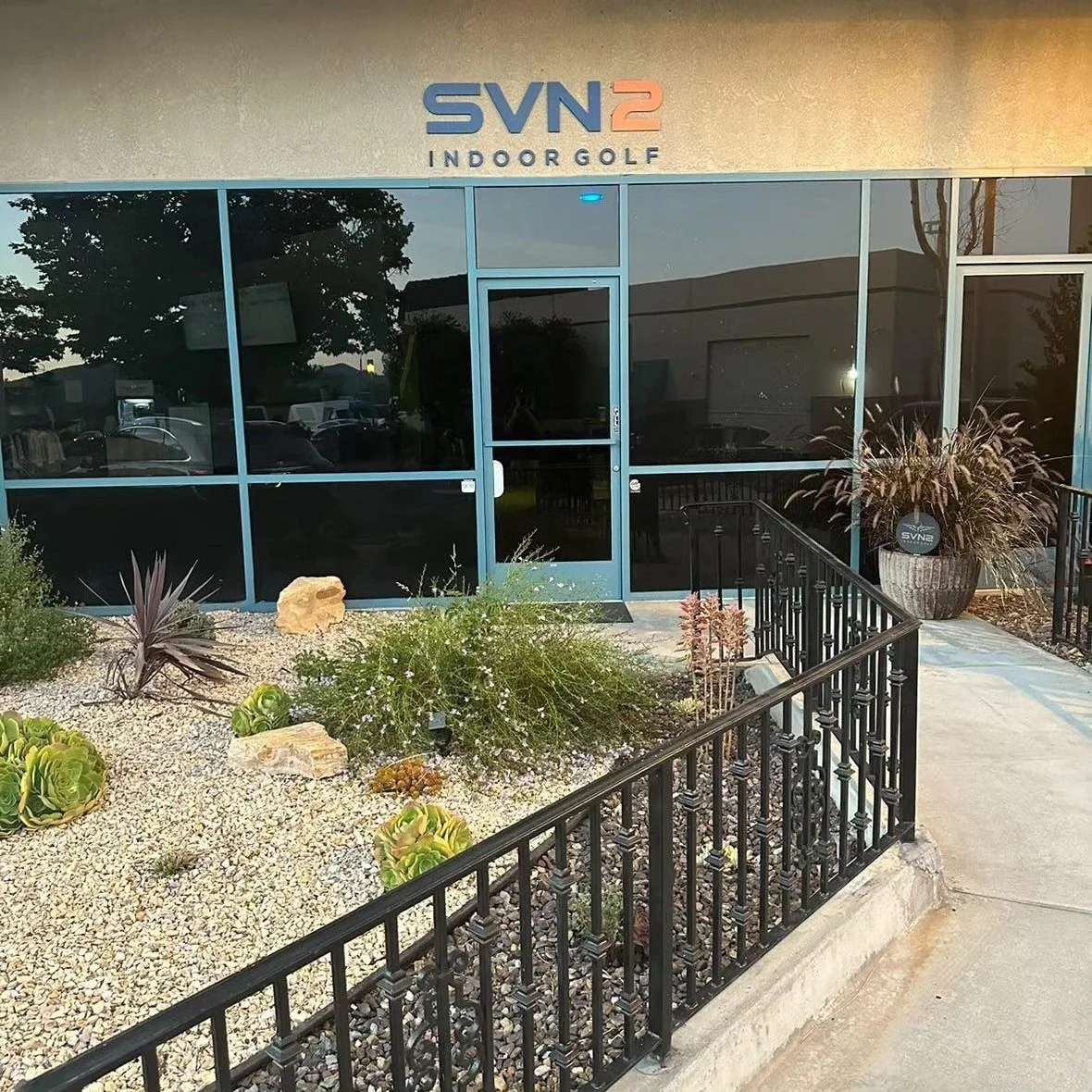
SVN2 Indoor Golf in Newbury Park

SVN2 Indoor Golf is a premium TrackMan golf simulation facility offering any level of golfer the opportunity to learn, practice, and play on the best simulation technology in the business. Explore your swing utilizing shot analysis or play from 230+ courses, anywhere from the sea cliffs of Pebble Beach to the historic bridge at St. Andrew’s in Scotland.

Located at 3311 Grande Vista Drive in Newbury Park and open 8am to 10pm Daily. Four hitting bay facility starts at $45/hour. Learn more at www.svn2golf.com or call 805-376-0276.

Rancho Sierra Vista / Satwiwa in Newbury Park

RanchoSierraVistaEntry.jpg

We are fortunate to have such great trails and views of Boney Peak from in Newbury Park. At Wendy and Potrero is the Western edge of the Santa Monica Mountains where Sycamore Canyon cuts through Rancho Sierra Vista/Satwiwa and Point Mugu State Park.

SatwiwaSign.JPG
Satwiwa.jpg

Roughly a mile easy hike from Wendy/Potrero gets you to the Satwiwa Native American Indian Culture Center where you can explore some native Chumash items and educational information and chat with rangers. This is a nice little hike to take the kids on. There are restrooms and water at the center, which is open from 9 to 5 on weekends.

Learn more about hiking in Rancho Sierra Vista/Satwiwa at THIS LINK.

You can get easier access to the center by parking in the adjacent National Park Service parking lot via Lynn Road to the access road at Via Goleta in Newbury Park.

Another mile and a half of hiking gets you to a small waterfall, which is fun to check out with the kids but somewhat more strenuous of a hike. Note that in recent years (2012-2015), the waterfall has barely flowed due to low rainfall.

Here is more information about the Boney Mountain Trail, leading up to Hidden Valley Overlook, the waterfall and Danielson Monument.

SatwiwaCircle.JPG

Visit www.nps.gov/samo/planyourvisit/rsvsatwiwa.htm for a map and site information on the National Park Service website.

BoneyViewsSatwiwa.jpg
SatwiwaTrails.JPG
WendyPotreroTrailhead.JPG

Trailhead at the corner of Wendy Drive and Potrero Road in Newbury Park. Park on the dirt on the south side of Potrero or on the street on Wendy.