Over 150 Movie Theater Screens Around Ventura County

Here's a handy list of movie theaters with over 130 (originally it was over 150, but there’s been some closures over the years) screens throughout Ventura County and adjacent areas. Click the links for theater websites and/or showtimes.

Thousand Oaks, Westlake Village, Agoura Hills

Cinépolis Luxury Cinemas at the Promenade at Westlake, 100 Promenade Way, Westlake Village  (8 screens). Order food and drink from your seat and enjoy. cinepolisusa.com/locations/cinepolis-luxury-cinemas-westlake-village (805) 413-8838

AMC Dine-In Thousand Oaks 14, 166 West Hillcrest Drive at The Oaks Mall. Tickets at www.amctheatres.com/movie-theatres/los-angeles/amc-dine-in-thousand-oaks-14. $5 Tuesdays all day for AMC Stubs members.

Regal Janss Marketplace 9 is located at Janss Marketplace in Thousand Oaks, 255 North Moorpark Road. www.regmovies.com/theatres/regal-janss-marketplace-1418

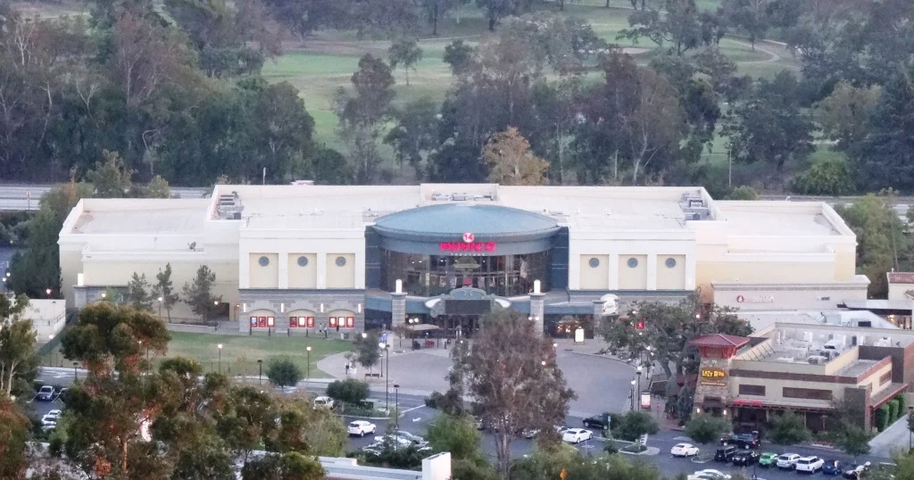
Former Muvico (now AMC Dine-In) Thousand Oaks.

Former Muvico (now AMC Dine-In) Thousand Oaks.

Century Riverpark 16 at The Collection at Riverpark

Cinemark Century Riverpark 16 at The Collection at Riverpark

Regal Edwards Camarillo Palace 12 and IMAX, 680 Ventura Boulevard, Camarillo (805.383.8879) (Located adjacent to The Promenade section of Camarillo Premium Outlets. www.regmovies.com/theatres/regal-edwards-camarillo-palace-1009

Plaza Stadium Cinemas 14, 255 West Fifth Street, Oxnard (805.487.8380). santarosacinemas.com

Regal Civic Center Plaza, Tapo Canyon Road, just north of the 118.

Other Local Theaters

Regency Theatres at The Commons at Calabasas.www.regencymovies.com/locations/calabasas-commons

Regency Santa Paula 7, 550 West Main Street, Santa Paula (805.933.6707). www.regencymovies.com/locations/santa-paula-7 Seats just $7 on Sundays!

The Ojai Playhouse at 145 East Ojai Avenue (805.646.1011) (1 screen) - reopened in late 2024 after it was closed for repairs due to a water main break in January 2018. The theater originated in 1914.

CLOSED

Regal Malibu Twin at 3822 Cross Creek Road, Malibu (310.456.6990) (closed in September 2017)

Simi Valley 10 Tristone Cinemas, 1457 E. Los Angeles Avenue (805.526.4329) simivalley.tristonecinemas.com (Closed 12/5/19 “due to leasing disagreements”)

Regency Paseo Camarillo Cinemas (3 theaters), 390 North Lantana Street, Camarillo (805.383.2267). regencymovies.com/main.php?theaterId=3 (“TEMPORARILY CLOSED” SINCE AUGUST 2021.)

Regency Westlake Village Twin, 4711 Lakeview Canyon Road, Westlake Village (818.889.8061) regencymovies.com/main.php?theaterId=1 Closed 1/17/22.

Edwards Grand Palace Stadium 6, 4767 Commons Way, Calabasas (818.223.0223). www.regmovies.com/theaters/edwards-calabasas-stadium-6/C00791471576 Closed 9/15/22

The Shoppes at Westlake Village

The Shoppes at Westlake is a 240,000 sq ft retail shopping center that opened at 30770 Russell Ranch Road, Westlake Village in the summer of 2014. It is anchored by a large Target store on the east side of the center with three dozen other shops and eateries, including a uniquely appointed In-N-Out Burger on the west side. This is an outdoor center with plenty of parking, outdoor eating spaces and a nice fountain. 

Retail stores include Guitar Center, BCBC Nail Spa, Lighthouse Salon Suites, Tilly's, Kirk Jewelers and others.

Eateries include 101 North Eatery & Bar, Los Agaves Restaurant, Tifa Chocolate & Gelato, Figueroa Mountain Brewing Company, Novo Cafe, The Bamboo Room (craft cocktail lounge), Crumbl Cookies, Q Sushi, Board & Brew 101 BBQ Hut, A Tea Thing, Hummus Lali and In-N-Out.

Learn more at shoppesatwestlakevillage.com.

Triunfo Creek Park in Westlake Village

Owned and maintained by the Santa Monica Mountains Conservancy, 600-acre Triunfo Creek Park in Westlake Village/Agoura provides deep oak woodland, native grasslands and blankets of wildflowers in the springtime. The main feature of the park, the Pentachaeta Trail, is named after the Pentachaeta lyonii, a federally-listed endangered flower found in the park. The yellow, daisy-like flower is found only in Southern California, and blooms between April and June.

PentachaetaTrail.JPG

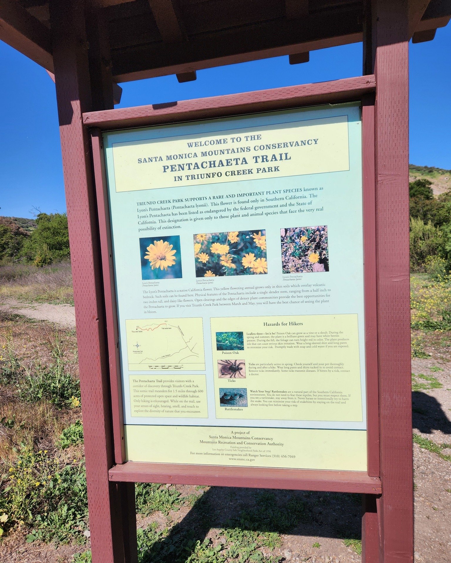
An informational kiosk at the trailhead interprets the Pentachaeta lyonii, as well as other unusual wildflowers found on the site such as the Chocolate Lily, and the White Globe Lily. The site also provides access to hiking trails on the Westlake Vista parcel, also owned and managed by the Conservancy.

PentachaetaTrail1.JPG
PentachaetaTrail2.JPG
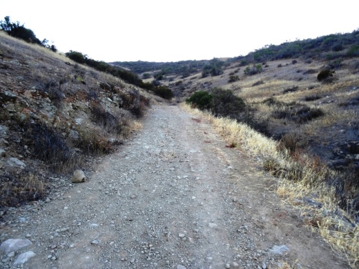
Pentachaeta Trail to the east. Westlake Vista Trail towards the Las Virgenes Reservoir on the west.

Pentachaeta Trail to the east. Westlake Vista Trail towards the Las Virgenes Reservoir on the west.

Pretty flowers off the Pentachaeta Trail in March 2016.

Pretty flowers off the Pentachaeta Trail in March 2016.

pentachaeta1.JPG
Views from Westlake Vista Trail towards, well, but of course, Westlake Village

Views from Westlake Vista Trail towards, well, but of course, Westlake Village

Las Virgenes Reservoir in close proximity to Westlake Vista Trail.

Las Virgenes Reservoir in close proximity to Westlake Vista Trail.

The Westlake Vista Trail takes you to a fence that encloses the Las Virgenes Reservoir, where you may be treated to sounds of birds and other wildlife. Find the trail that parallels the fence up the mountain and you will be treated to gorgeous views of the area down to Westlake Lake and beyond and the Santa Monica Mountains to the south.

Views towards Westlake Lake from the Westlake Vista Trail.

Views towards Westlake Lake from the Westlake Vista Trail.

Directions: The main trailhead with kiosk is on Triunfo Canyon Road east of the southern terminus of Lindero Canyon Road. There are a small number of off-pavement parking spots there. The other end of the trail is at the west end of Triunfo Canyon Road about 1.5 miles west of Kanan Road.

Directions: From the 101 Freeway in Westlake Village exit Lindero Canyon Road. Take Lindero south to Triunfo Canyon Road. Turn left. The trailhead is located opposite Oak Forest Mobile Home.

Visit mrca.ca.gov/parks/park-listing/triunfo-creek-park for more information.

Map courtesy of Santa Monica Mountains Conservancy at THIS LINK. (Note that Truinfo is a typo on map; actual spelling is Triunfo. But at least is was consistently misspelled not once, not twice, but seven times lol.)

Map courtesy of Santa Monica Mountains Conservancy at THIS LINK. (Note that Truinfo is a typo on map; actual spelling is Triunfo. But at least is was consistently misspelled not once, not twice, but seven times lol.)

Demolished car sitting near Westlake Vista Trail.

Demolished car sitting near Westlake Vista Trail.

Los Robles Trail System in Thousand Oaks

LosRoblesTrailSign.JPG

The Los Robles Trail winds from Potrero Road, just east of Wendy Drive in Newbury Park, to Foothill Drive near Fairview Road (near Hampshire Road in Westlake Village). A popular access point is at South Moorpark Road and Greenmeadow Avenue in Thousand Oaks.

Along with its many connecting trails (Triunfo Canyon Trail, Rosewood Trail, White Horse Canyon Trail, Los Padres Trail and more), awesome opportunities abound for hikers, bikers and equestrians to enjoy the open space.

If you're looking for an easy, one mile trail hike with the kids, the Oak Creek Canyon Loop is a nice one to do. There is also a unique Interpretive Trail at Oak Creek Canyon Loop that is accessible to handicapped/wheelchairs and blind individuals! Or extend the Oak Creek Canyon Loop to an easy 3 mile hike to the Los Robles Nature Walk. Also, the 1 mile Spring Canyon Trail is an excellent choice for families with young children.

OakCreekCynLoop_sign.JPG

For some of the most spectacular views of the Conejo Valley, try hiking up to Angel Vista Peak in Newbury Park.

A rugged, single track trail popular with mountain bikers and hikers is the Los Robles Trail West that goes up "Space Mountain" in Thousand Oaks. And Los Robles Trail East is another nice hike accessible from several points.

This nearly 2,000 acre ridgeline trail system with its many neighborhood feeder trails is located at the southern portion of the Conejo Open Space. The Los Robles Trail also traverses several open space areas including Los Padres, Los Vientos, Conejo Ridge. Hope Nature Preserve, Old Conejo, Deer Ridge, Rancho Potrero and Ventu Park.

Additional Los Robles Trail trailhead points west of the Rosewood Trail trailhead to Angel Vista Peak include Felton Street, east of Lynn Rd in Newbury Park (end of cul de sac) and Potrero Road, about 1/4 mile east of S Wendy Drive in Newbury Park (parking lot available).

Views from Angel Vista Peak are iconic.

Views from Angel Vista Peak are iconic.

To the west of Los Robles is Rancho Sierra Vista/Satwiwa and Point Mugu State Park which creates a public backcountry of over 27,000 acres of open space that stretches to the Pacific Ocean at Sycamore Cove. This scenic region is part of the Santa Monica Mountains National Recreation Area and provides panoramic views of Hidden Valley, the Conejo Valley and the Channel Islands.

Los Robles Trail trailhead and parking area on Potrero Road in Newbury Park.

Los Robles Trail trailhead and parking area on Potrero Road in Newbury Park.

The Los Robles Trail has historical significance. On February 28, 1776, Juan Bautista de Anza and his band of 198 settlers came through the Conejo Valley on their way from Mexico to San Francisco. Though the 101 freeway is the actual route, the National Park Service has designated the Los Robles Trail as the official recreational route so that everyone can enjoy the only national historical trail in the state of California.

Approximately 25 miles of trails provide a contiguous route from Westlake Village to Newbury Park with several shorter loops into narrow canyons and up steep ridges. The adjoining open space areas are managed by the Conejo Open Space Conservation Agency (COSCA), a joint powers authority created by the City of Thousand Oaks and the Conejo Recreation and Park District in 1977.

Unless you are an ant, this Los Robles Trail map is too small to read...click it for a full-size pdf map!

Unless you are an ant, this Los Robles Trail map is too small to read...click it for a full-size pdf map!

For more information about the Los Robles Trail, visit the Conejo Open Space Foundation website at cosf.org/trails/los-robles.

Triunfo Canyon Trail in Westlake Village

TriunfoCanyon_sign.JPG

If you are looking for peaceful trails and outstanding panoramic views of the Conejo Valley from Thousand Oaks to Westlake Village, Hidden Valley and beyond, take a look at the Triunfo Canyon Trail, accessible from Triunfo Community Park, Triunfo Canyon Road at Tamarack Street in Westlake Village.

TriunfoCanyon1.JPG

The trailhead is on the northwest end of the park, near the tennis courts. It is a beautiful, winding, single track canyon trail for most of the first mile or so, then links up to the main Los Robles Trail and utility road, which is much wider.

Views of the Westlake Lake area from the Triunfo Canyon Trail.

Views of the Westlake Lake area from the Triunfo Canyon Trail.

You'll discover some steps to a bench at the top offering a birds eye view of the surrounding areas. It really is spectacular up there and the images here don't come close to doing the view justice.

Bench at the top of the hill allows you to catch your breath and take in the sights.

Bench at the top of the hill allows you to catch your breath and take in the sights.

From the bench, either turn around and go back down the hill or continue your way on if you'd like to the Los Robles Trail, above the Los Padres Trail.

One thing I'll say about these trails is that they seem particularly rocky, so wear decent shoes, as you don't want to twist your ankle. A bit of a climb to get up there; about 1,000 feet.

Learn more about the trail on the Conejo Open Space Foundation website at cosf.org/trails/los-robles/los-robles-moderate-hike-triunfo-park-to-east-los-robles-trail.

TriunfoCanyon6.JPG

Glass Arts Collective in Westlake Village

Glass Arts Collective opened its doors on February 5, 2020 at 31139 Via Colinas, # 201 in Westlake Village. Glass Arts Collective offers classes and workshops in fused glass, mosaic and stained glass. They are equipped to cut glass, shape it, melt it, glue it, solder it and make beautiful objects from it.

Glass is a friendly material-- everyone can learn to use it to create beautiful decorative and functional works of art. Whatever your level, from beginner to advanced, our fully equipped glass studio and enthusiastic instructors welcome you to explore and play.

You can also book team events at the studio, purchase glass supplies and tools and explore the gift shop.

Learn more at www.glassartscollective.com or call 818.318.1462.

Lake Eleanor Open Space Hike in Westlake Village

For a nice, fairly moderate hike in Westlake Village, take Triunfo Canyon Road south to Highgate Road and head up to the southeast endpoint of Highgate, past Hillsbury Road, to the end of the road, where you'll see a trailhead sign. Park on the street.

It doesn't actually say "Lake Eleanor Open Space Hike" but this is indeed the way to get to this trail maintained by the Conejo Open Space Foundation (COSF).  Walk past the fence on the pavement, and in about 60 steps, the trailhead is on the right. There's no sign. In fact, I've never seen any signs indicating which way to go on this trail. But once you reach this path, for the most part the trail is pretty obvious.

COSF has some helpful images and a trail map at cosf.org/trails/other-trails/easy-lake-eleanor-open-space-hike.

There are some brief, slightly challenging hilly sections on this hike, along with some rocky sections, but for the most part, this trail is perfectly fine for all ages. I generally wouldn't recommend strollers on this trail though because of these sections, but if you have a solid off-road stroller, it is possible.

LakeEleanorTrail.JPG
After record rainfalls in January/February 2017, this place is looking quite green.

After record rainfalls in January/February 2017, this place is looking quite green.

On the left you'll see the beautiful Las Virgenes Reservoir for most of the 1 1/2 mile hike.

You can't go swimming in the Las Virgenes Reservoir but it sure makes for gorgeous views.

You can't go swimming in the Las Virgenes Reservoir but it sure makes for gorgeous views.

Towards the endpoint (Denver Springs Drive), on the right you can look down towards Westlake Boulevard/Decker Canyon and see the eight acre Lake Eleanor. Pretty cool to see from above as it is not accessible to the public.

There is also a trailhead and some parking on Hillsbury Road.

The main trail is on the left; veer right however for best views of Lake Eleanor.

The main trail is on the left; veer right however for best views of Lake Eleanor.

Lake Eleanor along with the Lake Eleanor Dam (also called Banning Dam) and surrounding 529 acres of open space has been named City of Thousand Oaks Historical Landmark #9. 

Lake Eleanor, which is fenced off to protect the wildlife, is clearly visible from the trail.

Lake Eleanor, which is fenced off to protect the wildlife, is clearly visible from the trail.

I love this little hike. It is quiet and peaceful and the views are just wonderful up here. And you are just minutes from civilization.

CLICK HERE FOR DOZENS OF OTHER GREAT HIKING TRAILS AROUND VENTURA COUNTY

Wishbone Trail in the North Ranch Open Space

The Wishbone Trail is a two mile round trip, moderately steep trail that takes you from the west end of Westlake Village Community Park through the North Ranch Open Space to the Bowfield Trail. There are two entry points - one directly behind the baseball fields and the other at the far west end of the parking lot.

This is one of the newest trails in the Conejo Open space, constructed in 2018. If you’re looking for views, you will get them on this trail. Clear views of Ladyface Mountain on the south, the Boney Mountain Range and other local scenes. And this is the best place to catch California poppies in the spring, in most years. There are several view benches along the west trail as well as a bench at the top, near the juncture with the Bowfield Trail.

More information on the Conejo Open Space Foundation website at cosf.org/files/routes/Wishbone%20Trail.pdf. Westlake Village Community Park is located at 31107 Thousand Oaks Boulevard.

View from the east Wishbone Trial looking west towards the west Wishbone Trail. It is definitely not a flat trail - it is a moderately steep trail.

This access point to the east fork of the Wishbone Trail is directly behind the baseball fields on the west side of Westlake Village Community Park. The other entry point is past the baseball fields at the far west end of the parking lot.

There are some patches of poppies visible off of the Wishbone Trail in the spring but the biggest patches seem to be off of the connecting Bowfield Trail. the wetter the winter, the bigger the poppy display.

King Trivia Live Pub Quiz Games at Locations Throughout Ventura County

KingTrivia.jpg

King Trivia Live Pub Quiz hosts trivia games in pubs and restaurants all around Southern California. The games are free to play at designated venues, including the following areas local to Ventura County and nearby areas:

  • Institution Ale Co. in Camarillo

  • Mouthful Eatery in Thousand Oaks

  • BL Dancehall and Saloon in Agoura Hills

  • Poseidon Brewing Company in Ventura

  • Seaward Brewing in Ventura

  • Social Tap Pub & Grill in Ventura

  • The Garage in Ventura

For more information, visit www.kingtrivia.com.

101 Escape Rooms in Westlake Village and Thousand Oaks

As of October 2022, 101 Escape Rooms has two locations in the Conejo Valley - 31139 Via Colinas #210, Westlake Village, across the street from the Four Seasons Westlake Village and on the ground level of the outdoor shops section of The Oaks shopping mall in Thousand Oaks (just opened).

Open 7 days a week. Hours vary by day. Offering interactive fun trying to escape from a room, using puzzles and clues.

Learn more at www.101escaperooms.com. Phone numbers are (747) 222-7638 (WLV) and (805) 750-2644 (T.O.).

Westlake Lake in Westlake Village

Westlake Lake is a 125 acre lake with 8 miles of shoreline in Westlake Village. Over 1,300 homes are located on the lake or are within access of it. It is a man-made lake that was completed in 1969 at a cost of $3.5 million.  A number of homes are located on an island in the lake that is connected by La Venta Drive.

View of Westlake Lake from southwest side on Triunfo Canyon Road. The Landing is on the left side.

View of Westlake Lake from southwest side on Triunfo Canyon Road. The Landing is on the left side.

While Westlake Lake is a private lake maintained for Westlake Village residents by the Westlake Lake Management Association, you can still enjoy its beauty in many ways. Running, cycling and walking around the lake via Triunfo Canyon and other adjacent streets is quite popular. Or visit The Landing (32129 Lindero Canyon) on the southwest side of the lake to enjoy a meal at one of several lakefront restaurants such as Boccacio's, Zin Bistro Americana and The Landing Grill and Sushi Bar, all with indoor/outdoor dining. Or just stroll around, taking in the sweeping views and serenity.

View from the southwest side of the Lake while cycling on Lindero Canyon Road.

The lake is stocked with bass but fishing and boating is restricted to Westlake Village residents with guests and permits. So if you don't live there, start making some Westlake Village friends!

Hillcrest Open Space Preserve in Thousand Oaks

The Hillcrest Open Space Preserve is an area bound on the south by Hillcrest Drive, on the east by Westlake Boulevard and on the west by La Granada Drive. I don't know the exact boundary on the north side. The kids and I usually enter the Hillcrest Open Space at the White Sage Trail trailhead off of Hillcrest Drive, just west of Blue Mesa Street, about half a mile west of Westlake Boulevard.

There is no parking to be found on that stretch of Hillcrest Drive and the nearest crosswalks from the other side of Hillcrest Drive, where you can find parking on residential streets, is at Westlake Boulevard (1/2 mile east) and Duesenberg Drive (1/3 mile west). I've parked on Blue Mesa Street and run across Hillcrest but would not recommend that as the cars speed along on that busy boulevard.

In any case, this is a fun little excursion, particularly if you enjoy a steep hill to climb and beautiful panoramic views of the area.

Hillcrest 2.17.19_1.JPG

Another access point to the Hillcrest Open Space is the southeast endpoint of La Granada Drive (at Crown View Ct), east of Erbes Road in Thousand Oaks.  This 4 1/2 mile, hilly loop is a great way to view the local scenery, from the Conejo Grade to the Civic Arts Plaza and most everything else.

More detailed information on the Hillcrest Open Space Loop trail can be found on the Conejo Open Space Foundation website at cosf.org/trails/other-trails/moderate-hike-hillcrest-open-space-loop.

Trailhead access point at the end of La Granada Drive.

Trailhead access point at the end of La Granada Drive.

In greener times.

Hiking in the North Ranch Open Space in Thousand Oaks

The North Ranch Open Space is represented by several massive sections of nearly 2,600 acres located in the east side of Thousand Oaks. There is a section east of Erbes Road to Westlake Boulevard down to Hillcrest Drive on the west side (this area is referred to as the Hillcrest Open Space Preserve) as well as a section further east bounded by Westlake Boulevard on the west, Lindero Canyon Road on the east and Thousand Oaks Boulevard on south.

These hills are beautiful and quite prominent from throughout the Conejo Valley. Hiking, running and cycling these hills can be a challenge as they are quite steep in most sections.

A main trailhead into the North Ranch Open Space is on Bowfield Street, just east of the North Ranch Playfields. The trail is called the Saddle Pass Trail, winding up and down the hills south towards Thousand Oaks Boulevard.

There are various other neighborhood trail entry points throughout the vast area. One of these is located at Canyon Oaks Park, 6200 Hedgewall Drive, Westlake Village. There's a walkway and a small bridge that leads to a quite intense looking path up the hill. And indeed, it is a very steep path. Definitely not for everyone. This is a path into the Bowfield/Saddle Pass Trail, which is maintained by the Conejo Open Space Conservation Agency.

The Wishbone Trail is a loop trail into the North Ranch Open Space that starts and ends at Westlake Village Community Park, 31107 E. Thousand Oaks Blvd., Westlake Village. Trailhead is at the west end of the parking lot. You can connect to the Saddle Pass Trail from the Wishbone Trail via the Wishbone Connector trail.

Small COSCA sign at the bottom of the steep hill from Canyon Oaks Park leading into the North Ranch Open Space.

Small COSCA sign at the bottom of the steep hill from Canyon Oaks Park leading into the North Ranch Open Space.

A view of Canyon Oaks Park from about a third of the way up the hill.

A view of Canyon Oaks Park from about a third of the way up the hill.

There are roughly 3 or 4 miles of trails up here, mostly the Saddle Pass north/south trail but other connector trails to nearby neighborhoods, such as the townhome complex on Via Colinas above Thousand Oaks Blvd and the new Westlake Village Community Park and YMCA.

These hills get quite dry and hot during the summer months but in the spring green up nicely. You may even get the opportunity to enjoy some wildflowers.

Orange beauties can often be seen in the March time frame off the Saddle Pass Trail south section.

Orange beauties can often be seen in the March time frame off the Saddle Pass Trail south section.

Here's another section of trail that connects homes off of Via Colinas into the North Ranch Open Space. Most of these connector trails are quite steep, though generally well maintained!

Here's another section of trail that connects homes off of Via Colinas into the North Ranch Open Space. Most of these connector trails are quite steep, though generally well maintained!

California poppies on March 16, 2019.

California poppies on March 16, 2019.