Mt. McCoy Trail in Simi Valley

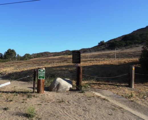
The Mt. McCoy Trail is located on the west side of Simi Valley with a trailhead at the corner of Washburn Street and Los Amigos Avenue (off the west end of Royal Avenue).

The trailhead at the corner of Washburn St and Los Amigos Avenue

The trailhead at the corner of Washburn St and Los Amigos Avenue

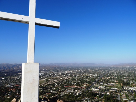
The Mt. McCoy trail is distinctive as there is a large white cross at the top of the mountain, which is about a 600 or so foot climb. From the trailhead, go straight and then take the switchbacks up the mountain.

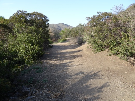
At this first juncture, keep going straight (south) to the switchbacks. Turn right and you'll be going straight up the steep hill, like we did the first time.

At this first juncture, keep going straight (south) to the switchbacks. Turn right and you'll be going straight up the steep hill, like we did the first time.

Actually, after just a few hundred feet from the Washburn/Los Amigos trailhead, you'll reach a juncture where you either go straight (which is correct) or take a trail to the right, which is much steeper, but a much more direct path to the top. We made the mistake of taking that path the first time and it got us right up to the cross, but it is pretty steep.

The trails here are all really nicely groomed, thanks to the Rancho Simi Trailblazers and RSRPD. There are dozens of "shortcuts" along the trail but try to stick to the main path. Taking the correct path, with its switchbacks and twists and turns, is a bit over a mile to the top of Mt. McCoy, where you will be treated to panoramic views of the entire Simi Valley and the other direction towards the Reagan Library.  In fact, there are paths from the top that take you in other directions, including  a fire road that intersects with Presidential Drive to the Reagan Library.

View of the cross from about halfway up

View of the cross from about halfway up

A couple benches at the top of the hill to take in the beautiful views

A couple benches at the top of the hill to take in the beautiful views

McCoyTrail_cross2.JPG

The Rancho Simi Recreation and Park District owns 200 acres surrounding Mt. McCoy and the Rancho Simi Trailblazers helped construct the nicely maintained trail. Learn more at www.rsrpd.org/business_detail_T9_R17.php/

McCoyTrail_topview.JPG
Looking down from the cross to the south, where the benches and trailhead are.

Looking down from the cross to the south, where the benches and trailhead are.

Ojai Valley Trail

OjaiValleyTrail_Sign.jpg

The Ojai Valley Trail is a 9 mile trail that parallels Highway 33 from Foster Park on the outskirts of west Ventura, to Soule Park in Ojai. One side of the trail is paved for bicyclists, walkers, joggers and people exercising their pets. Post-and-rail wood fence separates the paved path from a dirt bridle path for horseback riders. Sections wind through wooded areas and past riverbeds. While most of the path is offset from Highway 33 (the main thoroughfare in Ojai), it does have a number of street crossings. If staying in Ojai and you run or bike, you will no doubt cross paths with this path!

At Foster Park, the Ojai Valley Trail connects with the 6.3 mile Ventura River Trail, which in turn extends to the Omer Rains Trail along the Ventura beachfront.

OjaiTrail1.JPG
OjaiTrail2.JPG
OjaiTrail3.JPG
Ojai Valley Trail near Foster Park

Ojai Valley Trail near Foster Park

Long Canyon Trail in Simi Valley

The Long Canyon Trail is an easy to moderate hike in the Wood Ranch section of Simi Valley, located at the corner of Wood Ranch Parkway and Long Canyon Road (take Wood Ranch Parkway south until it ends, and turn right into the parking lot).

About a .7 mile hike to the top of the canyon connects you with the Lang Ranch / Woodridge Open Space in Thousand Oaks. Great views from the top towards Simi Valley,  Thousand Oaks and beyond, towards the Channel Islands on clear days.

More information at www.rsrpd.org/business_detail_T9_R16.php.

LongCanyon0.jpg
Technically I believe this bench is in the Lang Ranch/Woodridge Open Space in Thousand Oaks, which connects with the Long Canyon Trail. Nice view here towards Simi Valley.

Technically I believe this bench is in the Lang Ranch/Woodridge Open Space in Thousand Oaks, which connects with the Long Canyon Trail. Nice view here towards Simi Valley.

Lizard Rock Hike in Wildwood Park, Thousand Oaks

Lizard Rock is just over a mile from the main entrance to Wildwood Park at the west end of Avenida de los Arboles. Walk/run/hike the Mesa Trail towards Lizard Rock and you will be treated to beautiful views of the surrounding spaces where shows like Gunsmoke and The Rifleman were filmed.

The entrance area and dirt parking lot at the Wildwood Park main trailhead.

The entrance area and dirt parking lot at the Wildwood Park main trailhead.

LizardRockInDistance.JPG
Lizard Rock in the distance

Lizard Rock in the distance

View from on top of the lizard

View from on top of the lizard

Trail sign south of Lizard Rock indicating Lizard Rock Trail to Wildwood Canyon Trail

Trail sign south of Lizard Rock indicating Lizard Rock Trail to Wildwood Canyon Trail

You can make this hike a 4 1/2 mile loop past Paradise Falls and the Indian Creek Trail by reviewing the map on the Conejo Open Space Foundation website at cosf.org/trails/wildwood/wildwood-park-easy-hike-indian-creek.

Santa Rosa Loop Hike in Wildwood Park

The Santa Rosa Loop Hike at Wildwood Park in Thousand Oaks is a 6 1/2 mile trek with moderately challenging uphills and downhills. You’ll be rewarded with beautiful views of the Conejo Valley and Santa Rosa Valley.

Start at the main Wildwood trailhead at the west end of Avenida de Los Arboles. Take the main Mesa Trail towards Lizard Rock. You'll soon reach the Santa Rosa Trail sign, which points you north.

Box Canyon Loop Trail
As you crest the hill, follow the arrows toward the Lower Santa Rosa Trail.

As you crest the hill, follow the arrows toward the Lower Santa Rosa Trail.

Views of Santa Rosa Valley

So you're heading east and almost feeling like maybe you're getting lost, but this indeed is the Santa Rosa Trail. Just stay towards the left. It is single track much of the way over here. Then, you'll see the following sign as you get closer to the bottom of the Santa Rosa Valley.

So now you are zig zagging down the Shooting Star Trail, which eventually merges into the Lower Santa Rosa Trail.

(That said, you can continue east from the above juncture and make your way to Cal Lutheran.)

Now you're going to turn left (west) on Lower Santa Rosa Trail for some gentle slopes alongside private residences and farms in the Santa Rosa Valley for about a mile or so.

Some old farming equipment on the side of the Lower Santa Rosa Trail.

Some old farming equipment on the side of the Lower Santa Rosa Trail.

Then soon you come to the end of the trail and there's a sign that tells you to get back into Wildwood Park via the Box Canyon Trail, take the road up ahead 4/10ths of a mile. You're actually in Camarillo now on Rocky High Road.

The trail ends at the juncture of Talal Ct (private) and Rocky High Road.

The trail ends at the juncture of Talal Ct (private) and Rocky High Road.

At the end of the short stretch of road is the trailhead back into Wildwood Park.

And soon you'll see the Box Canyon Trail sign. Veer left (although I think if you go right it loops around to the main trail also).

Box Canyon Trail Sign

It's about a 300 foot climb over less than half a mile up the Box Canyon Trail that gets you back to the main Mesa Trail artery in Wildwood Park. Take your time...you're almost there!

Box Canyon Lizard Rock Sign Wildwood Park

Then you'll see the Lizard Rock / Box Canyon sign that signifies you are back at the Mesa Trail to head about half a mile back to the parking lot. Or turn right to check out the views from Lizard Rock before you go.

To see a map of this hike, visit www.cosf.org/website/html/santa-rosa-loop.html.

OK, so if you're looking to take a break and sit back and enjoy the view near the juncture of the Mesa Trail and Box Canyon Trail?  Then head back (west) from the "Lizard Rock/Box Canyon" trail sign above toward Box Canyon and take the trail on the left to the Box Canyon Overlook, where you will find the following place to park your rear end. Not a bad view, eh?

Bench at Box Canyon Overlook.

Bench at Box Canyon Overlook.

Sycamore Canyon Campground in Point Mugu State Park

Point Mugu State Park is located at 9000 W. Pacific Coast Highway, Malibu, offering a variety of beach, hiking and camping opportunities.

The Sycamore Canyon Campground is north of PCH, offering 58 tent/RV spaces along with drinking water, restrooms, showers and fire rings. There are also 4 tent spaces available for "Hike and Bike" campers. Pets are allowed on leash in the campground. Fees as of October 2024 are $35/night plus a $7.99 reservation fee at www.reservecalifornia.com (type in Point Mugu SP to find Sycamore Campground).

This campground is across the street from Sycamore Cove Beach, also part of Point Mugu State Park and just around the corner from the Thornhill Broome Campground on the beach, the giant sand dune across from Thornhill Broome, and Mugu Rock.

Sycamore Canyon has trails galore to explore, going all the way up, eight miles, to Newbury Park, if you so choose. Located just steps from the Sycamore Canyon Fire Road trailhead is the "Scenic Trail," a moderate trail with some steps that gets you to stunning views of everything mentioned above - beaches, Mugu Rock, sand dune, etc.

The Scenic Trail connects with the Overlook Fire Road, which continues on and eventually connects with the top of the Ray Miller Trail, then on towards the La Jolla Valley. It is lush and stunning when green in late winter/early spring. It gets pretty brown and dry up here towards last spring, summer and fall months. But the great views towards the Pacific never change.

Lang Ranch/Woodridge Open Space Trails in Thousand Oaks

Looking for some spectacular trail hiking and panoramic views stretching from the Conejo Valley to the Simi Hills? Then take a look at the open space trails in the Lang Ranch/Woodridge system in the northeast portion of Thousand Oaks in the Lang Ranch area (where Avenida de los Arboles meets Westlake Boulevard).

The 1,025 acre area is maintained by the Conejo Open Space Conservation Agency (COSCA) and connects with another 8,000 acres of open space that is part of the Santa Monica Mountains. There are 10 miles of well-maintained trails that are outstanding for hiking, running and biking. The views are spectacular and you can actually hike from Thousand Oaks to Simi Valley (via the Long Canyon Trail) and Agoura Hills (Woodridge to Cheeseboro/Palo Comado).

More information about the various trails in the Lang Ranch/Woodridge Open Space on the Conejo Open Space Foundation website at cosf.org/trails/lang-ranch.

The specific trails seen below can be accessed from the Autumn Ridge trailhead at Westlake Boulevard and Autumn Ridge Drive in Thousand Oaks.

Access to this trail is at the corner of Westlake Bd and Autumn Ridge Dr

Access to this trail is at the corner of Westlake Bd and Autumn Ridge Dr

You can get a clear view of Bard Lake (Calleguas Water District Reservoir) from the Sunrise Trail, which parallels to the north of a portion of the Autumn Ridge Trail.

LangRanchTrail4.jpg
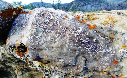
Checking out fossils on display in the open space. Pretty fun to see with the kids. The approximate spot of these fossil rocks is at THIS LINK.

Checking out fossils on display in the open space. Pretty fun to see with the kids. The approximate spot of these fossil rocks is at THIS LINK.

This bench is located at the juncture of the Sunrise and Meadow Vista Trails in the Lang Ranch Open Space and Long Canyon Trail, which is accessible via the Wood Ranch section of Simi Valley. Not a bad view, eh?

This bench is located at the juncture of the Sunrise and Meadow Vista Trails in the Lang Ranch Open Space and Long Canyon Trail, which is accessible via the Wood Ranch section of Simi Valley. Not a bad view, eh?

Trailhead at east end of Lang Ranch Parkway, to Albertson Fire Road trail.

Trailhead at east end of Lang Ranch Parkway, to Albertson Fire Road trail.

There’s another fun path I like to take in the Lang Ranch Open space. Take the Autumn Ridge Trail about half a mile and veer left at the Woodbridge Connector Trail, looping up and around to Wood Ranch in Simi Valley to the Long Canyon Trail trailhead, then back up to Lang Ranch. It’s only about 4 or 5 miles. See the map at cosf.org/files/maps/lang_ranch_trail_map.pdf for details.

Potrero Ridge Trail in Newbury Park

The Potrero Ridge Trail in Newbury Park is an interesting ridgeline trail that runs west/east in three sections over approximately 2 1/2 miles one way. You can access the trail from a number of locations and neighborhood feeder trails, but the main sections are as follows (west to east):

Via Las Brisas in the Dos Vientos tract, just north of Paseo Santa Rosa to Reino Road, just north of Paseo de Leon and Lynn Road, is a little over a mile. This is one of my favorite trails in the area, providing panoramic views of the southern portion of Newbury Park, Boney Mountain and Dos Vientos. There are some switchbacks on the west end near Reino Road but they are not overly strenuous.

Potrero Ridge Trailhead on Via Las Brisas, just north of Paseo Santa Rosa.

Potrero Ridge Trailhead on Via Las Brisas, just north of Paseo Santa Rosa.

potreroridgeview.JPG
Potrero Ridge Trail trailhead (and parking area) off of Reino Road

Potrero Ridge Trail trailhead (and parking area) off of Reino Road

The middle section of the Potrero Ridge Trail runs from Woodland Oak Place off of Reino Road to Wendy Drive between Felton and Peppermint, where there's a convenient dirt parking lot.  Only about a half mile to the top of the trail, where you'll see a water tank. The primary trail is a wide fire road to the water tank from Wendy Drive. There's a secondary single track trail that mostly runs parallel (south) to the main fire road that is accessible from several points. This trail treats you to wonderful, panoramic views of the area.

Potrero Ridge Trail trailhead off of Wendy Drive.

Potrero Ridge Trail trailhead off of Wendy Drive.

Views towards the water tank at top of Potrero Ridge Trail (middle section)

Views towards the water tank at top of Potrero Ridge Trail (middle section)

The east section of the trail runs from across the parking lot on Wendy Drive to another peak, then down towards Silas Lane near Grace Bible Church, about half a mile in total. There is no parking available for this section of trail, though you can park in the Wendy lot and find a crosswalk to cross over to the trailhead.

View from east section of Potrero Ridge Trail.

View from east section of Potrero Ridge Trail.

So basically these 3 segments are split between Via las Brisas and Reino Road, Reino Road and Wendy Drive and Wendy Drive and Silas Lane.

If you'e like to extend your trail trekking on the west side, cross over Via las Brisas and take the Sierra Vista Trail west another mile to Rancho Dos Vientos.

This trail is maintained by the Conejo Open Space Foundation.

Here's a view of the initial section of the western section of the Potrero Ridge Trail from the Wendy Water Tank section of the trail across Reino Road.

Here's a view of the initial section of the western section of the Potrero Ridge Trail from the Wendy Water Tank section of the trail across Reino Road.

Views into the Dos Vientos section of Newbury Park

Views into the Dos Vientos section of Newbury Park

Potrero Ridge Trail bench provide extensive views

Potrero Ridge Trail bench provide extensive views

Views from the same bench on a cloudy late October day in 2013

Views from the same bench on a cloudy late October day in 2013

Malibu Creek State Park

MalibuCreekSP_sign.JPG

Malibu Creek State Park is accessible in Calabasas, at 1925 Las Virgenes Road, south of Mulholland. The park contains over 8,000 acres of rugged, beautiful hills, trails and scenery. It stretches from Agoura Hills down to Malibu, down to Malibu Lagoon State Beach, covering much of the 25 mile Malibu Creek that flows from Boney Mountain down to the Lagoon. Malibu Creek is the only stream channel that crosses through the Santa Monica Mountain range.

There are three natural preserves in the park, Liberty Canyon, Udell Gorge and Kaslow, which protect Valley Oaks, rare plants and volcanic formations.

Things to do in Malibu Creek State Park include hiking, running, biking, camping, picnicking, fishing and checking out the wildlife. There are over 35 miles of trails and fire roads throughout the park. A fun added bonus is the old M*A*S*H series set, filmed from 1972 to 1983, that resides there.

Dogs are not allowed in Malibu Creek State Park trails.

Malibu Creek State Park contains roughly three dozen different trails, many easy, and some...extraordinarily challenging, such as the Bulldog trail, taking you to 2,500 foot peaks with panoramic views out to the ocean and surrounding peaks and valleys.

Parking for the day at Malibu Creek State Park is currently $12, or $3 per hour. You can also park at the corner of Mulholland and Las Virgenes and make your way into the park via the Grassland Trail.

The campground at Malibu Creek State Park has 62 campsites and 4 RV sites. Visit www.parks.ca.gov/?page_id=614 for more information.

The old M*A*S*H site is 2.7 miles from the parking area.

M*A*S*H site with plenty of picnic tables

M*A*S*H site with plenty of picnic tables

The Visitor Center is only a 10 minute walk from the parking lot and is generally open from noon to 4pm on weekends.

The Visitor Center is only a 10 minute walk from the parking lot and is generally open from noon to 4pm on weekends.

There's also an interesting visitor center about 1/2 mile from the main entrance to the park. It is open on Saturday/Sunday from noon to 4pm, subject to availability of docents. Worth a stop as there are some neat things to see in there, including wildlife and rocks/artifacts and other useful information. You can also purchase drinks in there as well as a small assortment of other items.
Hike to the Rock Pool at Malibu Creek State Park

Century Lake Hike at Malibu Creek State Park

Two Springs Trail and Wildwood Canyon Trails in Wildwood Park, Thousand Oaks

Sign on the west side of the Wildwood Park parking lot after walking down some steps

Sign on the west side of the Wildwood Park parking lot after walking down some steps. (Indian Creek Trail was renamed Two Springs Trail in May 2022.**)

If you enjoy the sound of running water, the Two Springs Trail (formerly Indian Creek Trail) and Wildwood Canyon Trail at Wildwood Park in Thousand Oaks are for you.

The Two Springs Trail can be accessed from the main Wildwood Canyon trailhead area parking lot at the east end of Avenida de los Arboles as well as at a separate trailhead on Arboles, slightly west of the parking lot.

Indian Creek Trail entry point from Avenida de los Arboles

Two Springs Trail (formerly Indian Creek Trail) entry point from Avenida de los Arboles

There are shady sections hidden among the trees and sections in the sun. Most of the trail runs along a creek that flows into Paradise Falls. This is not a completely easy hike as there are some hilly sections, a number of steps, and a stream crossing. That said, there's enough variety to make this a fun and interesting hike with the kids.

Visit the Conejo Open Space Foundation website at cosf.org/trails/wildwood/wildwood-park-easy-hike-moonridge-trail/ for a handy map of these trails.

About half a mile or so into the hike, you'll come across a fairly significant waterfall down below, way below, in the creek. Not as large as Paradise Falls, but definitely prominent. Adjacent to that area is a bench. And from there you have some steps and a stream crossing to make it down to the flatter section of the trail.

The waterfall seen from the Indian Creek Trail. Be careful!

The waterfall seen from the Two Springs Trail (formerly Indian Creek Trail). Be careful!

The bench on the Indian Creek Trail in Wildwood Park

The bench on the Two Springs Trail (formerly Indian Creek Trail) in Wildwood Park

Eventually you get to a bridge. If instead of crossing the bridge, you veer left (southwest), you'll be on the Wildwood Canyon Trail along the creek. This is a wide path that can take you on another little sidetrack loop up the Castillo Trail to Castillo Circle (street). A bit of a steep, roughly 3/8ths of a mile trail to Castillo Circle, where you can walk back to a separate trailhead via Velarde Drive north to San Miguel Circle to the San Miguel Trail. You'll end up back at the bridge area.

The Wildwood Canyon Trail is pretty cool. Fairly flat, wide and runs along a creek. The water they say is mostly urban runoff but fun to check out up close with the kids.

The Wildwood Canyon Trail is pretty cool. Fairly flat, wide and runs along a creek. The water they say is mostly urban runoff but fun to check out up close with the kids.

The Meadows Center next to the bridge has restrooms and a drinking fountain. The Conejo Rec & Park District leads many hikes here for s'mores and fun activities.

The Meadows Center next to the bridge has restrooms and a drinking fountain. The Conejo Rec & Park District leads many hikes here for s'mores and fun activities.

The bridge that intersects the Indian Creek Trail and Wildwood Canyon Trail. Lots of options!

The bridge that intersects the tWO sPRINGS (FORMERLY iNDIAN cREEK) Trail and Wildwood Canyon Trail. Lots of options!

Or, veer right (west) over the bridge, continuing on perhaps the Wildwood Canyon Trail southeast towards the top end entry into the Paradise Falls area (pretty cool to go this way). You can also sidetrack a bit by crossing the bridge and making a sharp right (north) to the short Little Cave Trail** and check out the Little Cave **.

The Indian Cave is really easy to get to. Wear good hiking shoes though as it can get slippery. I slipped several times recently because the sole of my sneakers was so worn down.

The Little Cave (formerly Indian Cave**) is really easy to get to. Wear good hiking shoes though as it can get slippery. I slipped several times recently because the sole of my sneakers was so worn down.

You can return to the parking area by either backtracking up the Two Springs Trail or by taking the trail directly across from the bridge (basically go straight) up the steep, moderately winding path to a public access road (there is overflow parking available here) to the main Mesa Trail. From there, go right (east) back to the parking lot.

I could go on but there are so many different options in Wildwood Park that we'll stop here for now. Here are links to some other options:

THE TEEPEE, LITTLE CAVE AND PARADISE FALLS

LIZARD ROCK

SANTA ROSA LOOP

SANTA ROSA TRAIL AND LOWER BUTTE TRAIL FROM WILDWOOD PARK TO CLU

** The change in name was approved by the Conejo Open Space Conservation Agency (COSCA) in May 2022. COSCA received a request to change the Indian Creek Trail name earlier that year. On its own, the work "Indian" refers to individuals from India, rather than Native Americans, and thus did not accurately reflect the origin of the people to whom it refers.

The Indian Cave and Indian Cave Trail were renamed Little Cave as it was unclear if the cave was naturally formed and/or historically used by Native Americans.

The Indian Creek Trail in Wildwood Park was renamed Two Springs Trail as two natural springs contribute to the stream flow in this portion of the channel.

El Encanto Trail in Dos Vientos Section of Newbury Park

ElEncanto_sign.JPG

If you're looking for quick access to gorgeous views in the Dos Vientos section of Newbury Park, from Thousand Oaks to Camarillo to the Santa Monica Mountains, stop by the roughly 1.2 mile El Encanto Trail. Access the trail either at the western endpoint of Kimber Drive, just past Greenway Avenue, or inside Dos Vientos at the eastern endpoint of Via Laguna, near the Calle Del Prado intersection.

After a fairly flat start off of Kimber, the trail gets a bit steep and narrow. My young kids were fine on it but it take a decent effort, with an elevation climb of about 300 feet.

And towards Thousand Oaks on the east

This little trail seems quite popular with mountain cyclists as well as hikers. Here's an inviting bench that awaits you near the top of the trail, about halfway between the Kimber and Via Laguna trailheads.

ElEncanto_Bench.JPG

The area was ravaged by the Springs Fire of 2013. The bench has an inscription dedicated to the efforts of the Ventura County Fire Department that did such a fantastic job protecting local neighborhoods.

ElEncanto_benchsign.JPG

If you start on the Kimber side all the way to the Via Laguna side, you can either retrace your steps back or take Calle Del Prado down to Via Rio, turning left (east) for a about a quarter mile walk back to the Kimber side.

For a detailed trail map of Dos Vientos area trails on the Conejo Open Space Foundation website, visit https://cosf.org/files/maps/dos_vientos_trail_map.pdf.

Upper Sycamore Canyon Trail in Point Mugu State Park

The Upper Sycamore Canyon Trail is a 1.3 mile trail connects to the bottom of steep Sycamore Canyon Fire Road on the west to the Danielson Road trail on the east.

Sign at top of Sycamore Canyon Road before the descent into the canyon.

Sign at top of Sycamore Canyon Road before the descent into the canyon.

The trail goes deep into the canyon and can get quite overgrown, especially after solid winter rains. But it is an interesting hike and alternative to other trails that take you to "The Waterfall" in the Boney Mountain Wilderness. Bike and dogs are not allowed on these back country trails. Watch out of course for poison oak and snakes.

The "Narrow Bridge" sign marks the bottom of the steep initial grade down Sycamore Canyon Fire Road. You'll cross the bridge, then see the Upper Sycamore Canyon Trail entry to the left.

The "Narrow Bridge" sign marks the bottom of the steep initial grade down Sycamore Canyon Fire Road. You'll cross the bridge, then see the Upper Sycamore Canyon Trail entry to the left.

After you enter the west end of the Upper Sycamore Canyon Trail, within about a 1/10th of a mile is the entry point to the Fossil Trail, a very steep trail that leads up to the Old Boney Trail. 

Inside the canyon, looking west, towards the Sycamore Canyon Fire Road.

Inside the canyon, looking west, towards the Sycamore Canyon Fire Road.

After the substantial rains of Winter 2017, a creek has been flowing through this canyon and has caused some obstacles and overgrown sections of the trail. Do wear good hiking shoes.

Upper Sycamore Canyon Trail (Map excerpt courtesy of National Park Service)

Upper Sycamore Canyon Trail (Map excerpt courtesy of National Park Service)

Danielson Road sign you will see at the east end of Upper Sycamore Canyon Trail, Now you can head back up towards Rancho Sierra Vista/Satwiwa to the left or go the The Waterfall and/or Danielson Monument.

Danielson Road sign you will see at the east end of Upper Sycamore Canyon Trail, Now you can head back up towards Rancho Sierra Vista/Satwiwa to the left or go the The Waterfall and/or Danielson Monument.

Triunfo Creek Park in Westlake Village

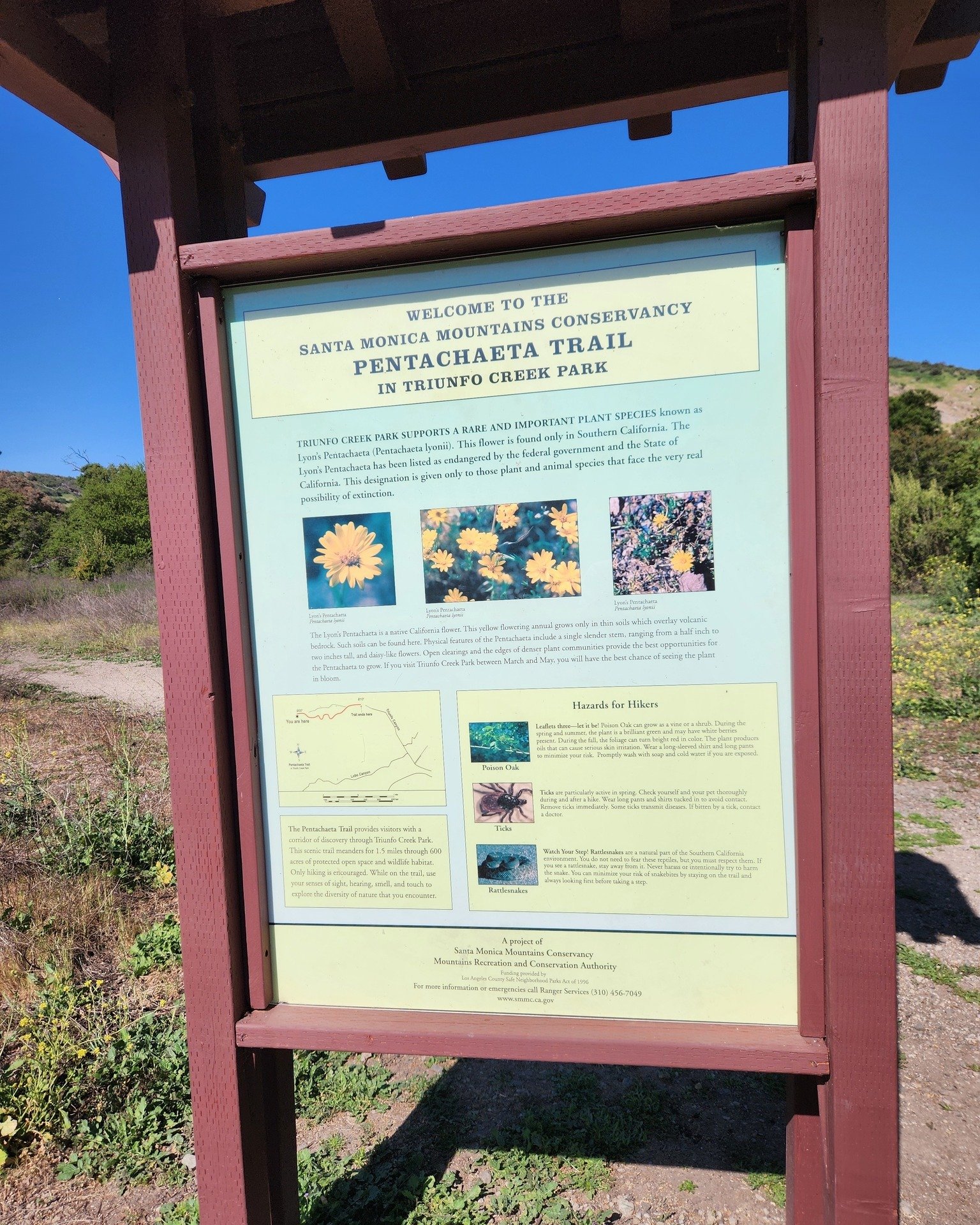
Owned and maintained by the Santa Monica Mountains Conservancy, 600-acre Triunfo Creek Park in Westlake Village/Agoura provides deep oak woodland, native grasslands and blankets of wildflowers in the springtime. The main feature of the park, the Pentachaeta Trail, is named after the Pentachaeta lyonii, a federally-listed endangered flower found in the park. The yellow, daisy-like flower is found only in Southern California, and blooms between April and June.

PentachaetaTrail.JPG

An informational kiosk at the trailhead interprets the Pentachaeta lyonii, as well as other unusual wildflowers found on the site such as the Chocolate Lily, and the White Globe Lily. The site also provides access to hiking trails on the Westlake Vista parcel, also owned and managed by the Conservancy.

PentachaetaTrail1.JPG
PentachaetaTrail2.JPG
Pentachaeta Trail to the east. Westlake Vista Trail towards the Las Virgenes Reservoir on the west.

Pentachaeta Trail to the east. Westlake Vista Trail towards the Las Virgenes Reservoir on the west.

Pretty flowers off the Pentachaeta Trail in March 2016.

Pretty flowers off the Pentachaeta Trail in March 2016.

pentachaeta1.JPG
Views from Westlake Vista Trail towards, well, but of course, Westlake Village

Views from Westlake Vista Trail towards, well, but of course, Westlake Village

Las Virgenes Reservoir in close proximity to Westlake Vista Trail.

Las Virgenes Reservoir in close proximity to Westlake Vista Trail.

The Westlake Vista Trail takes you to a fence that encloses the Las Virgenes Reservoir, where you may be treated to sounds of birds and other wildlife. Find the trail that parallels the fence up the mountain and you will be treated to gorgeous views of the area down to Westlake Lake and beyond and the Santa Monica Mountains to the south.

Views towards Westlake Lake from the Westlake Vista Trail.

Views towards Westlake Lake from the Westlake Vista Trail.

Directions: The main trailhead with kiosk is on Triunfo Canyon Road east of the southern terminus of Lindero Canyon Road. There are a small number of off-pavement parking spots there. The other end of the trail is at the west end of Triunfo Canyon Road about 1.5 miles west of Kanan Road.

Directions: From the 101 Freeway in Westlake Village exit Lindero Canyon Road. Take Lindero south to Triunfo Canyon Road. Turn left. The trailhead is located opposite Oak Forest Mobile Home.

Visit mrca.ca.gov/parks/park-listing/triunfo-creek-park for more information.

Map courtesy of Santa Monica Mountains Conservancy at THIS LINK. (Note that Truinfo is a typo on map; actual spelling is Triunfo. But at least is was consistently misspelled not once, not twice, but seven times lol.)

Map courtesy of Santa Monica Mountains Conservancy at THIS LINK. (Note that Truinfo is a typo on map; actual spelling is Triunfo. But at least is was consistently misspelled not once, not twice, but seven times lol.)

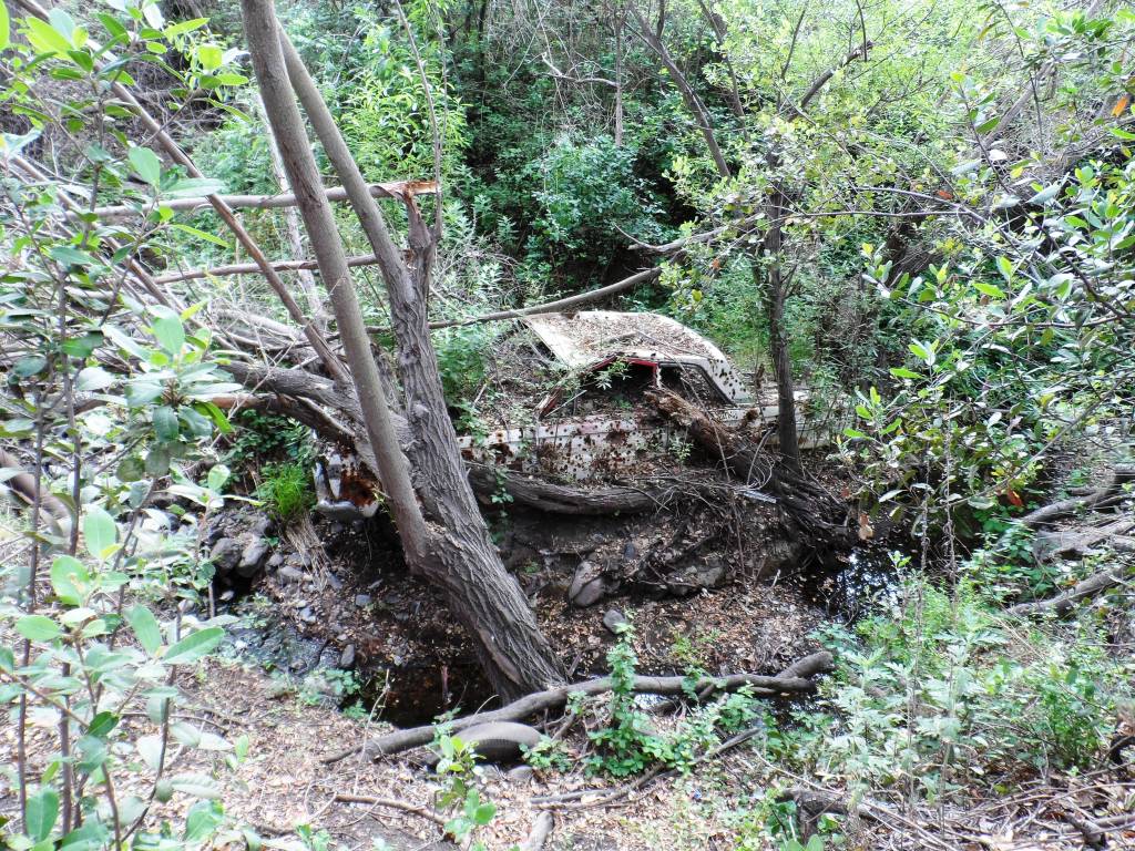
Demolished car sitting near Westlake Vista Trail.

Demolished car sitting near Westlake Vista Trail.