Rancho Potrero Open Space in Newbury Park

The Rancho Potrero Open Space is located in Newbury Park off of Lynn Road, just west of the intersection with Rancho Dos Vientos. The area includes the Rancho Potrero Community Equestrian Center and is adjacent to the Rancho Sierra Vista/Satwiwa area in the Santa Monica Mountains National Recreation Area.

Map excerpt courtesy of Conejo Open Space Foundation (www.cosf.org)

Map excerpt courtesy of Conejo Open Space Foundation (www.cosf.org)

A newer parking lot and restrooms were built in 2015 allowing for easier access to the Rancho Potrero Open Space. It is accessible just west of the equestrian center off of Lynn/Potrero Road.

u

There is a trailhead further west of the parking lot, just before Potrero (Lynn) Road takes a sharp right turn.  You can usually find parking off pavement here. A short (1/4 mile) walk up the hill gets you pretty darn nice views looking towards Camarillo and the Channel Islands. Take the adjoining Palomino Trail east towards Rancho Sierra Vista and the Satwiwa Native American Indian Cultural Center.

The entrance is further east off of Potrero/Lynn Road

The entrance is further east off of Potrero/Lynn Road

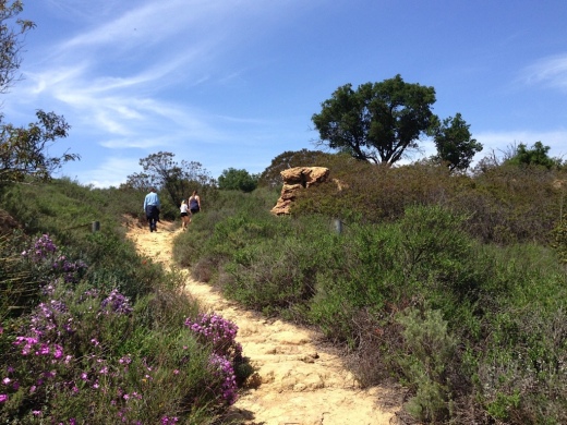
About a 1/4 mile gets you to the top of a hill that gives you views as far as the Channel Islands.

About a 1/4 mile gets you to the top of a hill that gives you views as far as the Channel Islands.

RanchoPotreroDec2014.JPG

Conejo Canyons Bridge and Trails in Thousand Oaks

In 2012, the Conejo Canyons bridge was constructed in Thousand Oaks, opening up more trails to explore in the Western Plateau area of Thousand Oaks, which ties into Wildwood Park. Check the map at cosf.org/conejo-canyons for trail maps.

WesternPlateauMap.JPG

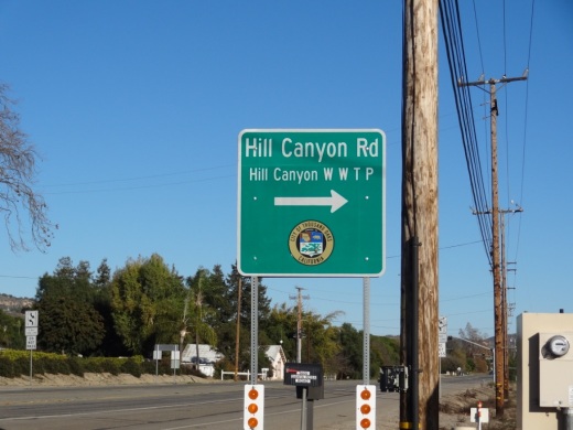
Access the Conejo Canyons bridge via Santa Rosa Road. Coming from Thousand Oaks, take Moorpark Road north down the Norwegian Grade, where it intersects with Santa Rosa Road. Continue about 3.7 miles on Santa Rosa Road and make a left on Hill Canyon Road. Drive down Hill Canyon Road and you will see a large, flat dirt parking area on the right, adjacent to Santa Rosa Valley Regional Park.

Sign on Santa Rosa Road at Hill Canyon (coming from Camarillo)

Sign on Santa Rosa Road at Hill Canyon (coming from Camarillo)

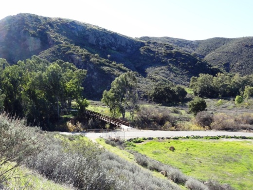
Parking area on Hill Canyon Road, as seen from the Canyon Overlook Trail leading to Lizard Rock.

Parking area on Hill Canyon Road, as seen from the Canyon Overlook Trail leading to Lizard Rock.

Park and you'll see the Conejo Canyons bridge just south, which takes you to the Hill Canyon Trail, a flat path that after a mile takes you to an intersection. At the intersection, you can turn around, go straight ahead to the Hawk Canyon Trail, take a right turn to the hilly Western Plateau Trail or veer left to make your way to the Arroyo Conejo Trail that ultimately takes you about 2 1/2 miles to the Rancho Conejo Playfields in Newbury Park.

Or go west to the steep Canyon Overlook Trail, a zig zagging hill that takes you to Lizard Rock in Wildwood Park. The hill is a fun challenge with the kids and you'll be rewarded with great panoramic views towards Boney Mountain, Camarillo, Ojai and Simi.

CanyonOverlookTrail.JPG
Conejo Canyons Bridge that takes you to the Hill Canyon Trail

Conejo Canyons Bridge that takes you to the Hill Canyon Trail

LizardRockLoop1.JPG
Conejo Canyons views

Conejo Canyons views

View towards Lizard Rock

View towards Lizard Rock

Wishbone Trail in the North Ranch Open Space

The Wishbone Trail is a two mile round trip, moderately steep trail that takes you from the west end of Westlake Village Community Park through the North Ranch Open Space to the Bowfield Trail. There are two entry points - one directly behind the baseball fields and the other at the far west end of the parking lot.

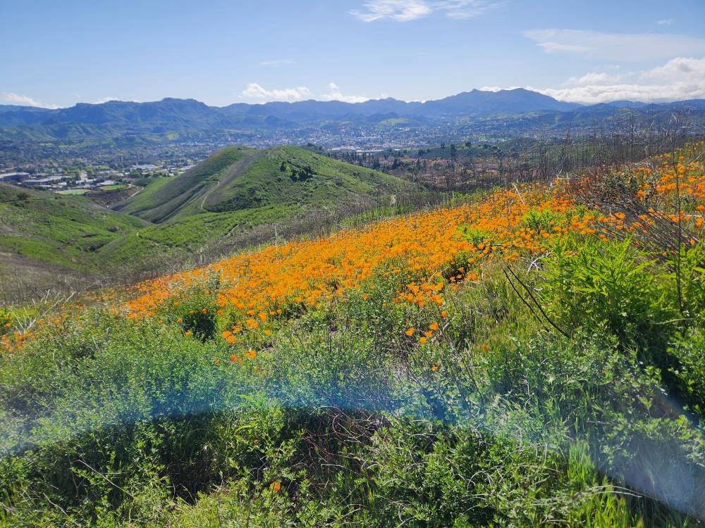
This is one of the newest trails in the Conejo Open space, constructed in 2018. If you’re looking for views, you will get them on this trail. Clear views of Ladyface Mountain on the south, the Boney Mountain Range and other local scenes. And this is the best place to catch California poppies in the spring, in most years. There are several view benches along the west trail as well as a bench at the top, near the juncture with the Bowfield Trail.

More information on the Conejo Open Space Foundation website at cosf.org/files/routes/Wishbone%20Trail.pdf. Westlake Village Community Park is located at 31107 Thousand Oaks Boulevard.

View from the east Wishbone Trial looking west towards the west Wishbone Trail. It is definitely not a flat trail - it is a moderately steep trail.

This access point to the east fork of the Wishbone Trail is directly behind the baseball fields on the west side of Westlake Village Community Park. The other entry point is past the baseball fields at the far west end of the parking lot.

There are some patches of poppies visible off of the Wishbone Trail in the spring but the biggest patches seem to be off of the connecting Bowfield Trail. the wetter the winter, the bigger the poppy display.

Charmlee Wilderness Park in Malibu

CharmleeSign.JPG

Charmlee Wilderness Park is a 532 acre park located at 2577 Encinal Canyon Road in Malibu, just 15 miles from the Conejo Valley. It is located within the Santa Monica Mountains. There are over eight miles of hiking trails, a nature center, picnic areas and more. Park hours are 8 a.m. to sunset and the nature center is open on weekends from 8 a.m. to 5 p.m. (or dark, whichever comes first). Parking is now free of charge.

Visit www.malibucity.org/561/Charmlee-Wilderness-Park for more information.

To get there from the Conejo Valley, take the 23 (Westlake Boulevard/Decker Canyon Road) toward the ocean and turn left on Lechusa Road. Continue on Encinal Canyon Road and look for the sign on the right.

Photos below courtesy of Suzy Demeter Photography.

Charmlee1.jpg
Charmlee3.jpg
Charmlee5.jpg
Charmlee6.jpg

Ronald Reagan Presidential Library and Museum

A local must see is the Ronald Reagan Presidential Library and Museum, located at 40 Presidential Drive, Simi Valley.  With sweeping hilltop views of the surrounding valleys, this 153,000 sq ft museum on 100 acres is educational and interesting for all ages.  A wealth of memorabilia and artifacts from throughout Reagan's life is on display.

ReaganStatue.JPG

In February 2011, over 26,000 sq ft of new exhibits and dozens of interactive displays spanning Reagan's life were introduced.  There are 24 galleries that pay tribute to our 40th President's life. You can act in a movie with Reagan, deliver his inaugural address with a teleprompter, set the table for a state dinner, learn about his economic policies in interactive games, read his handwritten diary, ride a horse alongside Reagan at Rancho del Cielo, and much more. There is also a full-scale Oval Office replica and a 9 1/2 foot, 6,300 lb section of the Berlin Wall on display.

Volunteer docents are very friendly, helpful and extremely knowledgeable. They are there to help guide you through your visit and answer your questions.

Exhibits include the Air Force One Pavilion, sections of the Berlin Wall, F-117 Nighthawk Stealth Fighter, F-14 Tomcat aircraft, Reagan Memorial Site, M-1 Abrams Tank, Marine One helicopter, Oval Office and more.

In addition to the permanent exhibits discussed above, there are usually temporary exhibits on display. Check out the museum's website for details.

Dine at the Reagan Library! The Gipper’s Bar + Bistro offers panoramic views and is open and is open from 10:30am to 3pm seven days a week. You can access this eatery without entering the Library. The Ronald Reagan Pub is located inside the Air Force One Pavilion and offers drinks and prepackaged sandwiches and other items.

The museum is open daily from 10 a.m. to 5 p.m. except Thanksgiving, Christmas and New Year's Day. Parking is free of charge. Admission costs vary based on the special exhibit on hand.

More information at www.reaganfoundation.org.

Tarantula Hill in Thousand Oaks

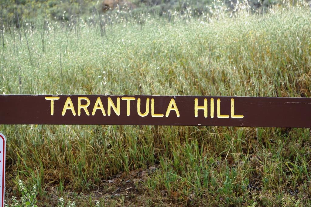
Tarantula Hill is located off of West Gainsborough Road in Thousand Oaks, between Grand Oak Lane and Camino Manzanas. Just park your car by the prominent oak tree and little green sign. The hill is named after the spiders that inhabit this peak that happens to be the highest point within the Conejo Valley, at about 1,057 feet.

I've seen people run, walk and cycle up the paved service road to the top, where you get treated to panoramic views of the entire Conejo Valley. The cyclist was working it pretty darn hard to get up there...the hill it pretty steep...about a 250 foot climb.

There’s also a couple ways to get near the top via trail. Look for the path on the east side of the hill, accessible from Gainsborough.

There's a single bench on the west side at the top and a water reservoir fenced in with barbed wire is quite prominent. For a quick dose of views, Tarantula Hill aims to please.

The bench at the top of Tarantula Hill faces west towards Newbury Park.

The bench at the top of Tarantula Hill faces west towards Newbury Park.

Tarantula Hill is dedicated open space that is protected by the Conejo Open Space Conservation Agency. Visit www.conejo-openspace.org for more information.

TarantulaHill2.JPG
The hill greens up nicely in the spring.

The hill greens up nicely in the spring.

TarantulaHill3.jpg

Boney Mountain Peak Hike From Newbury Park

At an elevation of 2,825 feet, the presence of Boney Peak (also known at Mount Boney), is felt throughout the Conejo Valley and surrounding areas. Want to climb it?

BoneyPeakHikers.JPG

Well you can! It is challenging, but possible. Boney Mountain is located in the Santa Monica Mountains. One way to get to Boney Peak is via the Upper Canyon Trail from the Danielson Monument.

Danielson Monument

Danielson Monument

First off, hike your way up to the Danielson Monument, click this link for details. The monument is next to the remains of a burned down cabin shown below.

There is a trail that veers left next to the chimney. This is where you want to go. You're looking at a challenging 2 mile climb to Boney Peak. Most of the trail is narrow single track. There are some really steep, rocky sections, some with deep crevices, that may freak you out. You may have to duck your head from time to time. The trail is definitely challenging, both going up and coming back down. Definitely not for everyone.

The trail gets tight at times.

The trail gets tight at times.

The trail is not "officially" maintained by the National Park Service and thus there are NO SIGNS that say, hey, go this way to get to Boney Peak.  But I've seen plenty of people make it up there just fine as the path is fairly obvious. Just stay on the main trail.

After twists, turns, rocks, crevices and hills, the trail flattens out a bit near the top.

After twists, turns, rocks, crevices and hills, the trail flattens out a bit near the top.

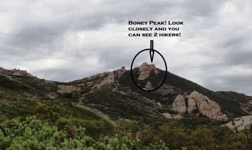
One thing to note when you think you've reached the top. Look at the picture at the top of this post. To the left of the circled area is a large boulder. This is not the peak. There's a trail to the left behind it that you'll have to go up to get to the actual peak. Again, there are no signs. But you should be able to see the path pretty easily. You will be climbing some sheer rock face to get there. Can be slippery. And standing on the top of Boney can be both exhilarating and scary as hell! So be careful!

The final ascent to the top on sheer rock path.

The final ascent to the top on sheer rock path.

How long does it take to get from the trailhead at Wendy and Potrero and back? I'd allow for 4 to 5 hours if you are hiking. If you are a strong runner you can get up to it in as little as an hour (I'm talking top notch runner) to hour and a half, but you will only be able to "run" about half of the trail above the Danielson Monument. The rest is more of a technical hike in and around the rocks, boulders and crevices.

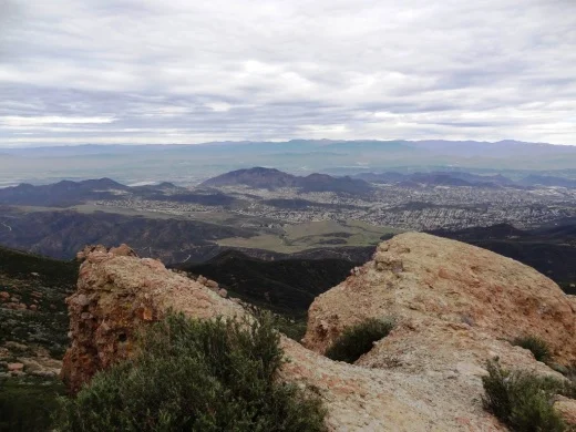
Here are some views you'll be treated to at the top.

BoneyPeakView3.3.13.JPG
BoneyPeak3.3.13_MoreViews.JPG
BoneyPeak3.3.13_Islands.JPG
BoneyPeak3.3.13_Top.JPG
BoneyPeak3.3.13HidVal.JPG
BoneyAnotherView.JPG

Soter Point at Marina Park in Ventura

SoterPoint1.JPG

Dedicated in 2011, Soter Point at Marina Park in Ventura consists of a shaded picnic area, benches, attractive landscaping and a 15 foot mermaid statue. Soter Point is the result of a private/public partnership between local Ventura residents and the City of Ventura.

The inscription on a plaque on the Mermaid of Soter Point tells the story:

This stunning landmark overlooking the Ventura Harbor represents a trailblazing cooperative effort to beautify our community through private citizens working with public agencies. Andy Soter developed and landscaped the area in memory of his daughter Andrea, a successful and much admired investment manager. The mermaid sculpture and its foundation were donated by Russian emigrants Alec and Tatyana Benke, as an expression of love for their new country, America. Samuel Povar created the first collaboration of this nature in 2007 as a tribute to his late wife Orianna and worked tirelessly to make this Marina Park project a reality. And, the Ventura City Council and the Coastal Commission gave their enthusiastic blessing. Now Povar, Soter, and Benke, all Ventura residents, hope to inspire others to use private capital along with public cooperation and support…to envision something beautiful and make it happen.

Soter Point is located at the southernmost point of Marina Park, a short walk from the main playground area of the park. With beautiful views looking out toward Ventura Harbor and picnic area cooled by sea breezes, Soter Point does not Disa-Point.

Bench faces south toward Ventura Harbor Village

Bench faces south toward Ventura Harbor Village

SoterPoint3.JPG
SoterPoint4.JPG
SoterPoint6.JPG

Angel Vista Peak in Newbury Park

AngelVistaBench_June2013_2.JPG

The 1,530' elevation Angel Vista Peak in Newbury Park may well have the most spectacular views of the Conejo Valley. You can see the entire Conejo Valley, stretching from the Conejo Grade to central Thousand Oaks, Agoura Hills, Hidden Valley, Boney Mountain and beyond from here!

Angel Vista can most easily be accessed via the Rosewood Trail at the southern terminus of Regal Oak Ct, off of Lynn Road) Or for a much longer hike, take the Los Robles Trail (either the Thousand Oaks side accessible at South Moorpark Road and Greenmeadow Ave or Newbury Park side off of Potrero Road). The Conejo Open Space Foundation provides a useful map at www.cosf.org/website/html/los-robles-angel-vista.html. There's a bench as well as a picnic table up there with wonderful views.

The hike is about 3 1/2 miles round trip.

You'll eventually see this sign if you make the trek up the Rosewood Trail.

You'll eventually see this sign if you make the trek up the Rosewood Trail.

The bench is in sight!

The bench is in sight!

AngelVista4 - Copy.JPG
AngelVista5 - Copy.JPG
Fun to see at least a portion of Hidden Valley from up here.

Fun to see at least a portion of Hidden Valley from up here.

Grant Park / Serra Cross Park in Ventura

SerraCrossPark1.JPG

For some of the most spectacular views of Ventura you can ask for, stop by Grant Park / Serra Cross Park off of Ferro Drive in Ventura. Grant Park is a 107 acre park of mostly open space. Serra Cross Park is located at Grant Park. It is a one acre parcel that contains the wooden cross shown below.

The land and cross were sold to San Buenaventura Heritage, Inc. in 2003 in order to maintain the historic cross, which was placed on this spot in 1941 to replace the previous cross that was erected in 1912.

Visit www.serracrosspark.org to learn more about Serra Cross Park.

Get there via Brakey Road to the left side of Ventura City Hall or Ferro Drive off of Cedar Street. There are no restrooms, playground, drinking fountains, etc. at this park.

SerraCrossPark2.JPG
SerraCrossPark3.JPG
SerraCrossPark4.JPG
SerraCrossPark5.JPG
SerraCrossPark8.JPG

Oakbrook Vista Trail in Thousand Oaks

The Oakbrook Vista Trail is a relatively easy out and back climb that provides nice panoramic views of the Lang Ranch area of Thousand Oaks. Access to the trail is on the south side of Lang Ranch Parkway, just east of Westlake Boulevard. See access point below.

OakbrookVista1.JPG

The first portion is a narrow trail that zig zags its way to a bench, where you can rest and enjoy the views. But I'd estimate this is only 1/4 of a mile, so keep going if you're game!

OakbrookVista2.5.JPG

After the bench, the trail opens up and continues up and up and up and if you reach the top, roughly a mile or so up the hill, you'll be enjoying 360 degree views towards Boney Mountain on the west, Lang Ranch/Woodridge trails on the north and more.

OakbrookVista4.JPG
OakBrookVista3.jpg
Same view as above, in May 2020.www.cosf.org/website/html/oakbrook-vista-trail.html

Same view as above, in May 2020.www.cosf.org/website/html/oakbrook-vista-trail.html

For a trail map and additional information, visit the Conejo Open Space Foundation website at cosf.org/trails/lang-ranch/lang-ranch-woodridge-easy-hike-oakbrook-vista-trail.

Sycamore Canyon Campground in Point Mugu State Park

Point Mugu State Park is located at 9000 W. Pacific Coast Highway, Malibu, offering a variety of beach, hiking and camping opportunities.

The Sycamore Canyon Campground is north of PCH, offering 58 tent/RV spaces along with drinking water, restrooms, showers and fire rings. There are also 4 tent spaces available for "Hike and Bike" campers. Pets are allowed on leash in the campground. Fees as of October 2019 are $35/night plus a $7.99 reservation fee at www.reservecalifornia.com (type in Point Mugu SP to find Sycamore Campground).

This campground is across the street from Sycamore Cove Beach, also part of Point Mugu State Park and just around the corner from the Thornhill Broome Campground on the beach, the giant sand dune across from Thornhill Broome, and Mugu Rock.

Sycamore Canyon has trails galore to explore, going all the way up, eight miles, to Newbury Park, if you so choose. Located just steps from the Sycamore Canyon Fire Road trailhead is the "Scenic Trail," a moderate trail with some steps that gets you to stunning views of everything mentioned above - beaches, Mugu Rock, sand dune, etc.

The Scenic Trail connects with the Overlook Fire Road, which continues on and eventually connects with the top of the Ray Miller Trail, then on towards the La Jolla Valley. It is lush and stunning when green in late winter/early spring. It gets pretty brown and dry up here towards last spring, summer and fall months. But the great views towards the Pacific never change.

Zev Yaroslavsky Las Virgenes Highlands Park in Calabasas

The Zev Yaroslavsky Las Virgenes Highlands Park is located on Las Virgenes Road, just south of Mureau Road and north of Highway 101 in Calabasas. Acquired in 2010, this area includes nearly 200 acres of open space providing a gateway to the Santa Monica Mountains and a welcome site to drivers navigating bottom of the Calabasas Grade on Highway 101.  Stop by sometime and take a hike up the moderately steep path through grasslands and oak trees to catch panoramic views of the surrounding areas. Learn more at THIS LINK.