Backbone Trail Hike From Kanan Road Trailhead to Zuma Ridge Motorway in Malibu

NOTE: Closed due to damage from the Woolsey Fire as of December 2018. Updates at www.nps.gov/samo/planyourvisit/backbonetrail.htm.

You've driven Kanan Road from Agoura Hills towards PCH for decades and have passed by the Backbone Trail trailhead on Kanan and Newton Canyon Road just before Tunnel "T-1" hundreds of times. But you never stopped there to check it out. Well, it's about time to give it a try!

The Backbone Trail stretches 67 miles through the Santa Monica Mountains, from Will Rogers State Park on the east to the Ray Miller Trailhead on the west. There are 12 "official" Backbone Trail trailheads and the Kanan Road Trailhead is one of them. More information on the National Park Service website at www.nps.gov/samo/planyourvisit/backbonetrail.htm.

There are two trailheads to catch here at what is also referred to as the Newton Canyon Trailhead. The Backbone Trail to the Latigo Canyon Trailhead is 2.5 miles one way headed east. The Backbone Trail to the Zuma Ridge Motorway - the one covered here - is also 2.5 miles one way headed west. 

The Backbone Trail to Zuma Ridge Motorway is a nice, moderate, winding, mostly single track, well-maintained trail. You'll encounter a creek, a view of the Upper Zuma Falls, a short bridge, some tree-lined canopied sections, wildflowers and moderately rocky sections.

KananBackboneTrail1.JPG

Once you reach Zuma Ridge Motorway, you can continue on the Backbone Trail or turn back for a five mile round trip hike.

Ranch Overlook Trail in Rancho Sierra Vista/Satwiwa in Newbury Park

Trailhead to the Ranch Overlook Trail starts at the juncture of Sycamore Canyon Fire Road (paved road that runs through Point Mugu State Park) and the access bridge to the Satwiwa Native American Culture Center.

Trailhead to the Ranch Overlook Trail starts at the juncture of Sycamore Canyon Fire Road (paved road that runs through Point Mugu State Park) and the access bridge to the Satwiwa Native American Culture Center.

This is the bridge heading the other direction from the Ranch Overlook Trail sign leading to the Satwiwa Native American Indian Culture Center.

This is the bridge heading the other direction from the Ranch Overlook Trail sign leading to the Satwiwa Native American Indian Culture Center.

The one mile Ranch Overlook Trail is located in Rancho Sierra Vista/Satwiwa in Newbury Park.

The trail extends from just west of the Satwiwa Native American Indian Culture Center to the Palomino Trail in the Rancho Potrero Open Space.

The trail is about two wide and you’ll find hikers, runners, cyclists and equestrians all sharing it. The east portion is moderately flat, leading to a moderate hill. At the peak, you’ll have nice views toward the Rancho Sierra Vista main parking area and adjacent ranch structures as well as towards Boney Mountain.

Continue west down the trail to a juncture where you can either veer right towards the parking area and road into Rancho Sierra Vista, or you can continue straight until the next juncture. At the next juncture, if you take a left, you’ll soon be transitioning from Federal land (Rancho Sierra Vista) to Conejo Open Space land (Rancho Potrero). Though you won’t find a trail sign that indicates this, the trail that continues westward is the Palomino Trail.

Do be mindful of rattlesnakes back here. They want nothing to do with you, so if you come across one crossing the trail, let them make their way across.

The “peak” of the Ranch Overlook Trail, looking southeast towards Satwiwa and Boney.

The “peak” of the Ranch Overlook Trail, looking southeast towards Satwiwa and Boney.

Peak of Ranch Overlook Trail, looking down towards main Rancho Sierra Vista/Satwiwa parking area and restrooms.

Peak of Ranch Overlook Trail, looking down towards main Rancho Sierra Vista/Satwiwa parking area and restrooms.

This is west of the peak of the Ranch Overlook Trail, a downhill section that takes you towards Rancho Potrero.

This is west of the peak of the Ranch Overlook Trail, a downhill section that takes you towards Rancho Potrero.

This sign is at the bottom of the west side of the Ranch Overlook Trail, facing east, if you opt to take the trail counter-clockwise from the parking area.

This sign is at the bottom of the west side of the Ranch Overlook Trail, facing east, if you opt to take the trail counter-clockwise from the parking area.

This ancient oak tree is adjacent to the Ranch Overlook Trail sign near the parking lot access. This was taken in September 2018. The large branch broke off earlier that summer. In the background is the parking area.

This ancient oak tree is adjacent to the Ranch Overlook Trail sign near the parking lot access. This was taken in September 2018. The large branch broke off earlier that summer. In the background is the parking area.

This is the Palomino Trail in the adjacent Rancho Potrero Open Space, looking east towards Rancho Sierra Vista, in June 2018. These areas do green up after the winter rains in the April/May time frame….but dry up fast.

This is the Palomino Trail in the adjacent Rancho Potrero Open Space, looking east towards Rancho Sierra Vista, in June 2018. These areas do green up after the winter rains in the April/May time frame….but dry up fast.

Old Boney Trail Hike in Pt. Mugu State Park

If you're looking for a hike of about 10 miles in the Rancho Sierra Vista/Boney Mountain Wilderness area, consider the Old Boney Trail loop from Newbury Park. You can park either in the National Park Service parking lot or at Wendy Drive where it meets Potrero Road.

You can do the hike clockwise or counter-clockwise since it is a loop course. I prefer clockwise, which starts by trekking through Rancho Sierra Vista to Danielson Road. Details of this path are at THIS LINK. This path gets you to a juncture where you can continue another 3/10ths of a mile to the Danielson Monument (which you definitely should do if you've never been there) or veer a sharp right up the Old Boney Trail.

Sign at juncture of Danielson Road trail and Old Boney Trail in Pt. Mugu State Park

Sign at juncture of Danielson Road trail and Old Boney Trail in Pt. Mugu State Park

I love the Old Boney Trail. It is narrow and covered with growth on both sides. Kind of like running through a chaparral jungle. This makes the trail mostly shade covered for the first couple miles of this 3.5 mile stretch of trail. You'll be treated to some nice views of Boney Mountain along the way.

OldBoneyTrail1.JPG

Although the Old Boney Trail does not reach a peak for panoramic views, you'll still find several spots that reward you with views towards the Channel Islands and west Ventura County.

OldBoneyTrail2.jpg

About a mile or mile and a half into Old Boney Trail from Danielson Road, you'll see a turnoff sign to the right that takes you to the Fossil Trail, a mile or so drop back down to the bottom of Sycamore Canyon. The drop is about 1300 ft to 500 ft with plenty of rocky surfaces, so you'll have some fun going back down this way, for a shorter route. And of course, look closely and you'll be treated to surfaces covered with sea fossil imprints from millions of years ago.

OldBoneyFossilTrailSign.JPG

From the Old Boney Trail/Fossil Trail juncture, you have another 2.1 fun miles to the next juncture at Blue Canyon Trail at the bottom of the canyon. You'll get some more neat views of Boney Mountain during this stretch. At the juncture is the following sign on Blue Canyon Trail.

Sign on Blue Canyon Trail at the Old Boney Trail juncture in Pt. Mugu State Park.

Sign on Blue Canyon Trail at the Old Boney Trail juncture in Pt. Mugu State Park.

You will turn right on Blue Canyon Trail, which will take you to the Danielson Multi-Use area and the paved Sycamore Canyon Fire Road. A left-hand turn will get you lots of fun for another day, onward to Chamberlain Trail that gets you up to some might nice peaks, and Serrano Valley.

Sign at entrance to Blue Canyon Trail at the Danielson Multi-Use area (you of course will be looking at the back side of this sign if you're coming from the Old Boney Trail).

Sign at entrance to Blue Canyon Trail at the Danielson Multi-Use area (you of course will be looking at the back side of this sign if you're coming from the Old Boney Trail).

I've never actually seen anyone using the Danielson Multi-Use area but here's the picnic area.

I've never actually seen anyone using the Danielson Multi-Use area but here's the picnic area.

So you run through the Danielson area to the main paved road to the right (turning left of course will take you to PCH in about 4-5 miles). In another 3 miles you'll be back in civilization; these miles include the 800 foot, 3/4 mile ascent into Rancho Sierra Vista, which can be a bit brutal...perhaps my (and maybe your) least favorite section of this course. But once you're up the hill, you're home free! Time for breakfast, lunch, dinner or all of the above!

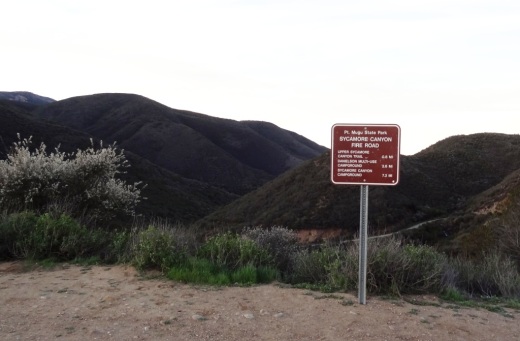
Sycamore Canyon Fire Road sign at the top of the hill in Rancho Sierra Vista/Satwiwa.

Sycamore Canyon Fire Road sign at the top of the hill in Rancho Sierra Vista/Satwiwa.

Of course, you can easily reverse this course and make your way DOWN Sycamore Canyon Fire Road, turn left onto Blue Canyon Trail, left on Old Boney Trail for 3.5 miles and then left on Danielson Road, back down into the canyon and up towards Satwiwa.

The Punch Bowls in Santa Paula

The Santa Paula Canyon Trail takes you to the "The Punch Bowls" in the Los Padres National Forest. This is a fairly challenging hike that is definitely not for everyone. But for many, it is quite an interesting, roughly 7 mile round trip exploration. Plan on at least a 4 to 6 hour excursion.

The trail begins in the hills behind Thomas Aquinas College at 10000 Ojai Road, Santa Paula. This is a private college and thus the public is not allowed access to parking on the campus. There is a small amount of street parking and several dirt lots nearby. Make sure though not to leave any valuables in your car.

Access to the trail takes a bit of a walk on the paved road that swings to the right of the college. There are signs that point the way to the trailhead and that asks hikers to stay on the paved roadway.

The winding road to the trailhead

The winding road to the trailhead

You will be entering private property (continue following the signs), so be mindful of that as you veer left, then past an oil rig through an avocado farm. You will be walking past a large red gate, then continue on, until you reach another oil pumping rig. Go left along the path around the rig to the trailhead, where you will be greeted by the sounds of the Santa Paula Creek.

You will be veering left after walking through this gate,  into private property. You will be walking past an oil pump then into an avocado orchard, then past another oil rig (veer left) to the trailhead.

You will be veering left after walking through this gate,  into private property. You will be walking past an oil pump then into an avocado orchard, then past another oil rig (veer left) to the trailhead.

Cross the creek (there are strategically placed stones) and you are on your way.

Veer right around this., which would seem obvious but to me it wasn't. 

Veer right around this., which would seem obvious but to me it wasn't. 

From here, there are no signs that clearly say "trail this way." Perhaps the main thing to keep in mind is that for the most part, you will be following the creek to the area known as the Punch Bowls. But the exact path is not always clear, especially when you are like me and have a tendency of picking the wrong path at each fork.

Some sections of the trail are perfectly flat and scenic. Most of the trail you will hear the Santa Paula Creek.

Some sections of the trail are perfectly flat and scenic. Most of the trail you will hear the Santa Paula Creek.

But one thing we generally found is that someone has sprayed orange arrows in the direction you need to go. That said, it is still not always clear. Unfortunately, there is graffiti and markings of various sorts much of the way up the trail. In fact this is probably the worst example of defacing of a public trail that I've ever seen. I will not post the images here.

In any case, we didn't let the graffiti bother us too much as the trails were so beautiful, interesting and challenging. In fact, aside from hiking up Boney Mountain, this is probably the most challenging trail I've tried in the local area. There are some "perfectly flat" sections but many sections of the trail are quite rocky, narrow, lined with poison oak and challenging.

Also, be prepared to cross the creek in various sections. It wasn't always clear if we should be on the left or right side of the creek. Make sure to wear good hiking shoes as you will be making some creek crossings, which can be slippery.

I don't usually hike with a walking stick, but it definitely came in handy on this trail. The higher up we got, the rockier and more "bouldery" the trail became. 

The boulders get larger and there are more areas with loose rocks the higher you get up the trail. I don't usually use a walking stick, but it definitely came in handy for this hike.
The boulders get larger and there are more areas with loose rocks the higher you get up the trail. I don't usually use a walking stick, but it definitely came in handy for this hike.

In any case, after some crazy sections of rocks that, when we went (mid-June 2016), included sections of significant piles of rocks (including some fairly recent looking rock slide areas), you will reach the first of the Punch Bowls. This was our final destination, but there are additional pools of water higher up, on trails that appear increasingly challenging.

This punch bowl was our final destination before heading back down. Beautiful to see, though the water was not particularly deep (blame it on the drought) or clean looking. But quite a great destination to hike to nonetheless and enjoyable to relax …

This punch bowl was our final destination before heading back down. Beautiful to see, though the water was not particularly deep (blame it on the drought) or clean looking. But quite a great destination to hike to nonetheless and enjoyable to relax and take it in.

I took 4th and 7th graders with me and they did fine. It was a lot of fun. Definitely not stroller friendly. Dogs are ok on leash, though I wouldn't bring my dog due to the proliferation of rocks.
Learn more about the Santa Paula Canyon Trail at www.hikelospadres.com/santa-paula-canyon-trail.html.

Marvin Braude Coastal Bike Path - Pacific Palisades to Torrance

We love driving down to Will Rogers State Beach from time to time, bring the bikes and enjoy the Marvin Braude Coastal Bicycle Path along the Pacific Ocean. 

This fun 22 mile path takes you from Pacific Palisades as far as Torrance.  Depending on how far you want to go and if you have kids with you, there are so many spots to stop along the way. 

To get to Will Rogers State Beach from the Conejo Valley, take the 101 to Las Virgenes/Malibu Canyon Road south to PCH, then about 9 miles down PCH to Will Rogers (17000 PCH), just east of Gladstones and Sunset Boulevard. Parking at Will Rogers varies based on when you go; I last recall paying $10.

The path doesn't actually start at Will Rogers Beach as it is a walking path only at this point. Ride the bike through the parking lot to the start of the bike path at Temescal Canyon Road. And, you're off!

From the start of the path, here are some approximate distances to destinations:

  • Santa Monica Pier - 3.2 miles
  • Venice Pier - 5.8 miles
  • Marina del Rey - 8.7 miles
  • Playa del Rey - 9.9 miles
  • Dockweiler Beach - 12.5 miles
  • Manhattan Beach Pier - 16.5 miles
  • Hermosa Beach Pier - 18.2 miles
  • Redondo Beach Pier - 20.4 miles
  • Torrance Beach - 22.3 miles (endpoint)

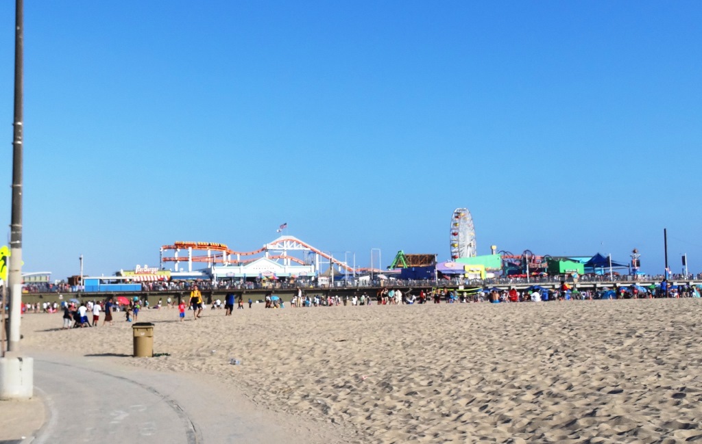
With younger kids, the Santa Monica Pier makes a perfect 6 1/2 mile round trip destination as you can stop, eat lunch and have some fun at Pacific Park, then ride back. Or kick it a few notches and ride to/through Venice Beach for all the action. 

Pacific Park up ahead

Pacific Park up ahead

There are plenty of restrooms water stops and of course non-stop BEACH to enjoy here, making this one of my favorite destination for bicycling with the family. And of course, you don't have to park at Will Rogers...you can park anywhere on PCH in and around the bike path to enjoy it.

Of course you do have to be careful of sand on the path, pedestrians/beach goers crossing and walking on the path, other cyclists, runners, roller bladers and crowds.  

Detailed map at file.lacounty.gov/SDSInter/dbh/docs/189949_2013-BIKEMAP85x11Web-Ready(highres).pdf

CLICK HERE FOR DOZENS OF FAMILY-FRIENDLY BIKE PATHS BACK UP IN THE VENTURA COUNTY AREA!

Paradise Falls Hike - Wildwood Park in Thousand Oaks

Perhaps the most popular destination in Wildwood Park in Thousand Oaks is Paradise Falls. There are a variety of trails and ways to get to Paradise Falls. Here's a quick and easy 1 mile route.

Park in the main trailhead at the west end of Avenida de los Arboles. Take the Mesa Trail about a 3rd of a mile until you see the sign below, where you'll turn left.

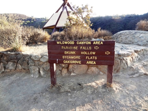
Another third of a mile and you're at the teepee, where you'll find another clearly marked sign pointing you in the direction of Paradise Falls.

Wildwood_Teepee1.JPG

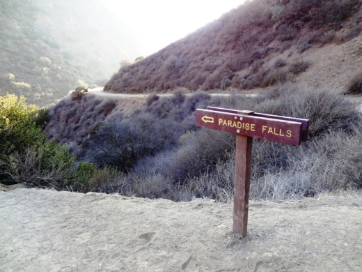
You turn right down the hill and take a short walk to the following sign.

ParadiseFalls2.JPG

Hike down some switchbacks and stairs and you're almost there.

ParadiseFalls3.JPG

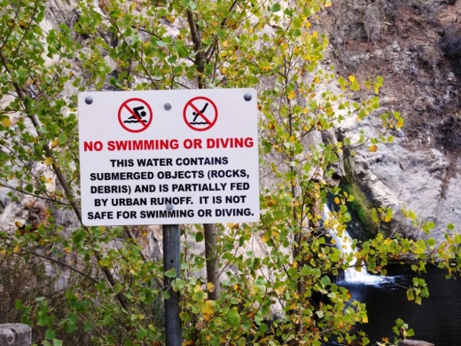
And wallah! You're at the following sign, where you'll be reminded that these year-round falls are partially fed by urban run-off, making them something you may not want to jump into.

ParadiseFalls4.jpg

But Paradise Falls is fun to get to and see. A full-on roughly 40 foot waterfall a mile away from civilization in Thousand Oaks.

ParadiseFalls5.JPG

You can walk back the way you came or hike back up the trail above the falls and loop back up to the teepee via the Wildwood Canyon Trail.

Getty Villa in Pacific Palisades

The Getty Villa is located at 17985 Pacific Coast Highway in Pacific Palisades, one mile north of Sunset Boulevard, overlooking the Pacific Ocean. It is about 28 miles from the heart of Thousand Oaks. The most direct path is the 101 south to Old Topanga Canyon Road, though you can also take other arteries like Malibu Canyon and Kanan to PCH.

The Getty Villa is one of two locations of the J. Paul Getty Museum, the other being the spectacular Getty Center in Brentwood.

The Getty Villa houses the J. Paul Getty Museum’s extensive collection of over 44,000 Greek, Roman and Etruscan antiquities dating from 6,500 BC to 400 AD, including the Lansdowne Heracles and the Victorious Youth. More than 1,200 of them are on view in 23 galleries devoted to the permanent collection. An additional six galleries present changing exhibitions, often featuring works from other institutions.

Main museum at the Getty Villa

Main museum at the Getty Villa

The Family Forum features hands-on activities that encourage shared learning and discovery for children, while another interactive installation, the TimeScape Room, helps place the collection in an historical context.

On a personal note, this place is stunning, Pristine, well maintained, peaceful. The grounds take you back to how the Romans may have lived. Although my younger son in 3rd grade was not particular engaged during our first visit, my 6th grader had learned about the Greek and Roman Gods in school and found many of the exhibits quite interesting. There's also a cafe and gift shop.

Due to the severe drought this was not filled with water, but is beautiful nonetheless

Due to the severe drought this was not filled with water, but is beautiful nonetheless

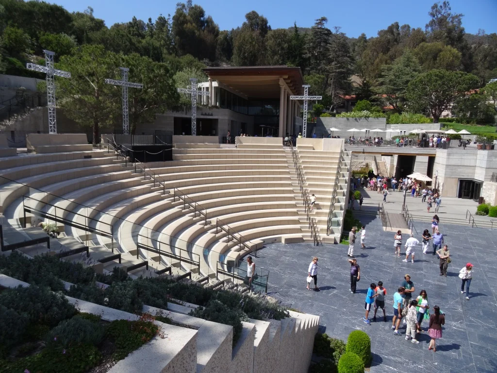
Located on a pristine 64 acres, the Getty Villa is modeled after the Villa dei Papiri, a first-century Roman country house, the Villa is an airy, sunlit environment, featuring mosaic floors and colorful trompe l’oeil walls and paintings. Its four gardens and grounds are planted with species known from the ancient Mediterranean, creating lush and fragrant places to stroll. There is also a 450 seat outdoor theater at the Villa.

You'll notice that these many of the antiquities on display have damages incurred for various reasons (they were outdoor displays thousands of years ago).  This adds to their aura.

You'll notice that these many of the antiquities on display have damages incurred for various reasons (they were outdoor displays thousands of years ago).  This adds to their aura.

The UCLA/Getty Master’s Program in Archaological and Ethnographic Conservation is housed on this campus. The collection is documented and presented through the online GettyGuide as well as through audio tours.

Admission to the Getty Villa is free of charge but requires advance reservation with a timed ticket that you can obtain at www.getty.edu, or by calling (310) 440-7300. There is a parking charge of $15 per car; $10 after 5pm for evening events. 

Open Wednesday–Monday, 10:00 a.m. to 5:00 p.m.  Closed Tuesdays and on major holidays (January 1, July 4, Thanksgiving and Christmas Day).

Outdoor amphitheater has an authentic feel to it

Outdoor amphitheater has an authentic feel to it

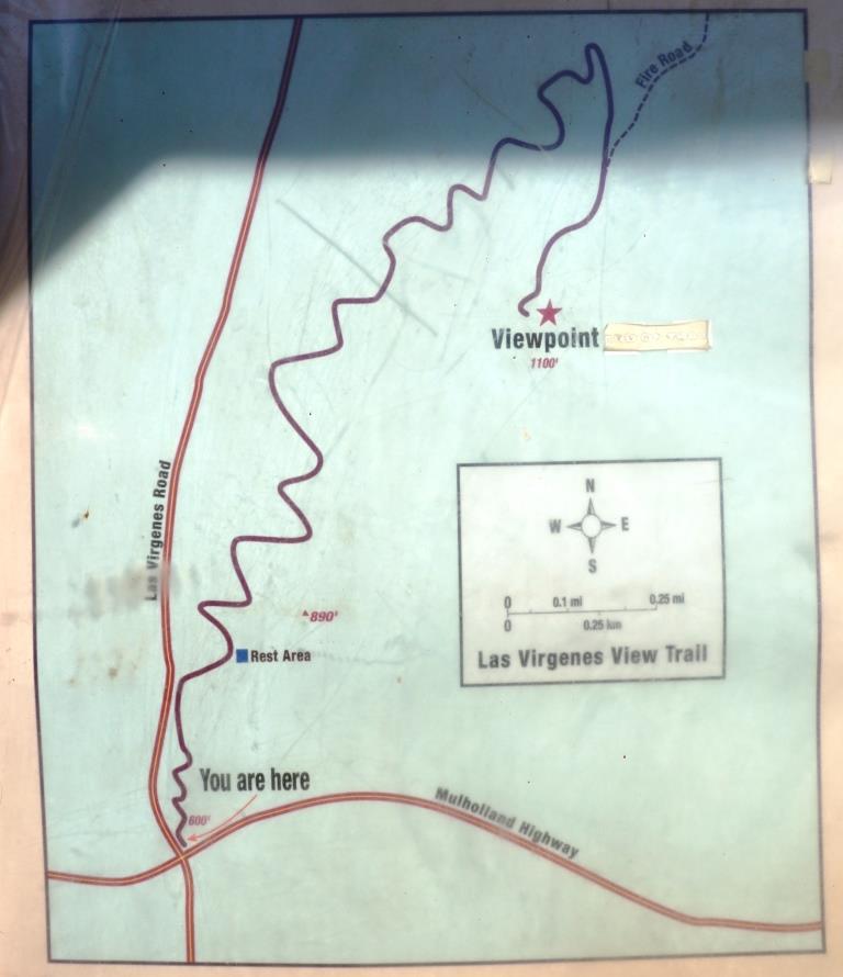
Las Virgenes View Park in Calabasas

Las Virgenes View Park is located at the northeast corner of Las Virgenes Road and Mulholland Highway in Calabasas. The park is a 696 acre project of the Santa Monica Mountains Conservancy, owned and managed by the Mountains Recreation and Conservation Authority in cooperation with the Las Virgenes Municipal Water District and City of Calabasas.

Enjoy a 2.4 mile trail through chaparral and woodlands to a scenic vista point at 1,100 feet. It is a single track trail of switchbacks that largely parallels Las Virgenes Road. You'll enjoy all sorts of views as you head up the trail, from Malibu Creek State Park, De Anza Park, King Gillette Ranch and beyond.

Off street dirt parking is at the trailhead and across the street. More information at www.lamountains.com/parks.asp?parkid=30.

Trailhead

Trailhead

LVViewPark2.JPG
LVViewPark3.JPG
View from the Las Virgenes View Park Trail towards Malibu Creek State Park.

View from the Las Virgenes View Park Trail towards Malibu Creek State Park.

LVViewPark5.JPG

Skatelab Museum and Skate Park - Simi Valley (CLOSED)

AFTER 21 YEARS, SKATELAB HAS CLOSED ITS DOORS AT THIS LOCATION AT 4226 VALLEY FAIR STREET, SIMI VALLEY.

However, Skatelab founder/owner Scott Radinsky posted on 1/6/19 that a new Skatelab location will be coming soon. Check for updates at www.facebook.com/Skatelab.

The world's largest and best skateboard museum resides in Simi Valley at Skatelab.  There are over 5,000 vintage skateboards, scooters and skateboard memorabilia at this 20,000 square foot facility from the 1960s to present day.  The museum is open to the public seven days a week and is free.  You really have to see this in person to get the full effect. This is a downright AMAZING collection!

Hours as of January 2018 are 4-10PM Mon, 3-10PM Tue-Thu, 3PM-Midnight Fri, 10AM-10PM Sat and 10AM-7PM Sun. Visit www.skatelab.com or call 805.578.0040 for more information.

SkatelabBoards.jpg

Read more about the world's largest skateboard collection on display at www.skateboardman.com

Skatelab has a large indoor skate park that your kids will love.  It is located at 4226 Valley Fair Street, Simi Valley.  Visit www.skatelab.com or call 805.578.0040 for more information. They offer skateboarding classes on Saturdays and Sundays for beginners and novices too!

Legacy Park in Malibu

Legacy Park is located at 23500 Civic Center Way in Malibu, bordered by PCH, City Hall and Malibu Country Mart. It is a unique park that displays different habitats...wet meadow, coastal prairie, woodlands, riparian corridor, vernal pools and coastal bluffs. There is a lagoon with wildlife, a nature path and an interesting kids' interpretative area as you'll see. Peaceful and unique, you might want to walk through and enjoy before heading to the Country Mart or the Malibu Lagoon Beach.

To learn more about the park, visit www.malibucity.org or call 310.317.1364.

The Woolworth Museum in Downtown Oxnard (CLOSED)

Woolworth1.jpg

Although the vintage items in the Woolworth Museum still reside in the building as described below, the museum is generally not open to the public at this point.

What is believed to be the only Woolworth Museum in the world is located in the Woolworth Building (circa 1950) at 210 West Fourth Street, Oxnard (4th and A Streets). This small, unique museum contains all sorts of nostalgia associated with the F. W. Woolworth Company, one of the original "five and dime" stores. Woolworth closed its stores in 1997.

The Woolworth Building is a 16,800 square foot building completed in 1950 that was completely redeveloped in 2003. It is now occupied by office tenants.

WoolworthMuseum.jpg

Many of the old items in the museum exemplify what Woolworths used to sell. Other items relate directly to this building and the people who worked there, including two managers and a woman who worked here on the first day that the store opened in 1950. There are souvenirs from the Woolworth Building in New York, which was the tallest building in the world when completed in 1913.

There is a collection of books related to the Woolworth stores. There are several items from old lunch counters, including dishes and menus, as well as some items that relate directly to the pivotal civil rights sit-in that took place at a Woolworth lunch counter in 1960.

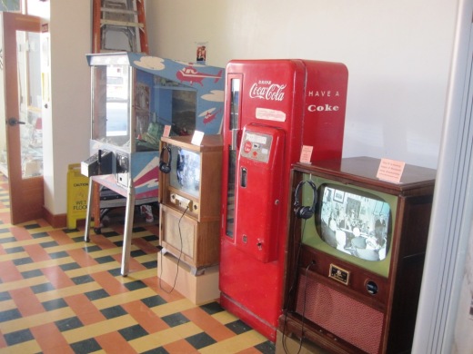
Photos of various Woolworth stores from 1878 through the 1960s are seen throughout the building. There is a working antique dial pay-phone, a take-your-own photo booth from the 1940s and games and vending machines from the 1930s through the 1960s.

WoolworthTVs.JPG

There is a vintage cash register, like those found in most stores in the 60's and 70's, displayed so visitors can push down "No Sale" so that the cash-drawer pops open with the familiar ch-ching, bell ringing and all, and the wooden drawer can be examined and closed.

Also seen is a 1959 Cavalier 96 Coke machine, which dispenses ice cold vintage coke bottles...at a not quite as vintage price of $1.25.

So stop by sometime! Just walk in. No attendants and no entrance fees. The museum is typically open from 7:30 am to 2:30 pm Monday to Friday and 9 am to 2:30 pm on Saturday.

For more information and pictures, visit www.thewoolworthbuilding.com (not functional as of 8/6/18).

WoolworthTV.JPG
Throwback time seen in the men's room

Throwback time seen in the men's room

Prickly Pear Trail in Newbury Park

The Prickly Pear Trail is located in the Dos Vientos section of Newbury Park. The entry point is at Del Prado Playfields, 402 Calle Del Prado, Newbury Park.

This is a short, roughly one mile in total, family-friendly hike at the east end of the Dos Vientos community. 

The entry point is on the south side of the parking lot in front of the park. It is quite clearly marked, as shown below. The first straightaway is about 1/4 mile, at which point you have the decision of which direction you'd like to take the loop. If you go left (clockwise loop), at the first fork in the trail take the left trail (if you take a right you'll be going back to where you came from). Then continue the remainder of the loop veering right until you're back at the straightway you came from.

This is a convenient little family hike as there is plenty of parking at the park, restrooms, a newer playground for the kids, pickleball and tennis at the park.

About 1/4 mile into the hike, looking back towards Del Prado Playfields.

About 1/4 mile into the hike, looking back towards Del Prado Playfields.

Views toward the protected pond behind Cypress Elementary, along Via Rio.

Views toward the protected pond behind Cypress Elementary, along Via Rio.

Seaside Wilderness Park in Ventura

Sign on W. Main Street near bike path and Highway 101 access point.

Sign on W. Main Street near bike path and Highway 101 access point.

The City of Ventura's Seaside Wilderness Park is located across the Ventura River Main Street Bridge, adjacent to Emma Wood State Beach Park. One fun way to access it is by taking the Omer Rains Trail (bike path) to it from the Ventura Promenade area. But get off your bike when you reach your destination as this is a pedestrians-only park that contains the Ventura River mouth, the former "Hobo Jungle," the 1.3 mile Ocean's Edge Trail (tide pools) and .7 mile River's Edge Trail for birdwatching. Last time we were there we enjoyed some geocaching.