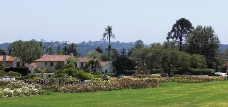
Bike Path in Oxnard at Oxnard Beach Park to Channel Islands Harbor

There's a bike path that starts at the ocean side of Oxnard Beach Park at Mandalay Beach Road at Beach Way and takes you south all the way to Hollywood Beach and Channel Islands Harbor. Alternatively you can just park at the Oxnard Beach Park and go from there. It is roughly 3/4 of a mile one way to Harbor Boulevard.

Cross Harbor Boulevard and make your way into Channel Islands Harbor, where you can ride all the way to the south end of the harbor.

Entrance to bike path at Mandalay Beach Road and Beach Way

Entrance to bike path at Mandalay Beach Road and Beach Way

There's a loop you can do around Oxnard Beach Park

There's a loop you can do around Oxnard Beach Park

The bike path continues south and goes around the Embassy Suites Mandalay Beach Hotel

The bike path continues south and goes around the Embassy Suites Mandalay Beach Hotel

Soon after passing the hotel, the path swing east towards Harbor Boulevard

Soon after passing the hotel, the path swing east towards Harbor Boulevard

At Harbor Boulevard, you can cross over to Channel Islands Harbor or veer right (west) on West Channel Islands Boulevard towards Hollywood Beach. 

At Harbor Boulevard, you can cross over to Channel Islands Harbor or veer right (west) on West Channel Islands Boulevard towards Hollywood Beach. 

plenty of sand at Hollywood Beach. There's a restroom facility here. You can bike along Ocean Drive, which parallels the beach, to an entry point. do note that you are no longer on a bike path. you can continue south on Ocean Drive until i…

plenty of sand at Hollywood Beach. There's a restroom facility here. You can bike along Ocean Drive, which parallels the beach, to an entry point. do note that you are no longer on a bike path. you can continue south on Ocean Drive until its endpoint, where you turn left on South Harbor Boulevard past Channel View Park, where you will soon reach Channel Islands Harbor. 

On S. Harbor Boulevard going north now, you will be able to take a right (east) turn on Albacore Way to get to the nice pedestrian/bike path along Channel Islands Harbor. It will take you past the Channel Islands Maritime Museum and marina, where th…

On S. Harbor Boulevard going north now, you will be able to take a right (east) turn on Albacore Way to get to the nice pedestrian/bike path along Channel Islands Harbor. It will take you past the Channel Islands Maritime Museum and marina, where there are restaurants and other things to do.

Pretty cool place to ride bikes at the harbor...and rarely crowded in my experience.

Pretty cool place to ride bikes at the harbor...and rarely crowded in my experience.

If you and the kids are up to it and want a longer ride, after reaching the north side of the Harbor, you can take Harbor Boulevard back over to W. Channel Islands Boulevard over the bridge to the middle of the Harbor. There's a popular Toppers…

If you and the kids are up to it and want a longer ride, after reaching the north side of the Harbor, you can take Harbor Boulevard back over to W. Channel Islands Boulevard over the bridge to the middle of the Harbor. There's a popular Toppers Pizza over there. Or go the east side of the Harbor. 

Other options of course include parking at the Channel Islands Harbor somewhere and cycling your way up to the Oxnard Beach Park. And you can also pedal your way over to S. Victoria Avenue and take the bike lane all the way down to Silverstrand Beach (or even park at Silverstrand and ride your way up from there...though do take not that this is not a bike path). Have fun!

Camarillo Bike Path Next to Calleguas Creek

Looking to take the kids on a nice, flat bike path unimpeded by cars? A great choice is the roughly 2 mile Calleguas Creek bike path from Pleasant Valley Fields at 100 Village at the Park Drive in Camarillo off the Dawson 101 exit up to the corner of Flynn and Upland Roads in Camarillo.
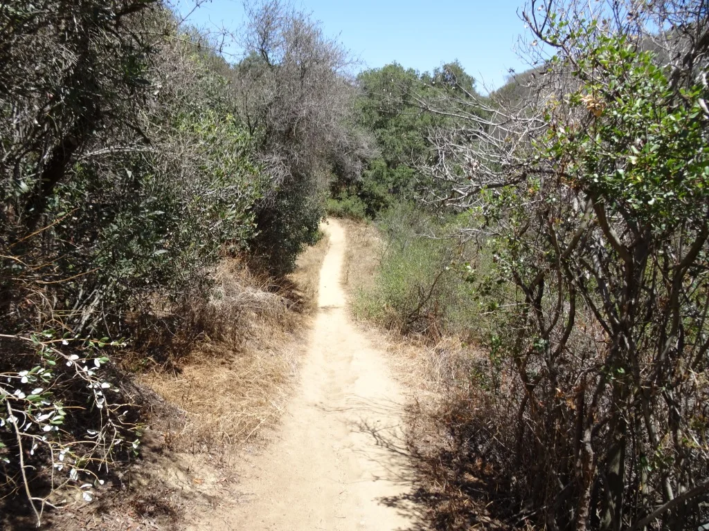
Look at how nice and flat this bike path adjacent to Calleguas Creek is!

Look at how nice and flat this bike path adjacent to Calleguas Creek is!

This is a nice, smooth and flat bike path that goes under several bridges, including the 101 freeway, so that you don't have to worry about cars! You can park your car at Pleasant Valley Fields and ride up and back down the path. This is a comfortable path to learn on as well as just enjoy.

At the north end of the path, you can detour off the path to Pitts Ranch Park at 1400 Flynn Road, just a short block northwest of the path, and enjoy lunch.

CamBikePathCC2.JPG
Calleguas Creek

Calleguas Creek

Sapwi Bike Park in Thousand Oaks

Beginners’ pump track at Sapwi Trails Community Park.

Beginners’ pump track at Sapwi Trails Community Park.

The Sapwi Bike Park project is a partnership between the Concerned Off-Road Bicyclists Association (CORBA) and Conejo Recreation and Park District (CRPD). The park is a free, public recreational bicycle skills park facility located in the heart of beautiful Sapwi Trails Community Park in Thousand Oaks.

The park also features several miles of multi-use trails, natural habitat preservation, and other activities such as disc golf, cross-country running, and a non-motorized glider flying area.

The Sapwi Trails Bike Park offers a wide range of trails and features to challenge all ages and skill levels. In addition to a pump track, the park features progressive drop and jump lines – varying in difficulty from beginner to advanced. Outside of the dedicated bike park area, there are several trail side feature areas and a hard-surface beginner level pump track.

This 145 acre Sapwi Trails Community Park is located in the open space between Erbes Road (at Scenicpark Street) on the west and Westlake Boulevard east, with Avenida de los Arboles on the north. There are three parking lots off of Erbes, Arboles and Westlake Boulevard.

Learn more about the Sapwi Bike Park at sapwibikepark.com.

sapwi sign.JPG

Surfer's Knoll Beach in Ventura

Surfer's Knoll Beach is located in Ventura adjacent from Ventura Harbor Village and as its name implies, is geared towards surfers, as well as others looking to relax and explore. Riptides are common here so be careful if you're a novice swimmer. There are restrooms and showers available. Lifeguard service on weekends only in May until Memorial Day weekend, then daily through Labor Day weekend. There is a relatively small parking lot available at 1596 Spinnaker Drive; parking is free.

One great thing about this beach is that it is one of the few almost completely westbound facing beaches throughout the area, meaning...it is a great place to catch the sunset! And several of the Channel Islands - Anacapa and Santa Cruz.

Though this is a nice, sandy beach, a better beach for kids/families is just north up the road at Harbor Cove Beach, which is calmer water, protected by jetties. 

Surfer’s Knoll Beach, Harbor Cove Beach and South Beach is managed by the Ventura Port District at venturaharbor.com/beaches.

Western Plateau Trail Loop Hike From Newbury Park

If you're looking for a trail a bit off the beaten path, check out the Western Plateau Loop from Conejo Center Drive in Newbury Park.

The trailhead for this hike is adjacent to the City of Thousand Oaks Household Hazardous Waste Facility at 2010 Conejo Center Drive, Newbury Park. You can park in the dirt lot next to the trailhead and head on your way.

The trailhead on Conejo Center Drive.

The trailhead on Conejo Center Drive.

It is mostly downhill over the first half mile or so of this 5 mile round-trip hike until you get to the Hawk Canyon Trail turnoff.

It is mostly downhill over the first half mile or so of this 5 mile round-trip hike until you get to the Hawk Canyon Trail turnoff.

You can either go straight from here and do a clockwise loop via the Western Plateau Trail or you can turn right on Hawk Canyon, which is a direct route to the Conejo Canyons Bridge.

Hawk Canyon Trail is a fairly narrow, mostly single-track trail.

Hawk Canyon Trail is a fairly narrow, mostly single-track trail.

The Hawk Canyon Trail is a fun, narrow trail surrounding by trees and other vegetation, like you're in the middle of nowhere. There's an old car in a crevice as you approach the Conejo Canyons towards Santa Rosa Valley.

Odd to see this old car out in the middle of nowhere. steep embankment makes it somewhat challenging reaching it.

Odd to see this old car out in the middle of nowhere. steep embankment makes it somewhat challenging reaching it.

Bring a snack and sit at a picnic table in the middle of what feels to be nowhere. Then either head back the way you came or find your way to the Western Plateau Trail and loop back counter-clockwise back towards where you parked.

See the Conejo Open Space Foundation's map of this trail at cosf.org/trails/conejo-canyons/conejo-canyons-moderate-hike-western-plateau-loop-from-conejo-center-dr

It can get a bit overgrown in the spring as seen here on the Hawk Canyon Trail but quite beautiful nonetheless!

It can get a bit overgrown in the spring as seen here on the Hawk Canyon Trail but quite beautiful nonetheless!

Hike to the Cross in the Hills Above Cal Lutheran University in Thousand Oaks

Views of Santa Rosa Valley from the hills above CLU.

Views of Santa Rosa Valley from the hills above CLU.

For a quick local hike and a calorie burner, try hiking to the cross in the hills above Cal Lutheran University in Thousand Oaks.

You can park in the CLU lot near the community pool at 100 Overton Court, Thousand Oaks. Then head in the direction of the adjacent baseball fields. Take the path just west of the fields towards the hills. After crossing the bridge, I veer right on the trail.

The hike itself is not particularly picturesque until you get to the top of the hill. On the east end of the hilltop is the prominent cross, along with several benches for enjoying the fruits of your uphill labor. Views extend towards the Santa Rosa Valley on the north and Thousand Oaks on the south.

You can continue your way west up the hill if you’d like. In total, the hike is about a mile to a mile and a half round-trip.

The trails are usually well maintained, though you can slip on the dirt if you don’t have decent traction on your shoes. Couldn’t hurt to bring a walking stick for the steeper, slippery parts of the hill towards the top.

So if you’re really feeling energetic, there’s a trail that takes you to Wildwood Park from these trails. See THIS LINK.

clu cross lr.JPG
As you make your way towards the hill after passing by the baseball fields, you’ll see this sign.

As you make your way towards the hill after passing by the baseball fields, you’ll see this sign.

National Park Service Visitor Center in Thousand Oaks (Moved to Calabasas in 2012)

IN JUNE 2012, THE NATIONAL PARK SERVICE VISITOR CENTER MOVED TO THE ANTHONY C. BEILENSON VISITOR CENTER IN CALABASAS. CLICK THIS LINK FOR MORE INFORMATION

The National Park Service Visitor Center, located at 401 West Hillcrest Drive in Thousand Oaks, is an outstanding place to learn more about the Santa Monica Mountains National Recreation Area (SSMNRA). SSMNRA is over 154,000 square acres, which makes it the largest urban national park in the United States.

The National Park Service controls 21,500 of those acres and the best place to learn more about the SMM is this Visitor Center! There is always has someone on duty to answer questions about trails, maps, habitat, plants, hiking, camping, etc. Additionally, the Center has informational displays, maps and brochures, books and educational items for the kids for sale.

Visit the NPS website at www.nps.gov/samo for more information or call the Center at 805.370.2301.

Mugu Peak in Point Mugu State Park

The 1,266 foot elevation Mugu Peak is at the western edge of the Santa Monica Mountains, in Point Mugu State Park. The peak provides views stretching from the Malibu Lagoon/Naval Base Ventura County and Channel Islands on the west, Thornhill Broome Beach on the east, La Jolla Valley on the north and more.

There are multiple ways of getting to the peak. The most direct (and albeit steepest) ascent is via the Chumash Trail, accessible across from the Naval Base shooting range (yes, sometimes you will hear rounds). The Chumash Trail is accessible off of PCH at this link. Look for the left turn into a small dirt parking area that has space for perhaps 15 or so cars.

The 7/10ths of a mile hike up the Chumash Trail is pretty brutal, but I've seen all shapes, sizes and ages making it up at varying paces.

Turn left after reaching the top of the Chumash Trail. Veering left continues the Chumash Trail towards La Jolla Valley. Veer right up the really steep hill for the most direct route to Mugu Peak.

Turn left after reaching the top of the Chumash Trail. Veering left continues the Chumash Trail towards La Jolla Valley. Veer right up the really steep hill for the most direct route to Mugu Peak.

The initial Mugu Peak Trail section is quite steep, then you plateau, then the remainder is more moderate, seen above.

The initial Mugu Peak Trail section is quite steep, then you plateau, then the remainder is more moderate, seen above.

The Mugu Lagoon within Naval Base Ventura County is a colorful sight from throughout the hike and at the top of Mugu Peak.

The Mugu Lagoon within Naval Base Ventura County is a colorful sight from throughout the hike and at the top of Mugu Peak.

Looking northwest from Mugu Peak you will see the the 1,421 foot Laguna Peak, which contains a Naval satellite tracking station.

Looking northwest from Mugu Peak you will see the the 1,421 foot Laguna Peak, which contains a Naval satellite tracking station.

Views southeast with Thornhill Broome Beach in the background.

Views southeast with Thornhill Broome Beach in the background.

So you've reached the top of Mugu Peak, enjoyed the panoramic views, saluted the flag on display, checked out the toolbox under the flag with logbooks and other items, the next choice is, do you go back the way you came or do you take another route? If you head back the direction you came, the title mileage of the hike is about 2 1/2 miles of mostly steep up/downhills.

Well, if you continue in the direction of Thornhill Broome Beach (southeast), you can continue on the Mugu Peak Trail, which is several miles traversing around the southern, then western sections of Mugu Peak. This is my preferred approach as the footing is much easier and your total mileage is roughly 4 miles. Plus, you are treated to additional views that are just beautiful.

Map snippet courtesy of California State Parks.

Map snippet courtesy of California State Parks.

Another view of Thornhill Broome Beach and the large sand dune across PCH from the southeastern edge of the Mugu Peak Trail.

Another view of Thornhill Broome Beach and the large sand dune across PCH from the southeastern edge of the Mugu Peak Trail.

You can also get to Mugu Peak from the La Jolla Canyon Loop Trail.

Westlake Lake in Westlake Village

Westlake Lake is a 125 acre lake with 8 miles of shoreline in Westlake Village. Over 1,300 homes are located on the lake or are within access of it. It is a man-made lake that was completed in 1969 at a cost of $3.5 million.  A number of homes are located on an island in the lake that is connected by La Venta Drive.

View of Westlake Lake from southwest side on Triunfo Canyon Road. The Landing is on the left side.

View of Westlake Lake from southwest side on Triunfo Canyon Road. The Landing is on the left side.

While Westlake Lake is a private lake maintained for Westlake Village residents by the Westlake Lake Management Association, you can still enjoy its beauty in many ways. Running, cycling and walking around the lake via Triunfo Canyon and other adjacent streets is quite popular. Or visit The Landing (32129 Lindero Canyon) on the southwest side of the lake to enjoy a meal at one of several lakefront restaurants such as Boccacio's, Zin Bistro Americana and The Landing Grill and Sushi Bar, all with indoor/outdoor dining. Or just stroll around, taking in the sweeping views and serenity.

View from the southwest side of the Lake while cycling on Lindero Canyon Road.

The lake is stocked with bass but fishing and boating is restricted to Westlake Village residents with guests and permits. So if you don't live there, start making some Westlake Village friends!

Hillcrest Open Space Preserve in Thousand Oaks

The Hillcrest Open Space Preserve is an area bound on the south by Hillcrest Drive, on the east by Westlake Boulevard and on the west by La Granada Drive. I don't know the exact boundary on the north side. The kids and I usually enter the Hillcrest Open Space at the White Sage Trail trailhead off of Hillcrest Drive, just west of Blue Mesa Street, about half a mile west of Westlake Boulevard.

There is no parking to be found on that stretch of Hillcrest Drive and the nearest crosswalks from the other side of Hillcrest Drive, where you can find parking on residential streets, is at Westlake Boulevard (1/2 mile east) and Duesenberg Drive (1/3 mile west). I've parked on Blue Mesa Street and run across Hillcrest but would not recommend that as the cars speed along on that busy boulevard.

In any case, this is a fun little excursion, particularly if you enjoy a steep hill to climb and beautiful panoramic views of the area.

Hillcrest 2.17.19_1.JPG

Another access point to the Hillcrest Open Space is the southeast endpoint of La Granada Drive (at Crown View Ct), east of Erbes Road in Thousand Oaks.  This 4 1/2 mile, hilly loop is a great way to view the local scenery, from the Conejo Grade to the Civic Arts Plaza and most everything else.

More detailed information on the Hillcrest Open Space Loop trail can be found on the Conejo Open Space Foundation website at cosf.org/trails/other-trails/moderate-hike-hillcrest-open-space-loop.

Trailhead access point at the end of La Granada Drive.

Trailhead access point at the end of La Granada Drive.

In greener times.

Oak Creek Canyon Loop Trail in Thousand Oaks

The Oak Creek Canyon Loop Trail is about a mile hike that is great to do with the kids near the Los Robles Trail in Thousand Oaks.

Get there by taking Moorpark Road south of the 101 until it ends at Greenmeadow Avenue. Turn right and drive about half a mile to the parking lot.

Signs along the Oak Creek Canyon Whole Access Interpretative Trail are in braille.

Signs along the Oak Creek Canyon Whole Access Interpretative Trail are in braille.

The first .4 mile section of trail is called the Oak Creek Canyon Whole Access Interpretive Trail and is a mostly shaded oak grove area that is accessible by all, including equestrians, bicycles, hikers, wheelchairs, disabled and blind individuals. There is actually a "guide cable" along the fence as well as informational signs in braille.

One of three picnic benches along the Interpretive Trail.

One of three picnic benches along the Interpretive Trail.

There is a restroom, drinking fountain and picnic bench at the trailhead as well as two other picnic tables and a bench on this portion of the trail. There is also abundant poison oak on the sides of the trails, so be careful to stay on the trail.

OakCreekTrail3

At the end of the Interpretive Trail section of the loop, you reach a well maintained dirt trail through the chaparral that is a bit more challenging and ok for most kids. There's a few moderate hills to be aware of, making it somewhat of a challenge with a stroller but in my opinion, a do-able challenge. And of course, you can always turn around and take the Interpretive Trail back. 

The loop trail continues on the left.

The loop trail continues on the left.

One of the moderate hills on the trail.

One of the moderate hills on the trail.

You go about .4 mile back towards Greenmeadow. Before you get to the street you will see a bench on the west side of the trail. Do be aware that there is no sidewalk on this section of Greenmeadow as you walk back towards the parking area. More information and a map available on the Conejo Open Space Foundation website at www.cosf.org/website/html/oak-creek-canyon.html.

Rincon Beach Park at the Ventura/Santa Barbara County Line

RinconPark.JPG

Rincon Beach Park is near the Ventura/Santa Barbara County line just a few miles east of Carpinteria. Just take the Bates Road offramp off the 101 Freeway (or type in Bates Road and Rincon Point Road, Carpinteria). Take Bates to the ocean and on the right you'll find plenty of free parking and easy beach access, with picnic tables and restrooms.

If you make a left turn off of Bates, there's a separate parking lot for Rincon Point, part of Carpinteria State Beach, one of the most popular surf destinations in the world. There are a couple of restrooms on this side also, albeit not particularly pleasant ones to use.

Campfires are not allowed on the beach.

To learn more about Rincon Beach Park or to reserve the picnic table, visit www.countyofsb.org/842/Rincon-Beach-Park or call 805.568.2465.

Views from the picnic area at Rincon Beach Park

Views from the picnic area at Rincon Beach Park

This sign always makes for great conversation starters at Rincon Beach Park

This sign always makes for great conversation starters at Rincon Beach Park

Reagan Ranch at Malibu Creek State Park

Most folks start their day at Malibu Creek State Park from the main parking lot area off of Las Virgenes Road or perhaps by parking on Mulholland Highway at Las Virgenes and hiking in via the Grassland Trail to Crags Road, the main artery within the park. Another approach into the park is the Reagan Ranch, accessible from a parking area located off of Lake Vista Drive, just south of the juncture of Cornell Road and Mulholland Highway. What's nice about this parking area is that there is no charge for parking.

Ronald Reagan bought this 300+ acre ranch in 1951 and subsequently sold it to 20th Century Fox as a movie ranch in 1966 after he became Governor of California. It was later sold to the State and made part of Malibu Creek State Park.

After parking your car in the lot, walk up the paved road where you will see some older ranch buildings. These are used by California State Parks employees and are not accessible by the general public. But you may feel an aura of Reagan back here.

The "Yearling Trail" leads you towards the heart of Malibu Creek State Park. Less than 2 miles to Century Lake, just over 2 miles to the Visitor Center and 2.7 miles to the M*A*S*H site. Stay on the main trail, which about a mile in starts on an uphill. You'll see a sign that indicates you are on the "Lookout Trail." Continue on this trail and you will soon see why they call it that - look out and you will have great views of the main park and of Century Lake.

There are several other trails you can explore too back here.

More info on Malibu Creek State Park at www.parks.ca.gov/?page_id=614