Potrero Ridge Trail in Newbury Park
/The Potrero Ridge Trail in Newbury Park is an interesting ridgeline trail that runs west/east in three sections over approximately 2 1/2 miles one way. You can access the trail from a number of locations and neighborhood feeder trails, but the main sections are as follows (west to east):
Via Las Brisas in the Dos Vientos tract, just north of Paseo Santa Rosa to Reino Road, just north of Paseo de Leon and Lynn Road, is a little over a mile. This is one of my favorite trails in the area, providing panoramic views of the southern portion of Newbury Park, Boney Mountain and Dos Vientos. There are some switchbacks on the west end near Reino Road but they are not overly strenuous.

Potrero Ridge Trailhead on Via Las Brisas, just north of Paseo Santa Rosa.


Potrero Ridge Trail trailhead (and parking area) off of Reino Road
The middle section of the Potrero Ridge Trail runs from Woodland Oak Place off of Reino Road to Wendy Drive between Felton and Peppermint, where there's a convenient dirt parking lot. Only about a half mile to the top of the trail, where you'll see a water tank. The primary trail is a wide fire road to the water tank from Wendy Drive. There's a secondary single track trail that mostly runs parallel (south) to the main fire road that is accessible from several points. This trail treats you to wonderful, panoramic views of the area.

Potrero Ridge Trail trailhead off of Wendy Drive.

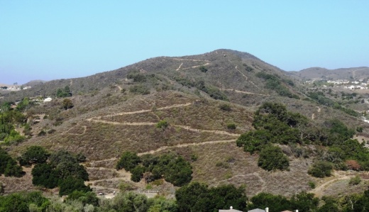
Views towards the water tank at top of Potrero Ridge Trail (middle section)
The east section of the trail runs from across the parking lot on Wendy Drive to another peak, then down towards Silas Lane near Grace Bible Church, about half a mile in total. There is no parking available for this section of trail, though you can park in the Wendy lot and find a crosswalk to cross over to the trailhead.

View from east section of Potrero Ridge Trail.
So basically these 3 segments are split between Via las Brisas and Reino Road, Reino Road and Wendy Drive and Wendy Drive and Silas Lane.
If you'e like to extend your trail trekking on the west side, cross over Via las Brisas and take the Sierra Vista Trail west another mile to Rancho Dos Vientos.
This trail is maintained by the Conejo Open Space Foundation.
Here's a view of the initial section of the western section of the Potrero Ridge Trail from the Wendy Water Tank section of the trail across Reino Road.

Views into the Dos Vientos section of Newbury Park

Potrero Ridge Trail bench provide extensive views
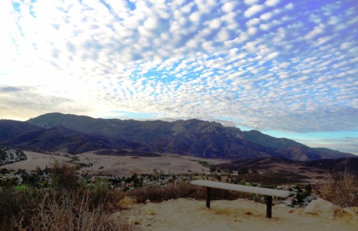
Views from the same bench on a cloudy late October day in 2013