Las Virgenes View Park in Calabasas

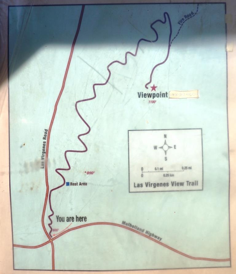
Las Virgenes View Park is located at the northeast corner of Las Virgenes Road and Mulholland Highway in Calabasas. The park is a 696 acre project of the Santa Monica Mountains Conservancy, owned and managed by the Mountains Recreation and Conservation Authority in cooperation with the Las Virgenes Municipal Water District and City of Calabasas.

Enjoy a 2.4 mile trail through chaparral and woodlands to a scenic vista point at 1,100 feet. It is a single track trail of switchbacks that largely parallels Las Virgenes Road. You'll enjoy all sorts of views as you head up the trail, from Malibu Creek State Park, De Anza Park, King Gillette Ranch and beyond.

Off street dirt parking is at the trailhead and across the street. More information at www.lamountains.com/parks.asp?parkid=30.

Trailhead

Trailhead

LVViewPark2.JPG
LVViewPark3.JPG
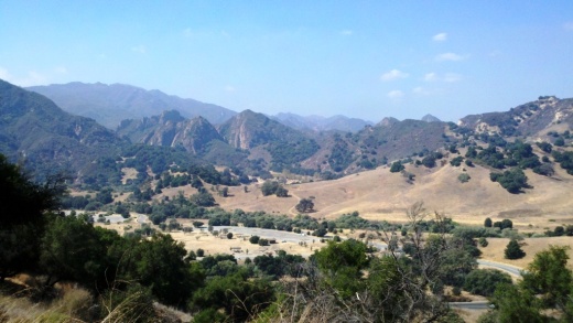
View from the Las Virgenes View Park Trail towards Malibu Creek State Park.

View from the Las Virgenes View Park Trail towards Malibu Creek State Park.

LVViewPark5.JPG

King Gillette Ranch in Calabasas

KingGilletteSign.JPG

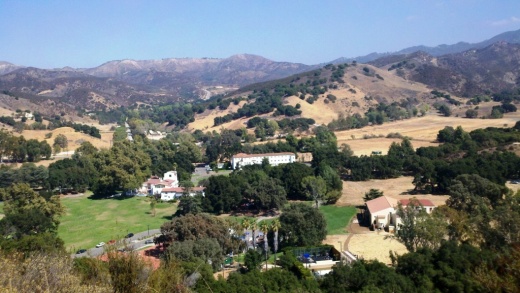
The 588-acre King Gillette Ranch (26800 West Mulholland Highway, Calabasas) is situated adjacent to Malibu Creek State Park. This scenic parkland at the lower end of the Las Virgenes Valley is a haven for larger mammals of the Santa Monica Mountains and offers a rare unspoiled view of California’s rich archaeological, cultural, and historic resources, including a Chumash settlement, and nationally significant structures designed for razor magnate King C. Gillette in the 1920’s by Wallace Neff, architect of California’s Golden Age.

View of King Gillette Ranch from Inspiration Point, south of the Gillette Mansion

View of King Gillette Ranch from Inspiration Point, south of the Gillette Mansion

A short, somewhat steep roughly 1 mile hike from the parking area south of the Gillette Mansion leads to a knoll with 360-degree views—including the famous rock formations of Malibu Creek State Park. This is referred to as Inspiration Point. You will love the spectacular views from up there.

View from Inspiration Point west towards Malibu Creek State Park.

View from Inspiration Point west towards Malibu Creek State Park.
Other activities include strolling, bicycling, photography, and picnicking. King Gillette Ranch is owned and managed by the Mountains Recreation and Conservation Authority in cooperation with the Santa Monica Mountains National Recreation Area unit of the National Park Service, the Santa Monica Mountains Conservancy, and California State Parks.  More information at lamountains.com/parks.asp?parkid=670 or call the Anthony C. Beilenson Interagency Visitor Center at 805.370.2301.

Directions from the Conejo Valley: Take Hwy 101 (Ventura Freeway) to the Las Virgenes/Malibu Canyon exit. Head south on Las Virgenes Road and continue to Mulholland Hwy, about two miles. Turn left onto Mulholland Highway and immediately look for the King Gillette Ranch entrance on the right.

Prickly Pear Trail in Newbury Park

The Prickly Pear Trail is located in the Dos Vientos section of Newbury Park. The entry point is at Del Prado Playfields, 402 Calle Del Prado, Newbury Park.
This is a short, roughly one mile in total, family-friendly hike at the east end of the Dos Vientos community. 

The entry point is on the south side of the parking lot in front of the park. It is quite clearly marked, as shown below. The first straightaway is about 1/4 mile, at which point you have the decision of which direction you'd like to take the loop. If you go left (clockwise loop), at the first fork in the trail take the left trail (if you take a right you'll be going back to where you came from). Then continue the remainder of the loop veering right until you're back at the straightway you came from.

This is a convenient little family hike as there is plenty of parking at the park, restrooms, a newer playground for the kids, pickleball and tennis at the park.
About 1/4 mile into the hike, looking back towards Del Prado Playfields.

About 1/4 mile into the hike, looking back towards Del Prado Playfields.

Views toward the protected pond behind Cypress Elementary, along Via Rio.

Views toward the protected pond behind Cypress Elementary, along Via Rio.

Vasquez Rocks Natural Area Park in Agua Dulce

The 932 acre Vasquez Rocks Natural Area Park, owned and managed by the County of Los Angeles, contains ancient rock sculptures created by 20 to 25 million years of earthquake movement along the Elkhorn Fault, an offshoot of the San Andreas Fault. The park is located in Agua Dulce off the Antelope Valley Freeway. Click the image below for more information.

Sandstone Peak to Inspiration Point and Tri Peaks in the Santa Monica Mountains

On everyone's local area bucket list should be the hike to the highest point in the Santa Monica Mountains - Sandstone Peak. That hike is about 3 miles round trip.

If you're looking to extend that hike, you can do the Mishe Mokwa Loop trail in reverse. Or you can explore several other peaks not far away - Inspiration Point and Tri Peaks. Hiking to Tri Peaks and back is about 6 miles round trip from the Sandstone Peak parking area.

Just north of the Sandstone Peak staircase/final ascent is a sign that indicates the trail to Tri Peaks. The trail is clearly marked and about 3/4 of a mile west you will come to the Inspiration Point spur trail. Do check it out as frankly I think the views towards the ocean are better here than at Sandstone Peak. Inspiration Point is 2,766 feet in elevation.

Follow the trail towards Tri Peaks from Sandstone Peak.

Follow the trail towards Tri Peaks from Sandstone Peak.

Sign on the Backbone Trail towards Tri Peaks signifying you are at the Inspiration Point spur trail. Sign indicates 2,800 ft elevation though I've read it is actually 2,766 ft. Close enough.

Sign on the Backbone Trail towards Tri Peaks signifying you are at the Inspiration Point spur trail. Sign indicates 2,800 ft elevation though I've read it is actually 2,766 ft. Close enough.

The view from Inspiration Point towards the ocean. The road below is Yerba Buena.

The view from Inspiration Point towards the ocean. The road below is Yerba Buena.

Inspiration Point dedication sign to an Eagle Scout who lost his life much too early.

Inspiration Point dedication sign to an Eagle Scout who lost his life much too early.

Another 3/4 mile or so of hiking gets you to Tri Peaks, which is 3,010 ft elevation, not too far behind Sandstone Peak. Tri Peaks is northeast of Inspiration Point and there are a number of signs that tell you you are getting close. The final sign before reaching Tri Peaks says you are .2 miles away. But after that, to my knowledge there is no official sign that says you have reached Tri Peaks. The final 1/2 mile spur trail to Tri Peaks is much more narrow than the main trail.

You have reached your destination - Tri Peaks.

You have reached your destination - Tri Peaks.

Personally when I went I was alone and in running shorts and t-shirt. Had I been wearing more appropriate hiking gear and long pants, I would have explored the peaks and caves a bit but without being properly equipped I opted to stay safe. But on the west side you can get some pretty sweet views of the Santa Monica Mountains towards Point Mugu and beyond.

Also, be careful to pay attention to the trail you came in from. There is no signage indicating the trail back, and the trail is not particularly clearly marked. 

View towards the Oxnard Plain from Tri Peaks.

View towards the Oxnard Plain from Tri Peaks.

Ventura River Trail

VenturaRiverTrail.jpg

The Ventura River Trail is a 6.3 mile asphalt pedestrian and bike path that follows the old Southern Pacific Railroad right-of-way from Main Street in Ventura to Foster Park inland towards Ojai. The path, originally opened in 1999, connects the Ojai Valley Trail to the Omer Rains Trail along the beachfront for 17 miles of great bicycling. The trail is open dawn to dusk.

Much of the Ventura River Trail parallels Ojai Freeway 33 and as such is also referred to as the Ojai Valley Trail Extension. Here are the various access points from south to north:

OK, so now for some commentary. This is not exactly the most exciting bike path in the world. You are paralleling Highway 33 and are kind of off the beaten path in an industrial area, but it is a peaceful path. Also, there are several stops you need to make as you cross streets, so your kids (and you) do need to be aware of that. You won't find an ocean view on this path.  But...it is never crowded, quite flat and a great way to get out on the bikes away, for the most part, from automobiles.

One of the more interesting, albeit somewhat creepy scenes along the path is this dormant USA Petroleum Refinery that was closed in 1984 after operating less than 10 years.  A bit of an eyesore this 96 acre, barbed wire fence enclosed section on the north end of the trail is. In the past there have been homeless encampments in the vicinity, but I've never seen them.

USAPetrol_view1.JPG
USAPetrol2.JPG
USAPetrol4.JPG

What I like to do is park in the free city parking lot near the Omer Rains Trail at the corner of W. Main St and Peking St, then take Main St a block east to N. Olive St, turn left (north) to Rex St. Take a left on Rex to the bike path entrance.

VenturaTrailEntry.JPG
VenturaTrailHwy33.JPG

Wheeler Gorge Visitor Center and Campground in Ojai

WheelerGorge.jpg

The Wheeler Gorge Visitor Center is located at 17017 Maricopa Highway, Ojai. To reach the Center from Ventura take Highway 33 towards Ojai at the “Y” intersection (by the Vons shopping center) turn left on Hwy 33 for about eight miles.

The Center provides information about the Los Padres National Forest and also sells maps, trail guides, forest-related books, Adventure Passes and other items. It opened in June 2001. Staff are on hand to help you plan your backcountry trip planning in the area.

The Center also serves as a hub for interpretive and educational activities and programs. These include membership functions and presentations about the resources and issues of Los Padres National Forest. One of the more popular programs is the Introduction to Backpacking course.

The Visitor Center has a kitchen, classroom, library, audiovisual equipment, large parking area, outside picnic areas, and tools/equipment storage and serves as a staging area for forest projects in the southern section of the Los Padres National Forest.

The Center is open on weekends from 9am to 3pm, except Thanksgiving and Christmas. More information at lpforest.org/wheeler or call 805.640.9060.

Across the street is the Wheeler Gorge Campground, which is open year-round and offers over 60 single-family sites for tent or RV camping. Some sites are available on a first-come, first-served basis. Visit www.recreation.gov/camping/Wheeler_Gorge/r/campgroundDetails.do?contractCode=NRSO&parkId=70392 to learn more about the Wheeler Gorge Campground.

Ojai Valley Trail

OjaiValleyTrail_Sign.jpg

The Ojai Valley Trail is a 9 to 10 mile trail that parallels Highway 33 from Foster Park on the outskirts of west Ventura, to Soule Park in Ojai. One side of the trail is paved for bicyclists, walkers, joggers and people exercising their pets. Post-and-rail wood fence separates the paved path from a dirt bridle path for horseback riders. Sections wind through wooded areas and past riverbeds. While most of the path is offset from Highway 33 (the main thoroughfare in Ojai), it does have a number of street crossings. If staying in Ojai and you run or bike, you will no doubt cross paths with this path!

At Foster Park, the Ojai Valley Trail connects with the 6.3 mile Ventura River Trail, which in turn extends to the Omer Rains Trail along the Ventura beachfront.

OjaiTrail1.JPG
OjaiTrail2.JPG
OjaiTrail3.JPG
Ojai Valley Trail near Foster Park

Ojai Valley Trail near Foster Park

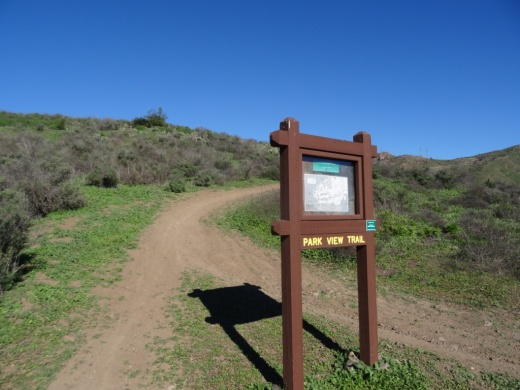
Park View Trail in Dos Vientos Section of Newbury Park

ParkViewTrail_sign1.JPG

The Park View Trail is a short little 1/2 mile trail adjacent to Dos Vientos Community Park in Newbury Park. There are two main access points. There is a trailhead near the corner of Rancho Dos Vientos and Via Rincon at the southwest corner of the park, and there is another trailhead on Via Ricardo, one block east of Via Pisa.

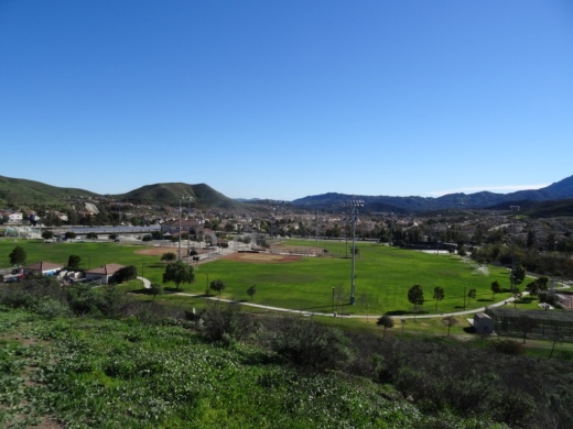
Views of Dos Vientos Community Park from the Park View Trail.

Views of Dos Vientos Community Park from the Park View Trail.

This short hike is perfect with the kids as it is not too strenuous and is adjacent to the park. Good for a quick getaway. There's also at least one geocache on this trail that's pretty cool.

Moderate trail it is. Not too steep, yet not completely flat.

Moderate trail it is. Not too steep, yet not completely flat.

View of the Edison power lines going up Conejo Mountain from Park View Trail.

View of the Edison power lines going up Conejo Mountain from Park View Trail.

Nice quick access to views of the park, Dos Vientos, the Powerline Trail and beyond. And speaking of the Powerline trail, the trailhead is directly across the street from the west end of the trail.

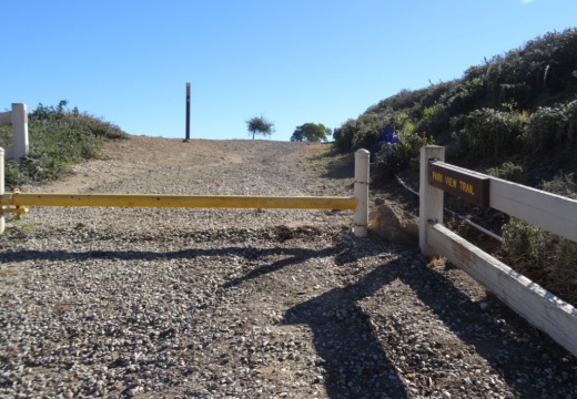
Trailhead on west side of Park View Trail off of Via Ricardo

Trailhead on west side of Park View Trail off of Via Ricardo

Interested in other Dos Vientos trails? Learn about the El Rincon, El Cerro and Las Brisas trails and the nearby (access point just south on Via Ricardo) Vista Del Mar Trail.

Fossil Trail Loop Hike in Point Mugu State Park

If you have two to three hours to spare and are looking to do about six miles of strenuous local hiking, consider trying the Fossil Trail loop in Point Mugu State Park, starting at the adjacent Rancho Sierra Vista/Satwiwa managed by the National Park Service in Newbury Park . If you're looking for a FLAT hike, this one isn't for you! Click the image below for detailed information and photos.

Chumash Trail in Simi Valley

The Chumash Trail in Simi Valley is a roughly 2.7 mile trail that takes you from near Chumash Park to the trailhead at the north end of Flanagan Drive to the Rocky Peak Trail. It is a moderate, uphill trail with plenty of views of Simi Valley. No trees and thus no shade. Dogs allowed on leash.

To get to the Chumash Trail trailhead, take the 118 to Yosemite, go north, turn right on Flanagan to the end. Park on the street. More information at www.rsrpd.org/simi_valley/trails/chumash_park_and_trail.php.

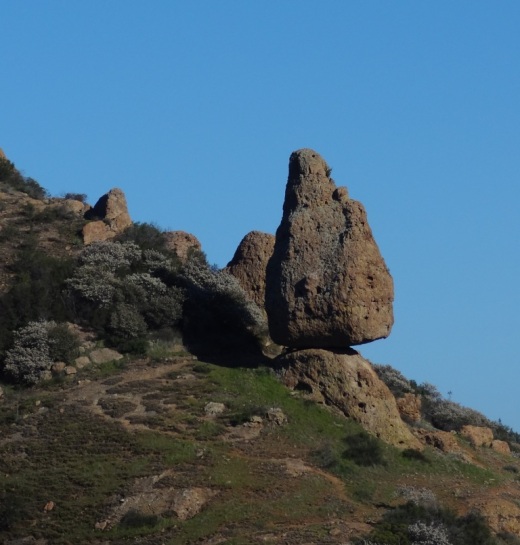
Sandstone formations appear on the upper portion of the trail.

Sandstone formations appear on the upper portion of the trail.