Marvin Braude Coastal Bike Path - Pacific Palisades to Torrance

We love driving down to Will Rogers State Beach from time to time, bring the bikes and enjoy the Marvin Braude Coastal Bicycle Path along the Pacific Ocean. 

This fun 22 mile path takes you from Pacific Palisades as far as Torrance.  Depending on how far you want to go and if you have kids with you, there are so many spots to stop along the way. 

To get to Will Rogers State Beach from the Conejo Valley, take the 101 to Las Virgenes/Malibu Canyon Road south to PCH, then about 9 miles down PCH to Will Rogers (17000 PCH), just east of Gladstones and Sunset Boulevard. Parking at Will Rogers varies based on when you go; I last recall paying $10.

The path doesn't actually start at Will Rogers Beach as it is a walking path only at this point. Ride the bike through the parking lot to the start of the bike path at Temescal Canyon Road. And, you're off!

From the start of the path, here are some approximate distances to destinations:

  • Santa Monica Pier - 3.2 miles
  • Venice Pier - 5.8 miles
  • Marina del Rey - 8.7 miles
  • Playa del Rey - 9.9 miles
  • Dockweiler Beach - 12.5 miles
  • Manhattan Beach Pier - 16.5 miles
  • Hermosa Beach Pier - 18.2 miles
  • Redondo Beach Pier - 20.4 miles
  • Torrance Beach - 22.3 miles (endpoint)

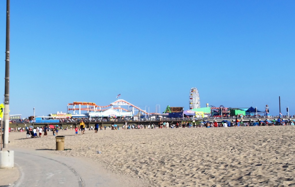
With younger kids, the Santa Monica Pier makes a perfect 6 1/2 mile round trip destination as you can stop, eat lunch and have some fun at Pacific Park, then ride back. Or kick it a few notches and ride to/through Venice Beach for all the action. 

Pacific Park up ahead

Pacific Park up ahead

There are plenty of restrooms water stops and of course non-stop BEACH to enjoy here, making this one of my favorite destination for bicycling with the family. And of course, you don't have to park at Will Rogers...you can park anywhere on PCH in and around the bike path to enjoy it.

Of course you do have to be careful of sand on the path, pedestrians/beach goers crossing and walking on the path, other cyclists, runners, roller bladers and crowds.  

Detailed map at file.lacounty.gov/SDSInter/dbh/docs/189949_2013-BIKEMAP85x11Web-Ready(highres).pdf

CLICK HERE FOR DOZENS OF FAMILY-FRIENDLY BIKE PATHS BACK UP IN THE VENTURA COUNTY AREA!

Paradise Falls Hike - Wildwood Park in Thousand Oaks

Perhaps the most popular destination in Wildwood Park in Thousand Oaks is Paradise Falls. There are a variety of trails and ways to get to Paradise Falls. Here's a quick and easy 1 mile route.

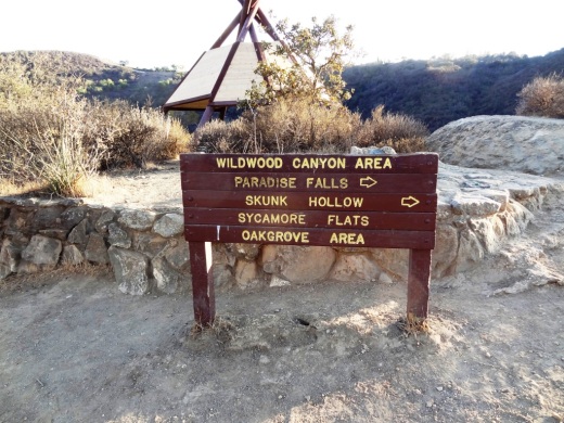
Park in the main trailhead at the west end of Avenida de los Arboles. Take the Mesa Trail about a 3rd of a mile until you see the sign below, where you'll turn left.

Another third of a mile and you're at the teepee, where you'll find another clearly marked sign pointing you in the direction of Paradise Falls.

Wildwood_Teepee1.JPG

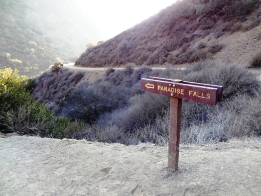
You turn right down the hill and take a short walk to the following sign.

ParadiseFalls2.JPG

Hike down some switchbacks and stairs and you're almost there.

ParadiseFalls3.JPG

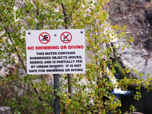
And wallah! You're at the following sign, where you'll be reminded that these year-round falls are partially fed by urban run-off, making them something you may not want to jump into.

ParadiseFalls4.jpg

But Paradise Falls is fun to get to and see. A full-on roughly 40 foot waterfall a mile away from civilization in Thousand Oaks.

ParadiseFalls5.JPG

You can walk back the way you came or hike back up the trail above the falls and loop back up to the teepee via the Wildwood Canyon Trail.

Santa Barbara Botanic Garden

SantaBarbaraBG.gif

Founded in 1926, the Santa Barbara Botanic Garden is the oldest botanic garden in California dedicated to the study, conservation and display of native flora.  The Garden is a place of beauty and serenity, of education, research and conservation, of history and stewardship.

The Garden's living collections, including more than 1,000 types of plants, are featured throughout 78 acres accessible by over 5.5 miles of public trails; many trails are accessible by stroller or wheelchair. Accredited by the American Association of Museums as a living museum, the collections are devoted to illustrating the remarkable diversity of California's native flora. Arranged in stunning displays and interpreted through signage and docent-led tours, the living collections capture California's natural beauty and provide endless opportunities for learning, appreciation, and enjoyment.

Garden sections and displays include the Arroyo Section, Campbell Trail, Canyon Section, Desert Section, Home Demonstration Section, Manzanita Section, Meadow Section, Porter Trail, Redwood Section, Tea House Garden and Woodland Trail.

Santa Barbara Botanic Garden

The Garden's library includes over 15,000 books and journals, representing an important resource for education and research. Special collections include rare books, photos, manuscripts, and horticultural catalogs. The strength of the collection lies in its diversity, representing important botanical and horticultural works on California flora, Mediterranean floras of the world, landscape history, and the disciplines of botany and horticulture.

Composed of over 140,000 specimens of plants, the herbarium represents the region's largest scientific collection of preserved central coast plants. Collectively, the specimens document the ecology and geography of the region's plant diversity.

Open 7 days a week, the Garden is closed on Thanksgiving, Christmas Eve, Christmas Day, New Years Day and during some special events. Current admission costs as of April 2018 are $12 for adults, $10 for 60+ seniors, $8 for ages 13-17, college students and active military, and $6 for ages 2 to 12. Current garden hours are 9 am to 6 pm March through October and 9 am to 5 pm November through February.

The Garden Shop has an extensive selection of crafts, nature-related books and gifts for all ages and is open daily. There's also a Garden Growers Nursery open year-round.

Located at 1212 Mission Canyon Road, Santa Barbara. Visit www.sbbg.org or call 805.682.4726 for more information.

Day at the Races - Santa Anita

Santa Anita Park

You don't have to be a gambler to enjoy a day at Santa Anita Park in Arcadia!  The winter/spring horse race season starts the day after Christmas and ends usually early April.

Santa Anita is a beautiful 320 acre park with a large grandstand that holds 26,000 people and a nice infield with plenty of open space.  I picked the horses for fun when I was a kid and loved it on the rare occasion when my father and I made a day of it at the race track.

SantaAnita1.jpg

The park is open Thursdays through Mondays, with 10 races on weekends/holidays and 8 races on most weekdays.  Gates open at 10:30 a.m. and first race is normally at 1 p.m. 

You don't have to put a lot of money down on a race to enjoy the excitement!  Heck, pluck down $2 and bet on a longshot and you'll be glued to the race.  It's really a lot of fun.

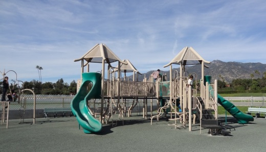
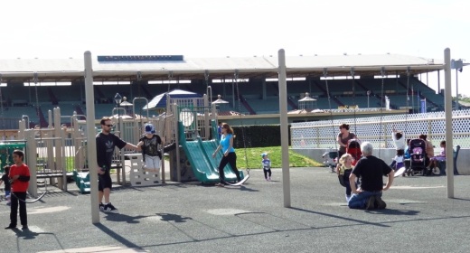
Admission is only $5 for adults and FREE for those under 17 accompanied by an adult.  Parking is $4 ($10 valet).  For kids there is a playground with slides, a jungle gym and swings.  There is a picnic facility for special events  Better yet, there are Family Fun Days from noon to 4 p.m. each Sunday in March through season's end in April.  Family Fun Days feature carnival games, giant inflatable slide and bounce house, face painting and pony rides.

SantaAnita4.JPG
SantaAnita5.JPG

If you're looking to take it up a notch, check out the fine dining at The Turf Club (dress code enforced...no jeans, sneakers and t-shirts here), Front Runner and Club House Terrace restaurants.

Santa Anita is located at 285 West Huntington Drive, Arcadia.  Visit www.santaanita.com or call 626.574.7223 for more information.

So I convinced the kids that that to drive with me to Santa Anita on Super Bowl Sunday 2013 with the goal of getting home in time for the Super Bowl. We left our house in the Conejo Valley around 9:40 a.m. and arrived about 20 minutes before the first race at 11 a.m., about 3 hours earlier than normal I guess because of the Super Bowl.

We parked in the northern lot that takes you directly to the infield area. Follow the green line in the parking lot to find it. The parking area is huge. I prefer the infield because it is outside and you don't have  to endure as much of massive plumes of cigarette smoke you have to endure in the grandstand area. That said, the food choices in the infield were limited to hot dogs and junk food, so if you don't bring your own lunch, you'll have to go under the tunnel into the grandstand area.

Speaking of the tunnels, they're cool. There's a tunnel to get from the parking lot to the infield and another one that gets you to the grandstand and paddock area. The tunnels are extremely good for echo sounds with the kids.

There's a humongous screen in the infield where you can view the horses and the race. We sat on the benches in front of the screen so we could stand up during the race and watch the horses down the stretch. I let the kids pick one horse each race. Having a little skin ($2) in the game makes it a lot more fun. Although the kids' choices were a little off the mark, I managed to win a couple exactas that brought me close to break even for the day.

The humongous screen in the infield area

The humongous screen in the infield area

So much excitement as the horses take it down the final stretch

So much excitement as the horses take it down the final stretch

We took a quick walk to the paddock area, where you can see the trainers prepping the horses before the race and walk into the track. We also met the trumpeter before the race. Such a nice guy who enjoyed interacting with the kids.

The park itself is just stunning. So huge and beautiful. Although the park was at very low capacity the day we went, but we still encountered some characters who were cursing and moaning about their lousy picks...so do be prepared for that.

The only drawback to the infield area is that it is mostly unshaded, so wear sunscreen and consider bringing an umbrella if you don't want too much sun. Or of course you can go to the grandstand. The playground area in the infield is pretty well maintained and comparable to what you'd find in most parks.

So we left after the 7th race around 2:15 p.m. and made it back home with 15 minutes to spare before the Super Bowl at 3:30 p.m. What a great day!

Las Virgenes View Park in Calabasas

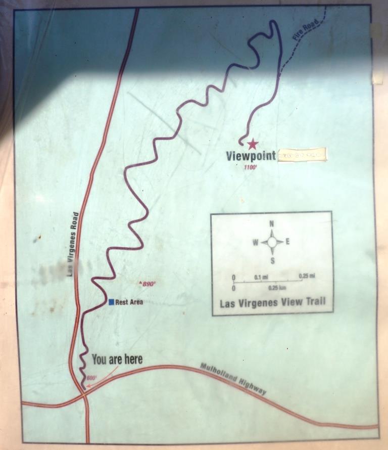
Las Virgenes View Park is located at the northeast corner of Las Virgenes Road and Mulholland Highway in Calabasas. The park is a 696 acre project of the Santa Monica Mountains Conservancy, owned and managed by the Mountains Recreation and Conservation Authority in cooperation with the Las Virgenes Municipal Water District and City of Calabasas.

Enjoy a 2.4 mile trail through chaparral and woodlands to a scenic vista point at 1,100 feet. It is a single track trail of switchbacks that largely parallels Las Virgenes Road. You'll enjoy all sorts of views as you head up the trail, from Malibu Creek State Park, De Anza Park, King Gillette Ranch and beyond.

Off street dirt parking is at the trailhead and across the street. More information at www.lamountains.com/parks.asp?parkid=30.

Trailhead

Trailhead

LVViewPark2.JPG
LVViewPark3.JPG
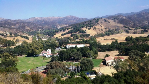
View from the Las Virgenes View Park Trail towards Malibu Creek State Park.

View from the Las Virgenes View Park Trail towards Malibu Creek State Park.

LVViewPark5.JPG

King Gillette Ranch in Calabasas

KingGilletteSign.JPG

The 588-acre King Gillette Ranch (26800 West Mulholland Highway, Calabasas) is situated adjacent to Malibu Creek State Park. This scenic parkland at the lower end of the Las Virgenes Valley is a haven for larger mammals of the Santa Monica Mountains and offers a rare unspoiled view of California’s rich archaeological, cultural, and historic resources, including a Chumash settlement, and nationally significant structures designed for razor magnate King C. Gillette in the 1920’s by Wallace Neff, architect of California’s Golden Age.

View of King Gillette Ranch from Inspiration Point, south of the Gillette Mansion

View of King Gillette Ranch from Inspiration Point, south of the Gillette Mansion

A short, somewhat steep roughly 1 mile hike from the parking area south of the Gillette Mansion leads to a knoll with 360-degree views—including the famous rock formations of Malibu Creek State Park. This is referred to as Inspiration Point. You will love the spectacular views from up there.

View from Inspiration Point west towards Malibu Creek State Park.

View from Inspiration Point west towards Malibu Creek State Park.

Other activities include strolling, bicycling, photography, and picnicking. King Gillette Ranch is owned and managed by the Mountains Recreation and Conservation Authority in cooperation with the Santa Monica Mountains National Recreation Area unit of the National Park Service, the Santa Monica Mountains Conservancy, and California State Parks.  More information at lamountains.com/parks.asp?parkid=670 or call the Anthony C. Beilenson Interagency Visitor Center at 805.370.2301.

Directions from the Conejo Valley: Take Hwy 101 (Ventura Freeway) to the Las Virgenes/Malibu Canyon exit. Head south on Las Virgenes Road and continue to Mulholland Hwy, about two miles. Turn left onto Mulholland Highway and immediately look for the King Gillette Ranch entrance on the right.

Legacy Park in Malibu

Legacy Park is located at 23500 Civic Center Way in Malibu, bordered by PCH, City Hall and Malibu Country Mart. It is a unique park that displays different habitats...wet meadow, coastal prairie, woodlands, riparian corridor, vernal pools and coastal bluffs. There is a lagoon with wildlife, a nature path and an interesting kids' interpretative area as you'll see. Peaceful and unique, you might want to walk through and enjoy before heading to the Country Mart or the Malibu Lagoon Beach.

To learn more about the park, visit www.malibucity.org or call 310.317.1364.

McCrea Ranch Visitor Center in Thousand Oaks

Opened in 2011, the McCrea Ranch Visitor Center is the former family home and ranch of Western film actor Joel McCrea and his wife and family.  McCrea Ranch is listed on the National Register of Historic Places.

The Center provides a variety of interpretive, educational, and cultural programs for the community, while preserving the unique history of this property through the Conejo Recreation and Park District. At some point and as funds become available in the future, the Visitor Center will be open to the general public. Visit crpd.org/about_us/community_partners/mccrea_ranch_visitor_center.asp for upcoming events at McCrea Ranch or call 805.495.2163.

McCrea Ranch is located at 4500 N. Moorpark Road, Thousand Oaks, near the bottom of the Norwegian Grade.

McCreaRanch1.JPG
McCreaRanch2.JPG
McCreaRanch3.JPG

Prickly Pear Trail in Newbury Park

The Prickly Pear Trail is located in the Dos Vientos section of Newbury Park. The entry point is at Del Prado Playfields, 402 Calle Del Prado, Newbury Park.

This is a short, roughly one mile in total, family-friendly hike at the east end of the Dos Vientos community. 

The entry point is on the south side of the parking lot in front of the park. It is quite clearly marked, as shown below. The first straightaway is about 1/4 mile, at which point you have the decision of which direction you'd like to take the loop. If you go left (clockwise loop), at the first fork in the trail take the left trail (if you take a right you'll be going back to where you came from). Then continue the remainder of the loop veering right until you're back at the straightway you came from.

This is a convenient little family hike as there is plenty of parking at the park, restrooms, a newer playground for the kids, pickleball and tennis at the park.

About 1/4 mile into the hike, looking back towards Del Prado Playfields.

About 1/4 mile into the hike, looking back towards Del Prado Playfields.

Views toward the protected pond behind Cypress Elementary, along Via Rio.

Views toward the protected pond behind Cypress Elementary, along Via Rio.

Seaside Wilderness Park in Ventura

Sign on W. Main Street near bike path and Highway 101 access point.

Sign on W. Main Street near bike path and Highway 101 access point.

The City of Ventura's Seaside Wilderness Park is located across the Ventura River Main Street Bridge, adjacent to Emma Wood State Beach Park. One fun way to access it is by taking the Omer Rains Trail (bike path) to it from the Ventura Promenade area. But get off your bike when you reach your destination as this is a pedestrians-only park that contains the Ventura River mouth, the former "Hobo Jungle," the 1.3 mile Ocean's Edge Trail (tide pools) and .7 mile River's Edge Trail for birdwatching. Last time we were there we enjoyed some geocaching.

Sandstone Peak to Inspiration Point and Tri Peaks in the Santa Monica Mountains

On everyone's local area bucket list should be the hike to the highest point in the Santa Monica Mountains - Sandstone Peak. That hike is about 3 miles round trip.

If you're looking to extend that hike, you can do the Mishe Mokwa Loop trail in reverse. Or you can explore several other peaks not far away - Inspiration Point and Tri Peaks. Hiking to Tri Peaks and back is about 6 miles round trip from the Sandstone Peak parking area.

Just north of the Sandstone Peak staircase/final ascent is a sign that indicates the trail to Tri Peaks. The trail is clearly marked and about 3/4 of a mile west you will come to the Inspiration Point spur trail. Do check it out as frankly I think the views towards the ocean are better here than at Sandstone Peak. Inspiration Point is 2,766 feet in elevation.

Follow the trail towards Tri Peaks from Sandstone Peak.

Follow the trail towards Tri Peaks from Sandstone Peak.

Sign on the Backbone Trail towards Tri Peaks signifying you are at the Inspiration Point spur trail. Sign indicates 2,800 ft elevation though I've read it is actually 2,766 ft. Close enough.

Sign on the Backbone Trail towards Tri Peaks signifying you are at the Inspiration Point spur trail. Sign indicates 2,800 ft elevation though I've read it is actually 2,766 ft. Close enough.

The view from Inspiration Point towards the ocean. The road below is Yerba Buena.

The view from Inspiration Point towards the ocean. The road below is Yerba Buena.

Inspiration Point dedication sign to an Eagle Scout who lost his life much too early.

Inspiration Point dedication sign to an Eagle Scout who lost his life much too early.

Another 3/4 mile or so of hiking gets you to Tri Peaks, which is 3,010 ft elevation, not too far behind Sandstone Peak. Tri Peaks is northeast of Inspiration Point and there are a number of signs that tell you you are getting close. The final sign before reaching Tri Peaks says you are .2 miles away. But after that, to my knowledge there is no official sign that says you have reached Tri Peaks. The final 1/2 mile spur trail to Tri Peaks is much more narrow than the main trail.

You have reached your destination - Tri Peaks.

You have reached your destination - Tri Peaks.

Personally when I went I was alone and in running shorts and t-shirt. Had I been wearing more appropriate hiking gear and long pants, I would have explored the peaks and caves a bit but without being properly equipped I opted to stay safe. But on the west side you can get some pretty sweet views of the Santa Monica Mountains towards Point Mugu and beyond.

Also, be careful to pay attention to the trail you came in from. There is no signage indicating the trail back, and the trail is not particularly clearly marked. 

View towards the Oxnard Plain from Tri Peaks.

View towards the Oxnard Plain from Tri Peaks.

Oakbrook Neighborhood Park in Thousand Oaks

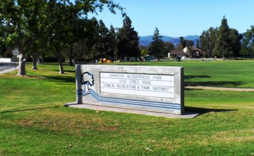
Located at the corner of Erbes Road and Pederson Road in Thousand Oaks, the 14 acre Oakbrook Neighborhood Park was expanded dramatically in 2012. The original park included a play area, sand volleyball court and large grassy area. The expansion includes a decent-sized parking area, small restroom, basketball and netball* courts, a jogging/walking/bike path and a nice horseshoe pit area. Visit the Conejo Recreation and Park District website at www.crpd.org for more information.

OakbrookParkTOsign.JPG
OakbrookParkGrassPlayArea.JPG
OakbrookParkPath.JPG
OakbrookParkHorseshoes.JPG

This is the original section of the park; primarily expansive grassy area with play area in background.Paved path area in the expanded section of the park.Something you don't see too often these days...new horseshoe pit area .

Yes, this is a netball court, not to be confused with a basketball court!

Yes, this is a netball court, not to be confused with a basketball court!

To learn more about the game of netball, click this link. This is the first, and, as of May 2013, only netball court in Thousand Oaks. And yes, I was confused when I saw it too.