Beaches Spanning From Carpinteria Through Ventura County to Malibu

My kids and I love going to the beach but for many years we seemed to go to the same ones all the time. So I stopped by the Automobile Club and asked them if they had a brochure on all the local area beaches open to the public. They shrugged their shoulders and said no such guidebook existed. They handed me a fold out map, which was of no use to me as I wanted to know exactly how to get to these beaches, if they have restrooms, parking, etc.

MalibuBeach.jpg

Then I started searching around for information and found bits and pieces in various locations that were marginally useful. So I decided to consolidate this information into one place where I could find out about where to go to the beach around Ventura County on up the coast to Carpinteria and Santa Barbara and down to Malibu. So I hope you find the following links helpful in finding local area beaches in Ventura County and surrounding areas!

Carpinteria to Ventura

Oxnard to Hueneme to Malibu

Santa Barbara Area Beaches

This took a lot of time to compile over 60 local area beach areas, so I truly hope you benefit from these lists! So enjoy and provide feedback if you have comments and/or additional information.

MuguFisherman.jpg
At Leo Carrillo State Beach in Malibu.

At Leo Carrillo State Beach in Malibu.

Windsurfers at Surfers' Point in Ventura.

Windsurfers at Surfers' Point in Ventura.

Malibu Creek State Park

MalibuCreekSP_sign.JPG

Malibu Creek State Park is accessible in Calabasas, at 1925 Las Virgenes Road, south of Mulholland. The park contains over 8,000 acres of rugged, beautiful hills, trails and scenery. It stretches from Agoura Hills down to Malibu, down to Malibu Lagoon State Beach, covering much of the 25 mile Malibu Creek that flows from Boney Mountain down to the Lagoon. Malibu Creek is the only stream channel that crosses through the Santa Monica Mountain range.

There are three natural preserves in the park, Liberty Canyon, Udell Gorge and Kaslow, which protect Valley Oaks, rare plants and volcanic formations.

Things to do in Malibu Creek State Park include hiking, running, biking, camping, picnicking, fishing and checking out the wildlife. There are over 35 miles of trails and fire roads throughout the park. A fun added bonus is the old M*A*S*H series set, filmed from 1972 to 1983, that resides there.

Dogs are not allowed in Malibu Creek State Park trails.

Malibu Creek State Park contains roughly three dozen different trails, many easy, and some...extraordinarily challenging, such as the Bulldog trail, taking you to 2,500 foot peaks with panoramic views out to the ocean and surrounding peaks and valleys.

Parking for the day at Malibu Creek State Park is currently $12, or $3 per hour. You can also park at the corner of Mulholland and Las Virgenes and make your way into the park via the Grassland Trail.

The campground at Malibu Creek State Park has 62 campsites and 4 RV sites. Visit www.parks.ca.gov/?page_id=614 for more information.

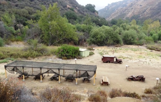
The old M*A*S*H site is 2.7 miles from the parking area.

M*A*S*H site with plenty of picnic tables

M*A*S*H site with plenty of picnic tables

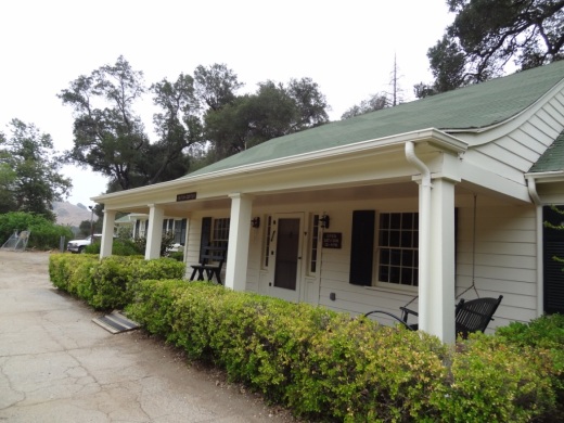
The Visitor Center is only a 10 minute walk from the parking lot and is generally open from noon to 4pm on weekends.

The Visitor Center is only a 10 minute walk from the parking lot and is generally open from noon to 4pm on weekends.

There's also an interesting visitor center about 1/2 mile from the main entrance to the park. It is open on Saturday/Sunday from noon to 4pm, subject to availability of docents. Worth a stop as there are some neat things to see in there, including wildlife and rocks/artifacts and other useful information. You can also purchase drinks in there as well as a small assortment of other items.

Hike to the Rock Pool at Malibu Creek State Park

Century Lake Hike at Malibu Creek State Park

The Collection at RiverPark in Oxnard

TheCollectionSign.JPG
TheCollection_logo.jpg

The Collection at RiverPark is an outdoor shopping center located on the northeast side of the 101 freeway in Oxnard, between the Oxnard and Vineyard exits.

The 650,000 sq ft center includes a combination of entertainment, retail, restaurants, various services, open space with fountains, parks and playgrounds and quality art. Parking is available on the streets as well as several parking lots.

As of September 2020, the following businesses operate at The Collection:

Retail: Here’s a small fraction of stores at The Collection - Cotton On Ethan Allen, Forever 21, Gap, H&M, Lane Bryant, lululemon, MAC Cosmetics, Pandora, Pet Food Express, REI, Sleep Number, Soma Intimates, Target,, The Container Store, ULTA Beauty, Urban Outfitters, Van’s, Victoria’s Secret, Whole Foods Market and many more.

Entertainment: Levity Live Comedy Club & Dinner Theater, Century RiverPark 16, Color Me Mine, Jump ‘N Jammin Indoor Play. Bowlero bowling lanes

Other: Bank of America, 24 Hour Fitness SuperSport, Massage Envy Spa, Ventura County Credit Union and more.

REI_Oxnard.JPG

Restaurants include:

  • After’s Ice Cream

  • Bottle & Pint (at The Annex)

  • Burnin’ Mouth Nashville Hot Chicken

  • Burrata House

  • Copper Blues Rock Pub & Kitchen

  • Da Hickory House

  • Devil & Angel Desserts

  • Five Guys Burgers & Fries

  • GEN Korean BBQ

  • Immigrant Son Caffe (coming soon)

  • It’s Boba Time

  • It’Sugar

  • Kabuki Japanese Restaurant

  • King & Queen Cantina (coming soon as of November 2021)

  • Larsen’s Grill

  • Lazy Dog Restaurant & Bar.

  • Love Pho Cafe (at The Annex)

  • Luna Grill

  • Menchie's Frozen Yogurt

  • Mong Q Mongolian BBQ

  • Panera Bread

  • Pizza Man Dan’s

  • Ragamuffin Coffee Roasters (at The Annex)

  • Red Robin

  • Settebello Pizzeria Napoletana,

  • Silverlake Ramen

  • Starbucks

  • Texas de Brazil

  • The Blend Superfood Bar (at The Annex)

  • The Cheesecake Factory

  • Two Hands Corn Dogs

  • Whole Foods Bar Rincon

  • Yard House.

Also at The Collection: The Annex, a 16,000 sq ft collection of micro shops, boutiques and eateries (included above). Across the street from Levity Live/Copper Blues.

There is unique public art placed throughout the center, including metal sculptures, ceramic tile murals, fountains and more. Shea Properties has spent around $1 million on art, bringing in seven artists for 18 individual art installations. Artists include Frank Bauer with his ceramic tile murals and benches and tile sidewalk medallions, and Michael Amescua with his cut metal sculptures.

RiverparkMural.JPG

Visit www.thecollectionrp.com or visit their Facebook page to learn more. To get there from the 101 North, exit on Oxnard Boulevard and turn right. Turn right again on Town Center Drive.

Playground at The Collection

Playground at The Collection

Places that have come and gone from The Collection: Toby Keith's Bar & Grill closed in Spring 2015. Sabra Fish Grill opened in 2015 and closed in late 2017. Famous Dave’s BBQ. Gandolfo’s New York Deli, ANGL. General Chow closed in October 2019, EMC Seafood, Maria’s Italian Kitchen (closed April 2020), Seoul Sausage Company, PokeCeviche, The Painted Cabernet, Ben & Jerry’s

Two Springs Trail and Wildwood Canyon Trails in Wildwood Park, Thousand Oaks

Sign on the west side of the Wildwood Park parking lot after walking down some steps

Sign on the west side of the Wildwood Park parking lot after walking down some steps. (Indian Creek Trail was renamed Two Springs Trail in May 2022.**)

If you enjoy the sound of running water, the Two Springs Trail (formerly Indian Creek Trail) and Wildwood Canyon Trail at Wildwood Park in Thousand Oaks are for you.

The Two Springs Trail can be accessed from the main Wildwood Canyon trailhead area parking lot at the east end of Avenida de los Arboles as well as at a separate trailhead on Arboles, slightly west of the parking lot.

Indian Creek Trail entry point from Avenida de los Arboles

Two Springs Trail (formerly Indian Creek Trail) entry point from Avenida de los Arboles

There are shady sections hidden among the trees and sections in the sun. Most of the trail runs along a creek that flows into Paradise Falls. This is not a completely easy hike as there are some hilly sections, a number of steps, and a stream crossing. That said, there's enough variety to make this a fun and interesting hike with the kids.

Visit the Conejo Open Space Foundation website at cosf.org/trails/wildwood/wildwood-park-easy-hike-moonridge-trail/ for a handy map of these trails.

About half a mile or so into the hike, you'll come across a fairly significant waterfall down below, way below, in the creek. Not as large as Paradise Falls, but definitely prominent. Adjacent to that area is a bench. And from there you have some steps and a stream crossing to make it down to the flatter section of the trail.

The waterfall seen from the Indian Creek Trail. Be careful!

The waterfall seen from the Two Springs Trail (formerly Indian Creek Trail). Be careful!

The bench on the Indian Creek Trail in Wildwood Park

The bench on the Two Springs Trail (formerly Indian Creek Trail) in Wildwood Park

Eventually you get to a bridge. If instead of crossing the bridge, you veer left (southwest), you'll be on the Wildwood Canyon Trail along the creek. This is a wide path that can take you on another little sidetrack loop up the Castillo Trail to Castillo Circle (street). A bit of a steep, roughly 3/8ths of a mile trail to Castillo Circle, where you can walk back to a separate trailhead via Velarde Drive north to San Miguel Circle to the San Miguel Trail. You'll end up back at the bridge area.

The Wildwood Canyon Trail is pretty cool. Fairly flat, wide and runs along a creek. The water they say is mostly urban runoff but fun to check out up close with the kids.

The Wildwood Canyon Trail is pretty cool. Fairly flat, wide and runs along a creek. The water they say is mostly urban runoff but fun to check out up close with the kids.

The Meadows Center next to the bridge has restrooms and a drinking fountain. The Conejo Rec & Park District leads many hikes here for s'mores and fun activities.

The Meadows Center next to the bridge has restrooms and a drinking fountain. The Conejo Rec & Park District leads many hikes here for s'mores and fun activities.

The bridge that intersects the Indian Creek Trail and Wildwood Canyon Trail. Lots of options!

The bridge that intersects the tWO sPRINGS (FORMERLY iNDIAN cREEK) Trail and Wildwood Canyon Trail. Lots of options!

Or, veer right (west) over the bridge, continuing on perhaps the Wildwood Canyon Trail southeast towards the top end entry into the Paradise Falls area (pretty cool to go this way). You can also sidetrack a bit by crossing the bridge and making a sharp right (north) to the short Little Cave Trail** and check out the Little Cave **.

The Indian Cave is really easy to get to. Wear good hiking shoes though as it can get slippery. I slipped several times recently because the sole of my sneakers was so worn down.

The Little Cave (formerly Indian Cave**) is really easy to get to. Wear good hiking shoes though as it can get slippery. I slipped several times recently because the sole of my sneakers was so worn down.

You can return to the parking area by either backtracking up the Two Springs Trail or by taking the trail directly across from the bridge (basically go straight) up the steep, moderately winding path to a public access road (there is overflow parking available here) to the main Mesa Trail. From there, go right (east) back to the parking lot.

I could go on but there are so many different options in Wildwood Park that we'll stop here for now. Here are links to some other options:

THE TEEPEE, LITTLE CAVE AND PARADISE FALLS

LIZARD ROCK

SANTA ROSA LOOP

SANTA ROSA TRAIL AND LOWER BUTTE TRAIL FROM WILDWOOD PARK TO CLU

** The change in name was approved by the Conejo Open Space Conservation Agency (COSCA) in May 2022. COSCA received a request to change the Indian Creek Trail name earlier that year. On its own, the work "Indian" refers to individuals from India, rather than Native Americans, and thus did not accurately reflect the origin of the people to whom it refers.

The Indian Cave and Indian Cave Trail were renamed Little Cave as it was unclear if the cave was naturally formed and/or historically used by Native Americans.

The Indian Creek Trail in Wildwood Park was renamed Two Springs Trail as two natural springs contribute to the stream flow in this portion of the channel.

Sycamore Canyon Nature Center at Point Mugu State Park

The Sycamore Canyon Nature Center is a small center located near the entrance to Sycamore Canyon Campground in Point Mugu State Park at 9000 Pacific Coast Highway. The center is open on Saturdays from noon to 3pm. Displays cover local wildlife, including specimens of a cougar, bobcat, birds of prey, and more. A volunteer is on hand to provide additional information.

El Encanto Trail in Dos Vientos Section of Newbury Park

ElEncanto_sign.JPG

If you're looking for quick access to gorgeous views in the Dos Vientos section of Newbury Park, from Thousand Oaks to Camarillo to the Santa Monica Mountains, stop by the roughly 1.2 mile El Encanto Trail. Access the trail either at the western endpoint of Kimber Drive, just past Greenway Avenue, or inside Dos Vientos at the eastern endpoint of Via Laguna, near the Calle Del Prado intersection.

After a fairly flat start off of Kimber, the trail gets a bit steep and narrow. My young kids were fine on it but it take a decent effort, with an elevation climb of about 300 feet.

And towards Thousand Oaks on the east

This little trail seems quite popular with mountain cyclists as well as hikers. Here's an inviting bench that awaits you near the top of the trail, about halfway between the Kimber and Via Laguna trailheads.

ElEncanto_Bench.JPG

The area was ravaged by the Springs Fire of 2013. The bench has an inscription dedicated to the efforts of the Ventura County Fire Department that did such a fantastic job protecting local neighborhoods.

ElEncanto_benchsign.JPG

If you start on the Kimber side all the way to the Via Laguna side, you can either retrace your steps back or take Calle Del Prado down to Via Rio, turning left (east) for a about a quarter mile walk back to the Kimber side.

For a detailed trail map of Dos Vientos area trails on the Conejo Open Space Foundation website, visit https://cosf.org/files/maps/dos_vientos_trail_map.pdf.

Color Me Mine Ceramics Studio in Calabasas

Paint ceramics with your friends and family at Color Me Mine at 23641 Calabasas Road, Calabasas. Pick from hundreds of ceramic pieces for kids, the kitchen, bath, pets and more. Design and paint them any way you like.

More information at www.calabasas.colormemine.com or call 818.222.4922.

Upper Sycamore Canyon Trail in Point Mugu State Park

The Upper Sycamore Canyon Trail is a 1.3 mile trail connects to the bottom of steep Sycamore Canyon Fire Road on the west to the Danielson Road trail on the east.

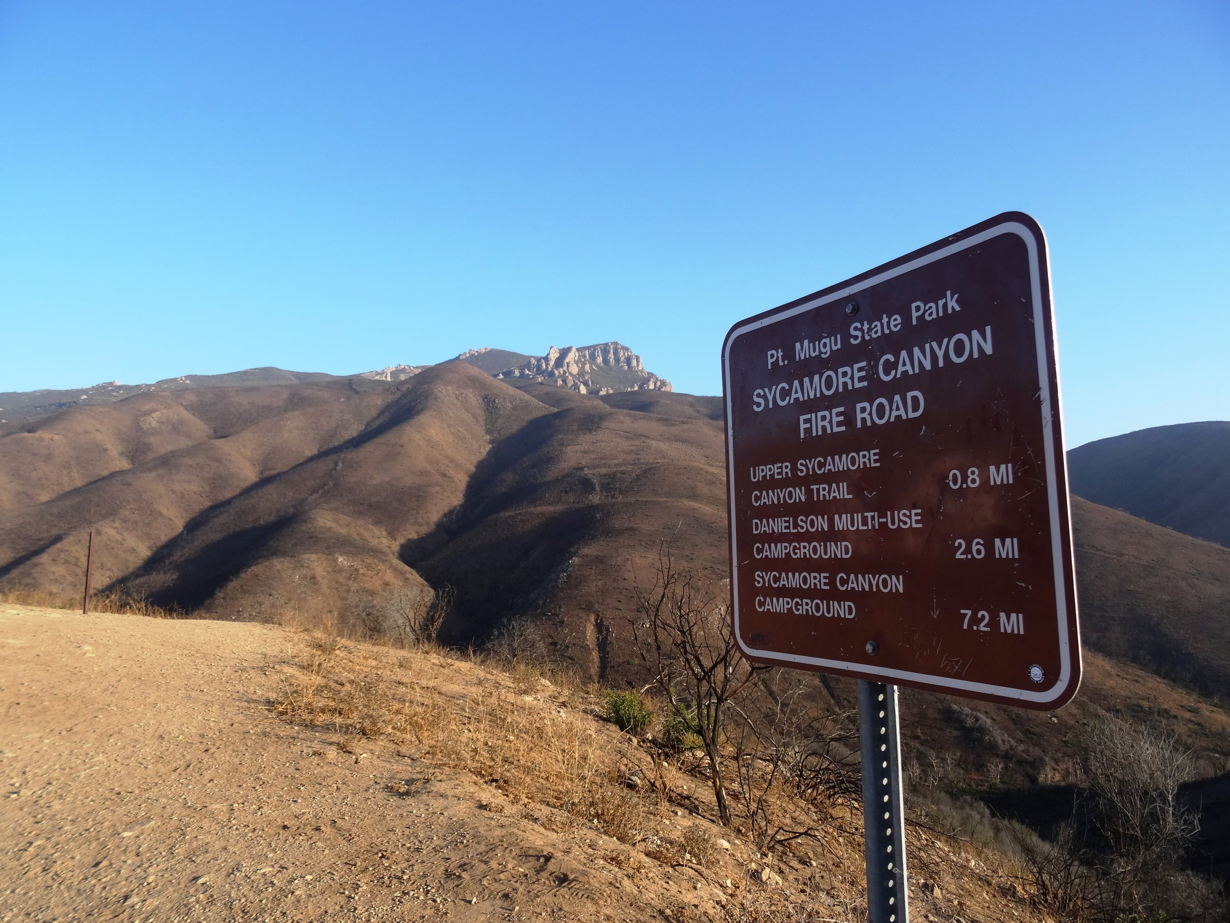
Sign at top of Sycamore Canyon Road before the descent into the canyon.

Sign at top of Sycamore Canyon Road before the descent into the canyon.

The trail goes deep into the canyon and can get quite overgrown, especially after solid winter rains. But it is an interesting hike and alternative to other trails that take you to "The Waterfall" in the Boney Mountain Wilderness. Bike and dogs are not allowed on these back country trails. Watch out of course for poison oak and snakes.

The "Narrow Bridge" sign marks the bottom of the steep initial grade down Sycamore Canyon Fire Road. You'll cross the bridge, then see the Upper Sycamore Canyon Trail entry to the left.

The "Narrow Bridge" sign marks the bottom of the steep initial grade down Sycamore Canyon Fire Road. You'll cross the bridge, then see the Upper Sycamore Canyon Trail entry to the left.

After you enter the west end of the Upper Sycamore Canyon Trail, within about a 1/10th of a mile is the entry point to the Fossil Trail, a very steep trail that leads up to the Old Boney Trail. 

Inside the canyon, looking west, towards the Sycamore Canyon Fire Road.

Inside the canyon, looking west, towards the Sycamore Canyon Fire Road.

After the substantial rains of Winter 2017, a creek has been flowing through this canyon and has caused some obstacles and overgrown sections of the trail. Do wear good hiking shoes.

Upper Sycamore Canyon Trail (Map excerpt courtesy of National Park Service)

Upper Sycamore Canyon Trail (Map excerpt courtesy of National Park Service)

Danielson Road sign you will see at the east end of Upper Sycamore Canyon Trail, Now you can head back up towards Rancho Sierra Vista/Satwiwa to the left or go the The Waterfall and/or Danielson Monument.

Danielson Road sign you will see at the east end of Upper Sycamore Canyon Trail, Now you can head back up towards Rancho Sierra Vista/Satwiwa to the left or go the The Waterfall and/or Danielson Monument.

Carbon Beach in Malibu

The Carbon Beach coastline as seen from the Malibu Pier.

The Carbon Beach coastline as seen from the Malibu Pier.

Carbon Beach is perhaps the most expensive 1 1/2 mile strip of beach in the world, located roughly between the Malibu Pier and just east of Carbon Canyon Road. 

The beach is wide, with lots of dry sand, making it particularly pristine and desirable, but public access is fairly limited, there are no public restrooms and dogs are not allowed.

According to the California Coastal Commission, in addition to "Public Access Easement" areas, "the public has the right to use all lands seaward of the ambulatory mean high tide line." Huh? This is no different than other beaches in California.

The access point on the west side of Carbon Beach is called the Zonker Harris* Access Way at 22670 Pacific Coast Highway, between Nobu Malibu (22706 PCH) and 22664 PCH (McDonald's is right across the street). 

* Opened in 1983 and named after the hippie Doonesbury character who worships the sun.

You can also park at the Malibu Pier and walk to Carbon Beach. It is about a half mile.

There is also public parking available on the upper floor of 22601 PCH on summer weekends and holidays.

The Carbon Beach West Public Accessway is at 22466 PCH. Funny, Google Maps actually refers to this as Billionaires Beach Public Access.

The Carbon Beach East Public Accessway is at 22126 PCH (in between 22140 PCH and the property at 22126 PCH - this is the property owned, or possibly now previously owned, by David Geffen).

And there you have it. For a pdf map from the California Coastal Commission showing public beach access at Carbon Canyon, click THIS LINK.

The Village at Dos Vientos Ranch

The Village at Dos Vientos Ranch (originally known as Paraiso at Dos Vientos Ranch), located at 350 Via Las Brisas, Thousand Oaks ("Dos Vientos" community of Newbury Park) is a 50,000 square foot community retail shopping center.

Tenants currently include The Local Table, Sushi2 Vientos, Honeycup Coffeehouse and Creamery, Fitness Together, Bubbles Dry Cleaners, Paraiso Family Dental, ETF Portfolio Management, Nati Boutique, Calvary Church and Village Trader Market and Deli.

No functional website as of December 2021.

www.facebook.com/thevillagedosvientos

Dave & Buster's in Thousand Oaks

Dave & Buster’s opened in the Janss Marketplace at 145 W. Hillcrest Drive in Thousand Oaks on March 4, 2019. This 40,000 square foot location offers a full lunch and dinner menu, large bar area with dozens of TVs, arcade games, virtual reality games, billiards, and more. Visit www.daveandbusters.com/us/en/about/locations/thousand-oaks for more information or call 805-857-7800.

Sycamore Cove Beach in Point Mugu

sycamorecovesign.JPG

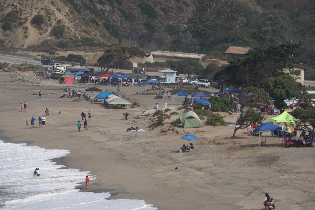
Sycamore Cove Beach is located at 9000 Pacific Coast Highway in Point Mugu. This beach is one of the closest and easiest to get to from the Conejo Valley and Camarillo via Las Posas and PCH.

Sycamore Cove Beach in the background. Sycamore Canyon Campground entrance on left.

Sycamore Cove Beach in the background. Sycamore Canyon Campground entrance on left.

The beach is popular with families looking to barbecue and enjoy quick and easy access to the beach. There are also porta-johns and restrooms available. Very limited parking on PCH (read the signs carefully as you don't want to get ticketed) but plenty of paid parking available (generally $12 to $14 for the day).

Dogs on a leash are allowed in day use areas, campgrounds and beaches within Point Mugu State Park. Dogs are not allowed on backcountry trails or dirt roads.

A view of Sycamore Cove Beach from the south.

A view of Sycamore Cove Beach from the south.

On the northwest end of the beach you can walk underneath PCH to the other side of PCH, where Sycamore Canyon Campground is located. From there, you can take Sycamore Canyon up to Newbury Park (about eight miles).

PCH is above. You can safely get from Sycamore Cove to Sycamore Canyon under this bridge (though at high tide can be a challenge). Beats risking your life crossing PCH!

PCH is above. You can safely get from Sycamore Cove to Sycamore Canyon under this bridge (though at high tide can be a challenge). Beats risking your life crossing PCH!

Due north of Sycamore Cove Beach is Thornhill Broome Beach/Campground, which along with Sycamore Cove and Sycamore Canyon is part of Point Mugu State Park. Across from Thornhill Broome is the large sand dune that makes for some fun climbing.

The humongous sand dune walking distance from Sycamore Cove.

The humongous sand dune walking distance from Sycamore Cove.

Visit www.parks.ca.gov/?page_id=630 for more information.