Compilation of Great Trails and Hikes In and Around Ventura County

TrailSign1.JPG

Looking for a good hike around Ventura County and nearby areas? We've highlighted a number of our favorite hikes in the Do Something section of Conejo Valley Guide.

HIKE TO A CONEJO VALLEY BENCH WITH A VIEW

HIKE TO AUTOMOTIVE RELICS IN THE CONEJO VALLEY OPEN SPACE

SEVEN FLAT, STROLLER FRIENDLY TRAILS IN THE CONEJO VALLEY

DOG-FRIENDLY TRAILS IN THE SANTA MONICA MOUNTAINS

Reminder: Please refrain from using the trails during rain events and afterwards, until they have dried. Doing otherwise causes damage to the trails.

Lone Oak at Rancho Sierra Vista/Satwiwa

Lone Oak at Rancho Sierra Vista/Satwiwa

Rancho Sierra Vista/Satwiwa in Newbury Park

Fossil Trail Loop in the Boney Mountain Wilderness

Oakbrook Vista Trail in Thousand Oaks

Rancho Potrero Open Space in Newbury Park

Wildwood Park in Thousand Oaks

Lynnmere Trail in Thousand Oaks (south of Wildwood Park)

Conejo Canyons Open Space (Western Plateau)

Tarantula Hill Hike in Thousand Oaks

Arroyo Conejo Trail in Thousand Oaks

Sunset Hills Trail in Thousand Oaks

Conejo Ridge Open Space in Thousand Oaks

North Ranch Open Space in Thousand Oaks/Westlake Village

Wishbone Trail in the North Ranch Open Space - Westlake Village

Hillcrest Open Space Preserve in Thousand Oaks

Powerline Trail in Newbury Park to Conejo Mountain

Lake Eleanor Open Space Hike in Westlake Village

Conejo Valley Botanic Garden in Thousand Oaks

Triunfo Creek Park in Westlake Village

Potrero Ridge Trail in Newbury Park

Marview Drive Trail in Thousand Oaks

Pentachaeta Trail and Westlake Vista Trail in Westlake Village

Rabbit Hill (Knoll Open Space) in Newbury Park

Hike to the Cross in the Hills Above Cal Lutheran in Thousand Oaks

Lynnmere Open Space views to the west.

Lynnmere Open Space views to the west.

Views from the Ray Miller Trail in Malibu.

Danielson Road trail in the Boney Mountain Wilderness.

Danielson Road trail in the Boney Mountain Wilderness.

Views of Simi Valley from the peak of Mt. McCoy in Simi Valley.

Views of Simi Valley from the peak of Mt. McCoy in Simi Valley.

Sunset Hills Trail in Thousand Oaks.

Sunset Hills Trail in Thousand Oaks.

Tree encampment along Los Padres Trail in Thousand Oaks.

Tree encampment along Los Padres Trail in Thousand Oaks.

Seven Flat, Stroller and Family Friendly Hikes in the Conejo Valley

There is a ring of about 15,000 acres of open space with 140 miles of trails for public use surrounding the Conejo Valley. All too often on the Conejo Valley Guide Facebook Page we hear requests for which trails are "stroller friendly" and/or suitable for young children. Here is a sampling of some of the more popular ones in the area.

Wildwood Park to many is the single greatest spot for family hikes and stroller-friendly trails. With 14 trails covering 17 miles, including the popular hike to Paradise Falls and the teepee as well as some wide, relatively flat sections along the Mesa Trail towards Lizard Rock.

It takes a bit of driving via the Norwegian Grade and Santa Rosa Road to get there, but the Conejo Canyons Open Space in the Western Plateau section of the Conejo Open Space leads to several miles of nice, flat, well-maintained family-friendly trails leading to tree-canopied picnic areas. The Hill Canyon Trail and Hawk Canyon Trail are very easy to navigate.

Shaded picnic area off the Hawk Canyon Trail from the Conejo Canyons Bridge.

Shaded picnic area off the Hawk Canyon Trail from the Conejo Canyons Bridge.

The one mile Spring Canyon Trail is a mostly flat trail that runs from Lynn Oaks Park, 359 Capitan Street, Newbury Park to the Los Robles Trail.  There are some moderate hills but with the park nearby, this makes for a fun little excursion with the little ones. (No restrooms, however.)

The main access point to the Los Robles Trail at the southern endpoint of Moorpark Road at Greenmeadow Ave starts out with a reasonably flat section that is a nice, easy family stroll.

Speaking of the Los Robles Trail, another great little hike to take with the kids is the Oak Creek Canyon Loop Trail. The first 4/10th of a mile of the trail, accessible off of Greenmeadow Avenue in Thousand Oaks, is the Oak Creek Canyon Whole Access Interpretive Trail. This is a nice, shady, flat trail with benches and picnic benches along the path. The remainder of the loop is not quite as stroller friendly, with a couple moderately steep sections that can be navigated on foot.

Picnic trails and shade abound at the Oak Creek Canyon Interpretative Trail.

Picnic trails and shade abound at the Oak Creek Canyon Interpretative Trail.

The Rancho Sierra Vista/Satwiwa area managed by the National Park Service in Newbury Park has several miles of trails to explore, most of which are flat and stroller-friendly. The Satwiwa Loop Trail takes you around the area and the Satwiwa Native American Indian Culture Center makes for a fun stop with the family when open on weekends.

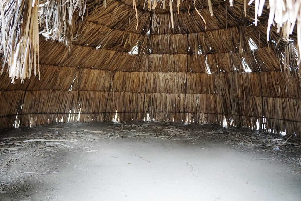
The Chumash home, or “‘Ap,” in the background. The one pictured has since been replaced.

The Chumash home, or “‘Ap,” in the background. The one pictured has since been replaced.

Cheeseboro/Palo Comado Canyons offer great family hiking opportunities. While there's definitely hills surrounding these canyons, try the Cheeseboro Canyon Trail, the 4 to 5 mile main artery into the park. Flat and kid/stroller friendly it is. Also try the Doubletree Trailhead connector to the Palo Comado Trail. Flat, fun and scenic.

The Los Padres Trail in Thousand Oaks is a short trail, half of which is pretty flat and tree lined, if you’re looking for a short excursion with a toddler. A seasonal creek makes it even more interesting as you may hear froggies in the spring.

PaloComadoSign.JPG

Although the trails in the Lang Ranch/Woodridge Open Space in Thousand Oaks are NOT FLAT and indeed quite HILLY, they are worth checking out with the kids because they wide and have some interesting sandstone rock formations. If you are really strong, strollers are possible here, but do know that you will encounter some hills like the hill shown in the image below.

This hill in the Lang Ranch/Woodridge Open Space at the Autumn Ridge Trail is a bit daunting but worth the climb.

This hill in the Lang Ranch/Woodridge Open Space at the Autumn Ridge Trail is a bit daunting but worth the climb.

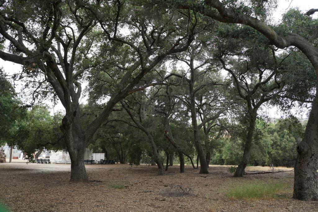
We're going to throw a bonus trail into the mix. The several miles of hiking trails in the Oakbrook Regional Park Archaeological Area in Thousand Oaks is an outstanding place for a flat, picturesque and oak-tree canopied place for a short hike with the kids.

For a more comprehensive compilation of trails in the Conejo Valley and throughout Ventura County, visit THIS LINK.

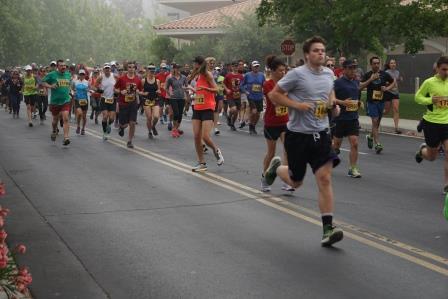
Upcoming 5K, 10K and Other Ventura County Area Running and Fitness Events

runners.JPG

Start training for upcoming 5K, 10K, half marathon and other Ventura County running and fitness events! We've made it easy for you to find a local race by tracking local events right here. So go on, get moving, lace up those shoes and start training!

Training for a marathon? Check out 26.2 Training Tips for Your First Marathon!

Running Clubs in the Local Area

Ventura Running Club www.venturarunningclub.com Sunday beach runs at the Ventura Pier, Wednesday track workouts and social event.

Inside Track Running Club www.insidetrackrunningclub.com Club has been training in Ventura since 1976. Saturday long runs, Tuesday intervals, Thursday hills and Sunday easy runs.

Thousand Oaks Pacers www.runpacers.org/thousandoaks/about Running club founded in 2014.

Future Track Running Pack futuretrackrunningpack.org Founded in 1988 in Agoura Hills. Tuesday night track workouts at Oak Park High School and more.

The Pacific Coast Track Club hosts training sessions on Sunday mornings at the Camarillo High School track and Ojai community track. Individual training sessions also available. Email mgenebyme@gmail.com for more information or visit www.facebook.com/genebyrne101.

Conejo Valley Run Club was established in 2024 for all levels of runners, meeting for local are runs every 2nd and 4th Wednesday of the month. www.strava.com/clubs/cvrunclub

Newbury Park Elite Endurance offers personalized coaching an training plans. Visit www.newburyparkendurance.com to learn more.

RunningShoeRack.jpg

For great running shoes from local businesses that know a lot about them, try the following:

Oakbrook Regional Park Archaeological Area in Thousand Oaks is City Historical Landmark #5

Oakbrook Regional Park Archaeological Area is located at 3290 Lang Ranch Parkway in Thousand Oaks, south of the intersection of Avenida de los Arboles and Westlake Boulevard.

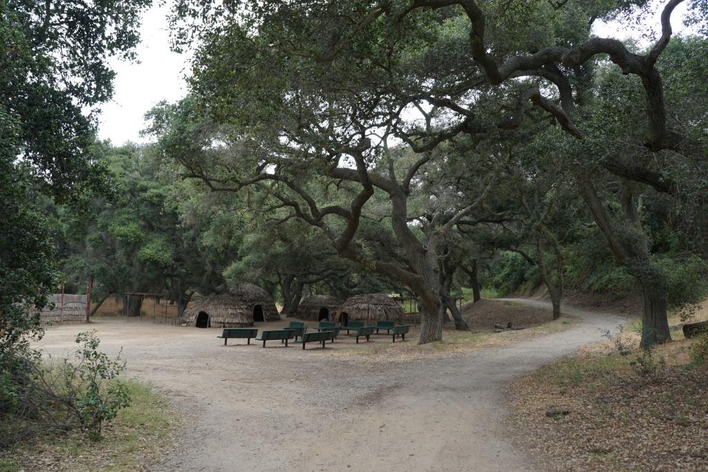
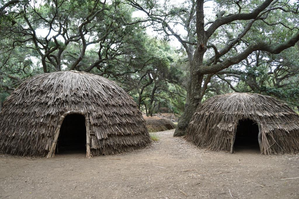
This 428 acre park is a designated historical landmark by the City of Thousand Oaks and County of Ventura. The Chumash inhabited this area going back as far as 12,000 years ago through the late 1800's. 

The park grounds are open to the public daily from 7 a.m. to 10 p.m.  There are flat hiking trails and a Chumash village reproduction available to explore. The oak trees provide a beautiful canopy for hikers. It is a peaceful place worth exploring. Note that dogs are prohibited from the property.

Located on the property is the Chumash Indian Museum, which contains a large collection of Chumash artifacts. The museum is open on Saturdays and Sundays from 10 a.m. to 4 p.m.

More information on Oakbrook Regional Park at www.crpd.org/park/oakbrook-regional-park.

Hiking and Exploring in Rancho Sierra Vista/Satwiwa in Newbury Park

Entrance to Rancho Sierra VistaSatwiwa at Lynn Road and Via Goleta in Newbury Park

Located on the western edge of the Santa Monica Mountains National Recreation Area, Rancho Sierra Vista/Satwiwa is accessible in Newbury Park at the intersection of Lynn Road and Via Goleta. This area spans from Potrero Road on the north and connects to Point Mugu State Park on the south.

Ranching in the area dates back to the early 1800s, when Spanish soldiers were granted 48,672 acres of land, "Rancho El Conejo," which through the years was subdivided and sold to other landowners. One of these ranchers was Carl Beal, who in 1937 named the area Rancho Sierra Vista "Mountain View Ranch." The last private landowner in the area was Richard Danielson, whose family farmed and ranched the area for 32 years. Danielson donated 5,585 acres of the ranch to the State of California, which became part of Point Mugu State Park, and sold 850 acres, including the horse ranch, to the National Park Service in 1980.

Sign at Danielson Monument accessible via Danielson Road/Old Boney Trail.

Sign at Danielson Monument accessible via Danielson Road/Old Boney Trail.

The Satwiwa Native American Indian Natural Area is a bike/horse free area within Rancho Sierra Vista/Satwiwa of roughly 60 acres. Located on the northwest corner of this area, just a short walk from visitor parking, is the Satwiwa Native American Culture Center.

The Culture Center is staffed from 9 a.m. to 4 p.m. most weekends with a park ranger or other staff. It is a small building that also hosts a variety of educational Chumash and wildlife items. NPS BROCHURE AND TRAIL MAP

Learn more about RSV at www.nps.gov/samo/planyourvisit/rsvsatwiwa.htm.

SatwiwaSign.JPG

The area is a popular destination for hikers with a variety of well maintained trails. Note, however, that bicycles and horses are not allowed in the "Satwiwa Natural Area" section (see map below).

Map excerpt courtesy of National Park Service.

Map excerpt courtesy of National Park Service.

The Satwiwa Loop Trail is an easy, 2 mile trail that starts at the Culture Center through grasslands, past the old windmill and back around, with several extensions for those looking to do a little more.

SatwiwaLoopTrail_sign.jpg

There's the Lower Loop Trail and the Upper Loop Trail that is a bit of a zig-zaggy trail with wooden footings placed by volunteers to help hikers navigate. The Upper Loop Trail runs past the "Old Windmill" pictured below.

Satwiwa Lower Loop sign at intersection of Danielson Road trail.

Satwiwa Lower Loop sign at intersection of Danielson Road trail.

The old windmill at the northeast corner of the Satwiwa Loop Trail (Upper Loop). (Windmill was knocked down by high winds in December 2016 and is still down as of MAY 2024).

You can also park at the Wendy and Potrero trailhead and walk to the Culture Center via the Wendy Trail, about a mile each way.

Wendy Trail trailhead at the intersection of Wendy and Potrero in Newbury Park

Wendy Trail trailhead at the intersection of Wendy and Potrero in Newbury Park

It is pretty dry in here most of the year but after the winter/spring rains, the green stages a comeback.

It is pretty dry in here most of the year but after the winter/spring rains, the green stages a comeback.

Another trail to explore is the 1 mile Ranch Overlook Trail that takes you from just west of the Satwiwa Native American Indian Culture Center, up a hill (where you can indeed look down toward the old ranch area, parking area and restrooms) to the main entrance and to the Palomino Trail in the Rancho Potrero Open Space.

Ranch Overlook Trail

Ranch Overlook Trail

One of my favorite trails in Rancho Sierra Vista/Satwiwa is the Hidden Valley Overlook Trail. This challenging, fairly steep trail branches off from the Satwiwa Loop Trail on the southeast, past the bench at the Upper Sycamore Canyon Overlook, via the Boney Mountain Trail/Danielson Road.

The popular bench at Upper Sycamore Canyon Overlook. Photo taken April 4, 2014, approximately 11 months after the devasting Springs Fire of 2013.

The popular bench at Upper Sycamore Canyon Overlook. Photo taken April 4, 2014, approximately 11 months after the devasting Springs Fire of 2013.

Roughly 700 feet past the Upper Sycamore Canyon bench is a juncture where you can either veer right into Point Mugu State Park and the Boney Mountain Wilderness, where you can walk down, over a stream (or a dry stream bed as the case may be), towards the popular "waterfall" (which in recent years has been not much more than a trickle) and the Danielson Monument. CLICK HERE for details.

If you veer left at the juncture, you'll see the Hidden Valley Overlook trail sign.

HiddenValleyOverlook_sign.jpg

The trail is steep and rocky and reaches an end point in about half a mile. If you are up to the challenge, you will be rewarded with sweeping views of Newbury Park, the Channel Islands, Sycamore Canyon and Boney Mountain.

Views from halfway up the Hidden Valley Overlook Trail towards the Satwiwa Native American Indian Natural Area

Views from halfway up the Hidden Valley Overlook Trail towards the Satwiwa Native American Indian Natural Area

At the end of the trail is the Hidden Valley overlook, where you will be able to peek into the not-so-hidden-anymore Hidden Valley and its peaceful ranches. As a final reward for your effort, it's all downhill the way back. Be sure to wear solid hiking shoes as the trails are a bit technical.

Peek at Hidden Valley at the end of the Hidden Valley Overlook Trail.

Peek at Hidden Valley at the end of the Hidden Valley Overlook Trail.

View of Santa Cruz Island, one of the Channel Islands, from Hidden Valley Overlook trail

View of Santa Cruz Island, one of the Channel Islands, from Hidden Valley Overlook trail

To learn more, visit the Anthony C. Beilenson Visitor Center at 26876 Mulholland Highway, Calabasas or visit www.nps.gov/samo or call 805.370.2301.

Dogs are allowed in Rancho Sierra Vista/Satwiwa as long as they are on a leash no longer than 6 feet. But please, pick up after your pet. Dogs are not allowed in the Point Mugu State Park / Boney Mountain Wilderness back country trails, though they are allowed on paved roads, such as the Big Sycamore Canyon Trail road.

Where to Play Pickleball in Ventura County

Pickleball court at Del Prado Playgrounds in Newbury Park.

Pickleball court at Del Prado Playgrounds in Newbury Park.

According to www.whatispickleball.com, pickleball is oversized ping pong played on a badminton sized court with a tennis sized net. Pickleball originated in Bainsbridge Island, Washington in 1965 when congressman Joel Pritchard and his friend Bill Bell created the game for their families to play.

Pickleball is played with a perforated plastic ball similar to a wiffle ball that weighs about an ounce and composite or wooden paddles about twice the size of ping pong paddles. Pickleball is an indoor/outdoor sport that is easy to learn and, like tennis and ping pong, can be played singles or doubles. Learn more about pickleball at www.usapa.org.

Today, the sport of pickleball is governed in the U.S. by the USA Pickleball Association. which was founded in 2005 to promote the sport. There are over 8.9 million pickleball players in the United States over the age of six and over 44,000 pickleball courts across the country.

Pickleball continues to grow in popularity here in the Ventura County area. Here is a list of pickleball courts in and around Ventura County as well as adjacent areas:

Thousand Oaks:

Westlake Village:

The City of Westlake Village is constructing four pickleball courts for public use at Westlake Village Community Park, 31107 Thousand Oaks Boulevard. The courts will be located in the northeast corner of the existing parking lot, east of the Yarrow Family YMCA and south of the skate park. Courts will be open from sunrise to 9pm and have lights. Grand opening date is November 15th at 10am. www.wlv.org/pickleball.

Simi Valley:

Oak Park:

Pickleball courts at Deerhill Park, 6700 Doubletree Road

Port Hueneme:

Pickleball is available at Walter B. Moranda Park, 200 Moranda Parkway, Port Hueneme. There are 10 courts; 5 of them are reservable. www.ci.port-hueneme.ca.us/1169/Moranda-Park

Moorpark:

Pickleball courts at Tierra Rejada Park, 11900 Mountain Trail Street open 8am to sunset and dual tennis/pickleball courts at Miller Park, 4530 Miller Parkway open 7am to 10pm.

Camarillo:

Ventura www.cityofventura.ca.gov/pickleball

Ojai

Calabasas

The privately-owned Calabasas Pickleball Club opened on June 1, 2024, with 16 courts at 5155 Old Scandia Lane. It is a members only club. Visit calabasaspb.com for more information.

Pickleball is offered at the Calabasas Tennis & Swim Center www.cityofcalabasas.com/government/community-services-parks-recreation/tennis-swim-center/tennis-pickleball

Clubs:

Ventura County Pickleball Club venturacountypickleballclub.com

Ojai Valley Pickleball www.ojaivalleypickleball.com

Ventura County Pickleball League camarilloathletics.com/ventura-county-pickleball-league

Visit camarillopickleball.fun to connect with other pickleball players.

Cycling Clubs and Groups In and Around Ventura County

CyclistsCam.JPG

Any given Sunday morning I come across hundreds of bicyclists on my morning runs in the Thousand Oaks area and throughout Ventura County.

Here are some local cycling groups:

CLICK HERE for some family-friendly friendly bike path options around Ventura County.

And for some local BMX track options, Freedom Park BMX Raceway in Camarillo

Bike shops in the local area:

EBike shops: