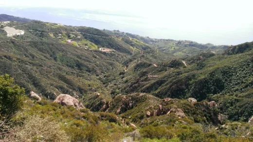
Cheeseboro and Palo Comado Canyons Still Beautiful in Late Spring

cheese1.jpg

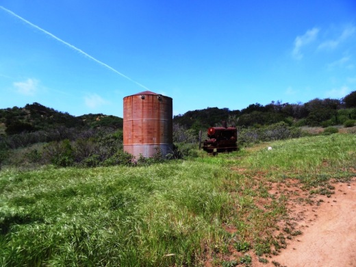
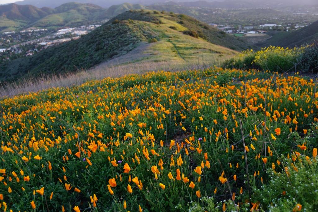
Local resident Barbara Syfacunda enjoyed a hike in Cheeseboro and Palo Comado Canyons yesterday and sent over these great photos via the CVG Facebook page. She remarked that although most of the green is gone back there, it is still beautiful. Indeed it is.

Cheeseboro and Palo Comado Canyons cover over 4,000 acres in the northernmost section of the Santa Monica Mountains National Recreation Area, in the Simi Hills. The Chumash occupied these canyons for thousands of years, until ranchers came into the area in the 1800s. The natural landscape changed as a result to accommodate the needs of grazing cattle.

The National Park Service (NPS) acquired Cheeseboro Canyon in the early to mid 1980s and Palo Comado Canyon (formerly known as the Jordan Ranch), in 1994.

Folks frequently ask, why is it called Cheeseboro when the road that gets you to the trailhead is called Chesebro? According to a knowledgeable NPS Ranger, the original owner of the land in the late 1800s was Oscar Cheesebrough (yet a different spelling). The NPS adopted the U.S. Geological Survey spelling, while Caltrans adopted the name Chesebro.

cheese2.jpg
cheese5.jpg
cheese3.jpg

Check Out Tarantula Hill Trail in Thousand Oaks for Views of the Conejo Valley

Tarantula Hill is located off of West Gainsborough Road in Thousand Oaks, between Grand Oak Lane and Camino Manzanas. Over the years we've visited this conspicuous 1,057 foot tall hill dozens of times. A bit of a steep climb up the paved road (not really a trail) to the top, where you'll find a bench facing towards the west and panoramic views of the entire Conejo Valley and beyond.

TarantulaHill080814_1.JPG

In the summer 2014 time frame, we noticed a new sign at the bottom of the hill, plus something fun on the sign. I don't know if this tarantula is a permanent addition to the sign, but it was amusing.

TarantulaHill080814_2.JPG

It takes anywhere from 10 to 20 minutes to walk up the paved hill to the top. If you're looking for some exercise but are lacking time, Tarantula Hill is a nice alternative to a stair stepper machine!

TarantulaHill080814_3.JPG
View facing east with gainsborough Road in the foreground

View facing east with gainsborough Road in the foreground

TarantulaHill080814_5.JPG

Aerial Views of Dos Vientos Ranch in Newbury Park in 1956

Aerial View of Dos Vientos Ranch in 1956 (Photo Credit: Howard D. Kelly, Kelly-Holiday Collection of Negatives and Photographs/Los Angeles Public Library)

Aerial View of Dos Vientos Ranch in 1956 (Photo Credit: Howard D. Kelly, Kelly-Holiday Collection of Negatives and Photographs/Los Angeles Public Library)

According to several Oxnard Press-Courier articles in September/October 1958, evangelist O.L. Jaggers purchased the 5,415 acre Dos Vientos Ranch from M.S. Clark Enterprises on June 21, 1957 for $2.9 million, with the goal of creating the "World Church City."

According to a 1994 L.A. Times article, Jaggers and his wife Velma talked about making Dos Vientos (now part of Newbury Park/Thousand Oaks) a 26,000 resident city, "situated under a perpetually hovering 'glory cloud' that would emit a pillar of smoke by day and fire by night. Airliners would be diverted so passengers could witness the phenomenon."

After years of lawsuits brought against Jagger and his World Church by investors in the project, the land was acquired in 1965 by Louis Lesser Enterprises of Beverly Hills.

Another Aerial View of Dos Vientos Ranch in 1956 (Photo Credit: Howard D. Kelly, Kelly-Holiday Collection of Negatives and Photographs/Los Angeles Public Library)

Another Aerial View of Dos Vientos Ranch in 1956 (Photo Credit: Howard D. Kelly, Kelly-Holiday Collection of Negatives and Photographs/Los Angeles Public Library)

The Thousand Oaks City Council approved development of Dos Vientos Ranch as a 2,350 home residential project in 1988 and construction began after years of planning and lawsuits in 1997. At the time, the land was owned by Courtly Homes Inc. and Operating Engineers Pension Trust Inc.

A 1997 Los Angeles Times article noted that Dos Vientos was the largest residential project ever in Newbury Park and the third-largest in the city's history. Dos Vientos is surrounded by two connecting roads that form a loop: Rancho Dos Vientos and Via Las Brisas. Lynn Road fronts the development on the south and Borchard Road serves as its main artery.

A more recent view of Dos Vientos from one of the many trails surrounding the area.

A more recent view of Dos Vientos from one of the many trails surrounding the area.

There are some nice hiking trails in Dos Vientos, including Sierra Vista Trail, Park View Trail, Vista Del Mar Trail, El Rincon, El Cerro and Las Brisas Trails, El Encanto Trail and Conejo Mountain Edison Road Trail.

Also located in Dos Vientos is The Village at Dos Vientos retail/business center, Dos Vientos Community Park and the newer Del Prado Playfield.

Piuma Road Overlook Views in the Santa Monica Mountains in Malibu

Most of us in Ventura County take Las Virgenes/Malibu Canyon Road down to PCH from time to time.  We look up and feel dwarfed by the canyons of the surrounding Santa Monica Mountains. What do these canyons look like from the hills above? Well make your way up Piuma Road in Malibu to find out!

Views towards PCH and Malibu Canyon Road from first of two overlooks.

Views towards PCH and Malibu Canyon Road from first of two overlooks.

Piuma Road is the road we pass as we're driving to the beach, but rarely stop to think about....unless we're driving to Saddlepeak Lodge for a great meal. And daring cyclists and motorcyclists may know about this winding, hilly joy ride to the ocean. But rarely do the rest of us give it a thought as we're busily navigating our way down Malibu Canyon Road.

Views of Las Virgenes Canyon looking north from Piuma

Views of Las Virgenes Canyon looking north from Piuma

Well if you're looking to take in some eye popping, panoramic views of Malibu Canyon down to Malibu Lagoon, towards Catalina Island looking south, as well as the Las Virgenes Valley on the other side, take a detour up Piuma Road. From the corner of Malibu Canyon Road and Piuma Road to several overlooks is about 4 1/2 miles. Whoever is driving better concentrate because, as you can see, the road is very winding, the elevation rises to 1500' and the views are jaw dropping.

View Larger Map

There are several overlooks where you can stop and park your car. The first one gives you a straight-on view of Malibu Canyon Road and the second provides views of the coastline towards Santa Monica.

Views from the second Piuma overlook looking down the Pacific coastline.

Views from the second Piuma overlook looking down the Pacific coastline.

Deep Malibu Canyon Gorge below. A Gorgeous Gorge it is!

Deep Malibu Canyon Gorge below. A Gorgeous Gorge it is!

About a 1/4 mile before you reach these overlooks, you'll pass the Malibu Canyon Piuma Ridge area, which has a small picnic area. The views of the canyons will take your breath away. The map below, courtesy of the Santa Monica Mountains Conservancy, shows this Ridge area in relation to the overlooks. Don't drive too fast as it is easy to pass by.

PiumaRidgeMap.jpg

Piuma Ridge and Overlook Map excerpt courtesy of Santa Monica Mountains ConservancyAfter you take in the views at the Ridge and/or overlooks, you can either head back or drive another six winding miles to PCH via Las Flores Canyon Road, where you end up at Duke's Malibu.

If you can handle the sound of my noisy kids, here's some footage from the Piuma Overlooks:

Springtime Beauty at Cheeseboro and Palo Comado Canyons in Agoura Hills

Cheeseboro Canyon Trail (CCT) is a 4.6 mile main artery into Cheeseboro Canyon with long flat sections surrounded by ancient oaks and flowing grasslands. Springtime is a great time to visit for a long walk the family, run with your training partners or cycling adventure with your buddies.

Take CCT past Sulphur Springs to the Shepherds' Flat area.

Once you reach Shepherds' Flat, you can take the Sheep Corral Trail north where it joins up with the Palo Comado Trail up to China Flat. Springtime colors abound after the winter rains.  Learn more about the trails of Cheeseboro and Palo Comado Canyons at THIS LINK.

Cheeseboro032215_1.JPG
Cheeseboro032215_2.JPG
Cheeseboro032215_3.JPG
Cheeseboro Canyon Trail north of Sulphur Springs

Cheeseboro Canyon Trail north of Sulphur Springs

Vintage items in the China Flat area

Vintage items in the China Flat area

Cheeseboro032215_7.JPG

Spring 2016 Has Arrived in the Conejo Valley

After off an on rains over the last several months, Spring has sprung in the Conejo Valley and wildflowers are beginning to make an appearance. Share them with us on the CVG Facebook Page when you come across some beauties in the Conejo Open Space. Check out some local trails at THIS LINK.

These wildflowers overlooking Ladyface MOuntain in the background were accessed from the hills above the new Westlake Village YMCA. The steep, unmarked trail can be accessed at Canyon Oaks Park, 6200 Hedgehall Drive, Westlake Village.

These wildflowers overlooking Ladyface MOuntain in the background were accessed from the hills above the new Westlake Village YMCA. The steep, unmarked trail can be accessed at Canyon Oaks Park, 6200 Hedgehall Drive, Westlake Village.

These mellow yellows were seen in abundance off of the Pentachaeta Trail in Triunfo Creek Park.

These mellow yellows were seen in abundance off of the Pentachaeta Trail in Triunfo Creek Park.

This pretty area can be found off the Westlake Village Trail, also in Triunfo Creek Park, adjacent to the Las Virgenes Reservoir.

This pretty area can be found off the Westlake Village Trail, also in Triunfo Creek Park, adjacent to the Las Virgenes Reservoir.

Aerial View of Central Thousand Oaks, Including Tarantula Hill, in 1957

Thousand Oaks 3-24-1957.jpg

Walt Dibblee opened his commercial studio in Ventura in 1949 and as Ventura County grew, the demand for aerial photography expanded. Walt bought a plane, learned to fly and for the next three decades photographed the cities of Ventura County from above.

The 1957 aerial shot above took place on a foggy day and captured Tarantula Hill on the right and what is now Conejo Community Park and the prominent Conejo Valley Botanic Garden hill in the foreground.

While we don't have an aerial shot of this scene from today, here's a look from the Los Robles Trail.

More recent view of Tarantula Hill from the Los Robles Trail East; The Oaks Mall in the foreground.

More recent view of Tarantula Hill from the Los Robles Trail East; The Oaks Mall in the foreground.

Walt's son Steve continues the tradition today with over 30 years of professional experience. Steve has shared some of Walt's work from the mid 1950s to the late 1960s at VenturaViews.com.

See other scenes from the smaller hill near Lynn Road and Gainsborough Road southwest of Tarantula Hill looking east and looking west.