Rincon Point in Carpinteria

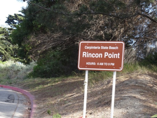
RinconPoint_sign.JPG

Rincon Point is home to one of the most popular surfing spots in the world. Accessible near the Ventura/Santa Barbara County line just a few miles east of Downtown Carpinteria. Take the Bates Avenue offramp off the 101 Freeway towards the ocean. On the right is access to the City of Carpinteria's Rincon Beach Park and on the left is access to the Rincon Point parking area. Open 6am to 9pm daily, with a not-particulary-nice porta-john available in the parking area.

There is a trail that takes you to the beach area from the parking lot. The area is also surrounded by beach homes.

A view toward the north from Rincon Point (in the direction of Rincon Beach Park).

A view toward the north from Rincon Point (in the direction of Rincon Beach Park).

THE BEACH BOYS INCLUDED A REFERENCE TO RINCON IN SURFIN' SAFARI:

At Huntington and Malibu

They're shooting the pier

At Rincon they're walking the nose

We're going on safari to the islands this year

So if you're coming get ready to go

Boney Mountain Trail to Hidden Valley Overlook, Danielson Monument and Waterfall

At Rancho Sierra Vista/Satwiwa in Newbury Park is a nice assortment of trails that reward hikers with beautiful views and peaceful surroundings.  Find your way to the Satwiwa Native American Culture Center and from there walk up Big Sycamore Canyon Road where you'll reach a fork in the road. If you go straight you'll be taking Big Sycamore Canyon road about 6-7 miles down to Sycamore Canyon Campground and Sycamore Cove Beach. The road is paved for about 3 miles until it intersects the Backbone Trail, at which point it is dirt trails to PCH.

Benches at the top of Big Sycamore Canyon Road.

Benches at the top of Big Sycamore Canyon Road.

Views from the benches looking down Big Sycamore Canyon. Photo taken a few months before the Springs Fire of 2013.

Views from the benches looking down Big Sycamore Canyon. Photo taken a few months before the Springs Fire of 2013.

View of Big Sycamore Canyon after the Springs Fire of 2013.

View of Big Sycamore Canyon after the Springs Fire of 2013.

Getting back to the benches at the top of Sycamore Canyon, looking off to the east you'll find the Boney Mountain Trail sign that takes you towards the Hidden Valley Overlook, Waterfall and Danielson Monument, a .4 mile, 1 mile and 2.2 mile one way hike, respectively.

BoneyMountainTrailMarker.JPG
Boney Mountain Trail sign in Rancho Sierra Vista post-Springs fire 5/5/13.

Boney Mountain Trail sign in Rancho Sierra Vista post-Springs fire 5/5/13.

Take the trail to the fork in the road. A sharp left takes you directly back to the Satwiwa Center, a "normal" left takes you on a trail towards Wendy Drive and/or back to the Satwiwa Center in a loop, and a right turn takes you up the hill towards the destinations mentioned above.

A short walk up the trail gets you to yet another bench that overlooks Sycamore Canyon from another angle. This is called the Sycamore Canyon Overlook.

This photo of the Sycamore Canyon Overlook was taken before the Springs Fire of 2013.

This photo of the Sycamore Canyon Overlook was taken before the Springs Fire of 2013.

Bench at Sycamore Canyon Overlook on 5/14/13.

Bench at Sycamore Canyon Overlook on 5/14/13.

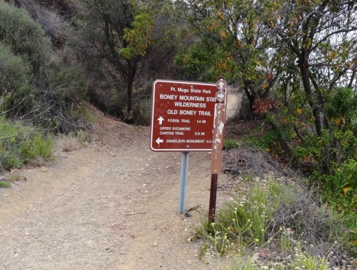
The rocky trail from there takes you to a fork. Veer LEFT to the Hidden Valley Overlook trail or right to the Danielson Monument and Waterfall (as well as the Old Boney Trail).

BoneyMountainSign.JPG

The Hidden Valley Overlook trail is rocky, pretty steep in some sections and a bit challenging. But...you will be rewarded with some nice views of Dos Vientos, Camarillo and eventually an "overlook" of Hidden Valley.

Endpoint of the Hidden Valley Overlook trail, peering into Hidden Valley. This photo was taken in April 2014.

Endpoint of the Hidden Valley Overlook trail, peering into Hidden Valley. This photo was taken in April 2014.

If you veer right at the fork in the trail, after a .4 mile jaunt down the hill you'll see a sign that tells you you're getting close the waterfall. There are lots of rocky sections as well as crevices as you make your way down this trail, so do be careful. But it is fairly wide most of the way.

Sign at bottom of hill indicating you distance to waterfall trail and danielson monument

Sign at bottom of hill indicating you distance to waterfall trail and danielson monument

There's a stream crossing that most of the year is easy to get across as there's not a lot of water in it, although in particularly rainy winters it can get more challenging in the winter/spring.

Mostly mud in the stream crossing that gets you to the Danielson Monument in mid-February 2013, but some years there's more water in there (like 2017, after the winter rainstorms).

Mostly mud in the stream crossing that gets you to the Danielson Monument in mid-February 2013, but some years there's more water in there (like 2017, after the winter rainstorms).

So after you cross the stream, you're off on a mostly narrow, single-track trail. Watch out for poison oak on the sides of the trails. I usually run up here in shorts, but you're much safer wearing long pants. The next juncture in the trail, you go straight to the waterfall, or veer right up to the Danielson Monument.

We've been to the waterfall when it had a lot of water flowing in it. This year (2013) there's barely a trickle.

We've been to the waterfall when it had a lot of water flowing in it. This year (2013) there's barely a trickle.

So if you take the sharp right hand turn, you're on your way to the Danielson Monument (a tribute to Richard Ely Danielson, Junior, who lived on land in this area for 32 years with his family, until it was sold to the National Park Service in 1980). Awesome views from several vantage points as you head up the trail. A bit of a climb. Be prepared! Check out other photos of the monument HERE and larger pics HERE.

Danielson Monument

Danielson Monument

About 4/5ths of the way from the bottom of the canyon to the Danielson Monument, you can veer right to the Old Boney Trail, an interesting, mostly single track trail that has great views of Boney and intersects with the Fossil Trail.

Here's the sign at the juncture of the Danielson Road trail and the Old Boney Trail turnoff, about .3 mile away from the Danielson Monument.

Here's the sign at the juncture of the Danielson Road trail and the Old Boney Trail turnoff, about .3 mile away from the Danielson Monument.

Moorpark College Art Gallery

MoorparkCollegeGallery.jpg

The Moorpark College Art Gallery is located in the Moorpark College Administration Building at 7075 Campus Road, Moorpark. The gallery is open Monday to Thursday from 8am to 6pm and Friday from 8am to noon.

Get there as follows: Take Collins Drive exit from the 118 north towards Moorpark College. Turn right at Campus Park Drive and park in Lot A. Parking is $2 (pay at machine). The Administration Building is located next to the President's Office.

Learn more about exhibit on display at the gallery at www.moorparkcollege.edu/departments/academic/art-department/art-gallery.

Rabbit Hill (Knoll Open Space) in Newbury Park

KnollTrail1.JPG

The Knoll Open Space is a 21 acre plot of land owned by the Conejo Open Space Conservation Agency located at the corner of Reino Road and Old Conejo Road in Newbury Park (across the street from Peppertree Playfields). This plot of land is more affectionately known as Rabbit Hill. While it doesn't take too much effort to get to the top of Rabbit Hill, you will definitely be rewarded with a nice, panoramic view towards Boney Mountain, Thousand Oaks and Conejo Mountain. This hill is somewhat less challenging than the steeper Tarantula Hill in Thousand Oaks, so if you're looking for a nice after-dinner stroll, this is a fine choice. While not the most exciting hill to look at, the views make it worthwhile! You can park on Reino Road to start your short journey.

You can either take a straight shot up the hill or a more gradual curved trail. 

You can either take a straight shot up the hill or a more gradual curved trail. 

Views toward Boney Mountain.

Views toward Boney Mountain.

Views towards Thousand Oaks

Peter Strauss Ranch in Agoura Hills

NOTE: PETER STRAUSS RANCH SUSTAINED MAJOR DAMAGE IN THE WOOLSEY FIRE OF NOVEMBER 2018 AND WILL BE CLOSED UNTIL FURTHER NOTICE. CHECK THEIR WEBSITE FOR UPDATES.

Peter Strauss Ranch sign on Kanan Road southbound before Troutdale.

Peter Strauss Ranch sign on Kanan Road southbound before Troutdale.

The 64 acre Peter Strauss Ranch is located at the juncture of Troutdale Drive and Mulholland Highway in Agoura Hills. The property is managed by the National Park Service (NPS) and is part of the Santa Monica Mountains National Recreation Area. It features a ranch house, .6 mile hiking trail, restrooms and an amphitheater area.

Parking lot access off of Mulholland Highway on northeast side of ranch.

Parking lot access off of Mulholland Highway on northeast side of ranch.

The Ranch has quite a history. According to the NPS, auto manufacturer Harry Miller bought the ranch at the turn of the 20th century as his weekend retreat. He built many of the structures on the site in the 1920s, including the stone ranch house, lookout tower and aviary.  He lost the ranch in the Depression.

Warren Shobert and Arthur Edeson purchased the ranch in the 1930s and created “Shoson”—a fairyland of charm and a paradise for children and adults. Later, a dam was constructed on Triunfo Creek, creating a small lake. The resort was renamed “Lake Enchanto.” Competition from other, larger amusement parks and resorts led to the decline of “Lake Enchanto.” It fell into disrepair and closed around 1960.

PeterStraussRanch_sign.JPG

Actor Peter Strauss purchased the property in 1976, restored the site, lived there until 1983, and later sold it to the Santa Monica Mountains Conservancy.  The NPS purchased the ranch in 1987 and the site will be preserved as part of our local natural and cultural history.

PeterStraussTrail_sign.JPG
PeterStraussRanch_trail1.JPG
PeterStrauss_Terrazo.JPG

Here is the ruins of the 650,000 gallon Lake Enchanto pool on the Peter Strauss Ranch site. The circular pool was 125 feet in diameter, ranging in depth from 2 to 9 1/2 feet. The pool was said to be the largest filtered, fresh-water swimming pool in California.

PeterStrauss_pool.JPG

More on the history of the Peter Strauss Ranch at peterstrauss.net/storyofranch.html.

Visit the NPS Peter Strauss Ranch page at www.nps.gov/samo/planyourvisit/straussranch.htm.

Lake Enchanto ad from the early 1940s.

Reagan Ranch Center Exhibit Galleries in Santa Barbara

ReaganRanchCenterGalleries.jpg

President Reagan’s home for 25 years and the Western White House during the height of the Cold War, the Reagan Ranch embodies the life and ideas of Ronald Reagan. In the spring of 1998, Young America’s Foundation stepped forward to save the Reagan Ranch; eight years later, in June 2006, the Reagan Ranch Center in downtown Santa Barbara opened its doors. 

The Reagan Ranch Center in downtown Santa Barbara is open to the general public for tours and visitation Thursdays and Fridays from 11:00 am to 4:00 pm.

These galleries feature original Reagan Ranch artifacts matched with state-of-the-art, interactive, multimedia exhibits that highlight the history of Ronald Reagan’s quarter-century at Rancho del Cielo and the accomplishments of his presidency.

ReaganRanchCenter1.jpg

Over six hours of dynamic multimedia exhibits provide access to exclusive speeches, interviews, radio addresses, and original video presentations. The centerpiece of the gallery is a 28-foot-long interactive “timeline” that gives users the ability to explore the “Western White House” during the 1980s.

The galleries also feature several unique collections on display, including the Lorraine Wagner Letter Collection, a nearly 300-piece collection of letters written by Ronald Reagan over a 50-year period and the Russell D. Sibert Collection, featuring rare Reagan-related memorabilia such as campaign buttons, posters and commemorative items.

A massive 5,000 pound section of the Berlin Wall greets visitors as they arrive at the Reagan Ranch Center, reminding the world of Ronald Reagan’s role in eliminating this assault on human dignity and freedom. The president’s famous blue Jeep Scrambler, complete with “Gipper” license plate, sits in the center of the gallery, flanked by a selection of his favorite books, an original saddle and chainsaw owned and used by President Reagan.

ReaganRanchGallery2.jpg

The Reagan Ranch Center is designed to engage visitors of all ages; younger children can even earn their “Junior Secret Service Clearance” by completing a fun and educational scavenger hunt.

The Reagan Ranch Center is located at 217 State Street next to the train station.

Admission is FREE. For more information call 1-888-USA-1776 or visit www.yaf.org/ExhibitGalleries.aspx.

Camarillo Grove Park

CamarilloGroveParkKiosk.JPG

Camarillo Grove Park is located at the bottom of the Conejo Grade at 6968 E. Camarillo Springs Road (Camarillo Springs exit). There is an off-leash dog park where you can bring your pooch. There are several large outdoor covered group picnic areas that are popular for parties. New playground installed in fall 2019.

Additionally, the 24.5 acre park has some fun trails for roughly a mile** or so of hiking and exploring. At the back (east) end of the park you'll see the trail sign. the lower loop is fairly short, with some interesting, large rock formations. The upper loop is more significant and steep and provides for some nice views.

Two miles of new trails with over 20 interpretive signs were added in January 2017.

Also relatively new is the Outdoor Nature Center, which includes interpretive signage along a trail that provides information about local ecosystems, flora and fauna; an interactive water table; teaching deck for programs; nature-based play equipment such as boulders, logs, ant hill, and more; as well as native gardens with braille signs.

This park offers multiple options for hiking. The lower loop is an easier gently sloping trail with oak trees, sage, volcanic rock formations, and more.  You can even take dogs off-leash on weekends Saturdays and Sundays before 10 a.m.

The park opens at 7:30 a.m. until dusk. There are parking fees at this particular park to help pay for its upkeep. As of November 2021, these fees are $3 on weekdays, $5 on weekends and $10 for oversized vehicles (RVs, etc.) on weekends. Or buy an annual pass for $55.

Learn more at www.pvrpd.org/camarillo-grove-park.

CamGrovePark_trail.jpg

Sierra Vista Trail in Newbury Park

The Sierra Vista Trail in the Dos Vientos section of Newbury Park is a roughly one mile long trail that connects the Vista Del Mar Trail on the west to the Potrero Ridge Trail on the east. The entry point on the west side is off of Rancho Dos Vientos just south of Via El Cerro and on the east side is on Via Las Brisas near Paseo Santa Rosa. As with most trails in this area, you will be treated with some great views of the surrounding mountains and neighborhoods. This trail is maintained by the Conejo Open Space Foundation.

SierraVistaTrail_1.JPG
SierraVistaTrail_2.JPG
SierraVistaTrail_3.JPG
SVistaBoney.JPG

California Sycamore Tree - Historic Landmark in Newbury Park

10.20.07 016.jpg

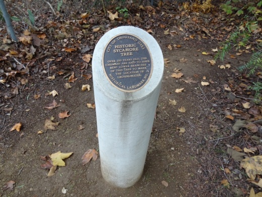
This extremely large and old California Sycamore tree was designated as a Ventura County Historic Landmark (#44) on May 1st, 1978.  The City of Thousand Oaks historical marker (see picture to the right) says the tree is over 250 years old.  It is believed that the Chumash Indians bent the lower branches to mark the location of groundwater.

This beautiful tree is located in the Stagecoach Inn Museum and complex at 51 South Ventu Park Road.  Park at the Stagecoach Inn parking lot and walk your way down the pathway to visit the tree, an Indian house and other old structures.

HistoricSycamoreTreeNP.JPG

Boney Mountain Peak Hike From Newbury Park

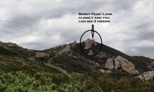
At an elevation of 2,825 feet, the presence of Boney Peak (also known at Mount Boney), is felt throughout the Conejo Valley and surrounding areas. Want to climb it?

BoneyPeakHikers.JPG

Well you can! It is challenging, but possible. Boney Mountain is located in the Santa Monica Mountains. One way to get to Boney Peak is via the Upper Canyon Trail from the Danielson Monument.

Danielson Monument

Danielson Monument

First off, hike your way up to the Danielson Monument, click this link for details. The monument is next to the remains of a burned down cabin shown below.

There is a trail that veers left next to the chimney. This is where you want to go. You're looking at a challenging 2 mile climb to Boney Peak. Most of the trail is narrow single track. There are some really steep, rocky sections, some with deep crevices, that may freak you out. You may have to duck your head from time to time. The trail is definitely challenging, both going up and coming back down. Definitely not for everyone.

The trail gets tight at times.

The trail gets tight at times.

The trail is not "officially" maintained by the National Park Service and thus there are NO SIGNS that say, hey, go this way to get to Boney Peak.  But I've seen plenty of people make it up there just fine as the path is fairly obvious. Just stay on the main trail.

After twists, turns, rocks, crevices and hills, the trail flattens out a bit near the top.

After twists, turns, rocks, crevices and hills, the trail flattens out a bit near the top.

One thing to note when you think you've reached the top. Look at the picture at the top of this post. To the left of the circled area is a large boulder. This is not the peak. There's a trail to the left behind it that you'll have to go up to get to the actual peak. Again, there are no signs. But you should be able to see the path pretty easily. You will be climbing some sheer rock face to get there. Can be slippery. And standing on the top of Boney can be both exhilarating and scary as hell! So be careful!
The final ascent to the top on sheer rock path.

The final ascent to the top on sheer rock path.

How long does it take to get from the trailhead at Wendy and Potrero and back? I'd allow for 4 to 5 hours if you are hiking. If you are a strong runner you can get up to it in as little as an hour (I'm talking top notch runner) to hour and a half, but you will only be able to "run" about half of the trail above the Danielson Monument. The rest is more of a technical hike in and around the rocks, boulders and crevices.

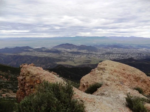
Here are some views you'll be treated to at the top.

BoneyPeakView3.3.13.JPG
BoneyPeak3.3.13_MoreViews.JPG
BoneyPeak3.3.13_Islands.JPG
BoneyPeak3.3.13_Top.JPG
BoneyPeak3.3.13HidVal.JPG
BoneyAnotherView.JPG

Murals of Santa Paula

The Murals of Santa Paula is a non-profit organization that has brought 9 murals depicting scenes from the city's history within a few mile radius. The murals are as follows:

  1. Trains, Planes & Automobiles (1890s-1940s): 815 Santa Barbara Street

  2. Our First Inhabitants: The Chumash Indians: 119 North 8th Street

  3. Santa Paula Family Farms (1880s-1930s): 715 East Main Street

  4. Santa Paula Citrus Capital of the World: Corner of Main and Davis Streets

  5. Main Street Santa Paula (1910): Corner of Main and Mill Streets

  6. Celebrating Santa Paula's Latino Culture: Corner of Main and 10th Streets

  7. Discovering Black Gold in Santa Paula (1860s-1950s): 123 N. 10th Street

  8. Santa Paula Artists and Architects: 136 North 10th Street

  9. Honoring Founders and Pilots of Santa Paula Airport (1890s-1940s): 560 E. Main Street

Visit www.santapaulamurals.org if it becomes functional again (not working as of summer 2021).

SPMural_1.jpg
SPMural_2.jpg
SPMural_3.jpg
SPMural_7.jpg

Pleasant Valley Historical Society Museum and Botanical Garden in Camarillo

NOTE: MUSEUM CURRENTLY (AS OF JULY 2022) CLOSED FOR AN EXPANSION PROJECTION PROJECT. GARDEN IS CURRENTLY OPEN ON SATURDAYS FROM NOON TO 4PM CHECK THE MUSEUM WEBSITE FOR UPDATES.

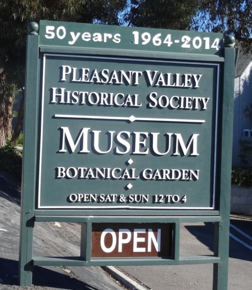
The Pleasant Valley Historical Society Museum and Botanical Garden at 720 Las Posas Road in Camarillo is dedicated to the preservation of the history of Pleasant Valley, the Oxnard Plain and adjacent areas where many of Camarillo’s pioneers settled before there was a City of Camarillo. Admission is free. Donations are accepted. The Museum and Garden are open from noon to 4:00 p.m. on Saturday and Sunday, except holidays. More information at www.pvhsonline.org.

PVHSMuseum_sign.JPG

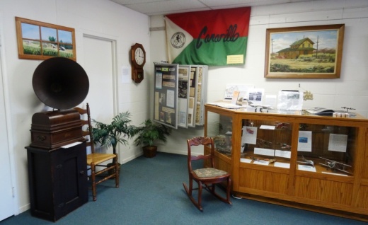
The museum is located in a small building on the property which contains a variety of antiques and items of local historical interest. Resident docents are genuinely interested in sharing stories about local history in the facility. I can almost guarantee you will learn something new every time you visit!

Old items and newspaper clippings from years past on display.

Old items and newspaper clippings from years past on display.

The Charles L. Honn Botanical Garden, associated with the Historical Museum and located behind it, is a beautiful park-like area that features plants and trees indigenous to the Pleasant Valley and the surrounding region. The garden includes a large gazebo that is available as a breathtaking setting for weddings, anniversaries and similar functions. Kitchen facilities are available. Donations are accepted for use of the garden/gazebo.

PVHS_BotanicGarden.JPG
PVHS_Gazebo.JPG

Call 805.482.3660 or visit www.pvhsonline.org for more information.

The Charles L. Honn Botanic Garden starts to brighten up after the winter rains.

The Charles L. Honn Botanic Garden starts to brighten up after the winter rains.

William Rolland Gallery of Fine Art at Cal Lutheran Thousand Oaks

RollandGallery.jpg

The William Rolland Gallery of Fine Art at Cal Lutheran is located adjacent to the William Rolland Stadium. It opened in October 2011.

The gallery has featured such exhibits as: Western Salon featuring sculptures and paintings from the Bob Eubanks and William Rolland Collections; Resonating Images I 1900-1950 featuring representational masterpiece paintings, drawings and prints from the first half of the 20th century; and Resonating Images II, exhibiting representational works by modern and contemporary masters including Chuck Close, Fernando Botero, and Picasso. Exhibitions rotate approximately 4-5 times a year.

The Gallery also hosts a parallel educational series of events. The specific events vary by exhibition, but typically include foreign language tours and lectures by professionals in the visual arts. Curator- or docent-led tours are available for free; they request that you make reservations beforehand.

The Gallery is open to the general public Tuesday through Friday, 10 am to 4 pm and Saturday from 11 am to 3 pm. Admission is free. Free parking is available. Location is 160 Overton Court.

Learn more at rollandgallery.callutheran.edu.