Scene From The Oaks Mall at Christmastime in December 1982

Here’s a scene from The Oaks shopping mall, courtesy of the Thousand Oaks Library’s Conejo Through the Lens collection, from December 1982.

The view is from the upper level of the east end of the mall. Looking west on the right you can see House of Fabrics and Hot Dog on a Stick and below, Wallpapers to Go.

And below is a more current view of The Oaks, albeit from a different vantage point in the mall.

The Macerich Company, which owns 47 million square feet of real estate consisting primarily of interests in 44 regional town centers. announced in its 3rd quarter financial report last month "We are under contract to sell The Oaks for $157 million, and expect to close** during the fourth quarter of 2024, subject to customary closing conditions." Real estate news site "The Real Deal" indicates the buyer is Stockdale Capital Partners. So perhaps we'll see some changes in the future. Macerich has owned the mall since 2002. The mall originally opened in 1978.

Tell Me About the History of the Street Names in Casa Conejo in Newbury Park

Casa Conejo is an unincorporated Ventura County community of about 1,000 homes located in Newbury Park. Casa Conejo is a rectangular shaped island within Thousand Oaks city limits, but is not part of the city. Although Casa Conejo is considered part of Newbury Park, it is not part of the majority of Newbury Park within the boundaries of the City of Thousand Oaks.

Casa Conejo Map.jpg

Premiering in 1960, Casa Conejo was the first planned community in Newbury Park. Several folks have asked about the origin of the street names in Casa Conejo. Here goes (with the help of a relative of the original developers):

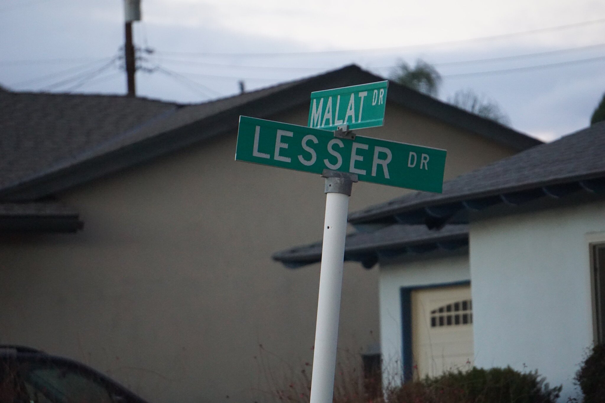
Louis Lesser Enterprises developed Casa Conejo. Members of the Lesser and Malat families created the street names; hence Lesser and Malat Drives, Rudman Drive came from Louis Rudman, also related through marriage to the Lessers, and who managed home sales.

malat and lesser.jpg
rudman and lesser.jpg

William Malat (William Drive) had twin sons, Melvin (Melvin Ct) and Gerald (Gerald Drive). William's wife was Ethel (Ethel Ct). Louis Lesser's wife was Jeanne (Jeanne Ct). Louis Lesser's brother, Alvin "Sonny" was married to Martha (Martha Dr). Louis Rudman's wife was Shirley (Shirley Dr), who was also Ethel’s sister. One of Sonny's daughters is Dena (Dena Dr).

dena and gerald.jpg

Ben (Ben Ct) and Lily (Lily Ct) were Louis and Alvin Lesser's parents. Michael (Michael Drive) is a cousin (by marriage) of the Lessers and Malats. Cathy (Cathy Dr) and Francine (Frankie Dr) were two of Louis and Jeanne’s four children. Lisa Rudman (Lisa Ct) is related to the Rudmans (I suspect their daughter).

The jackpot winner was WENDY, who has by far the longest street, not to mention a freeway on/offramp and overpass, named after her! Wendy, who lives in AZ, is a granddaughter of William Malat and daughter of Melvyn. Before it became Wendy Drive in mid-1961, it was called Avenida de la Felicidad.

There are a couple dozen other streets in Casa Conejo that I don’t have the source for at this time, but perhaps I’ll do some more digging:

North/South Streets: Jenny Drive, Gerst Drive, Ruth Drive, Lois Ave, Dorena Drive, Kitty St, Bella Dr, Randy Dr, Debbie St, Cay Ct, Henry Dr, Devia Dr, Virginia Dr, Nellie Ct, Bob Ct, Elinor Ct.

East/West Streets: Gloria Dr, Carl Ct, Alice Dr, Lynn Ct, Lois Ct, Verna Ave.

wendy drive.jpg

The Story Behind Those Historic El Camino Real Bell Markers on the 101 Freeway

Like me, perhaps you've wondered about those unique bell markers seen frequently on the 101 Freeway with the sign that says "Historic El Camino Real."

One of those ubiquitous Historic El Camino Real bell markers we see along the 101 Freeway.

One of those ubiquitous Historic El Camino Real bell markers we see along the 101 Freeway.

El Camino Real is Spanish for "The Royal Road" and in California is the name for the 700 mile historic California Mission Trail that connects 21 missions, 4 presidios (military forts) and several pueblos (towns) from Mission San Diego de Alcala in the south to Mission San Francisco Solano in Northern California. El Camino Real is designated as California Historical Landmark #784.

California State Assembly Bill 1707 defined the El Camino Real route, which includes portions of Routes 280, 82, 238, 101, 5, 72, 12, 37, 121, 87, 162, 185, 92, and 123 and connecting city streets and county roads in a continuous route from Sonoma southerly to the international border.

So what's up with those bell markers on the 101? According to the California Department of Transportation, the Mission Bell Marker system has existed on the historic El Camino Real route since 1906. The original marker system called for installation of bells one mile apart along the entire length of the El Camino Real. By 1913, over 450 markers were in place, but over the years the bells were removed due to damage, vandalism and theft. In 1959, the Division of Highways was legislatively mandated to maintain the marker system. Legislation in 1974 reiterated that responsibility.

Caltrans initiated a plan to maintain the system beginning in 1974, when less than 100 of the original Mission Bell Markers remained. The bells are exact copies of the original 1906 bells; in fact, the original bell molds were used to fabricate the new bells. Mission Bell Marker locations were chosen based on safety, constructability, visibility and scenic quality of the site. Spacing between marker locations varied based on existing site conditions and limitations. An average spacing of 1 to 2 miles was sought when identifying the locations.

The Caltrans Landscape Architecture Program began in 1996 to fulfill its vision to restore the historic El Camino Real Mission Bell Marker system from San Diego to Sonoma. The portion of the system from San Diego to Los Angeles was not addressed by the restoration project because those bells are mostly located on local streets outside of the State’s jurisdiction. The first phase of the restoration project, between Los Angeles to San Francisco, was completed in early 2005. The second and final phase of the restoration project was completed between San Francisco and Sonoma in late 2012. The Mission Bell Marker system as originally envisioned in the earlier part of the last century has finally been realized!

Caltrans received nearly $2 million in Transportation Enhancement grants to fund restoration of the Mission Bell Marker system on the El Camino Real from Orange County to Sonoma. Funding was received for the manufacture and placement of 585 Mission Bell Markers, placed approximately one to two miles apart along the roadside in the northbound and southbound directions of State Routes 101, 82, 37, 121, and 12. Mission Bell Markers located within the roadside of a state route are maintained by Caltrans. Maintenance of Markers located on local streets are the responsibility of the local entity.

So that explains why you see all of those interesting bell markers on the 101 Freeway! How would you like to have one of these authentic California El Camino Real Bell Markers in your own yard!? Visit the California Mission Bell company website at www.californiabell.com.

Older El Camino Real bell marker on display at the Old Mission Santa Barbara.

Older El Camino Real bell marker on display at the Old Mission Santa Barbara.

Hillside Letters in the Conejo Valley and Greater Ventura County

There are over 500 hillside letters, or “mountain monograms,” in the United States, including 81 in California. What are hillside letters, you ask. They are simply large single letters, abbreviations and sometimes even messages erected on a hillside, usually by a school or town.

The Big “C” overlooking UC Berkeley (From Wikipedia; public domain)

The Big “C” overlooking UC Berkeley (From Wikipedia; public domain)

One well known hillside letter is a giant concrete block letter “C” built in the hills overlooking UC Berkeley that was constructed on March 23, 1905.

We have our share of hillside letters here in the Conejo Valley and Greater Ventura County, some of which you may be aware of…others, perhaps not.

The mountain monograms visible in our neck of the woods include:

The letters CLU on Mt. Clef Ridge above Cal Lutheran University are maintained by students.

Hilltop A overlooking Agoura High School up a steep hill. Made out of wood, I believe.

Here is a view of the letter VC north of Ventura College in late April 2019.

Here is a view of the letter VC north of Ventura College in late April 2019.

If you drive north up Catalina Street, west of Ventura High School, you will be able to see this letter V on the hillside.

The letter F is located in the hills west of Fillmore and is quite easy to see.

This letters SP letters in the hills south of Santa Paula is cleared brush. They originated in 1922. More information on THIS PAGE.

Happy Face Hill in Simi Valley is not a mountain monogram but is perhaps the visible hillside attraction throughout Ventura County.

A Bit of History Behind the Origination of the Conejo Valley Unified School District

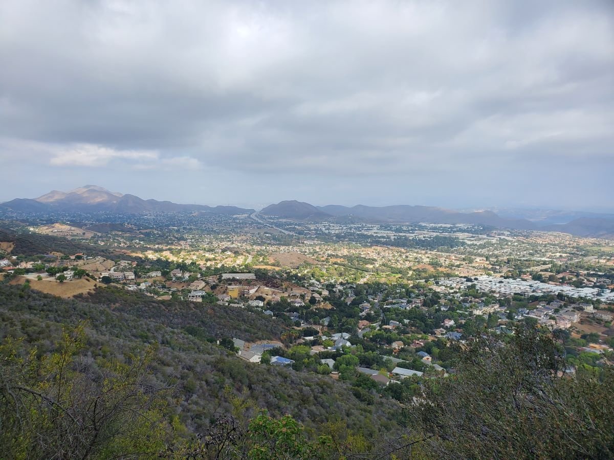
View of the Conejo Valley from the Los Robles Trail in Thousand Oaks

The Conejo Valley spans southeastern Ventura County and northwestern Los Angeles County. Communities in the Conejo Valley include Thousand Oaks, Newbury Park, Westlake Village, Oak Park, Agoura Hills, Lake Sherwood and a portion of Calabasas,

The Conejo Valley Unified School District was created July 1, 1974, unifying the following previous school districts:

  • Timber School District (founded in 1888).

  • Valley Oaks Union School District (founded in 1960 and formerly Conejo School District, founded 1877 and Santa Rosa School District, founded 1912).

  • Newbury Park and Thousand Oaks High Schools (formerly part of Oxnard Union High School District, founded in 1901).

The Timber School was established as the first school in Newbury Park in 1889. The original school was constructed at the intersection of what is now Newbury and Kelley Roads in Newbury Park. The original Timber School was a one room schoolhouse that was demolished to make way for the new, larger Timber School House erected in front of the original school in 1924. The Timber School Auditorium was built in 1948.

The Timber School House and Auditorium buildings at 1872 Newbury Road, Newbury Park represent City of Thousand Oaks Landmark No. 12 and Ventura County Historical Landmark No. 166.

A replica of the original Timber School House was built at the Stagecoach Inn Museum complex in 1995 by students of Newbury Park High School under direction of teacher, Randy Porter.

Replica of the original Timber School at the Stagecoach Inn Museum.

Replica of the original Timber School at the Stagecoach Inn Museum.

Photo of the original Timber School in 1889.

Photo of the original Timber School in 1889.

Formed in 1877, the Conejo School District predates the Timber School District. It was created at a time when there were 126 residents in the Conejo Valley, including 54 children under age 17. After operating for 4 months in a shanty on the ranch of Howard Mills, parents voted to assess $750 for a building that was constructed on two acres of land donated by Mills. The structure was called “Conejo School” and was located near what is now the northwest corner of Westlake Boulevard and Townsgate Road.

As a result of the terrible drought in late 1870s to early 1880s, many ranchers had to leave the area. The Mills property was sold to the Russell family. Abigail Russell, wife of Andrew Russell, Abigail struggled to keep the Conejo School open. Eventually, a new Conejo School was built and opened in 1929 at the current location of Conejo Elementary School at 280 N. Conejo School Road in Thousand Oaks. The original school built in 1929 was demolished in 1957 due to unsafe earthquake standards.

Learn more about the Timber School and Conejo School districts on the Stagecoach Inn Museum website at stagecoachinnmuseum.com/timber-school.

Students at Conejo School in 1941 (Photo donated by Gerald Olsen to the Conejo Through the Lens collection, Grant R. Brimhall Library, Thousand Oaks).

Students at Conejo School in 1941 (Photo donated by Gerald Olsen to the Conejo Through the Lens collection, Grant R. Brimhall Library, Thousand Oaks).

Today, the Conejo Valley Unified School District in Ventura County serves Thousand Oaks and its communities of Newbury Park and the Ventura County portion of Westlake Village. As of summer 2023, the district is comprised of the following schools:

  • 3 preschool/early child care (birth to 4 years old) schools - CVUSD Preschool - Early Childhood Program, Wonder Preschool, Horizon Hills Parenting Program

  • 18 elementary (K-5) schools (Acacia Magnet School, Aspen, Banyan, Conejo Academy of Leadership and Language Immersion, Cypress, EARThS Magnet, Glenwood, Ladera STARS Academy, Lang Ranch, Madroña, Maple, Open Classroom Leadership Magnet, Sycamore Canyon, Walnut, Weathersfield, Westlake, Westlake Hills, Wildwood)

  • SHINE: Home School Program (TK-12)

  • 6 middle schools (Century Academy, Colina, Los Cerritos, Redwood, Sequoia and Sycamore Canyon)

  • 5 high schools (Newbury Park, Thousand Oaks, Westlake, Conejo Valley and Century Academy)

  • The Conejo Valley Adult School

The Conejo Valley USD website is www.conejousd.org.

Voters Chose to Incorporate the City of Thousand Oaks Over the City of Conejo in a September 29, 1964 Special Election

City of Thousand Oaks Sign

On September 29, 1964, voters in the Conejo Valley were given the choice of whether to incorporate as a separate city in Ventura County and, if so, what to name this new city. It came down to 4,601 out of approximately 7,000 registered voters that Tuesday.

In March 1963, 27 local organizations gathered to form a Conejo City Committee to take steps to bring to a public vote the incorporation of the City of Conejo.

Conejo? Yes, Conejo. A 16 square mile city. There was plenty of controversy, since the name Thousand Oaks had been used for much of this area within the Conejo Valley for over 40 years.

A group of citizens successfully petitioned to add the name Thousand Oaks to the ballot as an alternative to Conejo..  A humorous example of some of the outrage over changing the name to Conejo is seen in this letter to the editor of the local Chronicle newspaper:

"Let's Not Drop Thousand Oaks" Conejo in Spanish means rabbit, and since talk has it to change our name to Conejo instead of our good old Thousand Oaks, I then suggest we cut down all our beautiful oak trees and replace each one with a nice fat rabbit so that we can identify ourselves with the strange new name which some newcomers have thrown at us without regard or consideration of our sentimentality and perhaps foolish tradition. If one lives in the San Fernando Valley in Canoga Park or Northridge, one says he lives in Canoga Park or Northridge in San Fernando Valley. So why can't we say we live in Thousand Oaks in the Conejo Valley or in Newbury Park in Conejo Valley. I don't care how we do it, just please let's not drop the name of Thousand Oaks." -Lucia Rios de Schneider, 3107 Radcliffe Road, Thousand Oaks

There were also a number of residents who did not want to be included in the incorporation initiative, including residents of Newbury Park, residents of the Rolling Hills area south of the 101, 500 acres of Janss Corporation owned land west of Cal Lutheran, 40 acres of land east and south of the Park Oaks Shopping Center and 100 acres of land south of the 101 owned by Louis Goebel.

Election Results - A City is Born

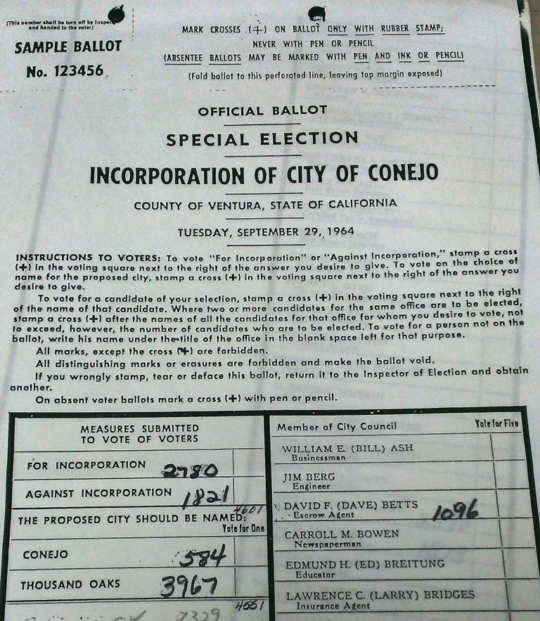
The Special Election for the Incorporation of the City of Conejo took place on Tuesday, September 29, 1964. Voting was a lot simpler back then. Instructions indicated to vote, "stamp a cross (+) in the voting square next to the right of the answer you desire to give." "On absent voter ballots mark a cross (+) with pen or pencil." The three measures submitted to vote were:

  • For or against incorporation

  • The proposed city should be named (vote for one): Conejo or Thousand Oaks

  • Vote for five city council members if the city is incorporated (there were 37 candidates on the ballot)

Portion of Sample Ballot from the September 29, 1964 Special Election for the Incorporation of City of Conejo (or Thousand Oaks, as the case were to be) (Courtesy Thousand Oaks Library Special Collections)

Portion of Sample Ballot from the September 29, 1964 Special Election for the Incorporation of City of Conejo (or Thousand Oaks, as the case were to be) (Courtesy Thousand Oaks Library Special Collections)

As you can see from the tallies written on the sample ballot above, residents voted to incorporate the city, but at 60% of the 4,601 votes it was not exactly a landslide. However, the desire to retain the name Thousand Oaks was quite clear, as 87% of votes tallied for this name over the city of Conejo.

The first City of Thousand Oaks City Council consisted of pharmacist Robert Talley (2,598 votes), Ventura County planner John Tapking (1,574 votes), Accounting Chief Alexander Fiore (1,139 votes), escrow agent David Betts (1,096 votes) and engineer Lee Williams (1,056 votes).

Councilman and Thousand Oaks Mayor David Betts in the 1966 Conejo Valley Days parade.

Councilman and Thousand Oaks Mayor David Betts in the 1966 Conejo Valley Days parade.

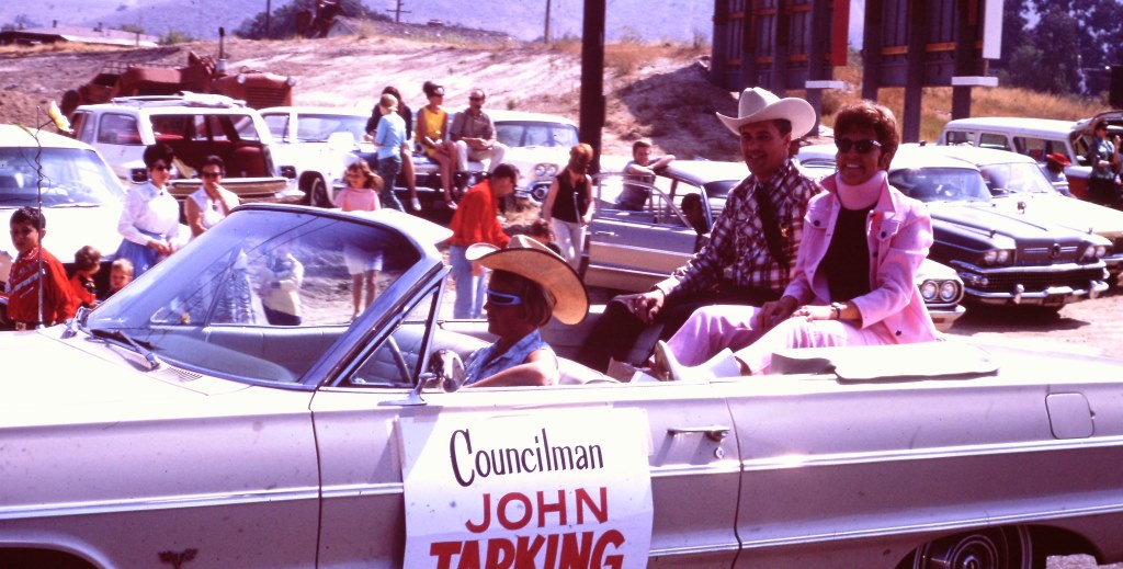
Another one of the original city of thousand Oaks councilmembers, John Tapking.

Another one of the original city of thousand Oaks councilmembers, John Tapking.

The City of Thousand Oaks was officially incorporated on October 7, 1964. At the time, the population of the city was approximately 22,000. The U.S. Census estimates 2014 population at just over 129,000. The City turned 50 in 2014.

Where Did the Name "Thousand Oaks" Come From?

According to the late Pat Allen, historian for the city, mostly farmers lived in the Conejo Valley in 1922.  The 2,200 acre Crowley Ranch was sold and subdivided and lots were sold for $1,000. As lots sold and population grew, developers held a contest to name the new village. Sixteen year old Bobby Harrington entered the name "Thousand Oaks," he won the prize and the rest is history.

Thousand Oaks became a subdivision of Ventura County on May 1, 1923, as recorded by the County Recorder. The Thousand Oaks post office opened October 31, 1938 (compared to July 16, 1875 for the Newbury Park post office).

Sources: Thousand Oaks Library Special Collections and news articles from the Conejo News, The Chronicle and Oxnard Press Courier.

Cheeseboro Canyon vs Chesebro Road in Agoura Hills

CheeseboroApr18.jpg

Cheeseboro and Palo Comado Canyons cover over 4,000 acres in the northernmost section of the Santa Monica Mountains National Recreation Area, in the Simi Hills. The Chumash occupied these canyons for thousands of years, until ranchers came into the area in the 1800s. The natural landscape changed as a result to accommodate the needs of grazing cattle.

The National Park Service (NPS) acquired Cheeseboro Canyon in the early to mid 1980s and subsequently acquired Palo Comado Canyon (formerly known as the Jordan Ranch), in 1994.

Nearly every time we post an image from Cheeseboro Canyon to a social media site, someone points out, "it's not Cheeseboro, it's Chesebro."

Why is it called Cheeseboro when the road that gets you to the trailhead is called Chesebro?

According to one NPS Ranger I've spoken with, the original owner of the land in the late 1800s was Oscar Cheesebrough (yet a different spelling). The NPS adopted the U.S. Geological Survey spelling of Cheeseboro, while Caltrans adopted the name Chesebro.

Why the difference? That's not so clear. But what IS clear is that the actual canyon is called Cheeseboro Canyon and it is a beautiful place to hike and bike!

CheeseboroPic1.jpeg
ChesebroSign.jpg