Then and Now: The Dairy Farm at Camarillo State Hospital

In 1932, the State of California purchased 1,760 acres of the Lewis Ranch and built the Camarillo State Mental Hospital, which operated from 1936 to 1997 and at one point treated as many as 7,000 patients in the mid 1950s.

Located on the parcel was a dairy farm that produced crops and housed livestock that fed the hospital community. The farm was disbanded in the 1960s and has been left in a state of disrepair, falling prey over the decades to vandals and coined "Scary Dairy."

Here are some "then and now" photos of the most prominent elements of the dairy farm.

The hay barn at Camarillo State Hospital in the 1940s (CSUCI John Spoor Broome Library historic photo collection)

The hay barn at Camarillo State Hospital in the 1940s (CSUCI John Spoor Broome Library historic photo collection)

The hay barn today.

The hay barn today.

The dairy at Camarillo State Hospital in the mid-1950s. (CSUCI John Spoor Broome Library historic photo collection)

The dairy at Camarillo State Hospital in the mid-1950s. (CSUCI John Spoor Broome Library historic photo collection)

The dairy building today, fenced off, covered with graffiti. 

The dairy building today, fenced off, covered with graffiti. 

Inside the hay barn - undated photo. (CSUCI John Spoor Broome Library historic photo collection)

Inside the hay barn - undated photo. (CSUCI John Spoor Broome Library historic photo collection)

Inside of hay barn - more recently.

Inside of hay barn - more recently.

Trolley Services in Ventura County and Surrounding Areas

Trolley seen around town in Westlake Village

Trolley seen around town in Westlake Village

The term "trolley" is derived from a grooved conductive wheel attached to a pole that "trolls," or pulls along, an overhead wire to transfer electricity to a streetcar. The first large-scale trolley line in the world, the Richmond Union Passenger Railway, was a 12 mile system that opened on February 12, 1888 in Richmond, Virginia. This trolley service operated until November 25, 1949. 

You don't see many trolley buses anymore (San Francisco's historic streetcars are a well known exception), but here in Ventura County and adjacent areas we do have some electric trolleys in operation!

Camarillo: The City of Camarillo provides trolley service seven days a week, with 10 stops at various shopping centers in town in a 30 minute cycle. Fare price is $1 for adults and students, $.50 for seniors and ADA riders.

Ojai: The City of Ojai's Ojai Trolley Service has operated since 1989, providing low cost fixed route service with 45 stops over roughly five miles in Ojai, Meiners Oaks and Mira Monte.

Calabasas: Just east of us, City of Calabasas offers free trolley service on Saturdays from 10 a.m. to 3 p.m. at 24 stops at various shopping and other venues.

Santa Barbara: The Santa Barbara Trolley Company is a commercial service that provides trolley tours to some of the area's great tourist venues Thursday to Monday.

Trolleys No More:

Ventura:  The Downtown Ventura-Harbor Trolley provided year-round free service to local shopping, tourist and hotel locations over an hour-long route, Wednesday through Sunday…until it closed operations at the end of March 2019.

Westlake Village: Previously provided a free trolley service on Fr/Sat nights during certain seasonal time frames in 2019. Program has been on hiatus since then but has been under consideration. Could be reinstated at some point; visit www.wlv.org for updates.

Over 25 Things to Do in Agoura Hills

Agoura Hills Sign.JPG

The City of Agoura Hills incorporated in 1982 and is part of Los Angeles County. But we consider Agoura to be part of our family, consisting of Thousand Oaks, Newbury Park, Westlake Village, Oak Park and other communities that form the Conejo Valley.

Agoura Hills has an area of 7.86 square miles, with a population of approximately 20,000. It became the 83rd city in Los Angeles County when residents voted to incorporate, just one year after neighboring city Westlake Village incorporated.

Here is a compilation of things to do in the City of Agoura Hills.

Trails and Hiking

  • Malibu Creek State Park is an 8,000 acre wonderland of trails, hiking, camping and other outdoor activities. The Hike to the Rock Pool at Malibu Creek State Park is extremely popular. Equally if not more popular is the hike to the M*A*S*H television show set.

  • Cheeseboro/Palo Comado Canyons include 4,000 acres of terrain with dozens of miles of trails to explore in the northernmost section of the Santa Monica Mountain range. Popular with cyclists, runners and hikers.

  • Paramount Ranch, maintained by the National Park Service on Cornell Road in Agoura Hills, was used by Paramount Pictures for over 80 years of film and television production. Sadly, the Woolsey Fire in November 2018 destroyed the historic structures at the park. However, four new structures will be constructed by the fall of 2024.

  • The 64 acre Peter Strauss Ranch in Agoura Hills is also managed by the National Park Service and features hiking and an outdoor amphitheater area.

A "must do" in the Agoura Hills area is the hike to the old M*A*S*H TV series set in Malibu Creek State Park.

A "must do" in the Agoura Hills area is the hike to the old M*A*S*H TV series set in Malibu Creek State Park.

Kids

Fitness Related

  • The Agoura Hills/Calabasas Community Center is a 30,000 square foot facility with basketball courts, fitness studio, 35 foot rock climbing wall, dance/exercise studio, kids' programs and more. (Currently closed as of June 2023 as renovations will be made to the facility.)

  • Looking for some fresh air on the golf course but don't golf? That's ok, try FootGolf at the Lake Lindero Country Club in Agoura Hills. Quite fun and no experience necessary.

  • Other fitness and sports activities in Agoura Hills compiled at THIS LINK.

Ah yes, comic relief courtesy of Caltrans signmakers in 2013 when a new Agoura Hills sign on the 101 was put up filled with typos. It was subsequently corrected.

Ah yes, comic relief courtesy of Caltrans signmakers in 2013 when a new Agoura Hills sign on the 101 was put up filled with typos. It was subsequently corrected.

Other Entertainment, Things to Do and Annual Events

The old Agoura sign on Agoura Road at Lewis Road.

The old Agoura sign on Agoura Road at Lewis Road.

Closed: Troutdale was a local fishing pond for those looking for the experience of fishing but without the hassle of driving far! Located just off of Kanan Road, near Triunfo Canyon. It appears to be closed as of summer 2018.

Get or Give Free Stuff With Freecycle

freecycle_logo.jpg

The Freecycle Network has over 5,300 groups and 11.3 million members around the world.  It is a grassroots, nonprofit movement of people who are giving (and getting) stuff for free in their own towns and thus keeping it out of landfills.  Membership is free, and everything posted must be free, legal and appropriate for all ages.

More information is available at www.freecycle.org.  There are groups organized and moderated by volunteers in many different locations via use of Yahoo Groups.

Here are the Ventura County area groups as of July 2024:

Thousand Oaks Group (2,600 members)

Simi Valley Group (1,700 members)

Ventura Group (2,100 members)

So check it out!  Somebody may need something that you don't want!

Another source for giving and getting local free stuff is www.craigslist.com.  Here is a link to free stuff in the Ventura County Craiglist and Los Angeles County Craigslist.

Tell Me a Little Bit About the City of Westlake Village Boundary

Westlake Village is a master-planned community that is transected diagonally by the Los Angeles/Ventura County line. 

The Ventura County side of Westlake Village, which is 8,544 acres, was annexed into the City of Thousand Oaks in 1968 and 1972. The Los Angeles County side of Westlake Village is 3,456 acres and was incorporated as the City of Westlake Village in 1981. 

Westlake Village Map.JPG

Ah yes, the challenge of distinguishing between the Los Angeles and Ventura County sections of Westlake Village. It truly is a diagonal boundary that stretches from just northeast of Lindero Canyon Road, south of Blackbird Avenue on the north to South Westlake Blvd at Kirsten Lee Drive on the south.

It is impossible to drive, bike or walk the boundary line because it crosses right through the middle of Westlake Lake. Although, you could drive along the border on La Venta Drive southwest from Watergate Road.

Further north, the border cuts diagonally across Westlake Golf Course.  In fact, the driving range section of the golf course bordered on the west by Lakeview Canyon Road and on the north by the 101 is located within the City of Thousand Oaks while the rest of the course is in Westlake Village.

Costco Westlake Village and the Four Seasons Westlake Village are solely part of the City of Westlake Village, as is the Las Virgenes Reservoir.

Does it really matter what side you're on? For most, no. But there's one clear financial difference. Sales taxes. As of July 2024, sales taxes in the Thousand Oaks/Ventura County portion of Westlake Village are 7.25% as compared to 9.5% in the Los Angeles County based City of Westlake Village. The difference is 2.25% for Los Angeles County district taxes. That means if you live in the City of Westlake Village, you’ll be paying $1,125 more for a $50,000 car than those living in the Ventura County portion of Westlake Village.

Las Virgenes Reservoir, the only body of water lying completely in the City of Westlake Village.

Las Virgenes Reservoir, the only body of water lying completely in the City of Westlake Village.

Satellite Tracking Station at Laguna Peak for the Naval Satellite Operations Center Point Mugu (Now 10th Space Operations Squadron)

UPDATE: On June 6, 2022, the Naval Satellite Operations Center that previously was responsible for the Laguna Peak station was transferred from the Navy to the Space Force, specifically, the 10th Space Operations Squadron (10 SOPS). The mission of 10 SOPS, which is headquarted at Naval Base Ventura County, is to operate, manage, and maintain assigned satellites and ground systems, providing continuous and reliable satellite communications in direct support of Fleet, Joint, and Interagency operations. Learn more at THIS LINK and about 10 SOPS at www.petersonschriever.spaceforce.mil/About-Us/Fact-Sheets/Display/Article/3146952/10th-space-operations-squadron.

(Military photo of Laguna Peak.)

(Military photo of Laguna Peak.)

If you’re in the vicinity of Thornhill Broome State Beach and Sycamore Cove Beach in Point Mugu or hiking up the Chumash Trail to the La Jolla Valley in Point Mugu State Park, you’ve probably noticed some futuristic looking equipment up on a hill to the west.

That hilltop is the 1,421 foot Laguna Peak in the westernmost tip of the Santa Monica Mountains, home to the Naval Base Ventura County’s Satellite Tracking Station.

The tracking station monitors rocket launches from Vandenberg Air Force Base and other sites and is a part of a network of satellite control facilities that includes stations in Prospect Harbor, Maine, Rosemount, Minnesota and the Lincoln Laboratory in Massachusetts.

laguna peak from PCH.JPG

Hiking to the Waterfall in Pt Mugu State Park from Rancho Sierra Vista/Satwiwa

One of the most popular hikes in the Rancho Sierra Vista/Satwiwa open space in Newbury Park is to a small waterfall in the adjacent Boney Mountain Wilderness. The hike is about 3 1/2 miles round-trip from the Satwiwa Native American Indian Culture Center and is a moderate hike that can be done by all ages.

Keep in mind that in drought years, there’s sometimes not more than a trickle flowing down this waterfall, while in rainier years like 2023-2024, the waterfall is quite active. In either case, it’s a fun hike to do.

You have two primary options for where to start the hike. You can drive into the Rancho Sierra Vista park entrance on Via Goleta in Newbury Park and park in a lot that is a brief walk to the Culture Center, or you can park at the Wendy Drive and Potrero Road trailhead and add an another two miles, round trip, to your adventure.

The entrance to Rancho Sierra Vista/Satwiwa at Via Goleta, 1 mile west of Reino Road.

The entrance to Rancho Sierra Vista/Satwiwa at Via Goleta, 1 mile west of Reino Road.

The trailhead where Wendy Road ends at Potrero Road in Newbury Park

The trailhead where Wendy Road ends at Potrero Road in Newbury Park

The Satwiwa Native American Indian Culture Center is a small building open from 9am to 5pm on weekends where you can learn about native Chumash items and local wildlife.

The Satwiwa Native American Indian Culture Center is a small building open from 9am to 4pm on weekends (as of April 2024) where you can learn about native Chumash items and local wildlife.

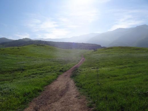
Next to the Culture Center, you'll see multiple paths, all of which can get you to your destination, but the most direct path is the Satwiwa Loop Trail seen on the left, which crosses through a meadow that can be quite green and beautiful in late Winter/early Spring and dry and brown the rest of the year. An alternate route is on the right of the picture above - the Big Sycamore Canyon Trail (paved road) to the Boney Mountain Trail, where you'll take a left.

Satwiwa Loop Trail section that takes you diagonally through the meadow. Seen here when it is nice an green.

Satwiwa Loop Trail section that takes you diagonally through the meadow. Seen here when it is nice and green.

At the end of the meadow, continue straight up a fairly steep hill, where on the right hand side you'll see the Sycamore Canyon Overlook bench shown below.

RSVW_sycoverlook.JPG

bench on sycamore canyon overlook

Hike up the moderately steep and rocky path up the hill behind the bench and you'll reach another fork in the road. If you veer left at this juncture you'll be on the Hidden Valley Overlook Trail within Rancho Sierra Vista/Satwiwa. Stay to the right and you'll be entering the Boney Mountain Wilderness area within Point Mugu State Park.

Sign that shows you the Hidden Valley Overlook Trail is on the left.

Sign that shows you the Hidden Valley Overlook Trail is on the left.

Veering right into the State of California managed Pt Mugu State Park; as you can see, dogs are not allowed in the back country area of the park.

Veering right into the State of California managed Pt Mugu State Park; as you can see, dogs are not allowed in the back country area of the park.

This trail is referred to as Danielson Road, named after the last private owner of these lands. The path down into the canyon is seen below (taken from a higher point en route to the Danielson Monument).

View of the initial section of Danielson Road trail down into the canyon; this is the path you will be taking towards the waterfall.

View of the initial section of Danielson Road trail down into the canyon; this is the path you will be taking towards the waterfall.

Danielson Road is a bit on the steep side but I see folks young and old walking up and down this section all the time. Seen here in very dry conditions.

Danielson Road is a bit on the steep side but I see folks young and old walking up and down this section all the time. Seen here in very dry conditions.

RSVW_waterfalltrailsign.JPG

THIS IS THE OLD SIGN, WHEN IT WAS CALLED DANIELSON ROAD (PRIOR TO 2024)

NEW SIGN IN 2024 SHOWING THE “OLD CABIN TRAIL” INSTEAD OF DANIELSON ROAD.

After .4 mile, you will reach the bottom of the canyon and see the sign above, the final sign indicating you are on your way to the Waterfall Trail. Then you will cross a creek bed, which can have water in it after the rains. The photo taken below in January 2015 shows minimal moisture, making it easy to cross. Some years you may have to rock hop your way a bit over the creek.

RSVW_stream.JPG

Creek bed crossing on the way to the waterfall IN 2015

Creek Crossing in April 2024.

After you cross the creek, the remainder of the trail to the waterfall is single track. Be careful not to come in contact with poison oak often seen on the sides of the trails. For this reason, I would generally not recommend strollers be taken up here.

Soon you will reach the final fork in the road. Go straight and soon you will be at the waterfall. To the right, the Old Cabin Trail (formerly Danielson Road Trail) continues upward to the Danielson Monument.

RSVWaterfallFeb17.JPG

the waterfall in april 2024.