Map From Westlake Master-Planned Community Brochure from 1968

In 1968, the American-Hawaiian Land Company, a division of American-Hawaiian Steamship Company, was developing the Westlake master-planned community, "the new city in the country."

At the time, 2,500 people lived in Westlake. The Ventura County sections of Westlake were annexed into the City of Thousand Oaks in 1968 and 1972. The Los Angeles County section of Westlake was incorporated as the City of Westlake Village in 1981. Some notable items from this 1968 map from a Westlake brochure:

1. "El Conejo Blvd." was later changed to Thousand Oaks Blvd.

2. Westlake Plaza did not exist at the time, though you can see "Future Town Center."

3. What is now Westlake Village Inn, Mediterraneo and Stonehaus back then was the Westlake Motor Hotel, Westlake Inn restaurant and Chauncey's Coffee House.

4. Last, but not least, there was no Costco in the original planned community map.

More information about the City of Westlake Village boundary lines at THIS LINK.

The Pedestrian Tunnel Under Avenida De Los Arboles in Thousand Oaks

There's a pedestrian tunnel that connects the Wildflower Playfield on Avenida De Los Arboles at Canna Street that goes underneath Arboles to Wildwood Neighborhood Park.

At the west end of Wildwood Neighborhood Park is a trail that will take you into Wildwood Park, and from there, you can either loop around back to the main Wildwood Park trailhead at the west end of Arboles, or turn back the way you came.

Wildwood Neighborhood Park was home to the original Wildwood Fort, built in 1967, but torn down in 2009 due to deterioration. New playground equipment was installed in 2021. There is also a playground across the street at Wildflower Playfield, along with restrooms at both parks. More info at www.crpd.org.

Playground at Wildwood Neighborhood Park

Concert Venues in Ventura County and Adjacent Venues

Looking to attend a concert in the Conejo Valley, greater Ventura County and adjacent areas? Here’s a compilation of such concert venues. For a separate listing of local area restaurant and bars where you can catch live music, visit THIS LINK.

The Bank of America Performing Arts Center (BAPAC) Thousand Oaks is one of the largest performing arts centers between Los Angeles and San Francisco at over 200,000 square feet. Managed by the City of Thousand Oaks, the BAPAC encompasses two theatres – the 1,800-seat Fred Kavli Theatre and the 394-seat Janet and Ray Scherr Forum Theatre. Located at 2100 E. Thousand Oaks Boulevardbapacthousandoaks.com

The Santa Barbara Bowl, located at 1122 N. Milpas Street, Santa Barbara, was originally built in 1936 and today with its capacity of nearly 5,000 people is the largest outdoor amphitheater in Santa Barbara County. www.sbbowl.com

The Majestic Ventura Theatre offers a 1920's Mission Style Architecture ambiance - you can see and feel close to the band from practically anywhere in the theater. All genres of music. 1200 capacity venue with multiple full bars, ballroom and occasional dinner shows. The theater is located at 26 S. Chestnut Ave., Venturawww.venturatheater.net 

Ventura Music Hall is located at 1888 E. Thompson Blvd in Ventura, hosting live music and offering craft food and drinks. www.venturamusichall.com

The Simi Valley Cultural Arts Center is a 220 seat theater at 3050 Los Angeles Avenue that hosts musicals, concerts, exhibits, children's theater and other events year-round.  The theater is a landmark Gothic structure built in the 1920s that was named as Ventura County Historical Landmark #67 in July 1981.  The building has served numerous purposes since inception and became the Cultural Arts Center in November 1995.  www.simi-arts.org

The Oceanview Pavilion located at 575 E. Surfside Drive in Port Hueneme offers concerts, theater, fairs, shows and a variety of other events for all ages.  The venue has a capacity for up to 1400 people and can be rented out for special events. www.oceanviewinfo.com

The Oxnard Performing Arts & Convention Center at 800 Hobson Way has over 1,600 seats in a theater that showcases local theater, dance, music and other programs. www.theopac.org

The High Street Arts Center at 45 E. High Street has been owned by the city of Moorpark since 2005, the theater now provides high quality theatrical performances and concerts at reasonable prices  www.highstreetarts.com

The Lisa Smith Wengler Center for the Arts at Pepperdine University, located on campus at 24255 Pacific Coast Highway, Malibu, showcases musicians, performers and artists from around the world at its Raitt Recital Hall (100 seats), Smothers Theatre (500 seats), Helen E. Lindhurst Theatre and the Frederick R. Weisman Museum of Art. www.arts.pepperdine.edu

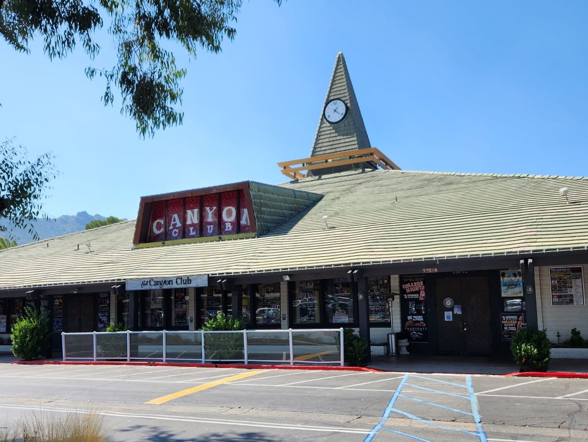
The Canyon Club in the Whizin Market Square at 28912 Roadside Drive, Agoura Hills is a live concert venue and supper club that host all types of bands and genres, comedy, special events and more. There are tables if you’re there to enjoy dinner too. Capacity is about 600. wheremusicmeetsthesoul.com/canyon-agoura-hills

Libbey Bowl is located in the heart of Ojai near the corner of Ojai Avenue and Signal Street. It was originally built in 1957 and has been used for the annual Ojai Music Festival, Storytelling Festival, Ojai Day event, holiday celebrations and many other community events through the years. It accommodates 1,300 people. www.libbeybowl.org.

The historic Arlington Theatre is located at 1317 State Street in Santa Barbara. Built in the mission revival style, it seats over 2,000 attendees. thearlingtontheatre.com

Identify Local Sex Offenders Using California Megan's Law Website

MegansLaw.jpg

California was the first state in the nation to initiate a Sex Offender Tracking Program in 1947, but until 1996, when California Megan's Law (CML) was initiated, information about sex offenders was not publicly available. 

Megan's Law is named after seven year old New Jersey girl Megan Kanka, who was raped and killed by a known molester who lived across the street from her family. All states now have a form of Megan's Law. On September 24, 2004, AB 488 was signed into law in California, providing the public Internet access to sex offender information at www.meganslaw.ca.gov.

This is a website that deserves a look, particularly by anyone who is a parent. While the website is not meant to "punish" sex offenders, it is a useful awareness tool. The search engine on the site allows you to search by name, address, city, zip and county, as well as within a two mile radius of parks and schools. You can also review the results of your search in both map and listing format.

Within seconds you can identify the 880=1 (as of July 2024) registered sex offenders in Ventura County, including photos, names, vital stats like date of birth, height and weight, their offenses and, where applicable, their addresses. You can view the offenders on a map or on a list.

Map view of megan’s Law offenders in Ventura County as of January 2023

The information in the CML database is not always up to date for each individual. The severity of the offenses for each individual vary from the more violent (rape, battery) to statutory rape, indecent exposure, etc.

Formula (Chain) Business Ordinance Since 2007 in Ojai

Since December 2007, the City of Ojai has had what’s called a Formula Business ordinance which bans new retail establishments that have over a designated number of locations with similar features such as standard menus, merchandise, decor, signage, facade, etc. Basically it’s ban of large chains (e.g. Starbucks, McDonald’s, 7-Eleven, etc.) to ensure the city maintains its small town charm.

Initially the ordinance defined a Formula Business as over 10 locations; it has since been changed to five or more locations. For more information, review City of Ojai municipal code section 10-2.1713.

This ordinance covers the 4.37 square mile City of Ojai. It does not cover other communities in the greater Ojai Valley.

Mira Monte (Spanish for “mountain view”) is an unincorporated community of approximately 6,800 residents in Ventura County that is located southwest of Ojai. Since Mira Monte does not have its own post office, addresses in this community use Ojai.

Several CVG social media followers brought up this interesting point because there are some chain establishments located in Mira Monte that have an Ojai address, such as the new drive-in Habit Burger (opened July 17, 2024), Starbucks, McDonald’s, and Taco Bell. Although these chain establishments have an Ojai address, they are not subject to the City of Ojai Formula Business ordinance. And there ya have it.

Evolution of the Conejo Grade in Ventura County Over the Last 100 Years

Horseshoe shaped section of the Conejo Grade in the 1920s.

Horseshoe shaped section of the Conejo Grade in the 1920s.

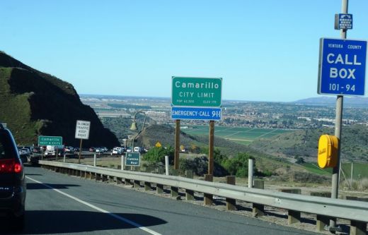
The Conejo Grade is the section of Highway 101 that connects the Conejo Valley with Camarillo. It is a four mile stretch of freeway with a significant 7% grade.

Going down the Conejo Grade from Newbury Park to Camarillo today.

Going down the Conejo Grade from Newbury Park to Camarillo today.

At 3:30 p.m. on the afternoon of May 1, 1937, a newly upgraded and realigned Conejo Grade premiered after a day of celebration commencing at the ranch of Adolfo Camarillo. Camarillo, the namesake of what in 1964 became the City of Camarillo, donated the right of way to enable the grade to be realigned. Actor Leo Carrillo entertained guests at Camarillo's ranch at the bottom of the grade.

Grand opening of the newly realigned Conejo Grade on May 1, 1937.

Grand opening of the newly realigned Conejo Grade on May 1, 1937.

The old Conejo Grade was constructed by the California Highway Commission in 1914-1915. The previous route had 49 twists and turns, making it somewhat hazardous to drive (albeit somewhat less steep than the current grade). The newly aligned Conejo Grade cut the number of curves by 75%.

Another view of the Conejo Grade before it was realigned in 1937.

Another view of the Conejo Grade before it was realigned in 1937.

The new 1937 Conejo Grade cost a total of $570,000, which is less than the average cost of a house in the Conejo Valley today! Over a year and a half, the project employed about 100 workers who put in over 272,000 hours, excavating over 800,000 cubic yards of mostly hard rock. Talk about rock stars!

In the 1950s and 1960s, Caltrans further widened and improved Highway 101 over the Conejo Grade.

In the 1950s and 1960s, Caltrans further widened and improved Highway 101 over the Conejo Grade.

Several decades later, as Ventura County grew and the cities of Camarillo and Thousand Oaks incorporated in 1964, Caltrans continued to widen and improve the highway to what it is today.

ConejoGrade2014_2.jpg

Source for historical information: "California Highways and Public Works" (May 1937) - official journal of the State of California Division of Highways, Department of Public Works.

Special thanks to the Pleasant Valley Historical Society for providing historic photos.

Then and Now: The Dairy Farm at Camarillo State Hospital

In 1932, the State of California purchased 1,760 acres of the Lewis Ranch and built the Camarillo State Mental Hospital, which operated from 1936 to 1997 and at one point treated as many as 7,000 patients in the mid 1950s.

Located on the parcel was a dairy farm that produced crops and housed livestock that fed the hospital community. The farm was disbanded in the 1960s and has been left in a state of disrepair, falling prey over the decades to vandals and coined "Scary Dairy."

Here are some "then and now" photos of the most prominent elements of the dairy farm.

The hay barn at Camarillo State Hospital in the 1940s (CSUCI John Spoor Broome Library historic photo collection)

The hay barn at Camarillo State Hospital in the 1940s (CSUCI John Spoor Broome Library historic photo collection)

The hay barn today.

The hay barn today.

The dairy at Camarillo State Hospital in the mid-1950s. (CSUCI John Spoor Broome Library historic photo collection)

The dairy at Camarillo State Hospital in the mid-1950s. (CSUCI John Spoor Broome Library historic photo collection)

The dairy building today, fenced off, covered with graffiti. 

The dairy building today, fenced off, covered with graffiti. 

Inside the hay barn - undated photo. (CSUCI John Spoor Broome Library historic photo collection)

Inside the hay barn - undated photo. (CSUCI John Spoor Broome Library historic photo collection)

Inside of hay barn - more recently.

Inside of hay barn - more recently.