Trolley Services in Ventura County and Surrounding Areas

Trolley seen around town in Westlake Village

Trolley seen around town in Westlake Village

The term "trolley" is derived from a grooved conductive wheel attached to a pole that "trolls," or pulls along, an overhead wire to transfer electricity to a streetcar. The first large-scale trolley line in the world, the Richmond Union Passenger Railway, was a 12 mile system that opened on February 12, 1888 in Richmond, Virginia. This trolley service operated until November 25, 1949. 

You don't see many trolley buses anymore (San Francisco's historic streetcars are a well known exception), but here in Ventura County and adjacent areas we do have some electric trolleys in operation!

Camarillo: The City of Camarillo provides trolley service seven days a week, with 10 stops at various shopping centers in town in a 30 minute cycle. Fare price is $1 for adults and students, $.50 for seniors and ADA riders.

Ojai: The City of Ojai's Ojai Trolley Service has operated since 1989, providing low cost fixed route service with 45 stops over roughly five miles in Ojai, Meiners Oaks and Mira Monte.

Calabasas: Just east of us, City of Calabasas offers free trolley service on Saturdays from 10 a.m. to 3 p.m. at 24 stops at various shopping and other venues.

Santa Barbara: The Santa Barbara Trolley Company is a commercial service that provides trolley tours to some of the area's great tourist venues Thursday to Monday.

Trolleys No More:

Ventura:  The Downtown Ventura-Harbor Trolley provided year-round free service to local shopping, tourist and hotel locations over an hour-long route, Wednesday through Sunday…until it closed operations at the end of March 2019.

Westlake Village: Previously provided a free trolley service on Fr/Sat nights during certain seasonal time frames in 2019. Program has been on hiatus since then but has been under consideration. Could be reinstated at some point; visit www.wlv.org for updates.

Guide to Finding Family Friendly Bike Paths In and Around Ventura County

As a casual cyclist with young kids I usually steer clear of riding on busy streets, particularly those that don't have any type of bike lane on them. Thankfully there are nearly 80 miles of bikeways in Thousand Oaks, including 3 miles of bike paths, 20 miles of bike lanes and 54 miles of marked bike routes.  

Bike routes are shared with vehicles

Bike routes are shared with vehicles

Class I Bike Paths are separate from auto traffic and thus are great for family friendly cycling. Class II Bike Lanes are striped, painted and shared lanes adjacent to automobile lanes. Class III Bike Routes are marked by green signs that signify sharing with autos.

We also love taking our bikes to other places in and around Ventura County to enjoy other sights and surroundings. So how about if we highlight Class I Bike Paths throughout Ventura County, stretching from Thousand Oaks to Ventura.

Conejo Valley

The Conejo Creek Bike Path is a 1.2 mile path in the heart of Thousand Oaks that connects Gainsborough Road on the south to Conejo Creek Park and the Thousand Oaks Library. This is a nice, flat path, good for kids.

Another access point to the Conejo Creek Bike Path on La Granada Drive.

Another access point to the Conejo Creek Bike Path on La Granada Drive.

There is another Thousand Oaks bike path, the .5 mile Greenmeadow Drive connector bike path accessible on the west at Greenmeadow and Yellowstone, on the south side of Los Robles Greens. This is not a particularly interesting path but it does enable cyclists and walkers a path around the golf course to the Los Robles trailhead and Moorpark Road from Newbury Park. A bit hilly, too.

Entrance to Greenmeadow Avenue connector bike path in Thousand Oaks

Entrance to Greenmeadow Avenue connector bike path in Thousand Oaks

There is also the .8 mile bike path on the north side of The Oaks mall as well as the .5 mile Read Road Connector path accessible off of Olsen Road just east of the 23 freeway.

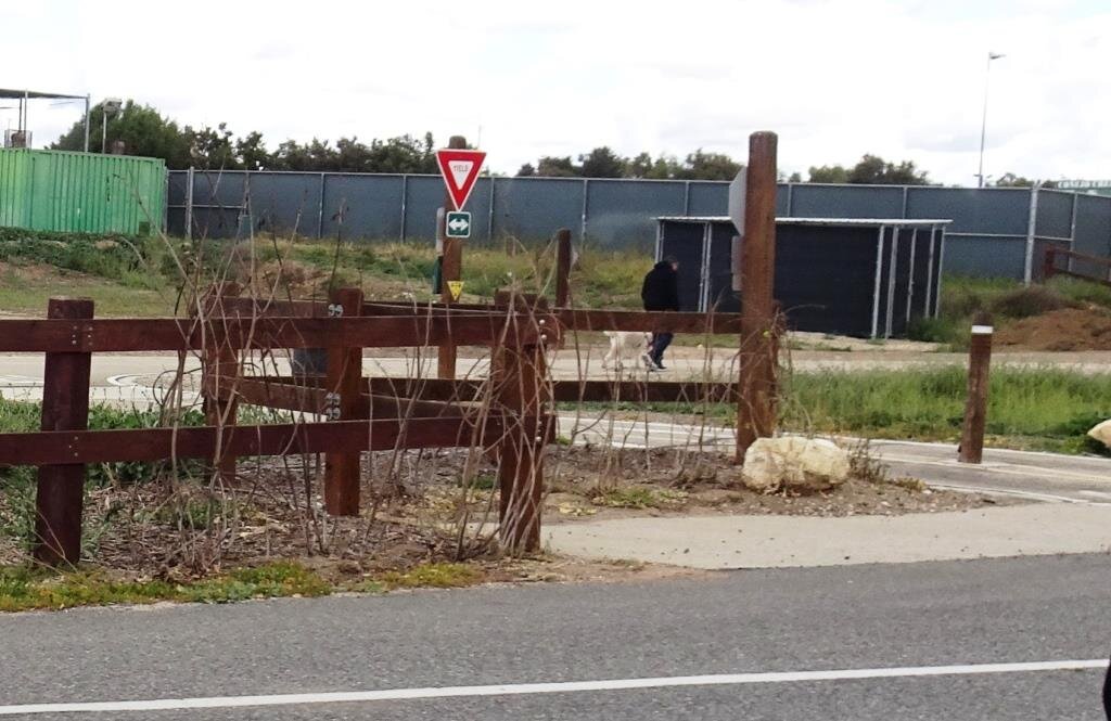
Sign at the Read Road connector path on Olsen Road east of 23 Freeway.

Sign at the Read Road connector path on Olsen Road east of 23 Freeway.

Medea Creek Natural Park has hiking, biking and fitness trails that stretch from Calle Rio Vista and Oaks Hills Drive in Oak Park on the north, then south past Medea Creek Lane and Conifer Street to a cul de sac entrance to the park at the west terminus of Tamarind Street. About a mile to mile and a half of paths, including paved and dirt paths.

Nicely paved path at Medea Creek Natural Park in Oak Park

Nicely paved path at Medea Creek Natural Park in Oak Park

Ventura

My personal favorite bike path in Ventura County is the Omer Rains Trail that runs the entire length of San Buenaventura State Beach.

Senator Omer Rains Ventura Oceanfront Bikeway Sign on Main Street next to Ventura Beach RV Resort

Senator Omer Rains Ventura Oceanfront Bikeway Sign on Main Street next to Ventura Beach RV Resort

We park the car at Marina Park in Ventura and ride a short distance north on Pierpont Blvd to the bike path entrance. This oceanfront path takes you past the Ventura Pier, through the Promenade area, adjacent to the Ventura County Fairgrounds, Emma Wood State Beach and beyond. Or you can get to the path from anywhere along the Ventura Promenade area.

Bike path along San Buenaventura State Beach.

Bike path along San Buenaventura State Beach.

Omer Rains Bike Path near Ventura Beach RV Resort on Main St.

Omer Rains Bike Path near Ventura Beach RV Resort on Main St.

Nice, newer paved section of Ventura beachfront bike path near Surfers Point.

Nice, newer paved section of Ventura beachfront bike path near Surfers Point.

The Ventura River Trail is a 6.3 mile asphalt pedestrian and bike path that follows the old Southern Pacific Railroad right-of-way from Main Street in Ventura to Foster Park inland towards Ojai. You can easily connect from the Omer Rains Trail to the Ventura River Trail up to the Ojai Valley Trail for quite a long, nearly automobile-free ride.

The Ventura Harbor Bike Path takes you 1.2 miles from Market St and Arundell Ave in midtown Ventura southwest through farmland to E. Harbor Boulevard and Schooner Drive, near Four Points by Sheraton.

Bike path from midtown Ventura to the Harbor is not the most exciting path but it is a convenient way to ride to Ventura Harbor, Marina Park and adjacent areas.

Bike path from midtown Ventura to the Harbor is not the most exciting path but it is a convenient way to ride to Ventura Harbor, Marina Park and adjacent areas.

The La Conchita Bike Path between Rincon Point at the Ventura/Santa Barbara County Line adjacent to Highway 101 past La Conchita to Mobil Pier Road in Ventura was completed in September 2014. This path has leapfrogged into my own personal favorite in Ventura County because of its spectacular beach views. This is about 4 miles of bike path in the Oil Piers Beach to Mussel Shoals to La Conchita Beach to Rincon Point beach areas.

Bike paths rarely get better than this stretch along the southbound 101 and the Pacific Ocean in Ventura.

Bike paths rarely get better than this stretch along the southbound 101 and the Pacific Ocean in Ventura.

There's another short stretch of bike path at the east end of Navigator Drive that goes west, then south, around the Ventura West Marina.

Entrance to short bike path adjacent to Ventura West Marina.

Entrance to short bike path adjacent to Ventura West Marina.

There is a two mile biking and hiking on the east side of the lake at the Lake Casitas Recreation Area, 11311 Santa Ana Road, Ventura. The path starts at picnic area #1 and follows the east shoreline of the lake for a four mile round trip ride. The path is paved in the recreational area and becomes a dirt road outside of that. More information at www.casitaswater.org/recreation/amenities/bike-trail.

Ojai

The Ojai Valley Trail is a 9 to 10 mile trail that parallels Highway 33 from Foster Park on the outskirts of west Ventura, to Soule Park in Ojai. It connects to the Ventura River Trail.

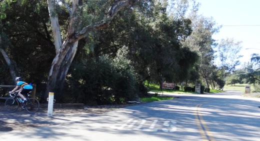
The Ojai Trail runs parallel to Ventura Ave/Ojai Ave.

The Ojai Trail runs parallel to Ventura Ave/Ojai Ave.

Simi Valley

The Arroyo Simi Bike Path is a two lane bike path in Simi Valley that runs from Madera Road, just south of Easy Street on the west, ending at Tapo Street on the east. Over seven miles.

Arroyo Simi Bike Path/Trail in Simi Valley.

Arroyo Simi Bike Path/Trail in Simi Valley.

Camarillo

We enjoy the newer, flat roughly 2 mile Calleguas Creek bike path from Pleasant Valley Fields up to the corner of Flynn and Upland Roads in Camarillo. Quick access from the Conejo Valley and a nice, relatively easy path good for all ages.

Look at how nice and flat this bike path adjacent to Calleguas Creek is!

Look at how nice and flat this bike path adjacent to Calleguas Creek is!

Other Areas

There's an online bike map available on the Ventura County Transportation Commission website at www.goventura.org where you can find other Class I, II and II bike paths around the county. Here are some of them.

The Santa Paula Bike Trail takes you roughly 3 miles on the east near W. Main St and Peck Rd to (roughly) Dike Road on the west

The Fillmore Bike Path runs from south of Highway 126 (Telegraph Road) up past Shiell Park.

In Moorpark there's a .5 mile path at Country Trail Park, around the neighborhood to the west, back to Mountain Trail Street.

There's a bike path that starts at the ocean side of Oxnard Beach Park and takes you south all the way to Hollywood Beach and Channel Islands Harbor. Cross Harbor Boulevard and make your way into Channel Islands Harbor, where you can ride all the way to the south end of the harbor.

Bike path near Oxnard Beach Park and Channel Islands Harbor.

Bike path near Oxnard Beach Park and Channel Islands Harbor.

In Port Hueneme there's a bike path that starts off of Bard Rd, west of South J St, through Richard Bard Running Springs Park and takes you southwest all the way to Hueneme Beach.

If you're willing to venture a bit further away from Ventura County, the Marvin Braude Coastal Bike Path stretches over 20 miles, from Will Rogers State Park in Pacific Palisades to Torrance. Flat, adjacent to the ocean, and so many things to do along the way!

Marvin Braude Coastal Bike Path in Pacific Palisades

Marvin Braude Coastal Bike Path in Pacific Palisades

That should be enough to get you started! Looking for local cycling clubs? Find some of them at this link.

Ventura County Area Crime Maps Online

The Ventura County Sheriff's Office serves the County of Ventura and five contract cities of Camarillo, Fillmore, Moorpark, Ojai, and Thousand Oaks. There is a wealth of information on the VC Sheriff's website at www.venturasheriff.org, including phone numbers for patrol stations.

One tool available that shows recent crimes in these jurisdictions is located at CrimeMapping.com, a website that provides information, in map format about crimes committed on a rolling 180 day basis.

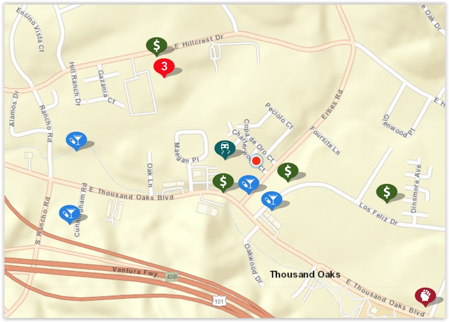
To use CrimeMapping.com, simply go to the site and type in a location - address, landmark or zip code. From there, you’ll see a map of crimes reported over the most recent week, which is the default time frame. You can change this time frame using filters on the site, up to 180 days’ worth of data. Here’s what the map looked like over a 180 day period:

crimemapping map.JPG

You can learn more about individual crimes by clicking the icons on the map. Crimes include arson, assault, burglary, disturbing the peace, drug/alcohol violations, DUI, fraud, homicide, auto theft, robbery, sex crimes, theft/larceny, vandalism, vehicle break-in and weapons.

The number 3 in a red circle in the image above indicates multiple records. I clicked it and there were 2 possession of a controlled substance - one in the 300 block of Hillcrest Drive on July 17th at 1:30pm and the other in the 2400 block of Hillcrest Drive on July 17th at 12:30pm. The third violation was fraudulent use of access card on April 1st at midnight.. Note that exact addresses are not provided; they report as specific as block number.

The first icon at the bottom right side of the image was an assault (battery) in the 2200 block of E. Thousand Oaks Boulevard at 10:05am on August 7th.

You may also create alerts on the CrimeMapping site that are sent to you via email. Click “Receive Alerts,” choose location (city, landmark, address or zip) and search distance (ranges from 500 feet to 2 miles).

Formula (Chain) Business Ordinance Since 2007 in Ojai

Since December 2007, the City of Ojai has had what’s called a Formula Business ordinance which bans new retail establishments that have over a designated number of locations with similar features such as standard menus, merchandise, decor, signage, facade, etc. Basically it’s ban of large chains (e.g. Starbucks, McDonald’s, 7-Eleven, etc.) to ensure the city maintains its small town charm.

Initially the ordinance defined a Formula Business as over 10 locations; it has since been changed to five or more locations. For more information, review City of Ojai municipal code section 10-2.1713.

This ordinance covers the 4.37 square mile City of Ojai. It does not cover other communities in the greater Ojai Valley.

Mira Monte (Spanish for “mountain view”) is an unincorporated community of approximately 6,800 residents in Ventura County that is located southwest of Ojai. Since Mira Monte does not have its own post office, addresses in this community use Ojai.

Several CVG social media followers brought up this interesting point because there are some chain establishments located in Mira Monte that have an Ojai address, such as the new drive-in Habit Burger (opened July 17, 2024), Starbucks, McDonald’s, and Taco Bell. Although these chain establishments have an Ojai address, they are not subject to the City of Ojai Formula Business ordinance. And there ya have it.

Fun Things to Do in Historic Ojai, Ventura County's Smallest City

Ojai, Ventura County's smallest city with under 8,000 residents, is 40 miles from Thousand Oaks, the 2nd largest city in the county. This drive is well worth it if you're looking for a unique old town feeling right here in Ventura County.

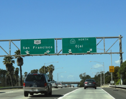
OjaiFreewaySign.JPG

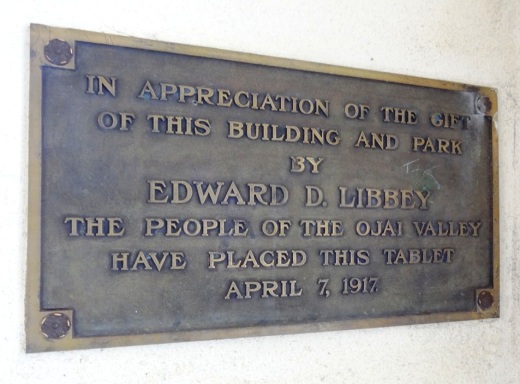
Incorporated as a city in 1921, the Ojai Valley was once inhabited by the Chumash Indians. The name Ojai is derived from the Chumash word "Awhai," meaning "moon." Glass manufacturer Edward D. Libbey helped create the layout of Ojai. After a fire destroyed much of the town in 1917, the western-style town received a new Spanish Revival look.

View of the arcade and pergola in front of Libbey Park on Ojai Avenue.

View of the arcade and pergola in front of Libbey Park on Ojai Avenue.

The Ojai Post Office tower and portico was completed in 1917 and is a focal point for the city at the corner of Ojai Avenue and Signal Street. The tower was modeled after the Christopher Columbus Cathedral in Havana, Cuba, with additional details from Mexico. The tower complements the arcade and pergola along Ojai Avenue. You can't miss the one block arcade with its shops, eateries and art galleries.

OjaiPostOffice.JPG
LibbeyTablet.JPG

Here's a selection of just some of the great things to do in Ojai:

The Ojai Valley Inn and Spa is a great local weekend getaway! Whether you stay there overnight or not, the Ojai Valley Inn's historic 18 hole golf course, 31,000 sq ft spa and fitness facility and four lighted tennis courts are available to local day trippers.

Libbey Bowl and Libbey Park are located in the heart of Ojai next to the downtown arcade area. Libbey Bowl, originally built in 1957 and completely renovated in 2011, is used for the annual Ojai Music Festival, Storytelling Festival, Ojai Day celebration, holiday events and much more. Libbey Park provides plenty of sitting areas, shade trees, a kids' playground in the heart of the city.

Strolling and shopping in the Ojai Arcade

Strolling and shopping in the Ojai Arcade

Founded in 1966, the Ojai Valley Museum at 130 West Ojai Avenue maintains an extensive collection of art, Native American baskets, pioneer tools and photographs of early days in Ojai.

Meditation Mount

Meditation Mount

Located on a 32 acre site overlooking the Ojai Valley, Meditation Mount is a public meditation center that has invited the public to its beautiful grounds since opening in 1970. Two hour visitation experiences are $12 at designated time frames. meditationmount.org

The Ojai Valley Trail provides cyclists, equestrians, runners and strollers a nine mile path paralleling Highway 33 from Foster Park on the north end of Ventura to Soule Park on west of downtown Ojai. My personal favorite activity in Ojai is riding bikes on this trail.

The Ojai Playhouse is a single screen theater originally built in 1914 that has been restored to its deco-style look inside and now shows first run movies in a theater that seats over 200 people. The Ojai Film Society hosts eclectic, independently produced movies here on Sunday afternoons.

NOTE: The Ojai Playhouse has been closed since January 2018 to restore the theater due to a water main break causing damage and flooding to the building. They anticipate re-opening in 2024. Check www.facebook.com/ojaiplayhouse for updates.

The Ojai Trolley Service provides transportation on a fixed route schedule throughout Ojai, Meiners Oaks and Mira Monte. Where else can you find a year-round trolley around here!?

OjaiTrolleyPic.JPG

Ojai Day was originally conceived in 1917, took a long hiatus in the 1920s, and came back in 1991 on the third Saturday of each October. The event showcases the best Ojai has to offer, with entertainment, a parade, art, food, games and much more. Visit www.ojaiday.com for more information.

One of my favorite activities with the kids just minutes from Ojai is the Lake Casitas Recreation Area, which includes the seasonal (Memorial Day to Labor Day weekend) Casitas Water Adventure. Though the water is not heated, the 1,200 foot lazy river and multi-level water jungle gym for the kids is sure to entertain you while cooling you off.

Casitas Water Adventure

Casitas Water Adventure

For other year-round things to do in Ojai, click here in the Do Something section of CVG or here for kids' activities. Or here for Fitness & Sports activities. And for upcoming Ojai events, click here. To learn more about the city, visit the City of Ojai website at ojaicity.org.

Things to Do With the Kids in Ventura County When It's Wet Outside

iStock_RainyDay.jpg

It doesn't rain nearly often enough here in Ventura County, but when it does, that's a great excuse for staying inside. You are in the right place as we have compiled this extensive list of well over 200 indoor activities from Agoura to Simi Valley to Ventura and everywhere in between!

Join a Local Ventura County Moms Club

MomsClubs.jpg

If you're looking for local Ventura County groups to meet up with other moms for playgroups, activities and socializing, look no further than this list (includes only organizations with websites... Contact Us for additions).

(Last update September 2018...subject to change.)

Calvary Community

Church MOPS (Mothers of Preschoolers) - Meets every other Tuesday morning

Conejo Valley Homeschoolers (Home school support group)

Conejo Valley Mothers of Multiples

Stroller Strides and Our Village of Conejo Valley

Ventura MOPS (Mothers of Preschoolers)

There are a number of local La Leche League groups in the area. Visit lllusa.org to find them.

Additional links and information at www.conejovalleyguide.com/moms-clubs.