
Beaches in the Santa Barbara Area
/Click the image for information about public beaches in and around Santa Barbara County

Click the image for information about public beaches in and around Santa Barbara County
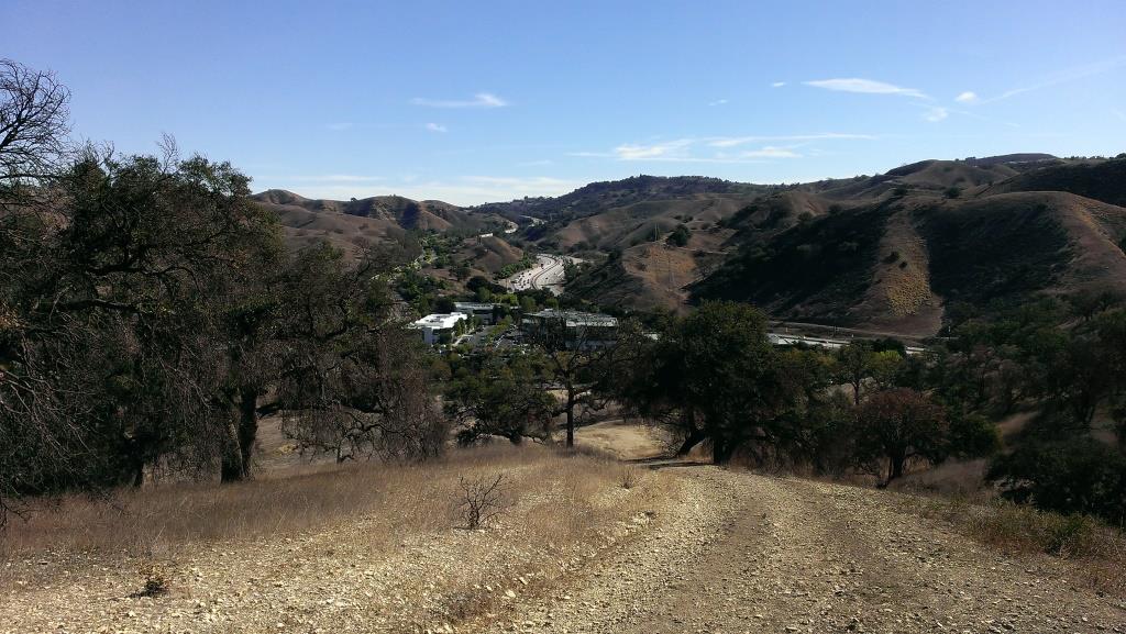
If you're looking for a challenge, consider hiking from the Palo Comado Canyon Doubletree Road Trailhead to the 2,405 foot elevation Simi Peak in Oak Park. This is about a 4 to 4 1/2 mile trek each way with a 1,200 foot elevation gain to the top that is well worth it if you have the time and the energy.
Mind you, this particular stretch of trail, the Palo Comado Fire Road, I've rarely seen more than a handful of hikers and runners on over the years. I usually see more cyclists up here than anything. Part of the challenge is that it can get pretty hot up here on these trails as most of them get full exposure to the sun. So do bring plenty of water and wear sunscreen unless it happens to be a rare, overcast day. No restrooms either.
A quicker, easier path to the panoramic Simi Peak, the highest point in the Simi Hills, is via the China Flat Trailhead.
So if you're up to the challenge, park your car near the trailhead on Doubletree Road , just east of Clear Haven Drive, in Oak Park. From the 101, take Kanan to Sunnycrest Drive, and make a right. Sunnycrest becomes Doubletree after it veers left. The trailhead is on the right.
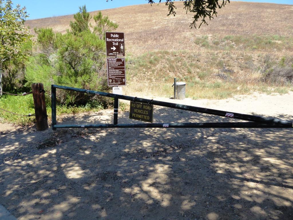
About a half mile from the trailhead gets you to the Palo Comado Canyon Trail, where you'll head north (left).

The Palo Comado Canyon Trail is fire road, so it is nice and wide.

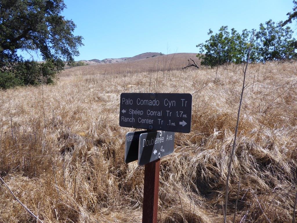
Eventually, after a bit of a grueling climb (this hike is not kid friendly if you ask me), you'll reach this corral area. Continue west (left).

Follow the direction of the signs toward the Simi Peak Trail and you're on your way.
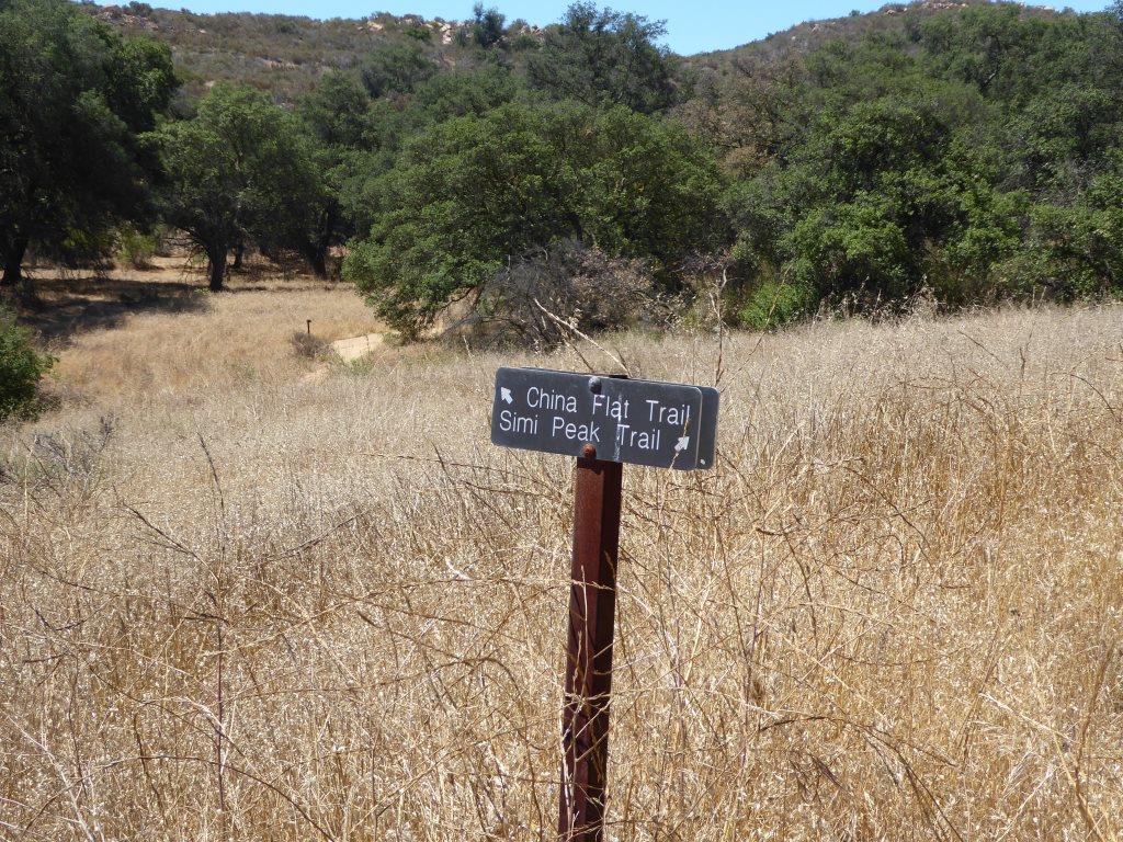
Follow the direction of the sign towards Simi Peak. The only challenge is that you have to go with your gut at some point as the signs stop.

The trails get narrower and a bit more technical as you head your way to the peak. Wear good shoes.

You've reached your destination when you see this.

You are now at Simi Peak, the highest point of the Simi Hills. The round marker on the right is from the Ventura County Surveyor. In background is Lindero Canyon Road headed south.
Fancy, green highlighted map (courtesy National Park Service).
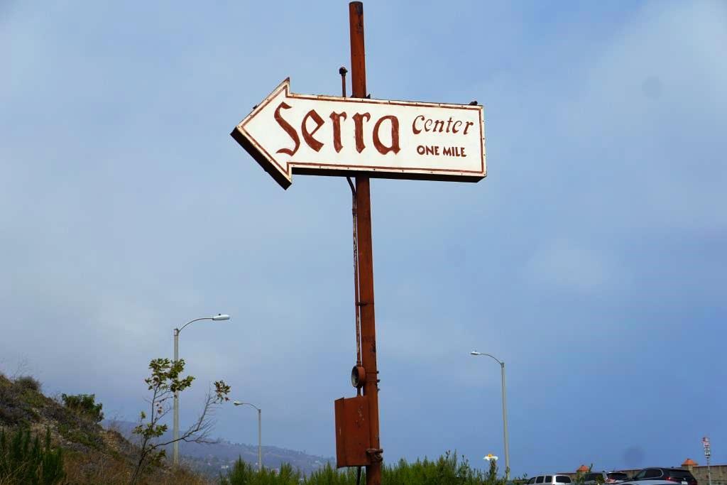
The Serra Center sign as seen from Pacific Coast Highway
The Serra Retreat is a Catholic retreat and conference center located in the hills of Malibu on a 26 acre knoll, across the street from the Malibu shoreline. The location, since 1943, has welcomed church groups, schools, non-profits and other organizations a quite space for retreats and workshops.
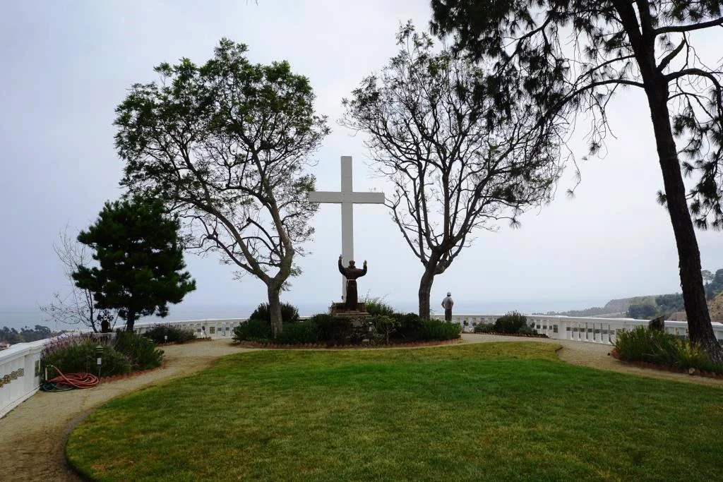
Courtyard area facing the Pacific Ocean
During the week, the public is allowed to visit the grounds between 9 am and 4:30pm for personal prayer and reflection. No reservations are required. You must stop at the guard gate, located on Serra Road at PCH, about a 1/4 mile east of Cross Creek Road, obtain a guest pass, then slowly drive up Serra Road, for about a mile until you seen the turnoff on to the Retreat on the left. The actual address of the facility is 3401 Serra Road, Malibu.

Parking pass received at guard gate
There are no public restrooms at the facility and dogs are not allowed, nor or picnic lunches. This is a place for reflection, not to mention taking in the great views. There are a number of benches to reflect as you look down below as you enjoy paths and walkways and enjoy the gardens and sights. There is also a stone lined labyrinth for walking and reflection.

Labyrinths are always cool, both to look at and to walk.
You can get married here too, with two locations to celebrate after the ceremony. Capacity is 120 guests.
Learn more at serraretreat.com.
The view is not too shabby either!

Although it takes a bit of patience getting from the Thousand Oaks area to Circle X Ranch nestled in the Santa Monica Mountains in Malibu, Sandstone Peak (highest point in the Santa Monica Mountains), the Mishe Mokwa Trail (including the amazing Balanced Rock) and the Grotto Trail make it a worthwhile trek.
The Grotto Trail is a 3 1/2 mile round trip hike from the Ranger Station at Circle X Ranch at 12896 Yerba Buena Road, Malibu.
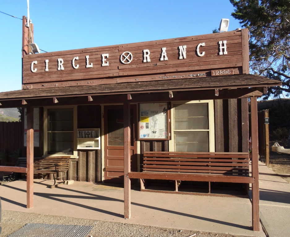
You can park in front of the Circle X Ranch building, then follow the signs down to the Grotto Trail trailhead adjacent to the group campground. Parking is free. There is a restroom and drinking fountain along with maps available. A park ranger may also be on hand to answer any questions.
The mostly single track trail leads you on rolling terrain down to an area called The Grotto, where you will find a creek and, in winter months, a waterfall. The trail is a bit rocky but can be done by most ages. The hills are rolling, the terrain varies with rocks, a areas with steps, etc. There is also ample amounts of poison oak growing on the sides of the trail various section, so do be aware. That said, I've been here several times with the kids and we managed to avert any issues.
Bikes are not allowed on the Grotto Trail. Dogs are allowed on leash, until you reach the streambed at the bottom of the canyon. Learn more at www.nps.gov/samo/planyourvisit/circlexranch.htm.

Grotto Trailhead sign adjacent to circle X campground
So what makes the Grotto Trail special? Well, you hike down through a canyon leading to the west fork of the Arroyo Sequit. Plenty of shade and views all over. Once you reach the bottom of the trail, there is a creek. You'll hear running water pretty much year-round (though in late summer it can be a trickle). If you keep trekking down the unimproved creek bed, you'll come across large boulders and rock formations down to the "Grotto," a caved area pooled with water. But to get down there is not for everyone. You'll want to have both hands available as you climb down the boulders to the cave below. It is pretty cool though and you can explore without actually getting into the water. Photos below.

About .4 mile into the hike, you'll see see this sign for the Canyon View Trail, which takes you .6 mile up to a small parking area off of Yerba Buena Road (about halfway between Circle X Ranger Station and Sandstone Peak trailhead)

Watch out for the poison oak on the sides of the trail...there's plenty of it but you can avert it if you are aware.

Another sign, the final sign you'll see, .7 miles from the trailhead.
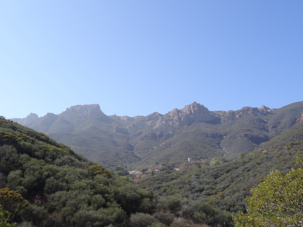
Some nice views of the surrounding canyons and towards Sandstone Peak.

Eventually you'll reach this tree-lined area next to a creek that leads to the grotto area.
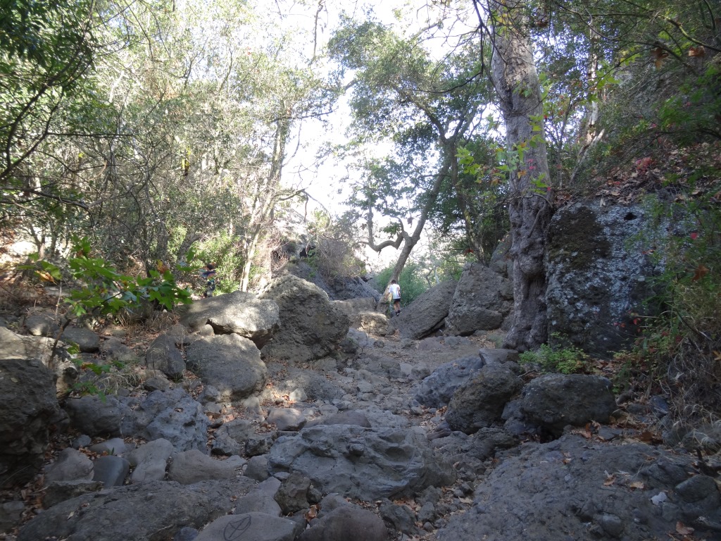
Continue your way to the grotto through this unmarked, increasingly rocky section.

For many, this may be the endpoint for your hike once you see these boulders. But there's a path (I won't call it a trail, because it isn't) on the right hand side that, with a bit of patience, will get you to the cave below.

Not exactly easy but do-able. After the boulders there's a dirt path that I slipped on and flew nearly parallel to the ground, landing my lower back on a tree root. I survived but my utterances had to be bleeped out by censors.

View of the grotto cave from the outside. You can go inside there either through the water if you are prepared or through a hole formed by boulders above the cave, which we opted not to attempt. Maybe next time. It is pretty cool in there!

Definitely an interesting place to explore. this is above the cave area. But do watch for snakes and such down here too
CLICK iMAGE FOR DETAILS ABOUT SOLSTICE CANYON IN THE SANTA MONICA MOUNTAINS
Community Center Park in Camarillo is home to the administrative offices of the Pleasant Valley Recreation and Park District, Community Center, Senior Center, classrooms and quite a nice park that is host to numerous community activities year-round. The park is nearly 13 acres and plenty of parking.


Community Center Park is located at 1605 E. Burnley Street in Camarillo. For more information, visit www.pvrpd.org/community-center-park or call 805.482.1996.
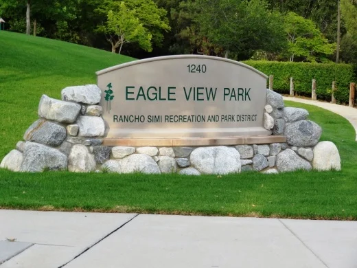
Eagle View Park is located at 1240 Hidden Springs Avenue in Oak Park, near the very top of Lindero Canyon Road. This is a nice little neighborhood park with a basketball court, bike path, recreational trail, picnic tables and play areas. No restroom though! The park is maintained by the Rancho Simi Recreation and Park District at www.rsrpd.org.

Play area for bigger kids

Play area for little kids
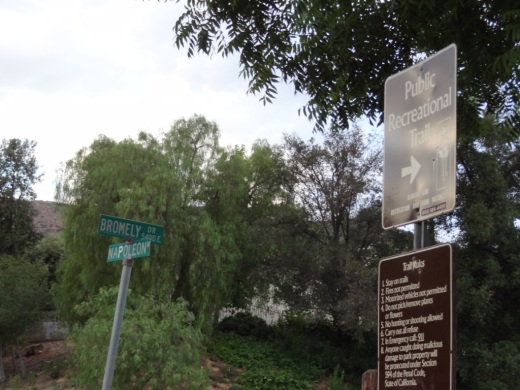
Recreational trail accessible just southeast of the park
Las Flores Creek Park at 3805 Las Flores Canyon Road in Malibu is a neighborhood pocket park with on-site parking, picnic tables, restrooms, a small playground, benches, a pedestrian bridge, and over one-third of a mile of walking trails. The park also has over 45 varieties of native plant species and interpretive signage throughout the park with information about the plants, riparian habitat, the creek stabilization project, and the history of the area. More at www.malibucity.org.

There are nearly 20 libraries in Ventura County and adjacent areas. Click the book cart for a link to them!
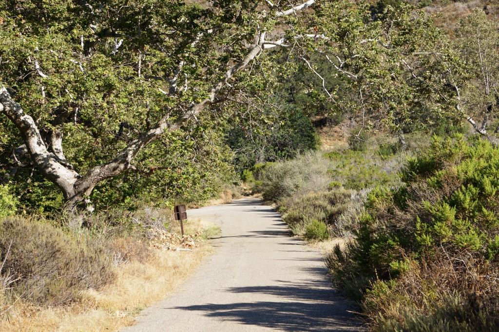
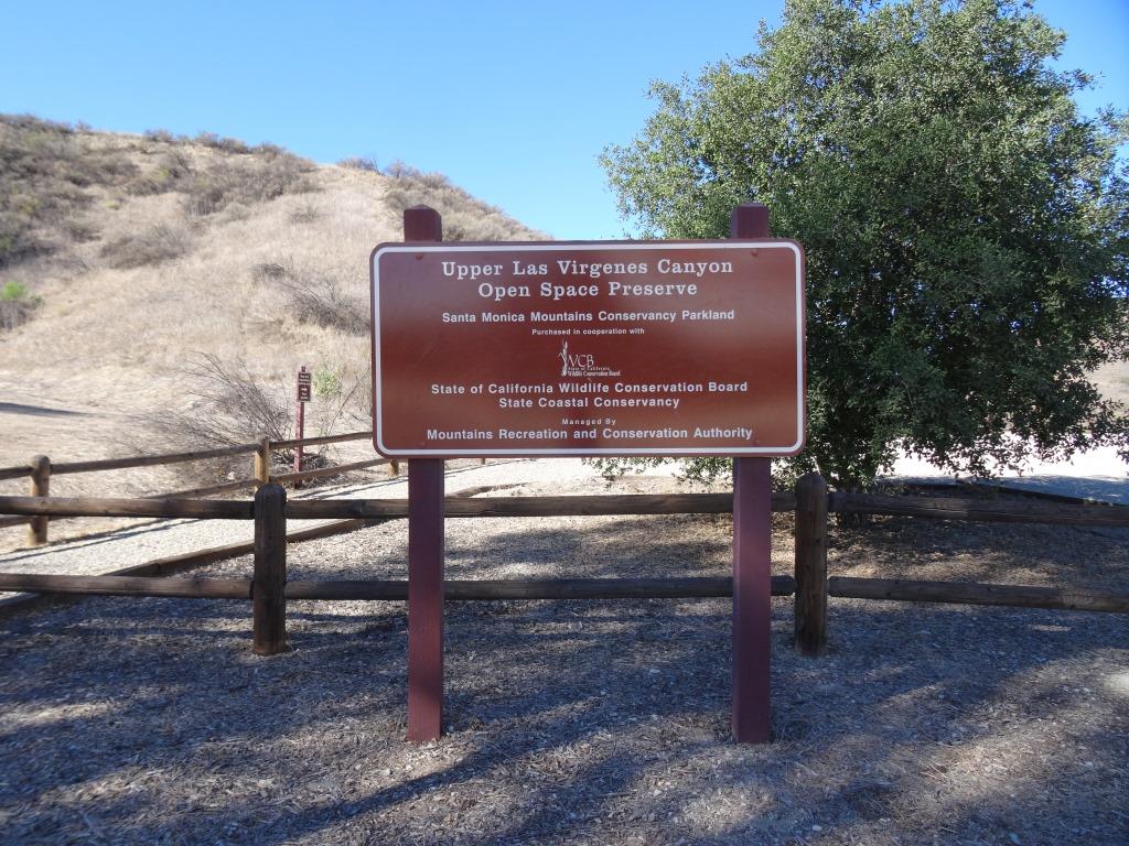
Looking for some good hiking? Click the image below for details about the Upper Las Virgenes Canyon Open Space Preserve in Calabasas.

The Zev Yaroslavsky Las Virgenes Highlands Park is located on Las Virgenes Road, just south of Mureau Road and north of Highway 101 in Calabasas. Acquired in 2010, this area includes nearly 200 acres of open space providing a gateway to the Santa Monica Mountains and a welcome site to drivers navigating bottom of the Calabasas Grade on Highway 101. Stop by sometime and take a hike up the moderately steep path through grasslands and oak trees to catch panoramic views of the surrounding areas. Learn more at THIS LINK.

The Conejo Recreation and Park Districthas served the Conejo Valley since 1963 and covers 66 square miles with a population of over 140,000 people in Thousand Oaks, Newbury Park and the Ventura County portion of Westlake Village.
The Recreation Division conducts over 3,000 organized recreation and leisure programs each year. The Parks Division maintains over 50 parks, over 1,000 acres with a variety of recreation amenities, including tot-lots, lighted sports fields, picnic areas, and community centers. Additionally, the Parks and Planning Division, through the Conejo Open Space Conservation Agency (COSCA), maintains approximately 15,000 acres of open space and a 140-mile multi-use trail system including a disabled accessible trail segment on Oak Creek Canyon.
CRPD releases its Recreation Program Guide four times a year (Winter, Spring, Summer, Fall) and has hundreds if not thousands of activities for adults, seniors, kids and teens.
Visit the CRPD website at www.crpd.org or call 805.495.6471 for more information or to access community class schedules, park listings, facilities, sports and other information about local Conejo Valley events and activities.
Conejo Recreation and Park District is located at 403 W. Hillcrest Drive, Thousand Oaks.


The Self-Realization Fellowship Lake Shrine was dedicated by Paramahansa Yogananda in 1950. This is a 10 acre spiritual sanctuary located at 17190 Sunset Boulevard in Pacific Palisades, about 25 miles from the Conejo Valley.

The beautiful site hosts a natural spring-fed lake along with gardens, swans, ducks, koi and trees and flowers from around the world.
The grounds include a Court of Religions honoring the five principal religions of the world, the Mahatma Gandhi World Peace Memorial where a portion of Gandhi's ashes is enshrined, a museum with exhibits on Paramahansa Yogananda's work, and a gift shop with arts and crafts from India.

The temple itself is on a hilltop overlooking the lake. A beautiful and peaceful place indeed.
The Gardens and Lake are open Tuesday - Saturday: 9:00 am to 4:30 pm and Sunday: 12:00 noon to 4:30 pm (closed on Monday)
The Visitors' Center is open Tuesday - Saturday: 9:00 am to 4:30 pm and Sunday: 12:00 noon to 4:30 pm
Learn more at www.lakeshrine.org.
Conejo Valley Guide covers events, activities and things to do throughout Ventura County and surrounding areas.
Conejo Valley Guide® covers thousands of events, activities and things to do throughout Ventura County, California and surrounding areas.
Conejo Valley Guide is a participant in certain affiliate programs. These affiliate advertising programs are designed to provide a means for sites to earn advertising fees by advertising and linking to the respective websites. Some links on the site may be affiliate links. We get paid if you buy something or take an action after clicking one of these links on our site. Learn more at paidforadvertising.com.
