Pleasant Valley Historical Society Museum and Botanical Garden in Camarillo
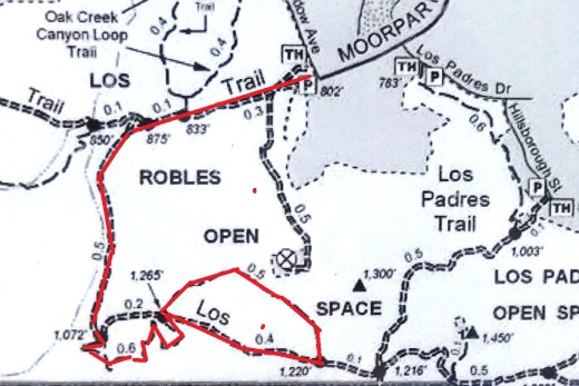
NOTE: MUSEUM CURRENTLY (AS OF JULY 2022) CLOSED FOR AN EXPANSION PROJECTION PROJECT. GARDEN IS CURRENTLY OPEN ON SATURDAYS FROM NOON TO 4PM CHECK THE MUSEUM WEBSITE FOR UPDATES.

The Pleasant Valley Historical Society Museum and Botanical Garden at 720 Las Posas Road in Camarillo is dedicated to the preservation of the history of Pleasant Valley, the Oxnard Plain and adjacent areas where many of Camarillo’s pioneers settled before there was a City of Camarillo. Admission is free. Donations are accepted. The Museum and Garden are open from noon to 4:00 p.m. on Saturday and Sunday, except holidays. More information at www.pvhsonline.org.

PVHSMuseum_sign.JPG

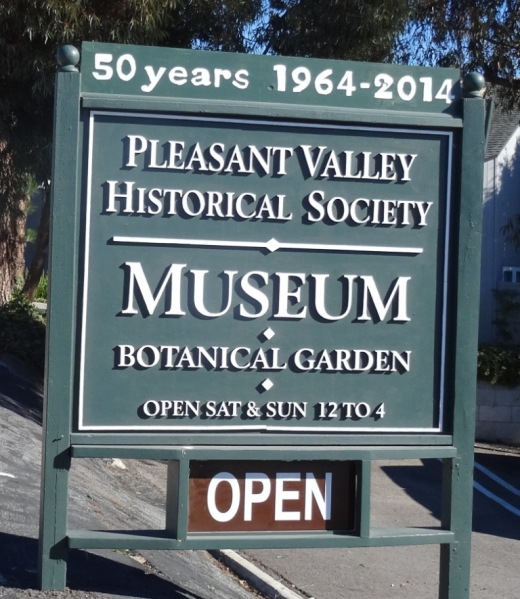
The museum is located in a small building on the property which contains a variety of antiques and items of local historical interest. Resident docents are genuinely interested in sharing stories about local history in the facility. I can almost guarantee you will learn something new every time you visit!

Old items and newspaper clippings from years past on display.

Old items and newspaper clippings from years past on display.

The Charles L. Honn Botanical Garden, associated with the Historical Museum and located behind it, is a beautiful park-like area that features plants and trees indigenous to the Pleasant Valley and the surrounding region. The garden includes a large gazebo that is available as a breathtaking setting for weddings, anniversaries and similar functions. Kitchen facilities are available. Donations are accepted for use of the garden/gazebo.

PVHS_BotanicGarden.JPG
PVHS_Gazebo.JPG

Call 805.482.3660 or visit www.pvhsonline.org for more information.

The Charles L. Honn Botanic Garden starts to brighten up after the winter rains.

The Charles L. Honn Botanic Garden starts to brighten up after the winter rains.

William Rolland Gallery of Fine Art at Cal Lutheran Thousand Oaks

RollandGallery.jpg

The William Rolland Gallery of Fine Art at Cal Lutheran is located adjacent to the William Rolland Stadium. It opened in October 2011.

The gallery has featured such exhibits as: Western Salon featuring sculptures and paintings from the Bob Eubanks and William Rolland Collections; Resonating Images I 1900-1950 featuring representational masterpiece paintings, drawings and prints from the first half of the 20th century; and Resonating Images II, exhibiting representational works by modern and contemporary masters including Chuck Close, Fernando Botero, and Picasso. Exhibitions rotate approximately 4-5 times a year.

The Gallery also hosts a parallel educational series of events. The specific events vary by exhibition, but typically include foreign language tours and lectures by professionals in the visual arts. Curator- or docent-led tours are available for free; they request that you make reservations beforehand.

The Gallery is open to the general public Tuesday through Friday, 10 am to 4 pm and Saturday from 11 am to 3 pm. Admission is free. Free parking is available. Location is 160 Overton Court.

Learn more at rollandgallery.callutheran.edu.

Soter Point at Marina Park in Ventura

SoterPoint1.JPG

Dedicated in 2011, Soter Point at Marina Park in Ventura consists of a shaded picnic area, benches, attractive landscaping and a 15 foot mermaid statue. Soter Point is the result of a private/public partnership between local Ventura residents and the City of Ventura.

The inscription on a plaque on the Mermaid of Soter Point tells the story:

This stunning landmark overlooking the Ventura Harbor represents a trailblazing cooperative effort to beautify our community through private citizens working with public agencies. Andy Soter developed and landscaped the area in memory of his daughter Andrea, a successful and much admired investment manager. The mermaid sculpture and its foundation were donated by Russian emigrants Alec and Tatyana Benke, as an expression of love for their new country, America. Samuel Povar created the first collaboration of this nature in 2007 as a tribute to his late wife Orianna and worked tirelessly to make this Marina Park project a reality. And, the Ventura City Council and the Coastal Commission gave their enthusiastic blessing. Now Povar, Soter, and Benke, all Ventura residents, hope to inspire others to use private capital along with public cooperation and support…to envision something beautiful and make it happen.

Soter Point is located at the southernmost point of Marina Park, a short walk from the main playground area of the park. With beautiful views looking out toward Ventura Harbor and picnic area cooled by sea breezes, Soter Point does not Disa-Point.

Bench faces south toward Ventura Harbor Village

Bench faces south toward Ventura Harbor Village

SoterPoint3.JPG
SoterPoint4.JPG
SoterPoint6.JPG

Angel Vista Peak in Newbury Park

AngelVistaBench_June2013_2.JPG

The 1,530' elevation Angel Vista Peak in Newbury Park may well have the most spectacular views of the Conejo Valley. You can see the entire Conejo Valley, stretching from the Conejo Grade to central Thousand Oaks, Agoura Hills, Hidden Valley, Boney Mountain and beyond from here!

Angel Vista can most easily be accessed via the Rosewood Trail at the southern terminus of Regal Oak Ct, off of Lynn Road) Or for a much longer hike, take the Los Robles Trail (either the Thousand Oaks side accessible at South Moorpark Road and Greenmeadow Ave or Newbury Park side off of Potrero Road). The Conejo Open Space Foundation provides a useful map at www.cosf.org/website/html/los-robles-angel-vista.html. There's a bench as well as a picnic table up there with wonderful views.

The hike is about 3 1/2 miles round trip.

You'll eventually see this sign if you make the trek up the Rosewood Trail.

You'll eventually see this sign if you make the trek up the Rosewood Trail.

The bench is in sight!

The bench is in sight!

AngelVista4 - Copy.JPG
AngelVista5 - Copy.JPG
Fun to see at least a portion of Hidden Valley from up here.

Fun to see at least a portion of Hidden Valley from up here.

Happy Camp Canyon Regional Park in Moorpark

Happy Camp Canyon Regional Park in Moorpark is a 3,000 acre wilderness area with 12 1/2 miles of trails maintained by the Santa Monica Mountains Conservancy. I've hiked back here from time to time and rarely see anyone in these quiet canyons!

HappyCamp_GolfCourse.JPG

There are a couple entry points to Happy Camp Canyon. The one shown above is adjacent to Rustic Canyon Golf Course, 15100 Happy Camp Canyon Road, Moorpark. The other main entry point shown below is at 14105 Broadway Avenue, Moorpark. Park here and hike to the canyon entrance point.

HappyCamp_CanyonEntrance.JPG

If you're looking for relatively flat trails well suited for comfortable hiking, mountain biking and horse riding, Happy Camp Canyon is a good choice.

You can take the main Happy Camp Canyon Fire Road for quite a ways and either head back the way you came or take the more strenuous Middle Range Fire Road back and catch some great views. I veered north up a steep maintenance road to some power lines shown below.

HappyCampPowerLines.JPG

Or try the 8 mile, strenuous, South Ridge Loop (via the Middle Ridge Fire Road). Begin at the canyon gate; about 100 yards beyond, turn right and follow a dirt road up to the ridge top. Continue east along the Big Mountain Ridge to a junction, enjoying views on your right of Moorpark, Simi Valley, the Santa Monica Mountains, and all the way to the Channel Islands. At the junction, turn north and drop down into Happy Camp Canyon. When you reach an old corral (and picnic area), turn west and walk back to the entrance gate on Happy Camp Canyon Fire Road (in the canyon bottom), approximately four miles. 

There is no cost for parking here. For more information, visit mrca.ca.gov/parks/park-listing/happy-camp-canyon-regional-park.

NOTE: Because of sensitive habitat, dogs are not allowed past the entrance gate.

It greens (and purples) up quite nicely after the winter rains in Happy Camp. March/April/May are the months to check it out.

It greens (and purples) up quite nicely after the winter rains in Happy Camp. March/April/May are the months to check it out.

CSU Channel Islands University Park in Camarillo

CSU Channel Islands University Park is a 367 acre parcel located adjacent to CSU Channel Islands off of S. Lewis Road in Camarillo. It is a regional educational and recreation area owned and operated by California State University Channel Islands.

CSUCIPark_sign.JPG

The park is open to the public daily from sunrise to sunset. Do note that there are no facilities at this park, like restrooms and drinking fountains. You can walk, hike, run, bike, etc. and perhaps come across some wildlife.

Disbanded dairy farm in the distance at CSU Channel Islands University Park

Disbanded dairy farm in the distance at CSU Channel Islands University Park

One item of historical interest at the park is the "Scary Dairy," a dairy farm located on the parcel that closed in the 1960s and was disbanded and subsequently vandalized and graffittied upon over the decades.

"Scary Dairy"

"Scary Dairy"

From Camarillo, take Lewis Road south to Camarillo Street and turn left (east).  Cross the bridge over Calleguas Creek and the entrance is on the left. Parking is $6 per vehicle (as of April 2019). Visit www.csuci.edu/cipark for more information.

Bring cash to pay for parking at entrance.

Bring cash to pay for parking at entrance.

CSUCI Park Barn.JPG

California ScienCenter - Exposition Park

CalScienceCenterFront.JPG

My kids and I visit California ScienCenter in Exposition Park from time to time, roughly a 1 hour drive from Thousand Oaks. It is worth the drive. The ScienCenter is built in the location where the first State Exposition Building that opened in 1912.  The redeveloped building is modern and beautiful, with several floors of scientific exhibits of interest to all ages, including Ecosystems, Creative World, World of Life, Air and Space and Science Court. Entrance to the museum is FREE, although donations are greatly appreciated.  Parking is $12 (as of December 2017).

The "World of Life" exhibit on the third floor is a perennial favorite in our family, where we get to see everything from brains and lungs to live cockroaches, termites and animals. There's also a kids' "Discovery Room" with additional fun activities for the younger one.

CalScienceCenter_Aircraft.JPG

If you have more time and energy on your trip to Exposition Park, visit the adjacent Natural History Museum of Los Angeles County and the California African American Museum as well as the Exposition Park Rose Garden (where they have 16,000 or so rose plants).

California ScienCenter is located at 700 State Drive at the corner of S. Figueroa and 39th Street in Exposition Park.  Visit www.californiasciencenter.org or call 323.SCIENCE (724.3623) for more information.

NOTE: AS OF APRIL 2021, TIMED-ENTRY RESERVATIONS ARE REQUIRED. THERE IS A $3 SERVICE FEE. SEE californiasciencecenter.org/visit/get-reservations-tickets.

The Space Shuttle Endeavor went on a flyover trip to the West Coast atop a Boeing 747 on Friday, September 21, 2012. The Endeavor completed 25 successful space missions between its first mission on May 7, 1992 and its final mission in May 2012 to the International Space Station, now resides at the ScienCenter in the Samuel Oschin Pavilion.

SpaceShuttleEndeavor.jpg

NASA named California ScienCenter one of only three museums in the U.S. to permanently exhibit a retired space shuttle.  We have visited the Endeavor and the exhibit is extraordinarily impressive. Learn more about the Endeavor at californiasciencecenter.org/exhibits/endeavour-experience/space-shuttle-endeavour.

EndeavorCSC.JPG

Los Padres Chapter of Sierra Club in Ventura and Santa Barbara Counties

Boney5.5.14.JPG

Founded in 1892,  the Sierra Club is the nation's largest and most influential grassroots environmental organization, with more than two million members and supporters.

The Los Padres Chapter of the Sierra Club serves California's Ventura and Santa Barbara counties. The Club encompasses everything from National Forest Wilderness areas of the San Ynez Mountains to the Channel Islands National Park in the Santa Barbara Channel.  

There are four groups in the Los Padres Chapter of the Sierra Club.  The Conejo Group and Ventura Network are based in Ventura County, while the Santa Barbara Group and Arguella Group (North County) are based in Santa Barbara County.

For upcoming Los Padres Chapter outings, visit www.sierraclub.org/los-padres.

For upcoming Conejo Group outings, visit www.sierraclub.org/los-padres/conejo.

For upcoming Ventura Sierra Club outings, visit www.sierraclub.org/los-padres/ventura.

And for Santa Barbara Group outings, visit www.sierraclub.org/los-padres/santa-barbara

General information about the Sierra Club at www.sierraclub.org.

Harmon Canyon Preserve in Ventura

Look for this address sign on Foothill Road to access the trailhead.

Look for this address sign on Foothill Road to access the trailhead.

Established in 2020, the Harmon Canyon Preserve is owned and managed by the Ventura Land Trust. The 2,100 acre preserve located at 7511 Foothill Road, Ventura (just west of Kimball Road) contains about 6 1/2 miles of well-maintained trails in the canyons and hills.

Open to hikers, bikers and runners. Dogs on leash allowed.

Free parking is available at the preserve trailhead off of McVittie Place. You can park on the west side of Kimball, or park a few blocks down Kimball and Loma Vista Road at Juanamaria Park, and walk a few blocks to the trailhead.

More details and trail map at www.venturalandtrust.org/harmoncanyon.

Trailhead

Trailhead

Old Jeep on the trail

Old Jeep on the trail

Harmon Canyon 3.JPG

Los Robles Trail West "Space Mountain"

"Space Mountain" is not the "official" name of the Los Robles Trail heading west from the South Moorpark Road and Greenmeadow Avenue in Thousand Oaks trail access point but this mostly single track trail was affectionately named after the Disneyland ride due to its switchbacks and twists and turns to the top, where you will be rewarded with outstanding views of the Conejo Valley and beyond. These trails are particularly popular with mountain bikers who enjoy the rocky, single track trails, as well as hikers and runners.

From the main trailhead, go west just under 1/2 mile and you'll see the fork in the road where you can go east or west. Go west, young man (or woman).

LosRoblesTrail_EastWestSign.JPG

After making your way up the hill to the right, you'll go down a hill to another fork in the road, where you can either veer slightly right to to the Spring Canyon Trail, which takes you about a mile to the Ventu Park area of Newbury Park. Veer to the left to continue on the Los Robles Trail West.

LosRobles_SpringCynSign.JPG

Only 4.7 miles from this juncture is the Rancho Sierra Vista/Satwiwa National Park area in Newbury Park. Some challenging miles for sure, but fun!

LosRoblesTrail_JunctureSign.JPG

This section of the Los Robles Trail is mostly single track although some sections you can walk two-wide (though you'd best not do so, as there are many mountain bikes on these trails). Good to be aware of others on the trail.

I've attempted from time to time to count the number of switchbacks on my way up to the top of Space Mountain and back down and come up with something in the neighborhood of 8 to 10 of them. This is not a stroller friendly trail as it is steep, with plenty or rocks jutting out. An easy trail to twist your ankle if you're not careful.

A photo of a section of the Los Robles Trail West up Space Mountain.

A photo of a section of the Los Robles Trail West up Space Mountain.

It is roughly 3 miles to the top, where you will find one bench directly on the trail, facing a very short path to a viewing area with another bench.

Bench on the trail at the top of "Space Mountain" on the Los Robles Trail.

Bench on the trail at the top of "Space Mountain" on the Los Robles Trail.

The viewing bench at the very top of Space Mountain.

The viewing bench at the very top of Space Mountain.

All told, this is roughly about 3.5 miles each way, or 7 miles round trip.

Los Robles Trail sign at the top of Space Mountain.

Los Robles Trail sign at the top of Space Mountain.

Views from the top of Space Mountain looking west toward the Conejo Grade.

And as mentioned above, you can continue west on the Los Robles Trail west into Newbury Park. Portions of the trail go through privately owned land, which the owner has generously made available for public trail access...so be sure to treat the trail with respect!

LosRoblesWest_PrivPropSign.JPG

And last but not least, a view of the single track trail heading towards Newbury Park, where you will eventually connect with the Angel Vista Peak trail.

Single track with awesome, continuous views as you continue west into Newbury Park.

Single track with awesome, continuous views as you continue west into Newbury Park.

Rocky Oaks Nature Reserve in the Malibu Hills

RockyOaks_sign.JPG

Rocky Oaks is a 250 acre nature reserve that is part of the Santa Monica Mountains Recreation Area, located at the 31500 block of Mulholland Highway in Malibu, west of Kanan Road. The entrance is on the north side of Mulholland Highway. The park is managed by the National Park Service.

RockyOaksLoopTrail.JPG

Rocky Oaks has various species of oak trees, some centuries old. The Overlook Trail takes you to a peak with gorgeous panoramic views while the Pond Trail (less than a mile round trip) takes you to a seasonal pond area which used to be part of a cattle ranch.

The Rocky Oaks Loop Trail is a 2.2 mile easy trail that is lined with sage. This is one of the more low key, easy to hike areas around town. It can get hot but at only 6 miles from PCH you can also feel some nice ocean breezes in these trails.

Learn more about Rocky Oaks and download a trail map at www.nps.gov/samo/planyourvisit/rockyoaks.htm.

Pond is looking quite nice in late spring of 2017.

Pond is looking quite nice in late spring of 2017.

RockyOaks_2.JPG

Los Robles Trail East in Thousand Oaks

The Los Robles Trail East in Thousand Oaks is accessible from the Los Robles Trail trailhead heading west from the corner of South Moorpark Road and Greenmeadow Avenue in Thousand Oaks.

LosRoblesTrail_SignMain.JPG

From the main trailhead, go west just under 1/2 mile and you'll see the fork in the road where you can go east or west. Head south (click here if you prefer going west) where you'll go towards the Los Robles Trail East.

A gradual uphill of about 1/2 mile on a wide fire road trail takes you to a picnic bench and then a more winding, partially shaded, narrower, eastbound section of trail.

Fire road that takes you to picnic bench.

Fire road that takes you to picnic bench.

Picnic bench at juncture of fire road and narrower, steeper Los Robles Trail East.

Picnic bench at juncture of fire road and narrower, steeper Los Robles Trail East.

LosRoblesTrail_MapEast.jpg

Another .6 mile gets you to a hill where you'll soon be treated to a reward for your hiking effort...a bench with a view of the Conejo Valley.

Los Robles Trail East near hilltop viewpoint with bench.

Los Robles Trail East near hilltop viewpoint with bench.

And the bench at the top. Nice view of the Conejo Valley, eh?

And the bench at the top. Nice view of the Conejo Valley, eh?

And the trail loops around with another bench on the other side of the trail looking south towards Hidden Valley.

Bench facing south.

Bench facing south.

The trail loops back around towards the main Los Robles Trail, where you can head back west again from where you came from, or head east towards the northern tip of the Los Padres Trail or stretch further east towards the Triunfo Canyon Trail and White Horse Canyon Trail.

Now go on, take a hike!

Los Padres Trail in Thousand Oaks

LosPadresTrail_trailhead.JPG

The Los Padres Trail is a short, 1 mile, neat little trail accessed on Los Padres Drive, near the corner of Fox Hills Drive in Thousand Oaks. Take Moorpark Road south of the 101 freeway and turn left on Los Padres Drive. The trailhead is clearly marked on the right hand side, The trail is maintained by the Conejo Open Space Foundation.

Surrounded by trees in the first section of the Los Padres Trail.

Surrounded by trees in the first section of the Los Padres Trail.

Short but sweet, the trail is.canopied by trees, several bridges, mostly single track trail and a bit of a climb (750 feet) as you make your way up to the Los Robles Trail junction. That's about a mile, so you can turn around there for a 2 mile round trip hike.

Where the Los Padres Trail meets the Los Robles Trail.

Where the Los Padres Trail meets the Los Robles Trail.

Or...you can turn right (west) and head your way up the wide, fire road sized section of the Los Robles Trail east. This is a bit of a climb, but pretty moderate and gradual. Crest the hill and you'll see a gate. Before the gate, on the left, is a picnic bench.

The Los Padres Trail is winding, uphill and wide in this section.

The Los Padres Trail is winding, uphill and wide in this section.

After you pass the sign below, there's a picnic bench on the left. You've climbed a couple miles. Time for a break before heading back down. Or turn left (east) and in 3 miles you're at Triunfo Park in the Los Padres Open Space via the Triunfo Canyon Trail. Or turn right (west) and you're off into the Los Robles Open Space. If you go straight ahead, you’ll reach a gate to Hidden Valley private property.

LosRoblesTrail_Triunfo.JPG
Gate at top of trail. Private property in Hidden Valley ahead.

Gate at top of trail. Private property in Hidden Valley ahead.