Chumash Indian Museum / Oakbrook Regional Park

ChumashMuseum_front.JPG

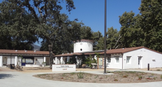
Located in Lang Ranch at the top of Westlake Boulevard near Avenida de los Arboles at 3290 Lang Ranch Parkway, Thousand Oaks, the Chumash Interpretative Center / Chumash Indian Museum contains Chumash artifacts and historical items, nature walks and tours of the beautiful local Oakbrook Regional Park area.  The museum is open Saturdays 10 am to 4 pm and Sundays from noon to 4 pm. Admission is $7 for adults, $5 for seniors 65+ and $5 for children under 12 (as of March 2023).

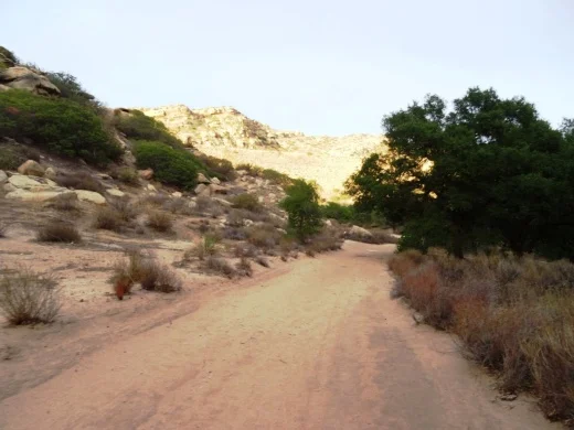
There is no charge to walk the trails in the park, which is open from sunrise to sunset daily. No dogs, except service animals, are allowed on museum grounds or trails.

OakbrookRegionalPark_sign.JPG

The Chumash Indian Museum is located on a historical Chumash village site and contains a large collection of Chumash artifacts.

ChumashIntCtr.jpg

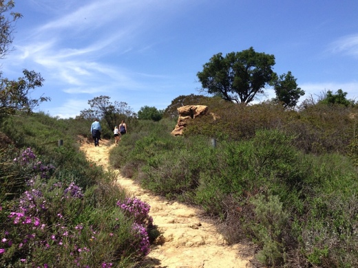
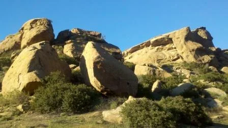
Stroll around the 436 acre Oakbrook Regional Park, a Ventura County historical landmark #90 (designated in 1983). More on Oakbrook Regional Park at www.crpd.org/park/oakbrook-regional-park.

Contact the Center for more information about these and other events, field trips, weddings and birthday parties at www.chumashmuseum.org or 805.492.8076.

To protect the wildlife, dogs are not allowed here.

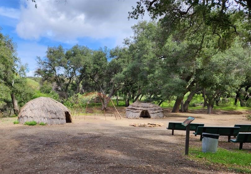
Examples of the Chumash Home - called an ‘ap (not to be confused with app). more on ‘aps at THIS LINK.

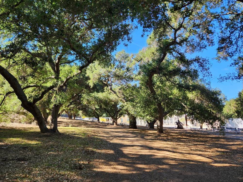
Beautiful canopied oak tree configuration at Oakbrook Regional Park, behind the Chumash Indian Museum.

Hunt Olive Tree - Historical Landmark in Thousand Oaks

When Richard Orville Hunt and his wife Mary Jane Hunt planted trees in their orchard on the Salto Ranch (currently Lynn Ranch) over 130 years ago, they probably never contemplated that one of their trees would be thriving next to the Sprouts Farmers Market (previously Circuit City) parking lot. 

Well, that's where this beautiful old timer is.  I'm not exactly sure why the Hunt Olive Tree was moved here from its prior home in 1993, but she looks like she is doing o.k.  This tree at 600 West Hillcrest was designated a Ventura County Historical Landmark #64 on January 25, 1982. It is also Historical Landmark #4 in the City of Thousand Oaks.

Richard Hunt served as postmaster of the Newbury Park Post Office (which at the time was located at his ranch) for 18 years, beginning in 1891.

So go pay homage to this lovely link to our local history en route to buying some fresh fruits, veggies and other health foods at Sprouts!

HuntOliveTree2.jpg
HuntOliveTree1.jpg

McGrath Family Farm in Camarillo

McGrathFarmhouse.jpg

McGrath Family Farm at 1012 West Ventura Blvd, Camarillo (take the Central Avenue offramp from the 101...McGrath is just south of the freeway) is a sustainable farm that grows organic fruits, vegetables and flowers for the local community.

The Store at McGrath Family Farm is open Tuesday through Sunday

We've been here numerous times over the years and I just love the fresh fruit and veggies available most of the year. You can find some nice locally grown gems here like heirloom tomatoes, strawberries, avocados and so much more.

And the kids always love visiting with the animals. For only $3 per person for a 15 minute visit, a McGrath staff lead you and the kids into the farm animal area behind the farm store. With some healthful treats for the goats, ducks, pigeons, geese and rabbit on hand, you'll have a lot of fun with these very friendly farm animals.

For more information, visit www.storeatmcgrath.com or call 805.983.0333.

McGrathProduce9.9.12.jpg
McGrath Farm Tours (as of September 2012)

McGrath Farm Tours (as of September 2012)

Feeding the animals at McGrath Family Farm.

Feeding the animals at McGrath Family Farm.

Charmlee Wilderness Park in Malibu

CharmleeSign.JPG

Charmlee Wilderness Park is a 532 acre park located at 2577 Encinal Canyon Road in Malibu, just 15 miles from the Conejo Valley. It is located within the Santa Monica Mountains. There are over eight miles of hiking trails, a nature center, picnic areas and more. Park hours are 8 a.m. to sunset and the nature center is open on weekends from 8 a.m. to 5 p.m. (or dark, whichever comes first). Parking is now free of charge.

Visit www.malibucity.org/561/Charmlee-Wilderness-Park for more information.

To get there from the Conejo Valley, take the 23 (Westlake Boulevard/Decker Canyon Road) toward the ocean and turn left on Lechusa Road. Continue on Encinal Canyon Road and look for the sign on the right.

Photos below courtesy of Suzy Demeter Photography.

Charmlee1.jpg
Charmlee3.jpg
Charmlee5.jpg
Charmlee6.jpg

Conejo Valley Botanic Garden - Thousand Oaks

CVBG_logo3.gif

The Conejo Valley Botanic Garden is a 33 acre retreat of hiking trails and natural habitat adjacent to Conejo Community Park off of Lynn Road and Gainsborough. 

CVBG now offers plant sales (weather permitting) every Sunday from 11:00 a.m. to 2:30 p.m. featuring California native and drought tolerant plants. Reasonable prices! Enter at the Kids' Adventure Garden entrance (400 W. Gainsborough Road).

This is really a special place to bring the kids for low key hike.  There are numerous trails and a short walk/hike to the top of the mountain rewards you with sweeping views of the entire Conejo Valley, from Westlake Village to Thousand Oaks to Newbury Park.

CVBotanicGarden.jpg
CVBotanic_Sign.jpg

Here is what you'll find at the CVBG:

  • The Nature Trail is 3/4 of a mile long and meanders above the creek through oaks and willows. This is a moderate trail.

  • The Little Loop Trail leads you above the creek, through chaparral and around a meadow.

  • The Native Plant Section and Lower Meadow feature southern and northern California plants.

  • Lillian's Meadow showcases perennials, shrubs and trees that thrive with minimal water.

  • The Salvia Garden delights hummingbirds and butterflies.

  • The Butterfly Garden is a safe haven that provides nectar and food sources for butterflies and caterpillars.

  • The Nursery houses workspace for the plant propagation team and hosts plant sales.

  • The Herb Garden exhibits an extensive and unusual collection of medicinal, kitchen and aromatic herbs.

  • The Bird Habitat has a fresh water source and is planted with native plants that provide year-round food source for birds.

  • The Australian Section features collection of plants from down under.

  • The Desert Garden hilltop landscape features cacti, succulents and desert trees and provides a panoramic view of the Conejo Valley.

  • The Rare Fruit Orchard holds an extensive collection of trees.

  • The Tranquility Garden is planted in the Japanese style featuring California native plants.

  • The Oak Tree Grove has many species of North American and other oak trees.

  • The Trail of Trees exhibits 50 trees with a variety of genera.

If you have small kids, they will love the Kids' Adventure Garden and treehouse, open on Sundays from 11 a.m. to 3 p.m.  They'll enjoy hiking through the trails and exploring the streams and bridges.

Conejo Valley Botanic Garden is located at 400 West Gainsborough Road, Thousand Oaks.  For more information visit www.conejogarden.org.

Desert Garden at the top of the hill, featuring cacti, succulents, etc.

Desert Garden at the top of the hill, featuring cacti, succulents, etc.

Japanese style Tranquility Garden featuring native California plants

Japanese style Tranquility Garden featuring native California plants

CVBG_bench.JPG
CVBG_cactus.JPG

Corriganville Park in Simi Valley

Corriganville3.JPG

Corriganville Park is a historical 206 acre park located at 7001 Smith Road in Simi Valley that is owned and operated by the Rancho Simi Recreation and Park District. The park has over four miles of hiking, biking and equestrian trails, sandstone cliffs, an oak forest, seasonal stream, shaded picnic areas, Camp Rotary Youth Campground, picnic shelter and more.

The park is named after Ray "Crash" Corrigan, a stuntman/actor who owned the park from 1937 to 1965, when over 3,500 movies, TV shows and commercials were filmed there. In 1949, the Corrigan Movie Ranch opened as a Western-style amusement park with a train ride and stagecoach ride that in the late 1950s had greater weekend attendance than Disneyland and Knott's Berry Farm.

Corriganville4.JPG

Bob Hope bought the property in 1965 and renamed it Hopetown, but filming stopped after a year. The ranch burned down in the 1970s and all that is left are the cement slabs and exterior rock walls of the barn. You've got to visit the Santa Susana Depot Museum around the corner from Corriganville and see the model of what Corriganville looked like in 1960, then visit the park to see the slabs and imagine what it was like back then.

There is an interpretative trail at Corriganville with 20 markers that provide information about the vegetation and surroundings as well as some of the history. Visit www.rsrpd.org/business_detail_T9_R53.php for a link to pdf brochures with information about the history and trails of the park. Or call 805.584.4400.

Corriganville1.jpg
Corriganville2.jpg

Anthony C. Beilenson Interagency Visitor Center in Calabasas

BeilensonCenter1.JPG

The Anthony C. Beilenson Interagency Visitor Center is located at King Gillette Ranch, 26800 Mulholland Highway, Calabasas. It opened to the public in June 2012.

BeilensonCenter2.JPG

The Visitor Center is jointly operated by the National Park Service, California State Parks, the Santa Monica Mountains Conservancy and the Mountains Recreation and Conservation Authority.

It features exhibits and interactive displays, the work of local artists, tours of sustainable features and a native plant garden. There is a tremendously comprehensive exhibit covering things to see and do within the Santa Monica Mountains.

The Visitor Center was formerly the horse stable for the Gillette Mansion. It retains some of its original design while achieving LEED Platinum certification as the first "net zero" visitor center in the National Park Service. Cool! (literally and figuratively)

Visitor Center staff and volunteers are very friendly and helpful.

There's also gift shop in the center with a variety of items including books, handmade items, kids' items and more.

Call 805-370-2301 or visit www.nps.gov/samo/planyourvisit/visitor-center.htm.

Open Wed though Sun, noon to 4pm. Closed Mon/Tues.

Nearby hiking is plentiful, including the Inspiration Point hike at King Gillette Ranch and across the street at Malibu Creek State Park.

BeilensonCenter4.JPG

Lake Casitas Recreation Area in Ventura

The Lake Casitas Recreation Area is operated by the Casitas Municipal Water District, which supplied water to 70,000 people and hundreds of farms in western Ventura County, encompassing Ojai, the Ventura River Valley area, the city of Ventura to Mills Road, the Rincon and beach area to the ocean and the Santa Barbara County line.

Lake Casitas is a reservoir that was completed in 1959, with a capacity of 254,000 acre feet. The lake was used for canoeing and rowing events for the 1984 Summer Olympics. While swimming is not allowed in the lake because it is a water supply, boating, canoeing, kayaking and fishing is indeed allowed here.

There are a lot of fun things to do in the Lake Casitas Recreation Area:

Day use hours are 6 am to 7:30 pm daily. $10 entry fee for vehicles during off season (Labor Day to Easter) and $20 on weekends during “on” season (Easter to Labor Day). Or you can be a cheapskate like me and park on Santa Ana Road and walk in. Location is 11311 Santa Ana Road, Ventura. For more information, visit www.casitaswater.org/recreation or call 805-649-2233.

Front entry to Lake Casitas Recreation Area in the summer of 2022.

Sapwi Bike Park in Thousand Oaks

Beginners’ pump track at Sapwi Trails Community Park.

Beginners’ pump track at Sapwi Trails Community Park.

The Sapwi Bike Park project is a partnership between the Concerned Off-Road Bicyclists Association (CORBA) and Conejo Recreation and Park District (CRPD). The park is a free, public recreational bicycle skills park facility located in the heart of beautiful Sapwi Trails Community Park in Thousand Oaks.

The park also features several miles of multi-use trails, natural habitat preservation, and other activities such as disc golf, cross-country running, and a non-motorized glider flying area.

The Sapwi Trails Bike Park offers a wide range of trails and features to challenge all ages and skill levels. In addition to a pump track, the park features progressive drop and jump lines – varying in difficulty from beginner to advanced. Outside of the dedicated bike park area, there are several trail side feature areas and a hard-surface beginner level pump track.

This 145 acre Sapwi Trails Community Park is located in the open space between Erbes Road (at Scenicpark Street) on the west and Westlake Boulevard east, with Avenida de los Arboles on the north. There are three parking lots off of Erbes, Arboles and Westlake Boulevard.

Learn more about the Sapwi Bike Park at sapwibikepark.com.

sapwi sign.JPG

Western Plateau Trail Loop Hike From Newbury Park

If you're looking for a trail a bit off the beaten path, check out the Western Plateau Loop from Conejo Center Drive in Newbury Park.

The trailhead for this hike is adjacent to the City of Thousand Oaks Household Hazardous Waste Facility at 2010 Conejo Center Drive, Newbury Park. You can park in the dirt lot next to the trailhead and head on your way.

The trailhead on Conejo Center Drive.

The trailhead on Conejo Center Drive.

It is mostly downhill over the first half mile or so of this 5 mile round-trip hike until you get to the Hawk Canyon Trail turnoff.

It is mostly downhill over the first half mile or so of this 5 mile round-trip hike until you get to the Hawk Canyon Trail turnoff.

You can either go straight from here and do a clockwise loop via the Western Plateau Trail or you can turn right on Hawk Canyon, which is a direct route to the Conejo Canyons Bridge.

Hawk Canyon Trail is a fairly narrow, mostly single-track trail.

Hawk Canyon Trail is a fairly narrow, mostly single-track trail.

The Hawk Canyon Trail is a fun, narrow trail surrounding by trees and other vegetation, like you're in the middle of nowhere. There's an old car in a crevice as you approach the Conejo Canyons towards Santa Rosa Valley.

Odd to see this old car out in the middle of nowhere. steep embankment makes it somewhat challenging reaching it.

Odd to see this old car out in the middle of nowhere. steep embankment makes it somewhat challenging reaching it.

Bring a snack and sit at a picnic table in the middle of what feels to be nowhere. Then either head back the way you came or find your way to the Western Plateau Trail and loop back counter-clockwise back towards where you parked.

See the Conejo Open Space Foundation's map of this trail at cosf.org/trails/conejo-canyons/conejo-canyons-moderate-hike-western-plateau-loop-from-conejo-center-dr

It can get a bit overgrown in the spring as seen here on the Hawk Canyon Trail but quite beautiful nonetheless!

It can get a bit overgrown in the spring as seen here on the Hawk Canyon Trail but quite beautiful nonetheless!

National Park Service Visitor Center in Thousand Oaks (Moved to Calabasas in 2012)

IN JUNE 2012, THE NATIONAL PARK SERVICE VISITOR CENTER MOVED TO THE ANTHONY C. BEILENSON VISITOR CENTER IN CALABASAS. CLICK THIS LINK FOR MORE INFORMATION

The National Park Service Visitor Center, located at 401 West Hillcrest Drive in Thousand Oaks, is an outstanding place to learn more about the Santa Monica Mountains National Recreation Area (SSMNRA). SSMNRA is over 154,000 square acres, which makes it the largest urban national park in the United States.

The National Park Service controls 21,500 of those acres and the best place to learn more about the SMM is this Visitor Center! There is always has someone on duty to answer questions about trails, maps, habitat, plants, hiking, camping, etc. Additionally, the Center has informational displays, maps and brochures, books and educational items for the kids for sale.

Visit the NPS website at www.nps.gov/samo for more information or call the Center at 805.370.2301.

Mugu Peak in Point Mugu State Park

The 1,266 foot elevation Mugu Peak is at the western edge of the Santa Monica Mountains, in Point Mugu State Park. The peak provides views stretching from the Malibu Lagoon/Naval Base Ventura County and Channel Islands on the west, Thornhill Broome Beach on the east, La Jolla Valley on the north and more.

There are multiple ways of getting to the peak. The most direct (and albeit steepest) ascent is via the Chumash Trail, accessible across from the Naval Base shooting range (yes, sometimes you will hear rounds). The Chumash Trail is accessible off of PCH at this link. Look for the left turn into a small dirt parking area that has space for perhaps 15 or so cars.

The 7/10ths of a mile hike up the Chumash Trail is pretty brutal, but I've seen all shapes, sizes and ages making it up at varying paces.

Turn left after reaching the top of the Chumash Trail. Veering left continues the Chumash Trail towards La Jolla Valley. Veer right up the really steep hill for the most direct route to Mugu Peak.

Turn left after reaching the top of the Chumash Trail. Veering left continues the Chumash Trail towards La Jolla Valley. Veer right up the really steep hill for the most direct route to Mugu Peak.

The initial Mugu Peak Trail section is quite steep, then you plateau, then the remainder is more moderate, seen above.

The initial Mugu Peak Trail section is quite steep, then you plateau, then the remainder is more moderate, seen above.

The Mugu Lagoon within Naval Base Ventura County is a colorful sight from throughout the hike and at the top of Mugu Peak.

The Mugu Lagoon within Naval Base Ventura County is a colorful sight from throughout the hike and at the top of Mugu Peak.

Looking northwest from Mugu Peak you will see the the 1,421 foot Laguna Peak, which contains a Naval satellite tracking station.

Looking northwest from Mugu Peak you will see the the 1,421 foot Laguna Peak, which contains a Naval satellite tracking station.

Views southeast with Thornhill Broome Beach in the background.

Views southeast with Thornhill Broome Beach in the background.

So you've reached the top of Mugu Peak, enjoyed the panoramic views, saluted the flag on display, checked out the toolbox under the flag with logbooks and other items, the next choice is, do you go back the way you came or do you take another route? If you head back the direction you came, the title mileage of the hike is about 2 1/2 miles of mostly steep up/downhills.

Well, if you continue in the direction of Thornhill Broome Beach (southeast), you can continue on the Mugu Peak Trail, which is several miles traversing around the southern, then western sections of Mugu Peak. This is my preferred approach as the footing is much easier and your total mileage is roughly 4 miles. Plus, you are treated to additional views that are just beautiful.

Map snippet courtesy of California State Parks.

Map snippet courtesy of California State Parks.

Another view of Thornhill Broome Beach and the large sand dune across PCH from the southeastern edge of the Mugu Peak Trail.

Another view of Thornhill Broome Beach and the large sand dune across PCH from the southeastern edge of the Mugu Peak Trail.

You can also get to Mugu Peak from the La Jolla Canyon Loop Trail.

Westlake Lake in Westlake Village

Westlake Lake is a 125 acre lake with 8 miles of shoreline in Westlake Village. Over 1,300 homes are located on the lake or are within access of it. It is a man-made lake that was completed in 1969 at a cost of $3.5 million.  A number of homes are located on an island in the lake that is connected by La Venta Drive.

View of Westlake Lake from southwest side on Triunfo Canyon Road. The Landing is on the left side.

View of Westlake Lake from southwest side on Triunfo Canyon Road. The Landing is on the left side.

While Westlake Lake is a private lake maintained for Westlake Village residents by the Westlake Lake Management Association, you can still enjoy its beauty in many ways. Running, cycling and walking around the lake via Triunfo Canyon and other adjacent streets is quite popular. Or visit The Landing (32129 Lindero Canyon) on the southwest side of the lake to enjoy a meal at one of several lakefront restaurants such as Boccacio's, Zin Bistro Americana and The Landing Grill and Sushi Bar, all with indoor/outdoor dining. Or just stroll around, taking in the sweeping views and serenity.

View from the southwest side of the Lake while cycling on Lindero Canyon Road.

The lake is stocked with bass but fishing and boating is restricted to Westlake Village residents with guests and permits. So if you don't live there, start making some Westlake Village friends!