California's Low Cost Auto Insurance Program Provides Affordable Insurance for Those Eligible

Auto insurance is a requirement if you have a valid driver's license and drive a vehicle in the state of California. The California Low Cost Auto (CLCA) Insurance program is a state-sponsored program that makes auto insurance more affordable to those meeting eligibility requirements.

To qualify, you must 1) have a valid California driver's license; 2) own a vehicle valued at $25,000 or less; 3) meet income eligibility guidelines; and 4) be at least 16 (under 18 must be legally emancipated) or older.

Maximum income requirements are based on the size of your household. As of 2024, that maximum is $37,650 for a household size of 1, increasing by $13,450 for each additional household member (e.g. household of 4 maximum income is $78,000.

Annual premiums vary by county. If you live in Ventura County, have been licensed continuously for 3 years and are not a 19-24 years of age and unmarried, your annual premium is $275 ($358 if you are an unmarried 19-24 year old).

While the premiums are great, the coverage is very limited. A basic policy includes only up to $10,000 per person and up to $20,000 per accident for bodily injury or death and up to $3,000 for property damage. Comprehensive and collision is not included in these policies (they would have to be purchased separately).

Learn more and sign up at www.mylowcostauto.com.

Ventura County Historical Landmarks at the Strathearn Historical Park in Simi Valley

Located at 137 Strathearn Place, Simi Valley, the six acre Strathearn Historical Park and Museum site contains no less than six designated Ventura County Historical Landmarks.

Originally from Scotland, the Strathearn Family purchased 15,000 acres of old Spanish Rancho from Simi Land and Water Co. around 1890.

The Simi Adobe/Strathearn House is Ventura County Historical Landmark No. 6, State Landmark No. 979 and is also listed on the National Register of Historic Places.  The Simi Adobe was originally built by Santiago Pico, original grantee of El Rancho Simi, in 1810. The Adobe was considered an important link between the San Fernando and Ventura missions.

The Strathearn House (built in 1892-3) includes the Simi Adobe (built in 1810)

After buying the property, the Strathearns built their nine-room Victorian-style farmhouse and kept two usable rooms of the adobe that were used as a dining room and kitchen. The Strathearn family occupied the house until 1968.

Built in 1930, the original Simi Library was located on Third Street near Los Angeles Avenue. Members of the community raised funds to purchase land and asked the Ventura County Library System to build this first purpose-built branch library in the county. It operated until 1962, when a new library opened on Church Street in the Community Center. The Simi Library briefly served as the first Simi Valley Museum until Strathearn Historical Park opened in 1969. The Library was designated Ventura County Historical Landmark No. 40 in May 1978. (More recently, in the Simi Valley Public Library became a separate municipal public library on July 1, 2013.)

The Haigh/Talley Colony House was designated Ventura County Historical Landmark No. 41 in May 1978 and was named to the National Register of Historic Places that same year. It is one of 12 pre-cut, partially assembled two-story homes shipped by rail in 1888 to the townsite of "Simiopolis" (this was just for six months; it was later

Read More

Highlights of a Dozen Fun Things to See and Do In and Around Camarillo

Residents voted to incorporate Camarillo as a city on September 29, 1964 (the same day that Thousand Oaks residents voted to do the same). Today Camarillo has the 5th largest population out of 10 cities in Ventura County, with about 71,000 residents.

One neat feature of Camarillo is its revitalized Old Town on Ventura Boulevard, a one mile stretch adjacent to Highway 101 between Lewis Road and Carmen Drive. There is a mixture of eateries, galleries, salons, boutiques and shopping along the pedestrian friendly thoroughfare that has transformed the area. Parking is free. More at www.facebook.com/camarillooldtown.

Here are a dozen other fun things to explore, see and do in Camarillo:

The roughly 2 mile Calleguas Creek Bike Path from Pleasant Valley Fields to the corner of Flynn and Upland Road in Camarillo is a family favorite, providing 4 miles of bicycling round-trip. The path is adjacent to Calleguas Creek with several street underpasses, keeping the path completely free of vehicular traffic.

Calleugas Creek Bike Path

Calleugas Creek Bike Path

McGrath Family Farm off the Central Avenue 101 offramp grows organic fruits, vegetables and flowers and is open 7 days a week from spring through fall. McGrath also offers farm tours, visits with the farm animals and "pick your own" produce. A quick, healthy and fun stop with the kids.

McGrathProduce9.9.12.jpg
CAF170.jpg

The Commemorative Air Force Southern California Wing Aviation Museum is open Friday through Sunday at the Camarillo Airport with hangars devoted to preserving, displaying and flying World War II aircraft. Docents are extremely knowledgeable and eager to share information.  This is a Camarillo must-see.

Also at the Camarillo Airport is the annual Wings Over Camarillo Air Show in the August time frame. This is a weekend display of restored World War II military aircraft in flight, aerobatic, vintage and experimental aircraft displays, classic cars and plenty of family fun. This is one event in Camarillo that you have to see up close at least once. Visit wingsovercamarillo.com for more information.

The Camarillo Ranch House is a 3-story, 14 room, 6,000 square foot Victorian home built by Adolfo Camarillo in 1892. The City restored the beautiful home to what it looked like during the 1914 to 1930 time frame. Today the house is a popular event venue and is open for docent-led tours several days a week. The Camarillo Ranch was added to the National Register of Historic Places in 2003.

The Camarillo Ranch House is a popular wedding and other special events destination.

The Camarillo Ranch House is a popular wedding and other special events destination.

I'm amazed at how few of the people I talk to have heard of the Western Foundation of Vertebrate Zoology, more popularly known as the Camarillo Bird Museum. The 22,000 sq ft non-descript facility in an industrial office park hosts a collection of over 250,000 sets of bird eggs representing approximately 4,000 species; 18,000 nests and 56,000 bird study skins. The Museum is open to the public for one-hour tours on Wednesdays and Fridays from 10am to 2pm.

CamBirdMuseumLR.jpg
CamPremOutlets170.jpg

The Camarillo Premium Outlets is Ventura County's premiere outlet mall, featuring over 160 shops and eateries. On the east side are the original outlets, including the Main Court and Fashion Court, while on the west is the newer The Promenade section. In between is the Edwards Camarillo Palace 12.

Harley's Camarillo Bowl is the go-to spot for most kids that I know in the Conejo Valley who throw bowling birthday parties. I know because when the kids go bowling, I make sure to join them. Harley's gets the job done with 20 lanes, a small arcade, and a bar that serves up cold beer.

There are dozens of great farmers' markets around Ventura County, including the Saturday morning Camarillo Certified Farmers Market in Old Town Camarillo from 8am to noon.

There are a number of nicely appointed parks of all shapes and sizes in Camarillo, including six larger parks. One of my favorites is the hidden away Camarillo Grove Park at the bottom of the Conejo Grade, 6968 E. Camarillo Springs Road. This 24.5 acre park offers hiking trails, a dog park, outdoor nature center and more.

A trail at Camarillo Grove Park

A trail at Camarillo Grove Park

The Pleasant Valley Historical Museum is dedicated to the preservation of local history and the adjoining Charles L. Honn Botanical Garden features plants and trees indigenous to the Pleasant Valley and the surrounding region. Both are fun, short, worthwhile visits, which is good because the Museum and Garden are only open from noon to 4:00 p.m. on Saturday and Sunday, except holidays. Admission is free. (MUSEUM IS UNDERGOING EXPANSION AND IS STILL CLOSED AS OF JUNE 2024. Check their website for updates at pvhsonline.org.

Areas in the Santa Monica Mountains Recreation Area Allowing Dogs on Leash

Pooch on leash

Pooch on leash

The Santa Monica Mountains National Recreation Area is the largest urban national park in the United States at over 150,000 acres, extending from the Hollywood Bowl on the east to Point Mugu at its western end; including the beaches of Santa Monica and Malibu as well as the canyons and peaks extending north to Simi Valley.

Dogs are allowed in a number of areas within the Santa Monica Mountains, as long as they are on leashes that are no more than 6 feet in length. Here is a listing of areas where dogs are allowed:

National Park Service: Arroyo Sequit (has been closed since the Woolsey Fire in 2018), Castro Crest, Cheeseboro/Palo Comado Canyons, Circle X Ranch, Deer Creek Canyon, Paramount Ranch, Peter Strauss Ranch, Rancho Sierra Vista/Satwiwa, Rocky Oaks, Solstice Canyon and Zuma/Trancas Canyons

Santa Monica Mountains Conservancy: Calabasas Peak, Dixie Canyon, Escondido Canyon, Franklin Canyon, Fryman Canyon, Marvin Braude Mulholland Gateway Park, Red Rock Canyon Park, San Vicente Mountain Park, Temescal Gateway Park, Wilacre Park

City of Malibu: Charmlee Wilderness Park, Malibu Bluffs

California State Parks: Pets are NOT allowed on backcountry trails of Topanga, Malibu Creek, Leo Carrillo and Point Mugu State Park, including the Boney Mountain Wilderness.

Canines are not allowed in the backcountry trails of Point Mugu State Park, including the Boney Mountain Wilderness.

Canines are not allowed in the backcountry trails of Point Mugu State Park, including the Boney Mountain Wilderness.

Dogs on leash are allowed at County Line Beach, Leo Carrillo State Park (on beach north of lifeguard tower 3 and campground only), Point Mugu State Park (on beach and campground only in Sycamore Cove and Thornhill Broome Beach), Will Rogers State Historic Park (day-use areas and loop road only)

L.A. City Recreation and Park District: Coldwater Canyon Park, Laurel Canyon Park, Runyon Canyon Park, Temescal Canyon Park

While you're out on the trails with your pooch, remember to pick up after your dog and bring plenty of water and food for you and Fido.

For more information, visit the Anthony C. Beilenson Interagency Visitor Center in Calabasas or www.nps.gov/samo.

Outside of the Santa Monica Mountains, trails in the Conejo Valley, Simi Hills and other local area locations are generally dog-friendly as long as your furry friend is on a leash. 

Dozens and dozens and dozens of local area trails and hikes

DOG PARKS IN AND AROUND VENTURA COUNTY

VISITING STATE PARKS WITH YOUR DOG

Compilation of Great Trails and Hikes In and Around Ventura County

TrailSign1.JPG

Looking for a good hike around Ventura County and nearby areas? We've highlighted a number of our favorite hikes in the Do Something section of Conejo Valley Guide.

HIKE TO A CONEJO VALLEY BENCH WITH A VIEW

HIKE TO AUTOMOTIVE RELICS IN THE CONEJO VALLEY OPEN SPACE

SEVEN FLAT, STROLLER FRIENDLY TRAILS IN THE CONEJO VALLEY

DOG-FRIENDLY TRAILS IN THE SANTA MONICA MOUNTAINS

Reminder: Please refrain from using the trails during rain events and afterwards, until they have dried. Doing otherwise causes damage to the trails.

Lone Oak at Rancho Sierra Vista/Satwiwa

Lone Oak at Rancho Sierra Vista/Satwiwa

Rancho Sierra Vista/Satwiwa in Newbury Park

Fossil Trail Loop in the Boney Mountain Wilderness

Oakbrook Vista Trail in Thousand Oaks

Rancho Potrero Open Space in Newbury Park

Wildwood Park in Thousand Oaks

Lynnmere Trail in Thousand Oaks (south of Wildwood Park)

Conejo Canyons Open Space (Western Plateau)

Tarantula Hill Hike in Thousand Oaks

Arroyo Conejo Trail in Thousand Oaks

Sunset Hills Trail in Thousand Oaks

Conejo Ridge Open Space in Thousand Oaks

North Ranch Open Space in Thousand Oaks/Westlake Village

Wishbone Trail in the North Ranch Open Space - Westlake Village

Hillcrest Open Space Preserve in Thousand Oaks

Powerline Trail in Newbury Park to Conejo Mountain

Lake Eleanor Open Space Hike in Westlake Village

Conejo Valley Botanic Garden in Thousand Oaks

Triunfo Creek Park in Westlake Village

Potrero Ridge Trail in Newbury Park

Marview Drive Trail in Thousand Oaks

Pentachaeta Trail and Westlake Vista Trail in Westlake Village

Rabbit Hill (Knoll Open Space) in Newbury Park

Hike to the Cross in the Hills Above Cal Lutheran in Thousand Oaks

Lynnmere Open Space views to the west.

Lynnmere Open Space views to the west.

Views from the Ray Miller Trail in Malibu.

Danielson Road trail in the Boney Mountain Wilderness.

Danielson Road trail in the Boney Mountain Wilderness.

Views of Simi Valley from the peak of Mt. McCoy in Simi Valley.

Views of Simi Valley from the peak of Mt. McCoy in Simi Valley.

Sunset Hills Trail in Thousand Oaks.

Sunset Hills Trail in Thousand Oaks.

Tree encampment along Los Padres Trail in Thousand Oaks.

Tree encampment along Los Padres Trail in Thousand Oaks.

Oakbrook Regional Park Archaeological Area in Thousand Oaks is City Historical Landmark #5

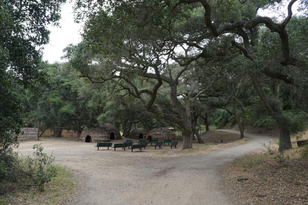
Oakbrook Regional Park Archaeological Area is located at 3290 Lang Ranch Parkway in Thousand Oaks, south of the intersection of Avenida de los Arboles and Westlake Boulevard.

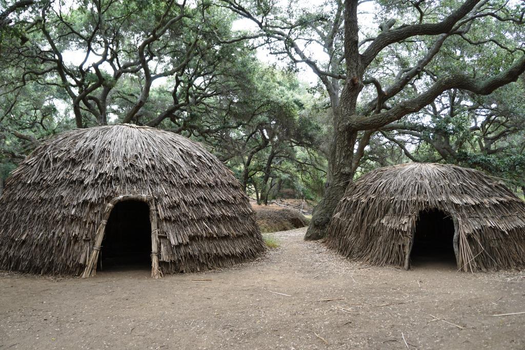
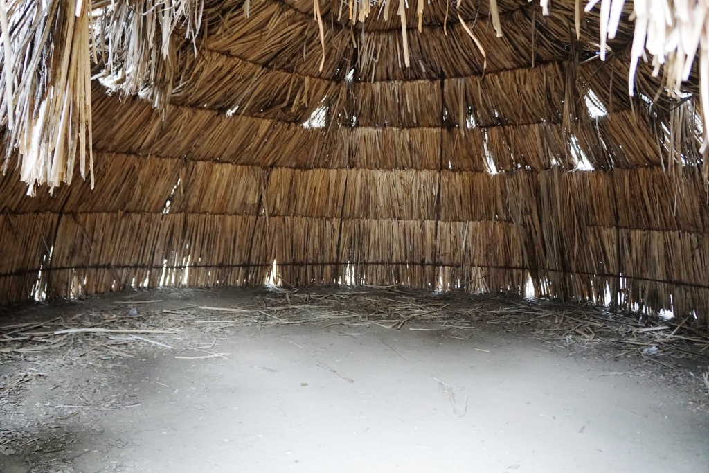
This 428 acre park is a designated historical landmark by the City of Thousand Oaks and County of Ventura. The Chumash inhabited this area going back as far as 12,000 years ago through the late 1800's. 

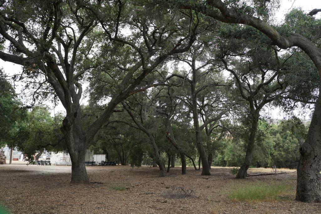
The park grounds are open to the public daily from 7 a.m. to 10 p.m.  There are flat hiking trails and a Chumash village reproduction available to explore. The oak trees provide a beautiful canopy for hikers. It is a peaceful place worth exploring. Note that dogs are prohibited from the property.

Located on the property is the Chumash Indian Museum, which contains a large collection of Chumash artifacts. The museum is open on Saturdays and Sundays from 10 a.m. to 4 p.m.

More information on Oakbrook Regional Park at www.crpd.org/park/oakbrook-regional-park.

Palo Comado Canyon Trail in Agoura Hills

Palo Comado Canyon is located adjacent to Cheeseboro Canyon in the National Park Service maintained Santa Monica Mountains in Agoura. Palo Comado is part of the 2,308 acre Jordan Ranch owned by comedian Bob Hope that was acquired for $16.7 million in 1993.

The Palo Comado Canyon Trail stretches from the Modelo Trail in Cheeseboro Canyon on the south to the China Flat area in Oak Park to the north, about six miles one way.

View of the Cheeseboro Canyon trailhead and parking are from the Modelo Spur Trail.

View of the Cheeseboro Canyon trailhead and parking are from the Modelo Spur Trail.

There are stretches of the trail that are flat, wide and good for family hikes and outings. This section of the trail is primarily in the area accessible via the Smoketree Avenue (east of Conifer St in Oak Park) and Doubletree Road (east of Clear Haven Dr in Oak Park) residential connectors.

The Palo Comado Trail on the south end connects with the Cheeseboro Canyon Trail in addition to the moderately steep Modelo Trail.

From the main Cheeseboro Canyon Trail, this juncture leads you to the south entry point to the Palo Comado Trail.

From the main Cheeseboro Canyon Trail, this juncture leads you to the south entry point to the Palo Comado Trail.

The Modelo Trail on the south end of the Palo Comado Canyon Trail is a bit steep, with awesome views.

The Modelo Trail on the south end of the Palo Comado Canyon Trail is a bit steep, with awesome views.

The southern section of the Palo Comado Trail has rolling hills with some beautiful views, but is a bit on steep side. The northern section of the trail, about a mile or so above the Doubletree trailhead, is also a moderately grueling climb, from 1,200 feet to 2,140 feet elevation at the China Flat area. In my personal experiences on these sections of the trail, mountain bikers are the vast majority. But don't let that stop you if you're up for a long, mostly quiet, hike!

The southern end of the Palo Comado Trail has rolling, moderately steep hills.

The southern end of the Palo Comado Trail has rolling, moderately steep hills.

Learn more about Cheeseboro/Palo Comado Canyon are at THIS LINK.