Guide to Finding Family Friendly Bike Paths In and Around Ventura County

As a casual cyclist with young kids I usually steer clear of riding on busy streets, particularly those that don't have any type of bike lane on them. Thankfully there are nearly 80 miles of bikeways in Thousand Oaks, including 3 miles of bike paths, 20 miles of bike lanes and 54 miles of marked bike routes.  

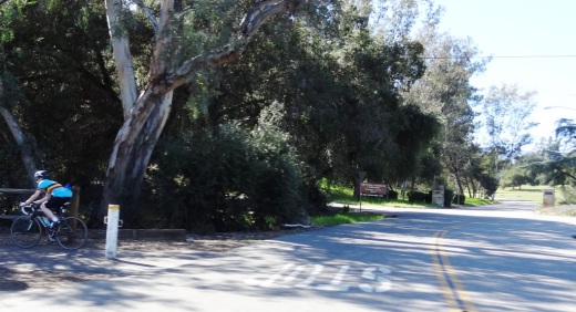
Bike routes are shared with vehicles

Bike routes are shared with vehicles

Class I Bike Paths are separate from auto traffic and thus are great for family friendly cycling. Class II Bike Lanes are striped, painted and shared lanes adjacent to automobile lanes. Class III Bike Routes are marked by green signs that signify sharing with autos.

We also love taking our bikes to other places in and around Ventura County to enjoy other sights and surroundings. So how about if we highlight Class I Bike Paths throughout Ventura County, stretching from Thousand Oaks to Ventura.

Conejo Valley

The Conejo Creek Bike Path is a 1.2 mile path in the heart of Thousand Oaks that connects Gainsborough Road on the south to Conejo Creek Park and the Thousand Oaks Library. This is a nice, flat path, good for kids.

Another access point to the Conejo Creek Bike Path on La Granada Drive.

Another access point to the Conejo Creek Bike Path on La Granada Drive.

There is another Thousand Oaks bike path, the .5 mile Greenmeadow Drive connector bike path accessible on the west at Greenmeadow and Yellowstone, on the south side of Los Robles Greens. This is not a particularly interesting path but it does enable cyclists and walkers a path around the golf course to the Los Robles trailhead and Moorpark Road from Newbury Park. A bit hilly, too.

Entrance to Greenmeadow Avenue connector bike path in Thousand Oaks

Entrance to Greenmeadow Avenue connector bike path in Thousand Oaks

There is also the .8 mile bike path on the north side of The Oaks mall as well as the .5 mile Read Road Connector path accessible off of Olsen Road just east of the 23 freeway.

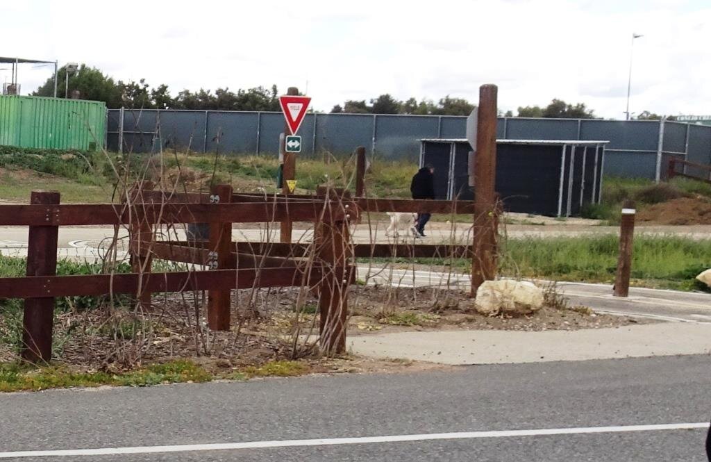
Sign at the Read Road connector path on Olsen Road east of 23 Freeway.

Sign at the Read Road connector path on Olsen Road east of 23 Freeway.

Medea Creek Natural Park has hiking, biking and fitness trails that stretch from Calle Rio Vista and Oaks Hills Drive in Oak Park on the north, then south past Medea Creek Lane and Conifer Street to a cul de sac entrance to the park at the west terminus of Tamarind Street. About a mile to mile and a half of paths, including paved and dirt paths.

Nicely paved path at Medea Creek Natural Park in Oak Park

Nicely paved path at Medea Creek Natural Park in Oak Park

Ventura

My personal favorite bike path in Ventura County is the Omer Rains Trail that runs the entire length of San Buenaventura State Beach.

Senator Omer Rains Ventura Oceanfront Bikeway Sign on Main Street next to Ventura Beach RV Resort

Senator Omer Rains Ventura Oceanfront Bikeway Sign on Main Street next to Ventura Beach RV Resort

We park the car at Marina Park in Ventura and ride a short distance north on Pierpont Blvd to the bike path entrance. This oceanfront path takes you past the Ventura Pier, through the Promenade area, adjacent to the Ventura County Fairgrounds, Emma Wood State Beach and beyond. Or you can get to the path from anywhere along the Ventura Promenade area.

Bike path along San Buenaventura State Beach.

Bike path along San Buenaventura State Beach.

Omer Rains Bike Path near Ventura Beach RV Resort on Main St.

Omer Rains Bike Path near Ventura Beach RV Resort on Main St.

Nice, newer paved section of Ventura beachfront bike path near Surfers Point.

Nice, newer paved section of Ventura beachfront bike path near Surfers Point.

The Ventura River Trail is a 6.3 mile asphalt pedestrian and bike path that follows the old Southern Pacific Railroad right-of-way from Main Street in Ventura to Foster Park inland towards Ojai. You can easily connect from the Omer Rains Trail to the Ventura River Trail up to the Ojai Valley Trail for quite a long, nearly automobile-free ride.

The Ventura Harbor Bike Path takes you 1.2 miles from Market St and Arundell Ave in midtown Ventura southwest through farmland to E. Harbor Boulevard and Schooner Drive, near Four Points by Sheraton.

Bike path from midtown Ventura to the Harbor is not the most exciting path but it is a convenient way to ride to Ventura Harbor, Marina Park and adjacent areas.

Bike path from midtown Ventura to the Harbor is not the most exciting path but it is a convenient way to ride to Ventura Harbor, Marina Park and adjacent areas.

The La Conchita Bike Path between Rincon Point at the Ventura/Santa Barbara County Line adjacent to Highway 101 past La Conchita to Mobil Pier Road in Ventura was completed in September 2014. This path has leapfrogged into my own personal favorite in Ventura County because of its spectacular beach views. This is about 4 miles of bike path in the Oil Piers Beach to Mussel Shoals to La Conchita Beach to Rincon Point beach areas.

Bike paths rarely get better than this stretch along the southbound 101 and the Pacific Ocean in Ventura.

Bike paths rarely get better than this stretch along the southbound 101 and the Pacific Ocean in Ventura.

There's another short stretch of bike path at the east end of Navigator Drive that goes west, then south, around the Ventura West Marina.

Entrance to short bike path adjacent to Ventura West Marina.

Entrance to short bike path adjacent to Ventura West Marina.

There is a two mile biking and hiking on the east side of the lake at the Lake Casitas Recreation Area, 11311 Santa Ana Road, Ventura. The path starts at picnic area #1 and follows the east shoreline of the lake for a four mile round trip ride. The path is paved in the recreational area and becomes a dirt road outside of that. More information at www.casitaswater.org/recreation/amenities/bike-trail.

Ojai

The Ojai Valley Trail is a 9 to 10 mile trail that parallels Highway 33 from Foster Park on the outskirts of west Ventura, to Soule Park in Ojai. It connects to the Ventura River Trail.

The Ojai Trail runs parallel to Ventura Ave/Ojai Ave.

The Ojai Trail runs parallel to Ventura Ave/Ojai Ave.

Simi Valley

The Arroyo Simi Bike Path is a two lane bike path in Simi Valley that runs from Madera Road, just south of Easy Street on the west, ending at Tapo Street on the east. Over seven miles.

Arroyo Simi Bike Path/Trail in Simi Valley.

Arroyo Simi Bike Path/Trail in Simi Valley.

Camarillo

We enjoy the newer, flat roughly 2 mile Calleguas Creek bike path from Pleasant Valley Fields up to the corner of Flynn and Upland Roads in Camarillo. Quick access from the Conejo Valley and a nice, relatively easy path good for all ages.

Look at how nice and flat this bike path adjacent to Calleguas Creek is!

Look at how nice and flat this bike path adjacent to Calleguas Creek is!

Other Areas

There's an online bike map available on the Ventura County Transportation Commission website at www.goventura.org where you can find other Class I, II and II bike paths around the county. Here are some of them.

The Santa Paula Bike Trail takes you roughly 3 miles on the east near W. Main St and Peck Rd to (roughly) Dike Road on the west

The Fillmore Bike Path runs from south of Highway 126 (Telegraph Road) up past Shiell Park.

In Moorpark there's a .5 mile path at Country Trail Park, around the neighborhood to the west, back to Mountain Trail Street.

There's a bike path that starts at the ocean side of Oxnard Beach Park and takes you south all the way to Hollywood Beach and Channel Islands Harbor. Cross Harbor Boulevard and make your way into Channel Islands Harbor, where you can ride all the way to the south end of the harbor.

Bike path near Oxnard Beach Park and Channel Islands Harbor.

Bike path near Oxnard Beach Park and Channel Islands Harbor.

In Port Hueneme there's a bike path that starts off of Bard Rd, west of South J St, through Richard Bard Running Springs Park and takes you southwest all the way to Hueneme Beach.

If you're willing to venture a bit further away from Ventura County, the Marvin Braude Coastal Bike Path stretches over 20 miles, from Will Rogers State Park in Pacific Palisades to Torrance. Flat, adjacent to the ocean, and so many things to do along the way!

Marvin Braude Coastal Bike Path in Pacific Palisades

Marvin Braude Coastal Bike Path in Pacific Palisades

That should be enough to get you started! Looking for local cycling clubs? Find some of them at this link.

Ventura County Area Crime Maps Online

The Ventura County Sheriff's Office serves the County of Ventura and five contract cities of Camarillo, Fillmore, Moorpark, Ojai, and Thousand Oaks. There is a wealth of information on the VC Sheriff's website at www.venturasheriff.org, including phone numbers for patrol stations.

One tool available that shows recent crimes in these jurisdictions is located at CrimeMapping.com, a website that provides information, in map format about crimes committed on a rolling 180 day basis.

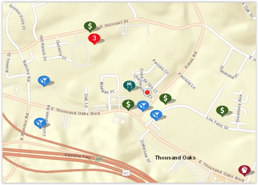
To use CrimeMapping.com, simply go to the site and type in a location - address, landmark or zip code. From there, you’ll see a map of crimes reported over the most recent week, which is the default time frame. You can change this time frame using filters on the site, up to 180 days’ worth of data. Here’s what the map looked like over a 180 day period:

crimemapping map.JPG

You can learn more about individual crimes by clicking the icons on the map. Crimes include arson, assault, burglary, disturbing the peace, drug/alcohol violations, DUI, fraud, homicide, auto theft, robbery, sex crimes, theft/larceny, vandalism, vehicle break-in and weapons.

The number 3 in a red circle in the image above indicates multiple records. I clicked it and there were 2 possession of a controlled substance - one in the 300 block of Hillcrest Drive on July 17th at 1:30pm and the other in the 2400 block of Hillcrest Drive on July 17th at 12:30pm. The third violation was fraudulent use of access card on April 1st at midnight.. Note that exact addresses are not provided; they report as specific as block number.

The first icon at the bottom right side of the image was an assault (battery) in the 2200 block of E. Thousand Oaks Boulevard at 10:05am on August 7th.

You may also create alerts on the CrimeMapping site that are sent to you via email. Click “Receive Alerts,” choose location (city, landmark, address or zip) and search distance (ranges from 500 feet to 2 miles).

Over 40 Things to Do in Malibu

This "27 Miles of Scenic Beauty" sign was swapped out for "21 Miles of Scenic Beauty" sign in April 2017 in order to correct the actual length of City of Malibu coastline.

This "27 Miles of Scenic Beauty" sign was swapped out for "21 Miles of Scenic Beauty" sign in April 2017 in order to correct the actual length of City of Malibu coastline.

The new sign updated in 2017.

The new sign updated in 2017.

Malibu was incorporated as a separate city in Los Angeles County on March 28, 1991, with 84% of Malibu voters supporting incorporation in a 1990 election.

The Conejo Valley lies just 8 to 10 miles away from the Malibu beachfront, making Malibu a natural choice to beat the heat and enjoy to its south-facing beaches. Here's a compilation of over 40 things to do in and around Malibu.

Beaches (East to West)

Surfrider Beach from the Malibu Pier

Surfrider Beach from the Malibu Pier

Adamson House

Adamson House

Ventura County Area Car Shows, Car Clubs and Car Museums

CarShow.jpeg

Looking for automotive fun around Ventura County?  Here are some options.

Monthly and Annual Car Shows:

County Line Cars and Coffee meets the 2nd Saturday of the month from 8-10AM at The Promenade at Westlake. www.facebook.com/countylinecarsandcoffee

Ventura Raceway offers racing events for dwarf cars, hobby stocks, motorcycles and more. Pricing varies. Visit venturaraceway.com for more information.

The Annual Touch-a-Truck Event in Thousand Oaks for kids and family takes place on Father’s Day weekend each year.

The Thousand Oaks Rotary Annual Street Fair in October always has a fantastic vintage and eclectic auto show worth stopping by for. www.tostreetfair.com

Father’s Day Car Show at Channel Islands Harbor every June www.channelislandsfathersdaycarshow.com

Sespe Creek Car Show in Fillmore every 4th of July sespecreekevents.org

Simi Valley Knights of Columbus Chili Cook-Off & Car Show every June chilikc.com

Tri-County Mustang Club Ponies by the Sea Car Show at Channel Islands Harbor is every October www.tricountymustangclub.com/car-show

Central Coast British Car Club Car Show is in the Sept/Oct time frame each year at the Channel Islands Harbor centralcoastbritishcarclub.com/car-show

Camarillo Old Town Friday Night Car Cruise takes place every 4th Friday in April through October. www.camarillooldtown.org/car-cruise

Ventura Nationals every Labor Day weekend in Ventura venturanationals.com

Annual shows usually pop up in the CVG Events Calendar.


The Nethercutt Museum in Sylmar (free admission; open Tuesday to Saturday).

Looking for local car clubs? Check the Social/Hobby Clubs section of CVG. Or here's a list of car and motorcycle clubs.

And also check the Events Calendar and Event Listings for additional events that you will enjoy!

Have something to add to this list? CONTACT US

CLOSED OR STATUS ON HIATUS OR UNCLEAR

Malibu Cars and Coffee on hiatus (still on hiatus as of December 2023).. www.malibucarsandcoffee.com

Conejo Valley Cars and Coffee - (seems to be on hiatus) www.cvcarsandcoffee.com

Muscles & Mojo Cars and Coffee took place every 3rd Sunday at the Murphy Auto Museum in Oxnard, but it’s finale was June 16, 2024 as the museum is closing on July 7th.

The Mullin Auto Museum in Oxnard closed its doors on Feb 10, 2024.

The Murphy Auto Museum in Oxnard closes its doors on July 7, 2024.

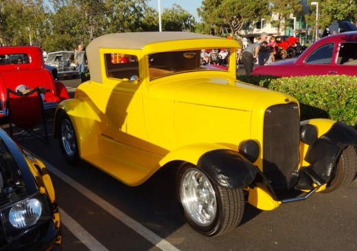
ClassicCarYello.JPG
ClassicCar1.JPG

Hazardous Waste Disposal and Recycling Programs in Ventura County

CalRecycle.gif

The California Department of Resources Recycling and Recovery (CalRecycle) website highlights common products that we use in our daily lives that contain potentially hazardous ingredients, thus requiring special care when disposed of.

Items that are banned from the trash are as follows:

Lights, Batteries and Electronics

  • Fluorescent light bulbs and tubes ("old school" incandescent bulbs can be thrown in the trash.). Remember that LED light bulbs and holiday light strands are considered hazardous waste and must be disposed off properly. Here’s a Home Depot guide on how to dispose of light bulbs.

  • Batteries of all types and sizes, AAA, AA, C, D, button cell, 9-volt, etc., both rechargeable and single use, as well as lead-acid batteries such as car batteries.

  • Computer and television monitors including cathode ray tube (CRT), liquid crystal diode (LCD), and plasma monitors.

  • Electronic devices including computers, printers, VCRs, cell phones, telephones, radios and microwave ovens.

Household and Landscape Chemicals

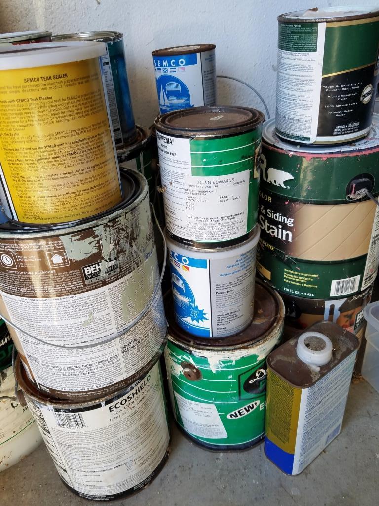
household waste.jpg
  • Flammables and poisons such as oil-based paints and reactive and explosive materials

  • Acids, oxidizers, and bases including some pool chemicals and cleaners

  • Pesticides and herbicides

  • Paints and Solvents - latex paint, oil-based paint, non-empty aerosol paint and solvent cans, and solvents such as paint thinners, nail polish remover, etc.

  • Building materials that contain asbestos and wood treated with chromium copper arsenate.

  • Automobile items including antifreeze, batteries, motor oil and filters and tires (tires are not considered hazardous but are banned from the trash for other reasons).

  • Items Containing Mercury including electrical switches and relays in old appliances, old style thermostats, pilot light sensors in some gas appliances, some gauges and mercury thermometers.

  • Other items such as propane tanks, hypodermic needles, syringes, expired/unwanted medications etc.

So what to do with these items? Recycle and reuse them! Here are some local Ventura County resident options:

The City of Thousand Oaks has a Household Hazardous Waste (HHW) Disposal Facility with details at THIS LINK. Appointments are required for HHW drop-offs. Materials accepted during regular operating hours include household items like aerosol sprays, nail polish, used frying oil, etc., items in the garage like antifreeze, brake fluid, oil, etc., as well as things like paint thinners, fertilizers, pesticides, etc. Click the link above for more detailed information.

City of Thousand Oaks battery recycling centers at THIS LINK. Dropoff options as of October 2022 include Borchard Community Park (front entrance), Dos Vientos Community Center (front lobby), Goebel Senior Center (front lobby), Thousand Oaks Library (both entrances), Newbury Park Library (front entrance), Thousand Oaks City Hall (front entrance), Thousand Oaks Community Center (front entrance) and Thousand Oaks Transportation Center (lobby). (Also Home Depot, but rechargeable batteries only.)

Thousand Oaks area computer and electronics recycling centers at THIS LINK.

Unwanted and/or expired medications can be dropped off throughout Ventura County at designated police stations. Details at THIS LINK.

Medicine disposal bin at East Valley Police Station in Thousand Oaks

The City of Westlake Village offers free monthly hazardous waste collection service via Waste Management. www.wlv.org/faq.aspx?TID=25

City of Simi Valley hazardous Waste Drop-Off Program on six Saturdays per year at THIS LINK.

City of Simi Valley household battery recycling options at THIS LINK includes Simi Valley Public Library, G.I. Industries/Waste Management and Anderson Rubbish.

City of Camarillo hosts household hazardous waste program drop-off events on the 2nd consecutive Friday/Saturday of each month. View upcoming dates and make appointments at www.cityofcamarillo.org/residents/trash___recycling/hazardous_waste.php.

Cities of Oxnard and Port Hueneme household hazardous waste collection events www.oxnard.org/household-hazardous-waste

Cities of Oxnard and Port Hueneme Antifreeze, Batteries, Oil and Paint Recycling www.ci.port-hueneme.ca.us/index.aspx?NID=1022

City of Moorpark hazardous waste drop-off events www.moorparkca.gov/150/Hazardous-Waste

Ventura County needle collection facilities crma.org/home-generated-sharps

City of Ventura hazardous waste collection events www.cityofventura.ca.gov/2103/Household-Hazardous-Waste-HHW-Events

City of Ojai hazardous waste collection options at THIS LINK (pdf doc)

Hazardous waste collection in Calabasas at THIS LINK.

Hazardous waste collection in Agoura Hills at THIS LINK.

Cheeseboro Canyon vs Chesebro Road in Agoura Hills

CheeseboroApr18.jpg

Cheeseboro and Palo Comado Canyons cover over 4,000 acres in the northernmost section of the Santa Monica Mountains National Recreation Area, in the Simi Hills. The Chumash occupied these canyons for thousands of years, until ranchers came into the area in the 1800s. The natural landscape changed as a result to accommodate the needs of grazing cattle.

The National Park Service (NPS) acquired Cheeseboro Canyon in the early to mid 1980s and subsequently acquired Palo Comado Canyon (formerly known as the Jordan Ranch), in 1994.

Nearly every time we post an image from Cheeseboro Canyon to a social media site, someone points out, "it's not Cheeseboro, it's Chesebro."

Why is it called Cheeseboro when the road that gets you to the trailhead is called Chesebro?

According to one NPS Ranger I've spoken with, the original owner of the land in the late 1800s was Oscar Cheesebrough (yet a different spelling). The NPS adopted the U.S. Geological Survey spelling of Cheeseboro, while Caltrans adopted the name Chesebro.

Why the difference? That's not so clear. But what IS clear is that the actual canyon is called Cheeseboro Canyon and it is a beautiful place to hike and bike!

CheeseboroPic1.jpeg
ChesebroSign.jpg

17th Annual Waves of Flags Display at Pepperdine University September 7-27, 2024

wavesofflags2018.JPG

For the 17th consecutive year, Pepperdine University will commemorate the lives lost in the terror attacks on September 11, 2001, with the Waves of Flags display at Alumni Park on the Malibu campus.

Waves of Flags commemorates the 2,977 lives lost in the September 11 terror attacks and features a vast display of American flags for each American life lost as well as international flags representing the home countries of those from abroad. Made possible through the support of donors and volunteers, the installation will be on display at the corner of Pacific Coast Highway and Malibu Canyon Road from Saturday, September 7 to Friday, September 27, 2024.

In addition to the Waves of Flags installation, Pepperdine is the permanent home of the Thomas E. Burnett, Jr., Heroes Garden, a place to honor all those who live heroic lives, including Pepperdine alumnus Thomas E. Burnett, Jr. (MBA ’95), a passenger on United Flight 93, whose life was cut short in the September 11 attacks. The garden's plaque reads: “Dedicated to freedom's heroes of September 11, 2001, and the passengers of United Airlines Flight 93, among them Pepperdine alumnus Thomas E. Burnett, Jr., who sacrificed their lives to overcome terrorists’ intent on destroying American lives and landmarks in our nation's capital. We shall never forget.” Heroes Garden is currently closed to the public, along with the rest of the Pepperdine campus.

www.pepperdine.edu/waves-of-flags

wavesofflags2018_2.JPG